Fernweh: Home
    ExploreTravel GuidesPlan a tripMy tripLast visited
    de|en
    All Places & RegionsAll highlightsAbout FernwehFAQPrivacy PolicyImprint
    ExploreTravel GuidesPlan a tripMy tripLast visited
    • Neighborhoods & highlights
    • Recommendations
    • Walking tours
    • Eat & drink
    • Food culture
    • Culture
    • Nightlife
    • Getting around
    • Accommodation
    • Plan trip
    • Nearby
    Punta Arenas

    Chile

    Punta Arenas

    CityCulture

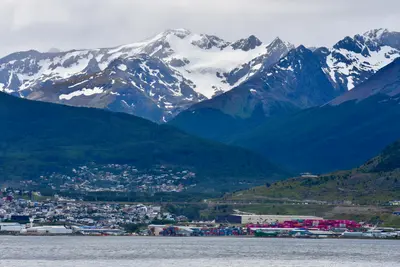
    Punta Arenas on the Strait of Magellan is the largest city in southern Chile and a starting point for penguin tours, Tierra del Fuego, and Torres del Paine.

    by Felix Gillen

    1. Home
    2. Destinations
    3. Chile
    4. Magellan and Chilean Antarctic (Magellan Region)
    5. Punta Arenas
    Punta Arenas on the Strait of Magellan is the largest city in southern Chile and a starting point for penguin tours, Tierra del Fuego, and Torres del Paine. City palaces, museums, and a cemetery with cypress-lined avenues tell of the wealth from the sheep farming era around 1900. The capital of the Magallanes Region is also an important port for ships heading to Antarctica.

    Sights in Punta Arenas

    Discover the most important sights and attractions

    Sacred Heart Cathedral, Punta Arenas

    1Sacred Heart Cathedral, Punta Arenas

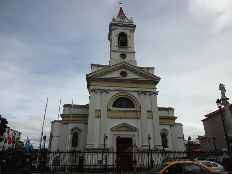
    The Cathedral of the Sacred Heart was built in 1901 as the city's main church on the southwest corner of Plaza Muñoz Gamero and is today the episcopal church of Punta Arenas. Striking is the tall bell tower above the simple structure.
    Open in Google Maps
    Letras Punta Arenas 500 años

    2Letras Punta Arenas 500 años

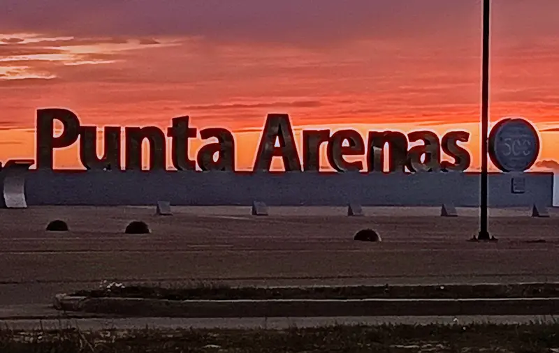
    The large letters on the Costanera del Estrecho waterfront were erected in 2020 and commemorate 500 years since Ferdinand Magellan's passage of the Strait of Magellan in 1520.
    Open in Google Maps
    Plaza de Armas Punta Arenas

    3Plaza de Armas Punta Arenas

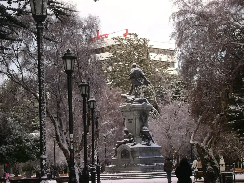
    The central square, officially Plaza Muñoz Gamero, is lined with old trees and city palaces like the Palacio Sara Braun. In the center stands the Magellan Monument, where visitors traditionally touch the foot of the indigenous figure.
    Open in Google Maps
    Monumento Hernando De Magallanes

    4Monumento Hernando De Magallanes

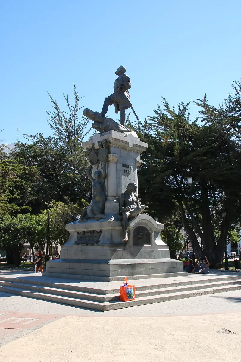
    The bronze monument to Ferdinand Magellan was created by sculptor Guillermo Córdova and donated by wool entrepreneur José Menéndez for the 400th anniversary of Magellan's 1520 passage. On the pedestal stand a Selk'nam representing Tierra del Fuego and a Tehuelche representing Patagonia. According to legend, whoever touches the Tehuelche's polished toe will return to Punta Arenas.
    Open in Google Maps
    Santuario Maria Auxiliadora

    5Santuario Maria Auxiliadora

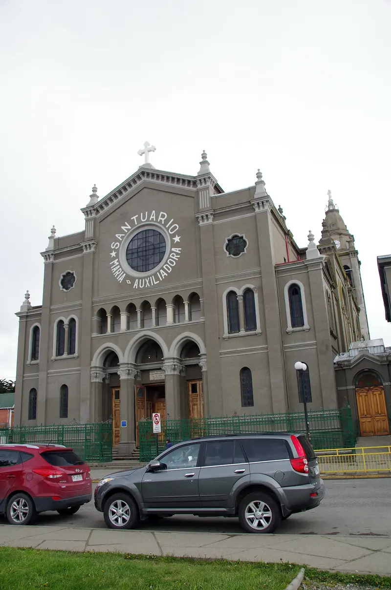
    The Salesian Church on Avenida Bulnes stands right next to the Museo Maggiorino Borgatello. The Salesians arrived in Punta Arenas around 1887 and have since shaped mission, schools, and research in Magallanes.
    Open in Google Maps
    Museo Maggiorino Borgatello

    6Museo Maggiorino Borgatello

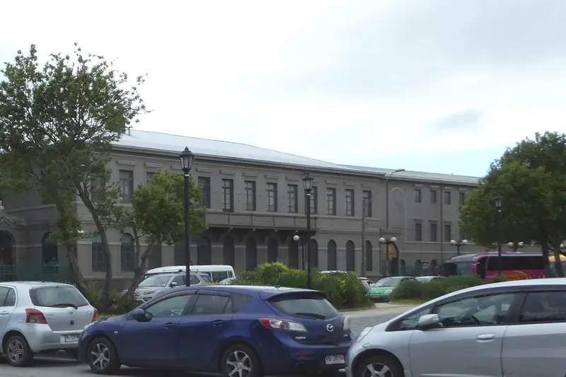
    The Salesian Museum showcases collections on the indigenous peoples Selk'nam, Yámana, Kawésqar, and Aónikenk, as well as the wildlife and Patagonia's settlement history. For the multi-story exhibition, you should allow at least two hours.
    Open in Google Maps

    City walks in Punta Arenas

    Curated walking tours through the city's highlights, handpicked by experienced travel journalists.

    Punta Arenas: Explorers' Trail at the End of the World

    Discover Punta Arenas on a two-hour walk that takes you from panoramic views high above the city to historic sites and the lively waterfront. Immerse yourself in the rich history of Patagonia and the unique atmosphere of this southernmost city.

    ~2 Std.
    Open in Google Maps
    Stops (6)

    Essen & Trinken

    1

    Kiosco Roca Punta Arenas

    The small snack bar on Calle Roca, established in 1932, is famous for a pairing: Choripán and a glass of Leche con plátano, milk with banana.
    Show on Google Maps
    2

    Wake Up - Coffee & Brunch

    City center cafe with breakfast, brunch, and specialty coffees.
    Show on Google Maps
    3

    Restaurant Damiana Elena

    Upscale restaurant on Calle Hernando de Magallanes north of the center. A reservation for the evening is advisable.
    Show on Google Maps
    4

    Rikys Pizza

    Pizzeria in the north of the city, away from the streets around the Plaza.
    Show on Google Maps
    5

    Entre Ollas y Sartenes

    Sushi restaurant with Japanese cuisine in residential Barrio Prat, northwest of the center.
    Show on Google Maps
    6

    Magallania Seafoods & Drinks

    Fish and seafood restaurant on the Costanera del Estrecho waterfront street, at the same address as the Mercado Municipal near Muelle Prat.
    Show on Google Maps
    7

    Dinos Pizza Ltda

    Pizzeria on Calle Bories, just under a kilometer north of Plaza Muñoz Gamero.
    Show on Google Maps
    8

    La Marmita

    Restaurant with Chilean cuisine on the small Plaza Sampaio, a few blocks northeast of Plaza Muñoz Gamero.
    Show on Google Maps
    9

    Restaurant Estilo Magallánico

    Steakhouse on Calle O'Higgins in the center, listed on Google as a grill restaurant.
    Show on Google Maps
    10

    El mercadito Cocina Austral

    Fish and seafood restaurant on Costanera del Estrecho waterfront road, at the same address as the Mercado Municipal near Muelle Prat.
    Show on Google Maps
    11

    La Luna

    Restaurant with Chilean cuisine on Calle O'Higgins in the center.
    Show on Google Maps
    12

    Sotito's Restaurant

    Restaurant serving Chilean cuisine on Calle O'Higgins, just steps from the waterfront.
    Show on Google Maps
    13

    Café Tapiz

    Café with small dishes on Calle Roca in the center.
    Show on Google Maps
    14

    Buda Express Magallanes

    Asian fast-food restaurant on Calle O'Higgins in the center.
    Show on Google Maps
    15

    El Fogón

    Restaurant on Calle Lircay in the west of the city, away from the center.
    Show on Google Maps
    16

    Jekus

    Restaurant with Chilean cuisine on Calle O'Higgins in the center.
    Show on Google Maps
    17

    Locos Por Los Rolls

    Sushi bar on Calle José Miguel Carrera, just over a kilometer north of Plaza Muñoz Gamero.
    Show on Google Maps

    Food & Drink in Punta Arenas

    The city's cuisine blends lamb from the steppe, seafood from the Magellan Strait, and European immigrant influences.
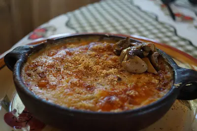
    Chupe de centolla

    Chupe de centolla

    A king crab, bread, milk, and cheese stew, baked au gratin in a clay pot. It's on the menu in many city restaurants.

    Pole-roasted lamb

    Patagonian Steppe lamb, slowly cooked on a spit over an open fire. It's the typical dish for celebrations and Asados.

    Choripán with Leche con plátano

    The combination of sausage roll and milk with banana is a city classic, sold for generations at the kiosk on Calle Roca.

    Calafate Sour

    A regional Pisco Sour variant featuring the dark Calafate berry. It's also found in jam, ice cream, and cake.

    Culture, Arts, and History

    From Penal Colony to Wool CityChile founded Punta Arenas in 1848 as a penal colony, after the first fort further south, Fuerte Bulnes, had been abandoned. Its location on the sea route between the Atlantic and Pacific made the city a trading port in the late 19th century, and sheep farming in the steppe brought great wealth. Immigrants came mainly from Croatia, Spain, and Great Britain; their names can still be found today on shops, clubs, and gravestones.Palaces and MausoleumsAround the Plaza Muñoz Gamero stand the city palaces of the wool families. The Palacio Sara Braun, built in 1895, was designed by French architect Numa Mayer with a mansard roof in the Parisian style; today it houses the Club de la Unión and a hotel. The Magellan Monument in the center of the Plaza was donated by wool entrepreneur José Menéndez for the 400th anniversary of Magellan's passage. On the Cementerio Municipal Sara Braun lie Menéndez, Sara Braun, and other pioneer families in magnificent mausoleums.Indigenous HistoryFor the Selk'nam, Aónikenk, Kawésqar, and Yámana, the city's rise meant displacement and persecution. The Salesians' Museo Maggiorino Borgatello displays ethnographic collections related to these peoples, as well as photographs by missionary Alberto de Agostini.

    Nightlife

    In Punta Arenas, you'll find unpretentious nightlife options. Cozy bars invite you for social gatherings; discover regional beers at Birra! Cerveza & Buena Mesa or dance in clubs until late into the night.
    1

    Araña

    Google-categorized nightclub venue on Calle Armando Sanhueza, about half a kilometer west of Plaza Muñoz Gamero.
    Show on Google Maps
    2

    8Doce Restobar

    Restobar on Calle Errázuriz in the center.
    Show on Google Maps
    3

    The Roxy Club

    Nightclub on Calle Bories, just north of Plaza Muñoz Gamero.
    Show on Google Maps
    4

    Celebrity Club

    Bar on Calle José Menéndez in the center, a good 300 meters east of Plaza Muñoz Gamero.
    Show on Google Maps
    5

    Taberna Club de La Union

    The bar in the basement of the Palacio Sara Braun on the Plaza belongs to the Club de la Unión. Besides drinks, dishes like Chupe de centolla and lamb are served. Closed Sundays.
    Show on Google Maps
    6

    Birra! Cerveza & Buena Mesa

    Pub on Calle Armando Sanhueza, a few blocks west of Plaza Muñoz Gamero, with beer and food.
    Show on Google Maps
    7

    Bodega 87

    Bar on Calle 21 de Mayo near the waterfront road.
    Show on Google Maps
    8

    Club La Perla del Estrecho

    Bar and restaurant in the small Passage Emilio Körner in the center, designed to reflect Magallanes' history and culture. Open evenings from Friday to Sunday; times vary seasonally.
    Show on Google Maps

    Traveling in Punta Arenas

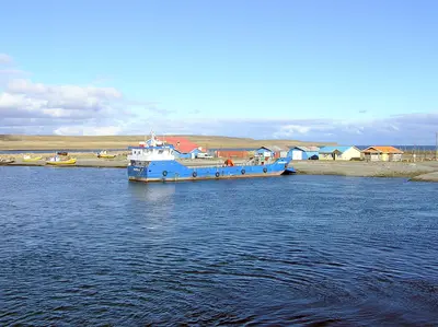
    On Foot and by TaxiThe city center around Plaza Muñoz Gamero, the waterfront promenade, and most museums are close to each other and are easily reachable on foot. For the cemetery and the Museo del Recuerdo, take a taxi or a Colectivo, a shared taxi with a fixed route, which is an important part of public transport in Punta Arenas. Taxis can be found at stands in the city center, and payment is usually in cash.Airport, Buses, and FerriesAirport: The airport is located about 20 km north of the city. Shuttles and taxis go to the center; some long-distance buses to Puerto Natales stop there.Long-distance Buses: Several companies operate daily services to Puerto Natales and destinations in Argentina. Tickets can be bought at the bus company offices in the city center or online.Ferry: The ferry to Porvenir on Tierra del Fuego departs from Terminal Tres Puentes in the north of the city.The wind in Punta Arenas can be very strong. Therefore, it's best to plan walks along the water for calmer hours.

    Accommodations in Punta Arenas

    Find perfect stay in Punta Arenas

    Booking.com* (Affiliate link)
    Search Hotels
    Agoda* (Affiliate link)
    Search Hotels
    Airbnb
    Vacation Rentals

    * Affiliate link: if you book through it, we earn a small commission. The price stays the same for you.

    Plan your trip to Punta Arenas

    Save places, build a route and plan your city trip, all in one place.

    1. 1
      Sunrise over alpine peaks and a sea of clouds
      1234

      Round trip

      12 days · 4 stops

      Saved

      Pick a route

      Pick a ready-made one or save places and plan your own.

      Open bookmarks
    2. 2

      Trip to Punta Arenas

      Live
      • 1Sacred Heart Cathedral, Punta Arenas3 days
      • 2Letras Punta Arenas 500 años4 days
      • 3Plaza de Armas Punta Arenas5 days
      Budget

      Plan your trip

      The planner sorts stops, days and budget. Plan together in real time.

      Start trip planning
    3. 3
      9:41 No signal
      Punta Arenas
      Available offline

      Use it on the road

      Download the guide to your phone and use it on site, even offline.

    Nearby

    Tierra del Fuego (Chilean part)

    Tierra del Fuego (Chilean part)

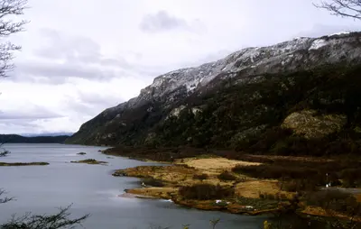
    Chilean Tierra del Fuego covers the west of the large island south of the Strait of Magellan. Open steppe, bays, bogs, and dense southern forests define the sparsely populated landscape. Main town is Porvenir, best-known destination the King Penguin colony at Bahía Inútil.
    Magellan and Chilean Antarctic (Magellan Region)

    Magellan and Chilean Antarctic (Magellan Region)

    The Región de Magallanes y Antártica Chilena encompasses the southernmost part of Chile, from the steppe around Punta Arenas to the granite towers of Torres del Paine and the fjords of Tierra del Fuego. Here you travel through vast, sparsely populated landscapes where wind and weather dictate the daily routine. Punta Arenas and Puerto Natales are the two starting points for almost all tours.
    Puerto Natales

    Puerto Natales

    Puerto Natales, which lies on Fjord Última Esperanza, is the main gateway to Torres del Paine National Park. This small town developed in the early 20th century around sheep farming and cold stores, and today lives primarily from tourism. Colorful wooden houses, a waterfront promenade, and many outfitters shape its center.
    Tierra del Fuego National Park

    Tierra del Fuego National Park

    Founded in 1960, the Parque Nacional Tierra del Fuego is located about twelve kilometers west of Ushuaia and is Argentina's only national park uniting mountains, forest, and coastline. It protects the last section of the Andes and the subantarctic forest of Lengas and Ñires, along with extensive peat bogs.The road in the park is the final stretch of Ruta Nacional 3 and ends at Bahía Lapataia with the famous 'Fin de RN3' sign. At Bahía Ensenada, you'll find the southernmost post office where you can get your passport stamped; from there, the Senda Costera leads as a moderately difficult coastal path along the Beagle Channel. Further trails lead to Lago Acigami and up Cerro Guanaco. An entrance fee is charged for the park; the ride on the Tren del Fin del Mundo costs extra.
    Ushuaia

    Ushuaia

    Ushuaia stretches as a narrow strip along the northern shore of the Beagle Channel, squeezed between the water and the mountains of the Sierra Martial. The city owes its origin to a prison: From 1902, prisoners built the Presidio, which was in operation until 1947. Today it houses the Museo Marítimo y del Presidio with exhibitions on the penal colony, maritime history, and Antarctica.The most popular excursion is a boat trip on the Beagle Channel to the islands with sea lions and seabirds and to the red-and-white Les Eclaireurs Lighthouse. Approximately twelve kilometers west lies the Tierra del Fuego National Park. The End of the World Train also runs there, a narrow-gauge railway on a section of the former prisoner's railway, which prisoners used to transport wood from the forests. Ushuaia is also the main departure port for cruises to Antarctica.

    Sources & method

    • Photos: Wikimedia Commons, Pexels, Google Maps. Each photo carries its credit.
    • Place data such as addresses and ratings comes from Google Maps.
    • The content is based on web research from public, traceable sources. How the content is made · The role of AI