Fernweh: Home
    ExploreTravel GuidesPlan a tripMy tripLast visited
    de|en
    All Places & RegionsAll highlightsAbout FernwehFAQPrivacy PolicyImprint
    ExploreTravel GuidesPlan a tripMy tripLast visited
    • Neighborhoods & highlights
    • Recommendations
    • Eat & drink
    • Accommodation
    • Plan trip
    • Nearby
    Ushuaia
    Parikshit Sharma Photography / Wikimedia Commons / CC BY-SA 4.0

    Argentina

    Ushuaia

    City

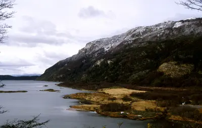
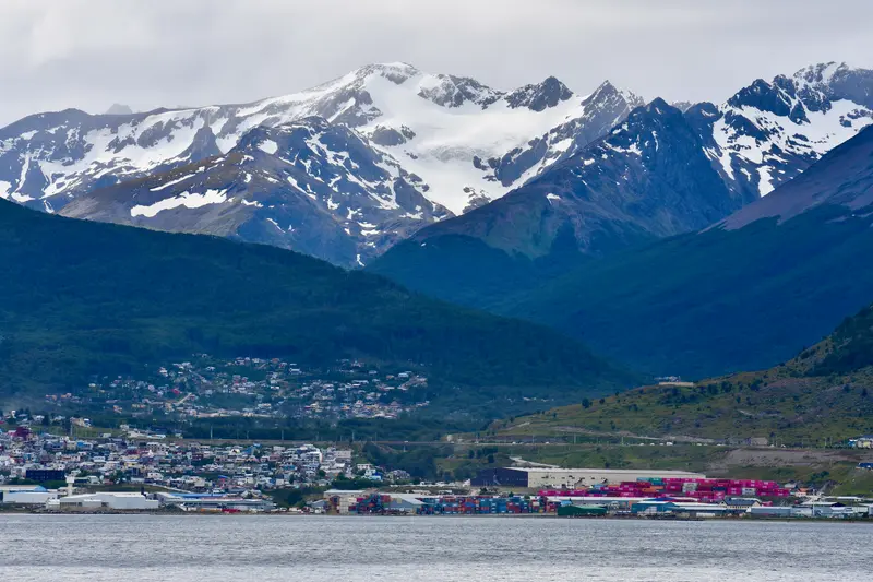
    Ushuaia stretches as a narrow strip along the northern shore of the Beagle Channel, squeezed between the water and the mountains of the Sierra Martial.

    by Felix Gillen

    1. Home
    2. Destinations
    3. Argentina
    4. Fireland
    5. Ushuaia
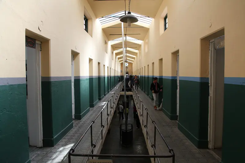
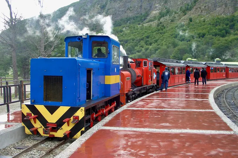
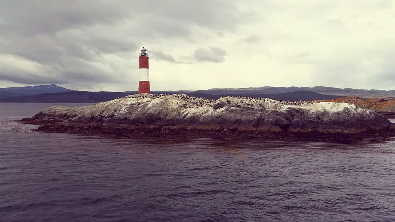
    Ushuaia stretches as a narrow strip along the northern shore of the Beagle Channel, squeezed between the water and the mountains of the Sierra Martial. The city owes its origin to a prison: From 1902, prisoners built the Presidio, which was in operation until 1947. Today it houses the Museo Marítimo y del Presidio with exhibitions on the penal colony, maritime history, and Antarctica.The most popular excursion is a boat trip on the Beagle Channel to the islands with sea lions and seabirds and to the red-and-white Les Eclaireurs Lighthouse. Approximately twelve kilometers west lies the Tierra del Fuego National Park. The End of the World Train also runs there, a narrow-gauge railway on a section of the former prisoner's railway, which prisoners used to transport wood from the forests. Ushuaia is also the main departure port for cruises to Antarctica.

    Sights in Ushuaia

    Discover the most important sights and attractions

    Maritime and Prison Museum

    1Maritime and Prison Museum

    The former prison, which prisoners themselves built from 1902 and which was in operation until 1947, today houses several museums: the Prison Museum with its cell blocks, a Maritime and an Antarctica Museum, as well as an art gallery. The complex is located within the naval base at the end of Avenida San Martín, reachable on foot from the city center.
    Open in Google Maps
    Tren del Fin del Mundo

    2Tren del Fin del Mundo

    The narrow-gauge railway starts at the Estación del Fin del Mundo about eight kilometers west of the city and travels approximately seven kilometers through the Pipo River valley to the edge of Tierra del Fuego National Park. It follows part of the route where, from 1902, prisoners transported wood for the prison; since 1994, it has been operating as a tourist train. Along the way, the train stops at Cascada La Macarena.
    Open in Google Maps
    Boat trip on the Beagle Channel

    3Boat trip on the Beagle Channel

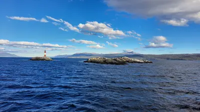
    From the harbor, excursion boats depart for the islands in the Beagle Channel: to Isla de los Lobos with sea lions, to Isla de los Pájaros with many seabirds, and to the red and white Les Eclaireurs lighthouse. It is often called the "Lighthouse at the End of the World," but the real one is on Isla de los Estados. Tickets can be purchased at short notice from providers at the harbor.
    Open in Google Maps

    Restaurants in Ushuaia

    Accommodations in Ushuaia

    Find perfect stay in Ushuaia

    Booking.com* (Affiliate link)
    Search Hotels
    Agoda* (Affiliate link)
    Search Hotels
    Airbnb
    Vacation Rentals

    * Affiliate link: if you book through it, we earn a small commission. The price stays the same for you.

    Plan your trip to Ushuaia

    Save places, build a route and plan your city trip, all in one place.

    1. 1
      Sunrise over alpine peaks and a sea of clouds
      1234

      Round trip

      12 days · 4 stops

      Saved

      Pick a route

      Pick a ready-made one or save places and plan your own.

      Open bookmarks
    2. 2

      Trip to Ushuaia

      Live
      • 1Maritime and Prison Museum3 days
      • 2Tren del Fin del Mundo4 days
      • 3Boat trip on the Beagle Channel5 days
      Budget

      Plan your trip

      The planner sorts stops, days and budget. Plan together in real time.

      Start trip planning
    3. 3
      9:41 No signal
      Ushuaia
      Available offline

      Use it on the road

      Download the guide to your phone and use it on site, even offline.

    Nearby

    Tierra del Fuego National Park

    Tierra del Fuego National Park

    Founded in 1960, the Parque Nacional Tierra del Fuego is located about twelve kilometers west of Ushuaia and is Argentina's only national park uniting mountains, forest, and coastline. It protects the last section of the Andes and the subantarctic forest of Lengas and Ñires, along with extensive peat bogs.The road in the park is the final stretch of Ruta Nacional 3 and ends at Bahía Lapataia with the famous 'Fin de RN3' sign. At Bahía Ensenada, you'll find the southernmost post office where you can get your passport stamped; from there, the Senda Costera leads as a moderately difficult coastal path along the Beagle Channel. Further trails lead to Lago Acigami and up Cerro Guanaco. An entrance fee is charged for the park; the ride on the Tren del Fin del Mundo costs extra.
    Fireland

    Fireland

    Argentina and Chile share Tierra del Fuego on the continent's southern tip. On the Argentine side, Ushuaia lies on the Beagle Channel between mountains and sea; Ruta Nacional 3, originating in Buenos Aires, ends in Parque Nacional Tierra del Fuego nearby. Ushuaia is also the main port for Antarctic expeditions.
    Tierra del Fuego (Chilean part)

    Tierra del Fuego (Chilean part)

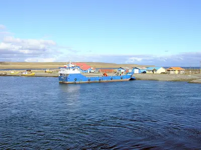
    Chilean Tierra del Fuego covers the west of the large island south of the Strait of Magellan. Open steppe, bays, bogs, and dense southern forests define the sparsely populated landscape. Main town is Porvenir, best-known destination the King Penguin colony at Bahía Inútil.
    Punta Arenas

    Punta Arenas

    Punta Arenas on the Strait of Magellan is the largest city in southern Chile and a starting point for penguin tours, Tierra del Fuego, and Torres del Paine. City palaces, museums, and a cemetery with cypress-lined avenues tell of the wealth from the sheep farming era around 1900. The capital of the Magallanes Region is also an important port for ships heading to Antarctica.
    Magellan and Chilean Antarctic (Magellan Region)

    Magellan and Chilean Antarctic (Magellan Region)

    The Región de Magallanes y Antártica Chilena encompasses the southernmost part of Chile, from the steppe around Punta Arenas to the granite towers of Torres del Paine and the fjords of Tierra del Fuego. Here you travel through vast, sparsely populated landscapes where wind and weather dictate the daily routine. Punta Arenas and Puerto Natales are the two starting points for almost all tours.

    Sources & method

    • Photos: Wikimedia Commons. Each photo carries its credit.
    • The content is based on web research from public, traceable sources. How the content is made · The role of AI