Fernweh: Home
    ExploreTravel GuidesPlan a tripMy tripLast visited
    de|en
    All Places & RegionsAll highlightsAbout FernwehFAQPrivacy PolicyImprint
    ExploreTravel GuidesPlan a tripMy tripLast visited
    National Park Torres del Paine

    Chile

    National Park Torres del Paine

    National Park

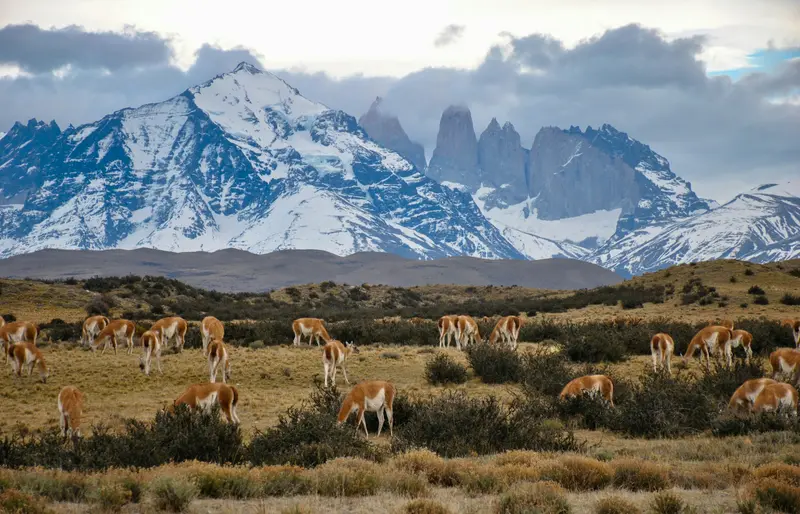
    Torres del Paine in southern Chile is one of Patagonia's most famous national parks: granite towers, glaciers, and turquoise lakes are concentrated here.

    by Felix Gillen

    1. Home
    2. Destinations
    3. Chile
    4. Magellan and Chilean Antarctic (Magellan Region)
    5. National Park Torres del Paine
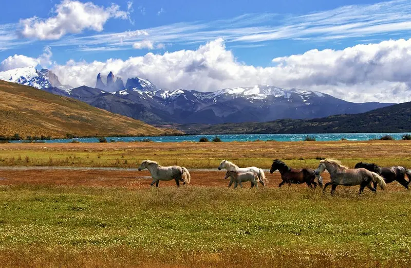
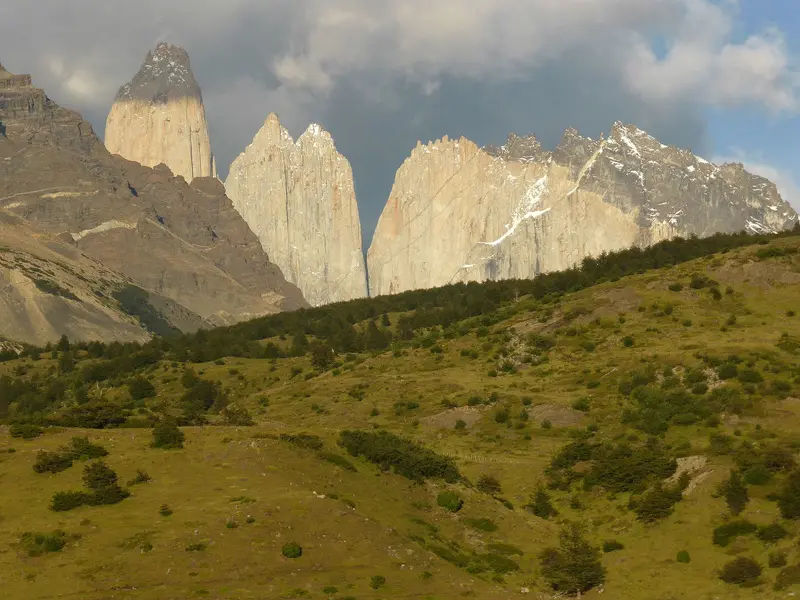
    Torres del Paine in southern Chile is one of Patagonia's most famous national parks: granite towers, glaciers, and turquoise lakes are concentrated here. You can hike multi-day treks like the W and O, or go on day hikes to viewpoints such as Base Torres. The park is located about 110 km north of Puerto Natales, protecting the Paine-Massif with its Torres and Cuernos peaks, as well as glaciers of the South Patagonian Ice Field.

    Sehenswürdigkeiten

    Discover the most important sights and attractions

    Torre del Paine Central

    1Torre del Paine Central

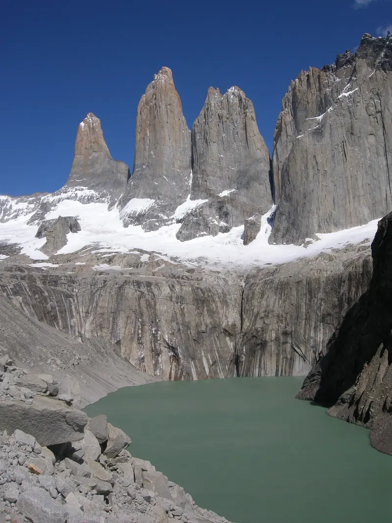
    The middle of the three granite spires is around 2,460 m high. It was first ascended in January 1963 by the Britons Chris Bonington and Don Whillans via the North Ridge. You get the best view of Torre Central from Mirador Base Las Torres, above the glacier lagoon.
    Open in Google Maps
    Mirador Las Torres Base

    2Mirador Las Torres Base

    The viewpoint at a glacial lagoon at the foot of the three Torres is the destination of the park's most famous day hike. The round trip is about 20 km and takes approximately eight hours from the Welcome Center; the final section ascends steeply over a boulder field. In case of strong winds or risk of rockfall, CONAF and Las Torres preemptively close the path, so check for current advisories the day before. In winter, an authorized guide is mandatory.
    Open in Google Maps
    Torre del Paine Norte

    3Torre del Paine Norte

    The northernmost and lowest of the three granite spires is around 2,240 m high and stands next to the Torre Central. Italian climbers on an expedition led by Guido Monzino first ascended it in 1958. It is clearly visible from the Mirador Base Las Torres.
    Open in Google Maps
    Salto Grande
    Natural Feature

    4Salto Grande

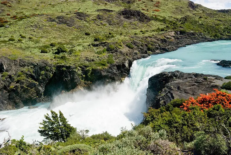
    Lago Nordenskjöld drains into Lago Pehoé via a wide waterfall in the park's south. From the car park, a ten-minute walk leads to a wooden platform over the water with views of the Cuernos del Paine, also marking the start of the Mirador Cuernos trail. Expect strong winds.
    Open in Google Maps
    Mirador Cuernos
    Attraction

    5Mirador Cuernos

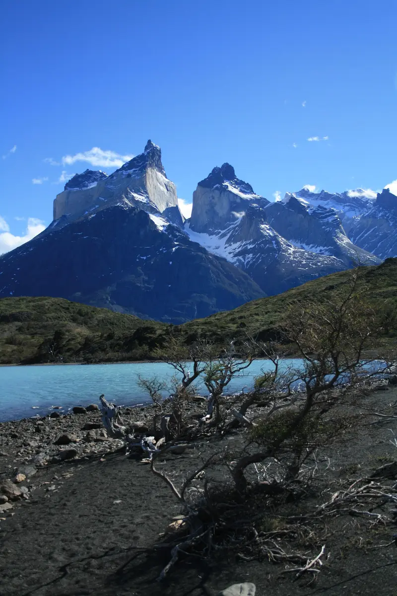
    The viewpoint above Lago Nordenskjöld is located at the end of an almost flat path that begins behind Salto Grande. The round trip takes about two hours. From here, you can see the Cuernos del Paine directly opposite on the other side of the lake. The path is highly exposed to the wind.
    Open in Google Maps
    Grey Glacier
    Natural Feature

    6Grey Glacier

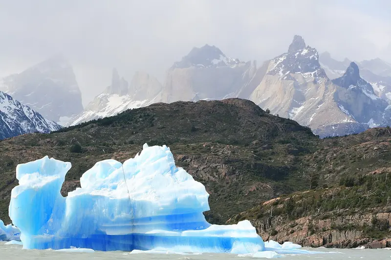
    The Grey Glacier is the largest glacier in the park, flowing from the Southern Patagonian Ice Field into Lago Grey. You can see it from viewpoints on the western section of the W Trek or during a boat trip across the lake, where icebergs often float.
    Open in Google Maps

    Essen & Trinken

    1

    Restaurant Pehoe Barbecue

    Google-listed grill restaurant in the south of the park, near Lago Pehoé.
    Show on Google Maps
    2

    Restaurante Pehoe

    Restaurant at Lago Pehoé with views over the lake to the Paine Massif, in the south of the park.
    Show on Google Maps

    Food & Drink in the Park

    There are only a few refreshment stops in the park. Most hikers provide for themselves or book meals in the Refugios.

    Food and Board in the Refugios

    Many mountain huts offer breakfast, packed lunch, and dinner, which you reserve together with your overnight stay. This saves you from carrying provisions for several days.

    Lamb on a stick

    The Patagonian lamb, cooked for hours on a spit over an open fire, is served in some hotels and estancias on the edge of the park.

    Trekking food from Puerto Natales

    Supermarkets and outdoor stores in Puerto Natales sell dried fruit, nuts, ready-meals, and gas canisters. Within the park, selection is limited.

    Calafate

    The blue berries of the thorny Calafate bush grow throughout Patagonia and ripen in late summer. They are processed into jam, juice, ice cream, and the Calafate Sour.

    History of the National Park

    From the Estancia to the National ParkLong before the park's establishment, the Aónikenk (Tehuelche) roamed the steppe at the foot of the mountains. The name also originates from their language: “Paine” means blue and refers to the color of the lakes and glaciers. In the late 19th century, settlers divided the land into large sheep estancias, traces of which, like old fence lines and buildings, can still be found in the park.In 1959, an initial protected area was created as Parque Nacional de Turismo Lago Grey; in 1970, it gained its present name. Gradually, former estancia lands were added, and in 1978, recognition as a UNESCO Biosphere Reserve followed.Fires and Protection RulesTwo major fires, caused by visitors in 2005 and 2011, destroyed vast forest and steppe areas. Since then, strict rules apply: Fire is prohibited outside designated areas, trails must not be left, and overnight stays are only permitted with reservations in Refugios and at campsites. Reforestation projects are ongoing to this day in the burnt areas.

    Getting to and Around the Park

    Getting ThereThe starting point is almost always Puerto Natales. From there, Ruta 9 heads north, with the last few kilometers to the park entrances being a gravel road. During high season, buses run early in the morning and at midday to the Laguna Amarga entrance and on to Pudeto; the journey takes about two to three hours depending on your destination. Return trips from Laguna Amarga usually depart in the early evening.Entrance Fees and ReservationsPark Entrance: Purchase your CONAF park authority ticket online in advance via pasesparques.cl, the only official sales point. It will be checked with your passport at the entrance. As of May 1, 2026, there is a day ticket and a multi-day ticket for up to ten consecutive days. Foreign visitors pay significantly more than Chileans; current prices are available on pasesparques.cl.Accommodation: On the W-Trek and O-Circuit, you may only stay overnight with a pre-booked spot. Two companies operate the campsites and refugios: Vertice Patagonia (including Paine Grande, Grey, Dickson, and Los Perros) and Las Torres Patagonia (including Central, Chileno, Serón, Francés, and Los Cuernos). Book both parts early; in high season, many spots are reserved months in advance.O-Circuit: This circular trail can only be hiked counter-clockwise starting from Laguna Amarga. It remains closed in winter, with its reopening in spring dependent on a safety inspection.Winter: From late April to mid-September, CONAF requires an approved guide for the Base Torres and the W-Trek. Entrances have longer opening hours in summer than in winter.Inside the ParkShuttles: Shuttle buses operate between Laguna Amarga and the Welcome Center at the starting point for the Torres.Catamaran: A boat crosses Lago Pehoé between Pudeto and Paine Grande, thus connecting the western part of the W-Trek with the road.Rental Car: By car, you can reach viewpoints such as Laguna Amarga, Salto Grande, or Lago Grey. There are no gas stations inside the park, so fill up in Puerto Natales.On the trekking routes, you are exclusively on foot. Plan for buffer time, as storms can cause boat trips and trail sections to close at short notice. Current closures are published by CONAF and the operators on their channels. Safety information can be found in the travel and safety advisories of the Federal Foreign Office.

    Accommodations in National Park Torres del Paine

    Find perfect stay in National Park Torres del Paine

    Booking.com* (Affiliate link)
    Search Hotels
    Agoda* (Affiliate link)
    Search Hotels
    Airbnb
    Vacation Rentals

    * Affiliate link: if you book through it, we earn a small commission. The price stays the same for you.

    Nearby

    Perito Moreno Glacier

    Perito Moreno Glacier

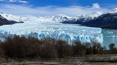
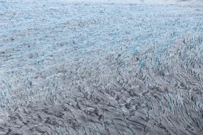
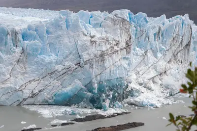
    The Perito Moreno Glacier in Los Glaciares National Park is one of the world's most accessible glaciers. Its ice front rises about 70 meters above Lago Argentino; ice blocks frequently calve into the water with a thunderous roar. Unlike most glaciers worldwide, it has long been largely in equilibrium. Occasionally, it advances to the shore of the Magallanes Peninsula, damming the Brazo Rico until the water breaks through the ice dam.Opposite the ice front, several kilometers of boardwalks offer circular routes of varying length and difficulty; plan at least two to three hours for this. Additionally, there are boat trips in front of the ice wall and guided hikes with crampons on the glacier, which you should book in advance. The National Park charges an entrance fee (50,000 Pesos for foreign visitors from June 2026), which is not included in any tour. From El Calafate, it's about 80 kilometers on a paved road.
    El Calafate

    El Calafate is located on the southern shore of Lago Argentino, Argentina's largest lake, between dry, windy steppe and the Southern Patagonian Ice Field. This compact town is the most important base for the Perito Moreno Glacier, about 80 kilometers to the west, and for boat trips to the Upsala and Spegazzini glaciers, which depart from Punta Bandera port, about 47 kilometers outside.On the edge of town is the Laguna Nimez Bird Sanctuary, with flamingos and black-necked swans; a few kilometers outside, the Glaciarium exhibition center explains the world of ice. The airport is located about 20 kilometers to the east and offers connections to Buenos Aires and Ushuaia. Intercity buses travel in about three hours to El Chaltén and in five to six hours to Chilean Puerto Natales. Stock up here before continuing to El Chaltén: the supermarkets are better stocked and more affordable.
    Puerto Natales

    Puerto Natales

    Puerto Natales, which lies on Fjord Última Esperanza, is the main gateway to Torres del Paine National Park. This small town developed in the early 20th century around sheep farming and cold stores, and today lives primarily from tourism. Colorful wooden houses, a waterfront promenade, and many outfitters shape its center.
    South Patagonia and Los Glaciares

    South Patagonia and Los Glaciares

    In the south of Santa Cruz province, the Patagonian Steppe borders the Southern Patagonian Ice Field. Parque Nacional Los Glaciares, a UNESCO World Heritage site since 1981, protects glaciers like Perito Moreno and the granite peaks of Fitz Roy and Cerro Torre. Starting points are El Calafate on Lago Argentino and the hiking village of El Chaltén, about three bus hours further north.The best time to visit is from November to March; in winter, many accommodations are closed, and the weather remains changeable and windy throughout the year.
    Magellan and Chilean Antarctic (Magellan Region)

    Magellan and Chilean Antarctic (Magellan Region)

    The Región de Magallanes y Antártica Chilena encompasses the southernmost part of Chile, from the steppe around Punta Arenas to the granite towers of Torres del Paine and the fjords of Tierra del Fuego. Here you travel through vast, sparsely populated landscapes where wind and weather dictate the daily routine. Punta Arenas and Puerto Natales are the two starting points for almost all tours.

    Sources & method

    • Photos: Wikimedia Commons, Unsplash, Pexels, Google Maps. Each photo carries its credit.
    • Place data such as addresses and ratings comes from Google Maps.
    • The content is based on web research from public, traceable sources. How the content is made · The role of AI