Fernweh: Home
    ExploreTravel GuidesPlan a tripMy tripLast visited
    de|en
    All Places & RegionsAll highlightsAbout FernwehFAQPrivacy PolicyImprint
    ExploreTravel GuidesPlan a tripMy tripLast visited
    • Places in the region
    • Videos
    • Round trips
    • Nearby
    South Patagonia and Los Glaciares

    Argentina

    South Patagonia and Los Glaciares

    Region

    In the south of Santa Cruz province, the Patagonian Steppe borders the Southern Patagonian Ice Field.

    by Felix Gillen

    1. Home
    2. Destinations
    3. Argentina
    4. South Patagonia and Los Glaciares
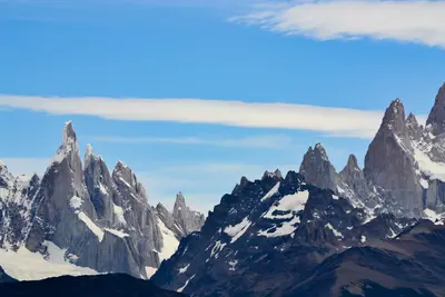
    In the south of Santa Cruz province, the Patagonian Steppe borders the Southern Patagonian Ice Field. Parque Nacional Los Glaciares, a UNESCO World Heritage site since 1981, protects glaciers like Perito Moreno and the granite peaks of Fitz Roy and Cerro Torre. Starting points are El Calafate on Lago Argentino and the hiking village of El Chaltén, about three bus hours further north.The best time to visit is from November to March; in winter, many accommodations are closed, and the weather remains changeable and windy throughout the year.
    Perito Moreno Glacier

    Place 1 of 2

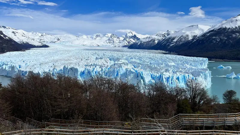
    Perito Moreno Glacier

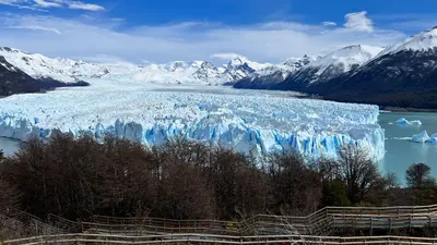
    The Perito Moreno Glacier in Los Glaciares National Park is one of the world's most accessible glaciers. Its ice front rises about 70 meters above Lago Argentino; ice blocks frequently calve into the water with a thunderous roar.

    Discover
    El Chaltén

    Place 2 of 2

    El Chaltén

    El Chaltén was only founded in 1985, partly to secure territorial claims in the border region then disputed with Chile, and is today, by law, the "National Trekking Capital".

    Discover

    More places in South Patagonia and Los Glaciares

    El Calafate

    El Calafate is located on the southern shore of Lago Argentino, Argentina's largest lake, between dry, windy steppe and the Southern Patagonian Ice Field. This compact town is the most important base for the Perito Moreno Glacier, about 80 kilometers to the west, and for boat trips to the Upsala and Spegazzini glaciers, which depart from Punta Bandera port, about 47 kilometers outside.On the edge of town is the Laguna Nimez Bird Sanctuary, with flamingos and black-necked swans; a few kilometers outside, the Glaciarium exhibition center explains the world of ice. The airport is located about 20 kilometers to the east and offers connections to Buenos Aires and Ushuaia. Intercity buses travel in about three hours to El Chaltén and in five to six hours to Chilean Puerto Natales. Stock up here before continuing to El Chaltén: the supermarkets are better stocked and more affordable.

    Videos & Travel Reports

    Von Patagonien nach Feuerland (ARD Reisen)

    Folge 2 der dreiteiligen ARD-Reihe „Tief im Süden“: eine Reise durch Argentinien von Patagonien bis nach Feuerland, auf Deutsch.
    Round trips through this region

    Argentina Classics: Tango, Waterfalls, Andes and Glaciers

    Argentina Classics: Tango, Waterfalls, Andes and Glaciers

    The route connects Argentina's four great faces in around two and a half weeks: Buenos Aires, Iguazú Falls, the colorful high valleys of the Northwest, and Southern Patagonia's glaciers and granite peaks. Long journeys are via domestic flights, the Northwest by rental car.

    19 Days
    8 stops
    Patagonia from the Lakes to the End of the World

    Patagonia from the Lakes to the End of the World

    This journey explores Argentine Patagonia: from Bariloche's Lake District to the Atlantic coast with its whales and penguins, then to the glaciers of Los Glaciares and El Chaltén's hiking trails, ending in Ushuaia on the Beagle Channel. You cover the vast distances with domestic flights.

    16 Days
    5 stops

    Nearby

    El Calafate

    El Calafate is located on the southern shore of Lago Argentino, Argentina's largest lake, between dry, windy steppe and the Southern Patagonian Ice Field. This compact town is the most important base for the Perito Moreno Glacier, about 80 kilometers to the west, and for boat trips to the Upsala and Spegazzini glaciers, which depart from Punta Bandera port, about 47 kilometers outside.On the edge of town is the Laguna Nimez Bird Sanctuary, with flamingos and black-necked swans; a few kilometers outside, the Glaciarium exhibition center explains the world of ice. The airport is located about 20 kilometers to the east and offers connections to Buenos Aires and Ushuaia. Intercity buses travel in about three hours to El Chaltén and in five to six hours to Chilean Puerto Natales. Stock up here before continuing to El Chaltén: the supermarkets are better stocked and more affordable.
    El Chaltén

    El Chaltén

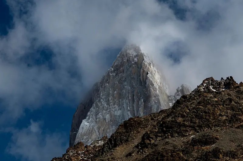
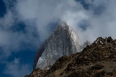
    El Chaltén was only founded in 1985, partly to secure territorial claims in the border region then disputed with Chile, and is today, by law, the "National Trekking Capital". This small village with hostels, breweries, and gear shops is located in the northern part of the Parque Nacional Los Glaciares, directly beneath the Fitz Roy massif, and the hiking trails start at the edge of town.The best-known day hike leads to Laguna de los Tres at the foot of Fitz Roy: approximately 20 to 24 kilometers round trip, eight to ten hours, with a very steep final ascent over loose rock. The trail to Laguna Torre beneath Cerro Torre is somewhat easier, at approximately 18 to 20 kilometers. For shorter excursions, the Mirador de los Cóndores above the village and Laguna Capri are suitable. The weather changes quickly: Bring wind and rain protection and turn back if wind or clouds increase on the final ascent.
    Perito Moreno Glacier

    Perito Moreno Glacier

    The Perito Moreno Glacier in Los Glaciares National Park is one of the world's most accessible glaciers. Its ice front rises about 70 meters above Lago Argentino; ice blocks frequently calve into the water with a thunderous roar. Unlike most glaciers worldwide, it has long been largely in equilibrium. Occasionally, it advances to the shore of the Magallanes Peninsula, damming the Brazo Rico until the water breaks through the ice dam.Opposite the ice front, several kilometers of boardwalks offer circular routes of varying length and difficulty; plan at least two to three hours for this. Additionally, there are boat trips in front of the ice wall and guided hikes with crampons on the glacier, which you should book in advance. The National Park charges an entrance fee (50,000 Pesos for foreign visitors from June 2026), which is not included in any tour. From El Calafate, it's about 80 kilometers on a paved road.
    National Park Torres del Paine

    National Park Torres del Paine

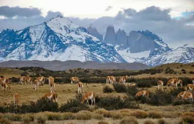
    Torres del Paine in southern Chile is one of Patagonia's most famous national parks: granite towers, glaciers, and turquoise lakes are concentrated here. You can hike multi-day treks like the W and O, or go on day hikes to viewpoints such as Base Torres. The park is located about 110 km north of Puerto Natales, protecting the Paine-Massif with its Torres and Cuernos peaks, as well as glaciers of the South Patagonian Ice Field.
    Puerto Natales

    Puerto Natales

    Puerto Natales, which lies on Fjord Última Esperanza, is the main gateway to Torres del Paine National Park. This small town developed in the early 20th century around sheep farming and cold stores, and today lives primarily from tourism. Colorful wooden houses, a waterfront promenade, and many outfitters shape its center.

    Sources & method

    • Photos: Pexels. Each photo carries its credit.
    • Video reportages: Von Patagonien nach Feuerland (ARD Reisen)
    • The content is based on web research from public, traceable sources. How the content is made · The role of AI