Fernweh: Home
    ExploreTravel GuidesPlan a tripMy tripLast visited
    de|en
    All Places & RegionsAll highlightsAbout FernwehFAQPrivacy PolicyImprint
    ExploreTravel GuidesPlan a tripMy tripLast visited
    • Neighborhoods & highlights
    • Eat & drink
    • Food culture
    • Culture
    • Getting around
    • Accommodation
    • Plan trip
    • Nearby
    Kefalonia (Island)

    Greece

    Kefalonia (Island)

    City

    Kefalonia is, at almost 780 square kilometres, the largest of the Ionian Islands and the one with the most rugged relief: Mount Ainos rises to 1,628 metres and is covered with Greek Fir, which is botanically named after the island.

    by Felix Gillen

    1. Home
    2. Destinations
    3. Greece
    4. Ionian Islands
    5. Kefalonia (Island)
    Kefalonia is, at almost 780 square kilometres, the largest of the Ionian Islands and the one with the most rugged relief: Mount Ainos rises to 1,628 metres and is covered with Greek Fir, which is botanically named after the island. Beneath the island lies a karst system where seawater disappears on one side and reappears on the other.In between lie pebble coves like Myrtos, vineyards with the Robola grape variety, and small harbours. The island is large enough for an entire week and can be easily combined with Ithaca.

    Sights in Kefalonia (Island)

    Discover the most important sights and attractions

    Agios Gerasimos Monastery

    1Agios Gerasimos Monastery

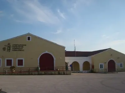
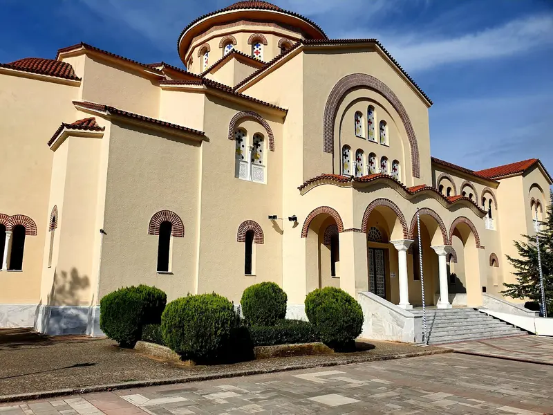
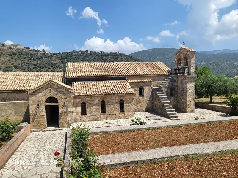
    The Monastery of Saint Gerasimos, the island's patron saint, lies in the Omala Valley among vineyards at the foot of Ainos. Gerasimos lived here as a hermit in the 16th century, founding the community; his body is preserved in a silver shrine in the main church.Next to the large new church is the smaller old one, underneath which lies a narrow cave, accessible via a ladder through a narrow opening. The Saint is said to have prayed there.Thousands of pilgrims flock here for the feast days in August and October, making the valley impassable. Otherwise, it is quiet. The Robola Cooperative, with a tasting room, is also located in the Omala Valley.
    Open in Google Maps
    Monastery Agios Andreas Milapidias

    2Monastery Agios Andreas Milapidias

    The Monastery of Agios Andreas Milapidias, southeast of Argostoli, dates back to Byzantine times and was established as a nunnery in the 16th century. A relic of the Apostle Andrew is preserved here.The 1953 earthquake severely damaged the old monastery church, but in doing so, revealed frescoes from the 13th to 17th centuries beneath the fallen plaster. These are now uncovered and form the core of the Ecclesiastical Byzantine Museum housed within the monastery.Also on display are icons from destroyed churches on the island. Covered clothing is required for the church interior, and opening hours are most reliable in the mornings.
    Open in Google Maps
    Cave of Melissani

    3Cave of Melissani

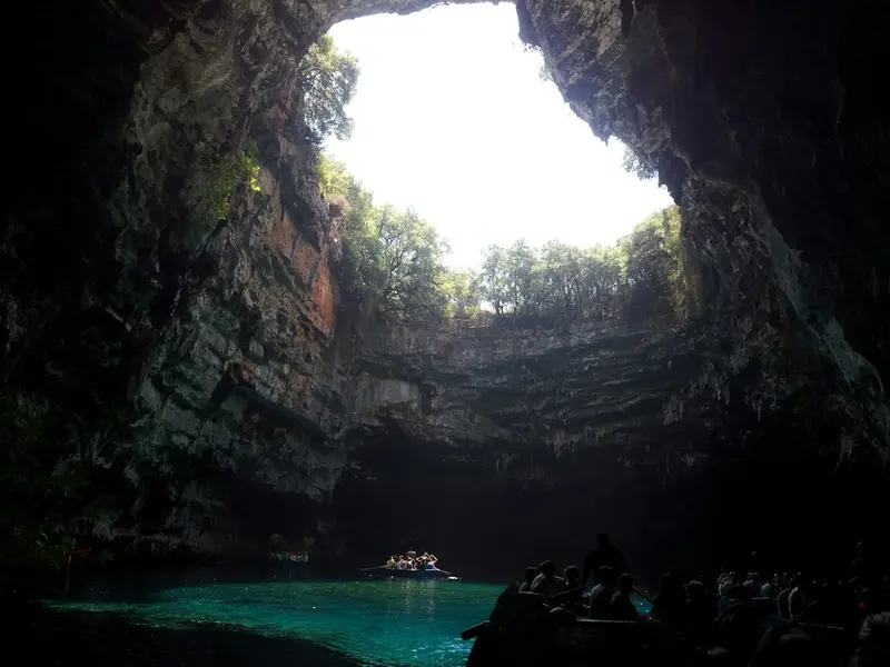
    The Melissani, near Karavomylos and Sami, is a karst cave with a lake of brackish and freshwater. Part of the ceiling collapsed millennia ago, so daylight falls directly onto the water, making the lake glow blue.It is fed, among other things, by seawater that disappears into the limestone at the Katavothres near Argostoli on the other side of the island and flows underground across the island. This was proven in the 1960s with dye experiments.The cave is explored by rowboat, with the tour lasting only a few minutes. Around midday, the sun is directly above the opening, which is when wait times are also longest.
    Open in Google Maps
    Myrtos Inlet

    4Myrtos Inlet

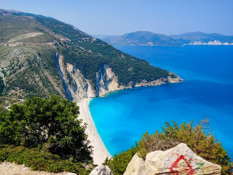
    Myrtos, located in the northwest between two mountain ridges, is the most famous beach of the Ionian Islands. Its pebbles consist of crushed limestone, whose fine particles float in the water, giving it its unusually bright color.From the coastal road between Divarata and Assos, several viewpoints offer views over the bay, from where a winding road descends. On the beach, there are sunbeds and a canteen, but no natural shade.The seabed drops steeply and the surf is stronger than pictures might suggest. In August, the car park at the bottom is full in the mornings; the pull-ins at the viewpoints are narrow and located directly on the road.
    Open in Google Maps
    Assos

    5Assos

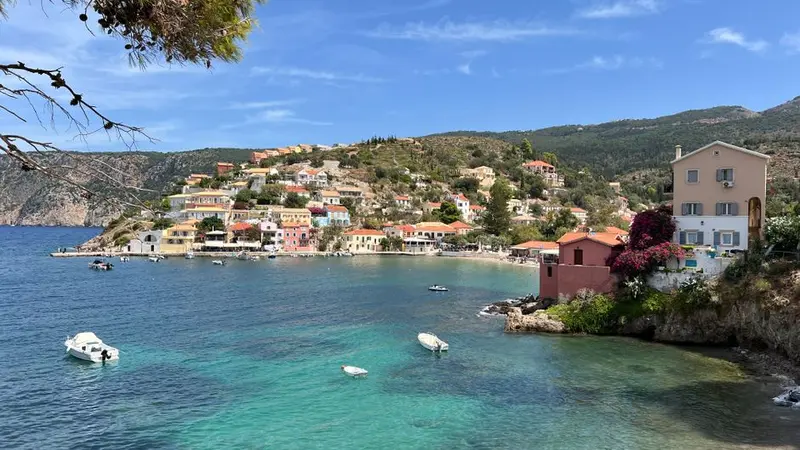
    Assos is situated on a narrow strip of land connecting a wooded peninsula to the island. Its pastel-coloured houses cluster around a small bay, with the hillside rising steeply behind them.On the peninsula stands a Venetian fortress dating from 1593, built as a refuge for the northern population and spanning approximately two kilometres in circumference. The ascent takes about 30 minutes via a paved path.After the 1953 earthquake, the village was rebuilt with French assistance, a fact commemorated by a square in the centre. Access is via a narrow winding road, and parking is scarce.
    Open in Google Maps
    Drogarati Stalactite Cave

    6Drogarati Stalactite Cave

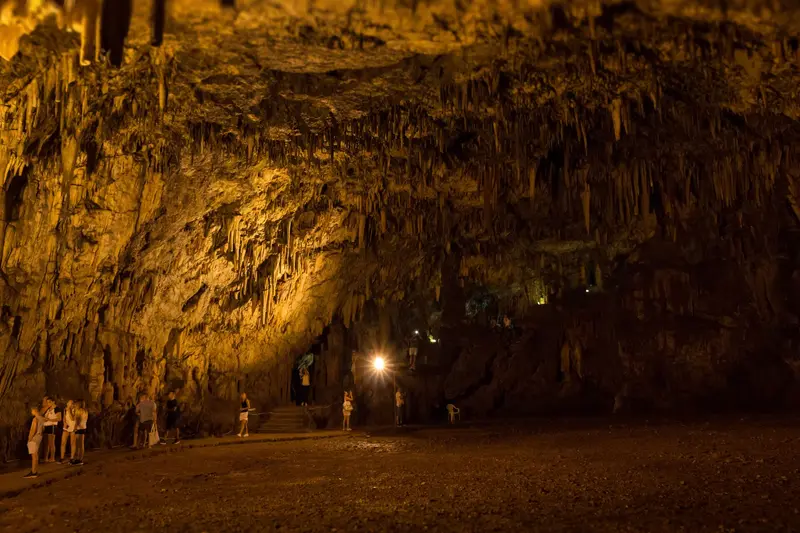
    Reportedly, the Drogarati Cave, southwest of Sami, became accessible about 300 years ago due to an earthquake and is entered via a staircase. Below lies a large hall with stalactites and stalagmites.Owing to its acoustics, the hall hosts occasional concerts. The temperature stays around 18 degrees year-round; humidity is high.The steps are damp and slippery, so sturdy shoes are recommended. Melissani is only minutes away; a combo ticket for both caves is available on-site.
    Open in Google Maps

    Food and Drink

    1

    Plátanos

    The family-run eatery is located in Valsamata in the Omala Plain, not far from Agios Gerasimos Monastery. The cuisine is Greek and simple: Souvlaki, grilled lamb chops, and Greek salad. It's ideal for a break when driving through the island's interior.
    Show on Google Maps
    2

    Mpotsolos restaurant

    The tavern in **Valsamata** is located on the road to Agios Gerasimos Monastery and is often visited after a monastery tour. Traditional Greek cuisine is served, including Horta, boiled wild greens with olive oil and lemon. Some tables are set up outdoors under a canopy.
    Show on Google Maps
    3

    Stou Tsagkari

    The village tavern in Zola, on the Gulf of Argostoli, has a terrace with sea views. The menu features traditional Greek and Kefalonian cuisine, plus fish. The terrace fills up in the evenings to catch the sunset.
    Show on Google Maps
    4

    3 Cheeky Monkeys

    This small eatery in the harbor village of Assos specializes in Souvlaki. It's perfect for a quick meal between a swim in the bay and the climb to the Venetian fortress.
    Show on Google Maps
    5

    Vista Mare

    The family restaurant in Agkonas, north of Argostoli, is located on a hillside with mountain and sea views. The focus is on grilled items. Pork, goat, and lamb are from the family's own farm; on Saturdays, suckling pig is available by pre-order.
    Show on Google Maps
    6

    Unbekannter Ort

    The village tavern in Troianata, southeast of Argostoli, focuses mainly on grilled meat. Besides, Greek classics and Kefalonian dishes are on the menu. The village is away from the coast and is ideal for a detour during a tour of the island's south.
    Show on Google Maps

    Food & Drink

    Kefalonia has its own grape variety, its own pie, and a cuisine that shares the region's Venetian influence. Much comes from the Omala Valley and the slopes of Ainos.
    Robola

    Robola

    The white grape grows on limestone up to 800m altitude, producing dry, acidic wines with protected origin. The cooperative in Omala Valley near Agios Gerasimos Monastery offers cellar and vineyard tours. It pairs with fish and local cheese.
    Kreatopita

    Kreatopita

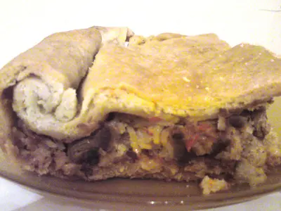
    The Kefalonian meat pie is filled with lamb or goat, rice, cinnamon and herbs and baked in puff pastry. It is a staple for feast days and Sundays and is on the menu as a daily special in many tavernas. It is served in thick pieces, usually lukewarm.

    Aliada and Bakaliaros

    Aliada is the Kefalonian garlic paste made from potatoes, olive oil, and plenty of garlic, served with fried stockfish. This combination is traditionally served on March 25th and Palm Sunday. In the tavernas of Argostoli, you can find it all year round.
    Riganada and Thyme Honey

    Riganada and Thyme Honey

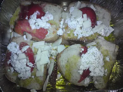
    Riganada is toasted bread with tomato, oregano, and olive oil, a dish from humble times that has endured. Accompanying it is thyme honey from the slopes of Ainos, sold by beekeepers along the road. You’ll find both on almost every mezedes menu.
    Fish from Fiskardo and Agia Efimia

    Fish from Fiskardo and Agia Efimia

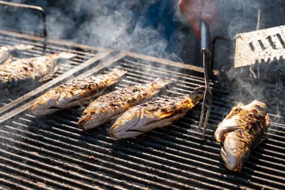
    Die kleinen Häfen im Norden und Osten liefern täglich Fangfrisches, das direkt in den Tavernen am Wasser landet. Abgerechnet wird nach Gewicht, ein Blick in die Kühlvitrine vor der Bestellung ist üblich. Die Preise liegen in Fiskardo spürbar höher als anderswo auf der Insel.

    History and Culture of Kefalonia

    Venetian CenturiesAfter Byzantine and Norman times, Kefalonia was briefly Ottoman from 1479 to 1500, until a Spanish-Venetian army conquered the island. It remained Venetian until 1797; the castle of Agios Georgios near Peratata and the fortress of Assos date from this period. Thereafter followed the French, Russians, and British, and in 1864 Kefalonia joined Greece.1943 and 1953In September 1943, after Italy's armistice, the Italian Acqui Division fought against the Wehrmacht on the island. Following their capitulation, several thousand Italian soldiers were shot; Louis de Bernières' novel "Corelli's Mandolin" recounts these events. Ten years later, the 1953 earthquake destroyed almost all settlements; only Fiskardo in the north remained largely intact.Faith and WineThe island's patron saint, Gerasimos, is revered at the monastery in the Omala Valley; many pilgrims arrive on his feast days in August and October. In the same valley, the white grape variety Robola is cultivated, from which the island's most famous wine is produced.

    Arrival and exploring Kefalonia

    Getting ThereKefalonia Airport is located about ten kilometers south of Argostoli. Ferries connect Poros with Kyllini on the Peloponnese, Sami with Ithaka and Patras, and Fiskardo with Ithaka and Lefkada. In summer, there's also a connection to Zakynthos. Schedules change seasonally, check them before your trip.Around the IslandA rental car is ideal, as KTEL buses mostly connect main towns and run infrequently. Roads are winding and narrow in the mountains; plan for a good 90 minutes from Argostoli to Fiskardo. A small ferry plies the bay between Argostoli and Lixouri, saving the overland detour.On Foot and LocallyExplore Argostoli, Assos, and Fiskardo on foot. Taxis are available in larger towns and at the airport; in smaller villages, it's best to call them in advance.

    Accommodations in Kefalonia (Island)

    Find perfect stay in Kefalonia (Island)

    Booking.com* (Affiliate link)
    Search Hotels
    Agoda* (Affiliate link)
    Search Hotels
    Airbnb
    Vacation Rentals

    * Affiliate link: if you book through it, we earn a small commission. The price stays the same for you.

    Campgrounds in Kefalonia (Island)

    Find perfect campground in Kefalonia (Island)

    Search via Google Maps
    Campgrounds nearby (15km)
    Camping.info
    Find Campgrounds
    Park4Night
    RV Parks & Camping

    Plan your trip to Kefalonia (Island)

    Save places, build a route and plan your city trip, all in one place.

    1. 1
      Sunrise over alpine peaks and a sea of clouds
      1234

      Round trip

      12 days · 4 stops

      Saved

      Pick a route

      Pick a ready-made one or save places and plan your own.

      Open bookmarks
    2. 2

      Trip to Kefalonia (Island)

      Live
      • 1Agios Gerasimos Monastery3 days
      • 2Monastery Agios Andreas Milapidias4 days
      • 3Cave of Melissani5 days
      Budget

      Plan your trip

      The planner sorts stops, days and budget. Plan together in real time.

      Start trip planning
    3. 3
      9:41 No signal
      Kefalonia (Island)
      Available offline

      Use it on the road

      Download the guide to your phone and use it on site, even offline.

    Nearby

    Ionian Islands

    Ionian Islands

    The Ionian Islands, west of the mainland, contrast sharply with the Aegean: more rain, more greenery, a Venetian rather than Ottoman past. Seven larger islands, from northern Corfu to southern Kythira, feature cypresses, olive groves, and towns with arcades and bell towers. Here, travelers find limestone cliffs, turquoise water, and Italian cuisine.
    Zakynthos (Island)

    Zakynthos (Island)

    Zakynthos is the southernmost of the larger Ionian Islands and presents two faces: in the north and west, a rugged coastline with caves and Shipwreck Bay Navagio; in the south, flat sandy beaches where loggerhead sea turtles lay their eggs. In between lies a fertile plain with vineyards and olive groves. The Venetians named the island Fior di Levante.
    Lefkada (Island)

    Lefkada (Island)

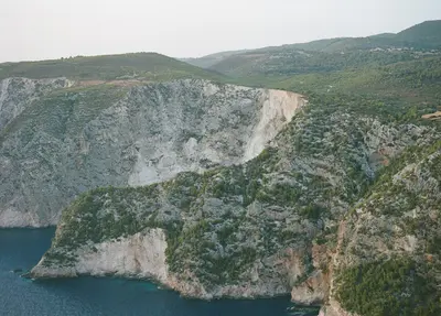
    Lefkada is accessible without a ferry: A causeway with a floating swing bridge connects the island to the mainland via a narrow canal. It is known for its west coast, where white limestone cliffs plunge steeply into turquoise waters.Behind this lies a mountainous island interior with lentil fields, embroidery traditions, and villages at over 700 meters altitude. On the quieter east coast, boat trips depart to the offshore islands.
    Ancient Olympia

    Ancient Olympia

    Ancient Olympia is located in the region of Elis in the west of the Peloponnese, where the Kladeos flows into the Alpheios. From 776 BC to 393 AD, the Olympic Games were held here every four years in honor of Zeus, for almost twelve centuries. Of the sanctuary, foundations, toppled column drums, and the stadium are preserved; the sculptures are in the museum opposite.
    Galaxidi

    Galaxidi

    Galaxidi is a small port town on the north coast of the Gulf of Corinth, about 30 kilometers southwest of Delphi. In the 19th century, it was one of Greece's most important shipping towns, and in the 1860s and 1870s, its merchant fleet comprised over 400 sailing ships. The stone captain's houses from this period still define the townscape today.You come to Galaxidi for a quiet evening at the harbor after visiting Delphi, for the Maritime Museum, and for walks between the two harbors and through the pine forest opposite. On Kathara Deftera, Clean Monday at the beginning of Orthodox Lent, the flour battle Alevromoutzouroma attracts many visitors.

    Sources & method

    • Photos: Wikimedia Commons, Unsplash, Pexels, Google Maps. Each photo carries its credit.
    • Place data such as addresses and ratings comes from Google Maps.
    • The content is based on web research from public, traceable sources. How the content is made · The role of AI