Fernweh: Home
    ExploreTravel GuidesPlan a tripMy tripLast visited
    de|en
    All Places & RegionsAll highlightsAbout FernwehFAQPrivacy PolicyImprint
    ExploreTravel GuidesPlan a tripMy tripLast visited
    • Neighborhoods & highlights
    • Walking tours
    • Eat & drink
    • Food culture
    • Culture
    • Getting around
    • Accommodation
    • Plan trip
    • Nearby
    Symi

    Greece

    Symi

    City

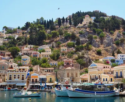
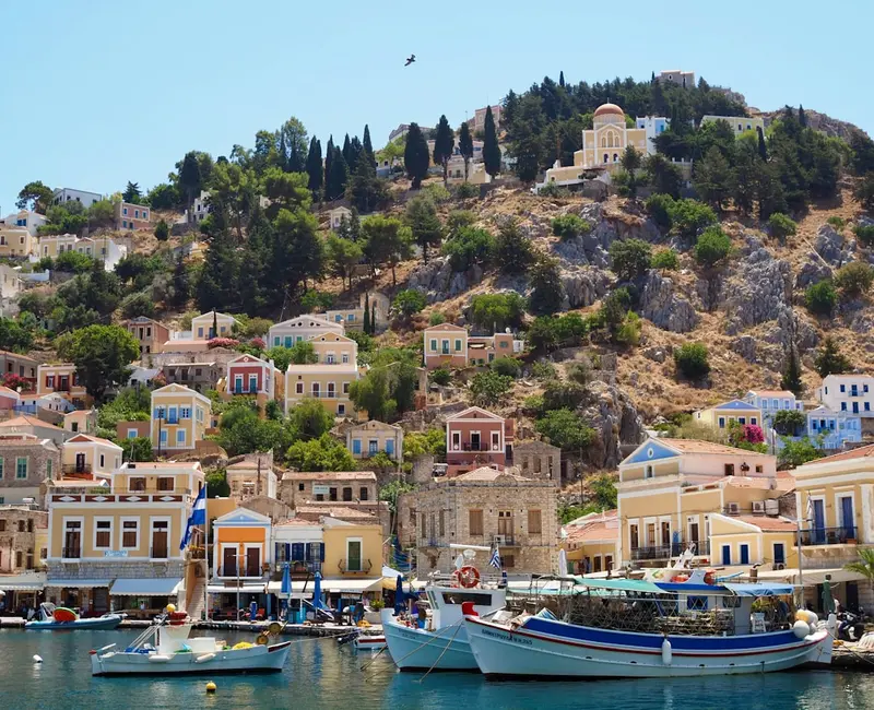
    Symi is located north of Rhodes, close to the Turkish coast, and is known for its harbor town Gialos, whose neoclassical houses in ochre, pink, and blue climb the hillsides.

    by Felix Gillen

    1. Home
    2. Destinations
    3. Greece
    4. Dodecanese
    5. Symi
    Symi is located north of Rhodes, close to the Turkish coast, and is known for its harbor town Gialos, whose neoclassical houses in ochre, pink, and blue climb the hillsides. Restorations are subject to the regulations of the State Archaeological Service, which is why the townscape appears cohesive to this day.The town thrived on sponge diving and shipbuilding, which made the island wealthy in the 19th century and allowed its population to grow to over 20,000. Today, around 2,600 people live here. During the day, many excursion boats arrive from Rhodes; in the evenings, it becomes significantly quieter.

    Sights in Symi

    Discover the most important sights and attractions

    1Symi viewpoint

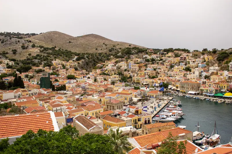
    The Symi viewpoint offers an unparalleled panoramic vista over the picturesque harbor of Gialos and the upper town of Chorio above it. You'll witness characteristic neoclassical mansions, terraced gracefully into the hillsides and glowing in vibrant hues. This architecture bears witness to the island's former prosperity, significantly shaped by the sponge trade and shipping during the 19th century. From here, you can survey the entire bay and appreciate the island's rich historical fabric, blending harmoniously into the Aegean Sea. The ascent to the viewpoint, often via the renowned Kali Strata with its hundreds of steps, is already part of the experience, constantly revealing new perspectives. Our tip: Visit the viewpoint in the late afternoon to capture the golden glow of the setting sun on the brightly colored houses. For an unobstructed photograph, we recommend an early morning visit before the day-trippers arrive.
    Open in Google Maps

    2Giala Beach

    Giala is a small pebble bay on the north coast of Symi, west of Gialos between the harbour and Emporios Bay. Steep rocky slopes frame the beach; the water is clear and ideal for snorkelling. There's no infrastructure; bring your own water and sun protection.
    Open in Google Maps

    38th of May Square

    The square is named after May 8, 1945, the day on which General Otto Wagener, commander of the German troops in the Dodecanese, signed the surrender to British officers on Symi. This marked the end of the German occupation of the island group. The anniversary is observed annually on Symi with a celebration. The square is situated on the slope above the bay, offering views over the houses of Symi.
    Open in Google Maps

    4Lapathos Beach

    Lapathos lies in the bay of Agios Vasilios on Symi's west, away from any road. You reach the beach on foot via a hiking trail of around 1.5 hours; the final stretch descends steeply to the water. Excursion boats visit the bay, but with no jetty, you'll swim the last part. There's no infrastructure; bring your own water and sun protection.
    Open in Google Maps

    5Plaka Beach

    Plaka is a small swimming spot on Symi's north coast, northwest of Gialos harbour, en route to Emporios. The seabed is pebbles and rock; the water deepens quickly. No facilities like sunbeds or tavernas are available. Reach it from Gialos on foot along the coast or by water taxi.
    Open in Google Maps
    Lookout Point over Gialos

    6Lookout Point over Gialos

    The viewpoint lies in the upper town Chorio at the top of the Kali Strata. From here, you overlook Gialos harbour and the slopes with neoclassical houses in ochre, pink, and blue, which were built in the 19th century with money from sponge diving and shipbuilding. On foot, it's about 20 minutes from the harbour via the approximately 500 steps of the Kali Strata.
    Open in Google Maps

    City walks in Symi

    Curated walking tours through the city's highlights, handpicked by experienced travel journalists.

    Symi: Stairways, Panoramas and Postcard Views

    On this 2-hour walk, immerse yourself in the enchanting world of Symi. From the colorful houses of the harbor, climb the famous Kali Strata to discover the charming upper town of Chorio and its breathtaking views. An unforgettable experience full of history, picturesque lanes and Mediterranean flair.

    ~2 Std.
    Open in Google Maps
    Stops (7)

    Dining & Drinks

    1

    Sunrise Cafe

    Cafe in Oberdorf Chorio with breakfast, coffee, pastries, and small dishes. A place for a break after the climb via the Kali Strata.
    Show on Google Maps
    2

    Agora Symi

    Restaurant on the lower section of Kali Strata above Gialos harbour. The cuisine focuses on fish, seafood and island dishes, including the small Symi shrimp.
    Show on Google Maps
    3

    Leonidas creperie

    Creperie in the port town of Gialos with sweet and savory crêpes. Suitable for a quick snack in between.
    Show on Google Maps
    4

    Constantinos View

    Restaurant on the southern edge of Chorio with views over the valley. The menu features Greek dishes, seafood, and Symi shrimp.
    Show on Google Maps
    5

    The Secret Garden

    Kafeneion on Kali Strata in Chorio's upper village. Serving coffee and drinks, its garden is away from the harbour's bustle.
    Show on Google Maps

    Food and Drink on Symi

    Symi has a shrimp specialty found only here. Otherwise, the island's cooking is Dodecanesian: much seafood, little meat, herbs from the slopes.

    Prawns from Symi

    The tiny shrimp from the deep waters around the island are fried whole and eaten with their shells, served with just lemon. They are so small that peeling them isn't worth it, and they taste distinctly saltier than large prawns. In the tavernas on the quay of Gialos, they are on every menu.

    Quayside fish

    The catch lands directly in Gialos and Pedi, with several tavernas buying fresh in the mornings. It's sold by weight, and the price per kilo is on the menu. Besides gilt-head bream and sea bass, sardines, anchovies, and grilled octopus are worth trying.

    Capers and Wild Herbs

    On the barren slopes grow capers, oregano, thyme, and sage, which are sold dried or pickled. The young caper shoots are salted and served with salads. In the shops along the Kali Strata, they are available in jars.

    Souma

    This clear pomace brandy is distilled from grape pomace after the harvest and traditionally produced only within a short time window. On Symi and Rhodes, it is served after meals in small glasses. It is usually sold directly by the producers.

    Pastries from Chorio

    In the upper town, several small businesses bake almond pastries, rusks, and cheese-filled pockets, often only in the mornings. Greek coffee comes with a spoon of fruit preserve. The cafés on Chorio Square serve both.

    History and Architecture on Symi

    Successive RulersLike the rest of the Dodecanese, Symi successively belonged to Byzantium, the Knights Hospitaller, and the Ottoman Empire, then to Italy. On May 8, 1945, German troops in the Dodecanese signed their surrender to British officers on Symi; a square in Gialos commemorates this.Sponge Divers and ShipbuildersIn the 19th century, sponge fishing and shipbuilding brought great prosperity to the island. At that time, the neoclassical merchant houses in Gialos and Chorio were built, featuring gables, pilasters, and colorful facades. With the decline of these industries in the 20th century, many residents emigrated, and numerous houses stood empty for a long time.PanormitisThe Monastery of Archangel Michael in the south is the island's religious center. Pilgrims from all over Greece come for the Feast of the Archangel in November. The present church dates from 1783, the bell tower from 1911.

    On the go locally

    Getting ThereSymi has no airport. The easiest route is via Rhodes: Ferries, catamarans, and excursion boats depart Rhodes Town for Gialos several times daily, some also stopping at Panormitis. Further ferry lines connect to the Dodecanese and Piraeus.Bus, Taxi, Water TaxiA small island bus connects Gialos with Chorio and Pedi, taxis are few. In summer, water taxis and excursion boats depart from Gialos to many coves like Agios Georgios Dysalona, Nanou, or Marathounda, which are difficult or impossible to reach by land.On FootGialos and Chorio are linked by the Kali Strata, approx. 20 minutes uphill. Hiking paths lead from Pedi to Agios Nikolaos and Agia Marina coves. The island is steep and hot in summer; bring plenty of water.

    Accommodations in Symi

    Find perfect stay in Symi

    Booking.com* (Affiliate link)
    Search Hotels
    Agoda* (Affiliate link)
    Search Hotels
    Airbnb
    Vacation Rentals

    * Affiliate link: if you book through it, we earn a small commission. The price stays the same for you.

    Campgrounds in Symi

    Find perfect campground in Symi

    Search via Google Maps
    Campgrounds nearby (15km)
    Camping.info
    Find Campgrounds
    Park4Night
    RV Parks & Camping

    Plan your trip to Symi

    Save places, build a route and plan your city trip, all in one place.

    1. 1
      Sunrise over alpine peaks and a sea of clouds
      1234

      Round trip

      12 days · 4 stops

      Saved

      Pick a route

      Pick a ready-made one or save places and plan your own.

      Open bookmarks
    2. 2

      Trip to Symi

      Live
      • 1Symi viewpoint3 days
      • 2Giala Beach4 days
      • 38th of May Square5 days
      Budget

      Plan your trip

      The planner sorts stops, days and budget. Plan together in real time.

      Start trip planning
    3. 3
      9:41 No signal
      Symi
      Available offline

      Use it on the road

      Download the guide to your phone and use it on site, even offline.

    Nearby

    Dodecanese

    Dodecanese

    The Dodecanese, a long chain of islands off the Turkish coast, only became part of Greece with the Treaty of Paris in 1947. More than elsewhere, the Knights Hospitaller, Ottomans, and Italians left their mark here, hence the architecture has little to do with the white cube houses of the Cyclades: knightly castles, mosques, fortified monasteries, and Italian administrative buildings.The group ranges from Rhodes, by far the largest and liveliest island, to islets with only a few hundred inhabitants. Visitors will find seaside resorts, ancient sites, and quiet harbour villages often just an hour's ferry ride apart.
    Rhodes (City)

    Rhodes (City)

    The Old Town of Rhodes City is one of Europe's most completely preserved medieval cityscapes and has been a UNESCO World Heritage site since 1988. It was shaped by the Knights Hospitaller, who ruled the island from 1309 to 1522, with mosques and baths later added by the Ottomans. Behind a roughly four-kilometer-long ring wall lie the Grand Master's Palace, the Street of the Knights, and a maze of alleys. Outside the walls are the New Town with Italian buildings from the 1920s and 1930s and Mandraki Harbor. Walk through the Old Town in the early morning or late afternoon; at midday, it's crowded with day-trippers.
    Kos

    Kos

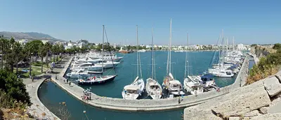
    Kos, the third-largest Dodecanese island, lies just a few kilometers off the Turkish coast near Bodrum. In the island capital, ancient ruins, a Knights Hospitaller castle, and 1930s Italian buildings stand side by side. Inland, the Dikeos Ridge rises, its slopes home to mountain villages like Zia and Pyli.
    Bodrum

    Bodrum

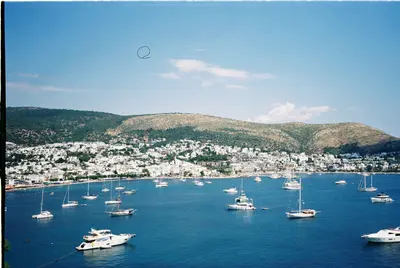
    Bodrum is located at the southern tip of the Turkish Aegean on the peninsula of the same name, at the site of ancient Halikarnassos. You come for the Castle of St. Peter with its Museum of Underwater Archaeology, the remains of the Mausoleum, and the evenings in the harbor and bar street. The Old Town with its castle, harbor, and bazaar is the focal point; on the peninsula are towns like Bitez, Gümüşlük, and Yalıkavak.
    Lindos

    Lindos

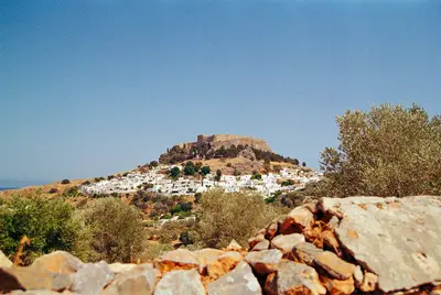
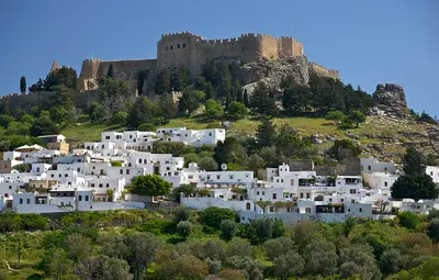
    Lindos is located on the east coast of Rhodes, about 40 kilometers south of the island capital, below a rock featuring an ancient acropolis and a castle of the Knights of St. John. White houses, pebble mosaics in the courtyards, and narrow streets define the village, whose center is closed to vehicles. Below are the main beach and the small St. Paul's Bay.

    Sources & method

    • Photos: Wikimedia Commons, Unsplash, Pexels. Each photo carries its credit.
    • The content is based on web research from public, traceable sources. How the content is made · The role of AI