Fernweh: Home
    ExploreTravel GuidesPlan a tripMy tripLast visited
    de|en
    All Places & RegionsAll highlightsAbout FernwehFAQPrivacy PolicyImprint
    ExploreTravel GuidesPlan a tripMy tripLast visited
    Buller Distrikt

    New Zealand

    Buller Distrikt

    DistrictCulture

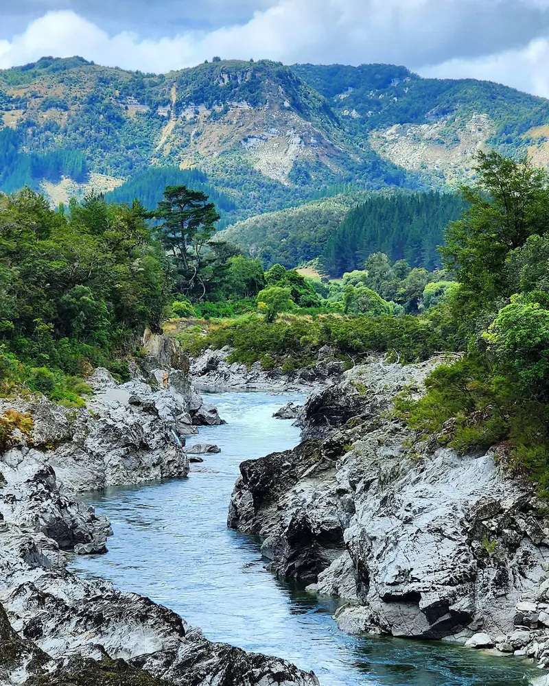
    The Buller District forms the northern West Coast, its main town Westport at the mouth of the Buller River. Inland, the river cuts through the Buller Gorge.

    by Felix Gillen

    1. Home
    2. Destinations
    3. New Zealand
    4. West Coast
    5. Buller Distrikt
    The Buller District forms the northern West Coast, its main town Westport at the mouth of the Buller River. Inland, the river cuts through the Buller Gorge. Along the coast are Cape Foulwind, with its seal colony, and old mining settlements like Denniston and Millerton.Further north, the road ends in Karamea. From there, you can reach the Oparara Arches in Kahurangi National Park and the southern end of the Heaphy Track.

    Sehenswürdigkeiten

    Discover the most important sights and attractions

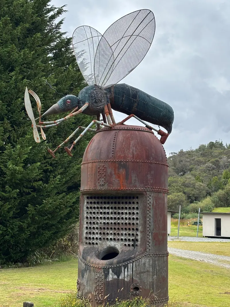
    Sandfly Statue

    1Sandfly Statue

    Giant sandfly sculpture, a photo stop with a wink. Real sandflies are ubiquitous on the West Coast, pack insect repellent.
    Open in Google Maps
    Whale Creek Rapid

    2Whale Creek Rapid

    Rapids in the Buller River in the Buller Gorge, a section navigated during rafting tours.
    Open in Google Maps
    Millerton Lookout

    3Millerton Lookout

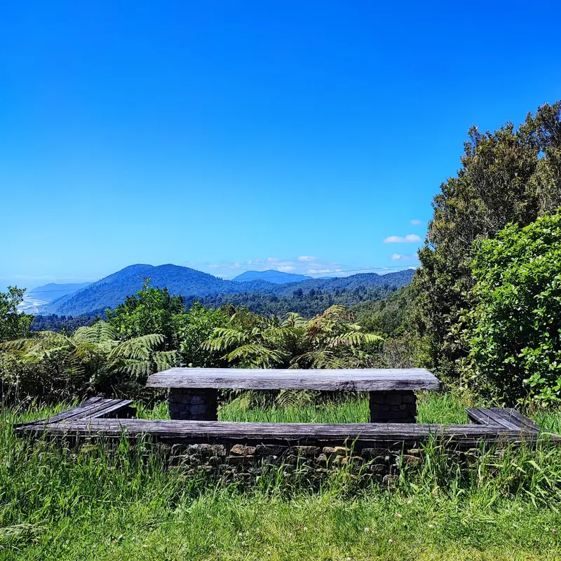
    Viewpoint near the former mining settlement of Millerton north of Westport. The plateaus around Millerton and Denniston supplied coal until the 20th century, traces of which are still visible in the landscape.
    Open in Google Maps
    Buller Gorge Swing Bridge
    Attraction

    4Buller Gorge Swing Bridge

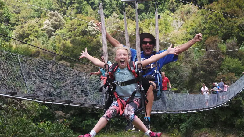
    Long suspension bridge over the Buller River in the upper Buller Gorge on State Highway 6. On the other side, short paths lead to gold rush remnants, with ziplining and jet boating.
    Open in Google Maps
    Oparara Arches
    Attraction

    5Oparara Arches

    Limestone Arches in Kahurangi National Park, north of Karamea, through which the Oparara River flows. Access is via a gravel road, and from the car park, you walk through rainforest to the arches.
    Open in Google Maps

    Essen & Trinken

    1

    Coalface Cafe & Takeaways

    Bakery and cafe on the Coastal Road north of Westport, convenient for a stop on the way to Karamea.
    Show on Google Maps

    Coal On The Coast

    Coal mining began on the coastal plateaus in the 19th century. In Denniston, the steep Denniston Incline brought coal down to the railway line; today, its remains are a historic site with info panels. Westport was long the region's most important coal port.

    Arrival and on-site

    You can reach Westport via State Highway 6 through the Buller Gorge or along the coast from Greymouth. State Highway 67 leads about a hundred kilometers north to Karamea, after which the road ends. Without your own car, the district is hard to explore.

    Accommodations in Buller Distrikt

    Find perfect stay in Buller Distrikt

    Booking.com* (Affiliate link)
    Search Hotels
    Agoda* (Affiliate link)
    Search Hotels
    Airbnb
    Vacation Rentals

    * Affiliate link: if you book through it, we earn a small commission. The price stays the same for you.

    Nearby

    Punakaiki

    Punakaiki

    Punakaiki is a small town on State Highway 6 between Greymouth and Westport, right on the edge of Paparoa National Park. It is known for the Pancake Rocks at Dolomite Point: limestone rocks that look like stacked pancakes. At high tide and strong surf, water shoots upwards through the blowholes.Behind the coast, limestone gorges with Nikau palms and rainforest begin. Plan at least half a day if you want to explore one of the river trails in addition to the rocks.
    Greymouth

    Greymouth

    Greymouth, Māwhera in Māori, is at the mouth of the Grey River and the largest town on the West Coast. Gold and coal made it thrive in the 19th century; today it's mainly a service hub and the TranzAlpine's terminus from Christchurch.The centre is small and quick to explore. For a day, highlights include the brewery, a walk along the river, and trips into the surrounding area, to Shantytown or the Brunner Mine.

    Mapua

    Mapua is a small coastal town on the Waimea Inlet, about 30 minutes west of Nelson. Its old fruit port, Mapua Wharf, is lined with shops, galleries, cafés, and a small brewery.The town is located on the Great Taste Trail, a cycle trail between Nelson and Motueka. Many cyclists take a break here and cross to Rabbit Island on the small ferry.

    Motueka

    Motueka is a small town on Tasman Bay, about 45 minutes from Nelson, surrounded by orchards and hop fields. For many travelers, it's the last supply point before Abel Tasman National Park and Golden Bay.On High Street, you'll find supermarkets, cafés, and outfitters, and on the waterfront, the shipwreck of the Janie Seddon and a tidal pool for swimming. On Sundays, a market is held.

    Tahunanui

    Tahunanui is Nelson's beach suburb, about five kilometers southwest of the centre. Its wide, flat sandy beach on Tasman Bay is popular with families; behind it are lawns, playgrounds, a small zoo and campsite.The kitesurfing scene gathers at Back Beach, behind the dunes. In neighbouring Stoke are Isel Park and Pic's peanut butter factory.

    Sources & method

    • Photos: Pexels, Google Maps. Each photo carries its credit.
    • Place data such as addresses and ratings comes from Google Maps.
    • The content is based on web research from public, traceable sources. How the content is made · The role of AI