Fernweh: Home
    ExploreTravel GuidesPlan a tripMy tripLast visited
    de|en
    All Places & RegionsAll highlightsAbout FernwehFAQPrivacy PolicyImprint
    ExploreTravel GuidesPlan a tripMy tripLast visited
    Punakaiki

    New Zealand

    Punakaiki

    Area

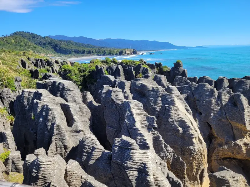
    Punakaiki is a small town on State Highway 6 between Greymouth and Westport, right on the edge of Paparoa National Park. It is known for the Pancake Rocks at Dolomite Point: limestone rocks that look like stacked pancakes.

    by Felix Gillen

    1. Home
    2. Destinations
    3. New Zealand
    4. West Coast
    5. Punakaiki
    Punakaiki is a small town on State Highway 6 between Greymouth and Westport, right on the edge of Paparoa National Park. It is known for the Pancake Rocks at Dolomite Point: limestone rocks that look like stacked pancakes. At high tide and strong surf, water shoots upwards through the blowholes.Behind the coast, limestone gorges with Nikau palms and rainforest begin. Plan at least half a day if you want to explore one of the river trails in addition to the rocks.

    Sehenswürdigkeiten

    Discover the most important sights and attractions

    Pancake Rocks and Blowholes Track
    Attraction

    1Pancake Rocks and Blowholes Track

    A 20-minute loop walk through the layered limestone cliffs of Dolomite Point. At high tide and with a westerly wind, the sea pushes water up through the blowholes. The track starts opposite the Visitor Centre on State Highway 6.
    Open in Google Maps
    Pororari River Track
    Attraction

    2Pororari River Track

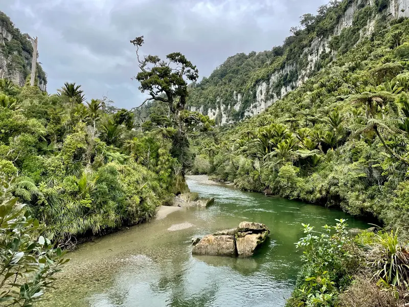
    Hiking trail along the Pororari River through a limestone gorge with Nikau palms and rainforest. The entry is at the bridge north of the town; the path can be walked as a short out-and-back or a longer loop.
    Open in Google Maps

    Essen & Trinken

    1

    Pete's Pattie Palace

    Small eatery on Owen Street in Punakaiki's village center, just a few minutes from the Pancake Rocks.
    Show on Google Maps
    2

    Punangairi Visitor Centre - Paparoa Experience

    Café in the visitor center opposite the Pancake Rocks, handy for a coffee and a snack before or after the circuit.
    Show on Google Maps
    3

    Ocean View Restaurant & Bar

    Restaurant with bar on State Highway 6, south of Pancake Rocks, overlooking the Tasman Sea.
    Show on Google Maps

    Paparoa National Park

    Established in 1987, Paparoa National Park protects limestone landscapes featuring gorges, caves, and rivers flowing directly into the sea. Since 2019, the Paparoa Track, a Great Walk, crosses the range, ending at the Pororari River near Punakaiki.Mind the TidesThe blowholes are active only at high tide with sufficient swell. Checking the tide timetable before you arrive is recommended.

    Arrival and On-site

    Punakaiki is located about 45 kilometers north of Greymouth on the coastal road State Highway 6. A private car is the easiest solution; public transport links are rare. In the town, the visitor center, parking, and trailheads are a few hundred meters apart; everything is accessible on foot.

    Accommodations in Punakaiki

    Find perfect stay in Punakaiki

    Booking.com* (Affiliate link)
    Search Hotels
    Agoda* (Affiliate link)
    Search Hotels
    Airbnb
    Vacation Rentals

    * Affiliate link: if you book through it, we earn a small commission. The price stays the same for you.

    Nearby

    Greymouth

    Greymouth

    Greymouth, Māwhera in Māori, is at the mouth of the Grey River and the largest town on the West Coast. Gold and coal made it thrive in the 19th century; today it's mainly a service hub and the TranzAlpine's terminus from Christchurch.The centre is small and quick to explore. For a day, highlights include the brewery, a walk along the river, and trips into the surrounding area, to Shantytown or the Brunner Mine.
    Buller Distrikt

    Buller Distrikt

    The Buller District forms the northern West Coast, its main town Westport at the mouth of the Buller River. Inland, the river cuts through the Buller Gorge. Along the coast are Cape Foulwind, with its seal colony, and old mining settlements like Denniston and Millerton.Further north, the road ends in Karamea. From there, you can reach the Oparara Arches in Kahurangi National Park and the southern end of the Heaphy Track.
    West Coast

    West Coast

    The West Coast stretches as a narrow strip for about 600 kilometers along the South Island, between the Tasman Sea and the Southern Alps. Rainforest, wild beaches, and rivers characterize the landscape; the towns are small and spread far apart.In the north await the limestone landscapes of Paparoa and Kahurangi, in the center the old gold mining towns of Greymouth and Hokitika, and in the south the Franz Josef and Fox Glaciers. Most travelers drive the entire coast.
    Hokitika

    Hokitika

    Hokitika is a small town on the South Island's West Coast, founded during the 1860s gold rush. Today, it's known for Pounamu workshops, its driftwood beach, and as a gateway to the turquoise Hokitika Gorge.

    Mapua

    Mapua is a small coastal town on the Waimea Inlet, about 30 minutes west of Nelson. Its old fruit port, Mapua Wharf, is lined with shops, galleries, cafés, and a small brewery.The town is located on the Great Taste Trail, a cycle trail between Nelson and Motueka. Many cyclists take a break here and cross to Rabbit Island on the small ferry.

    Sources & method

    • Photos: Pexels, Google Maps. Each photo carries its credit.
    • Place data such as addresses and ratings comes from Google Maps.
    • The content is based on web research from public, traceable sources. How the content is made · The role of AI