Fernweh: Home
    ExploreTravel GuidesPlan a tripMy tripLast visited
    de|en
    All Places & RegionsAll highlightsAbout FernwehFAQPrivacy PolicyImprint
    ExploreTravel GuidesPlan a tripMy tripLast visited
    • Neighborhoods & highlights
    • Eat & drink
    • Culture
    • Getting around
    • Accommodation
    • Plan trip
    • Nearby
    Montezuma
    Vlad Podvorny / Wikimedia Commons / CC BY-SA 3.0

    Costa Rica

    Montezuma

    City

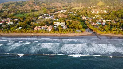
    Montezuma is a small coastal town on the eastern side of the southern tip of the Nicoya Peninsula, approximately 40 kilometers southwest of the Paquera ferry terminal.

    by Felix Gillen

    1. Home
    2. Destinations
    3. Costa Rica
    4. Nicoya Peninsula
    5. Montezuma
    Montezuma is a small coastal town on the eastern side of the southern tip of the Nicoya Peninsula, approximately 40 kilometers southwest of the Paquera ferry terminal. You come here for the waterfalls just behind the town, the beaches along the coast, and its proximity to the Cabo Blanco Nature Reserve.For a long time, Montezuma was a remote fishing village. In the 1950s, Swedish Nicolás Wessberg and Danish Karen Mogensen settled here; their efforts led to the establishment of Cabo Blanco in 1963, Costa Rica's first protected area. Later, expats and backpackers arrived, giving the town its somewhat alternative character that persists to this day.The center consists of a few streets with restaurants, accommodations, shops, and tour operators. To the north and south, rocky coves and sandy beaches line the coast, accessible on foot.From Montezuma, boat trips depart for Isla Tortuga in the Gulf of Nicoya, and a water taxi connects the town with Playa Herradura near Jacó on the opposite coast.

    Sights in Montezuma

    Discover the most important sights and attractions

    Waterfalls of Montezuma
    Point of Interest

    1Waterfalls of Montezuma

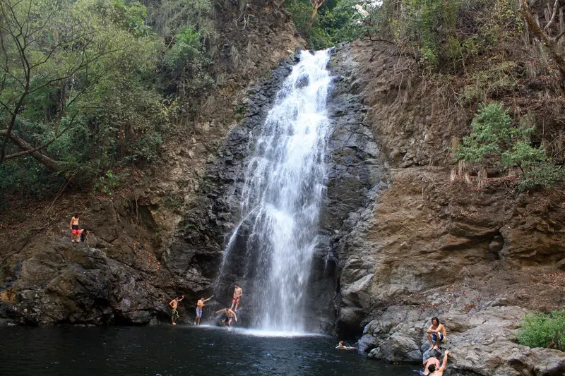
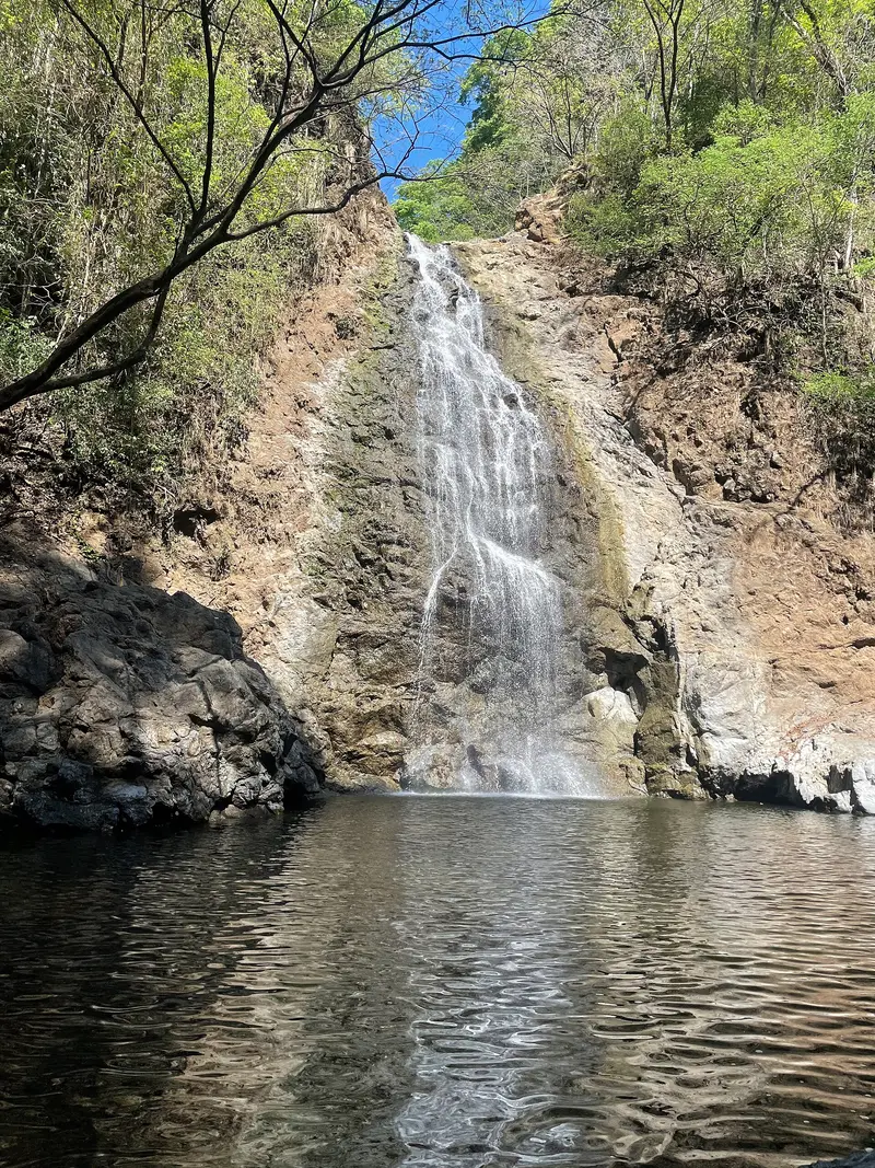
    Three waterfalls lie one after another in the river valley directly south of the village: the lower one about 25 meters high, the middle one around 12 meters, and the small upper fall with a bathing pool. A roughly 20-minute walk through the riverbed leads to the lower fall from the bridge on the road to Cabuya; you reach the upper falls via steep stairs or a path through the property of a private operator who charges an entrance fee. Jumping at the middle and lower falls is strongly discouraged, as fatal accidents have occurred there. During the rainy season, flash floods can occur.
    Open in Google Maps
    Absolute Natural Reserve Cabo Blanco
    Park

    2Absolute Natural Reserve Cabo Blanco

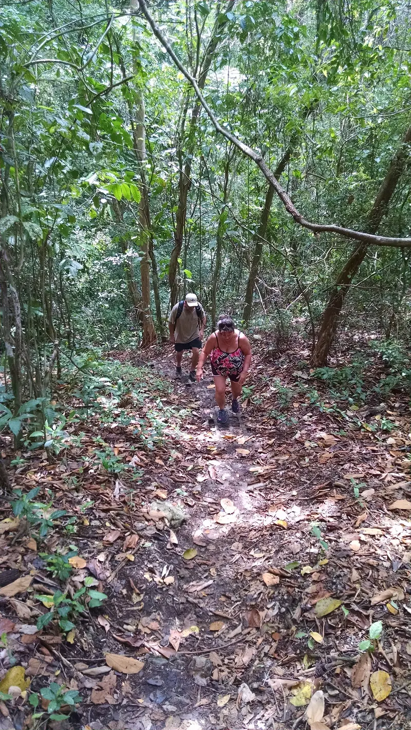
    Established in 1963, the reserve at the southern tip of the peninsula is considered Costa Rica's first protected area. Access is located near the village of Cabuya, south of Montezuma. The Sendero Sueco trail, a 4-kilometer round trip, leads via a steep ascent to a secluded beach, requiring about four hours. Off the coast lies Isla Cabo Blanco, with colonies of Brown Boobies and pelicans. According to local information, the reserve is closed on Mondays and Tuesdays, otherwise open from 8 AM to 4 PM; check opening hours before visiting.
    Open in Google Maps
    Playa Montezuma
    Beach

    3Playa Montezuma

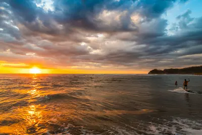
    The beach directly by the town center, at whose northern end the farm of Nicolás Wessberg and Karen Mogensen once stood. From here, you can walk north along the coast to more, quieter coves, behind which paths lead into the forest.
    Open in Google Maps
    Isla Tortuga
    Natural Feature

    4Isla Tortuga

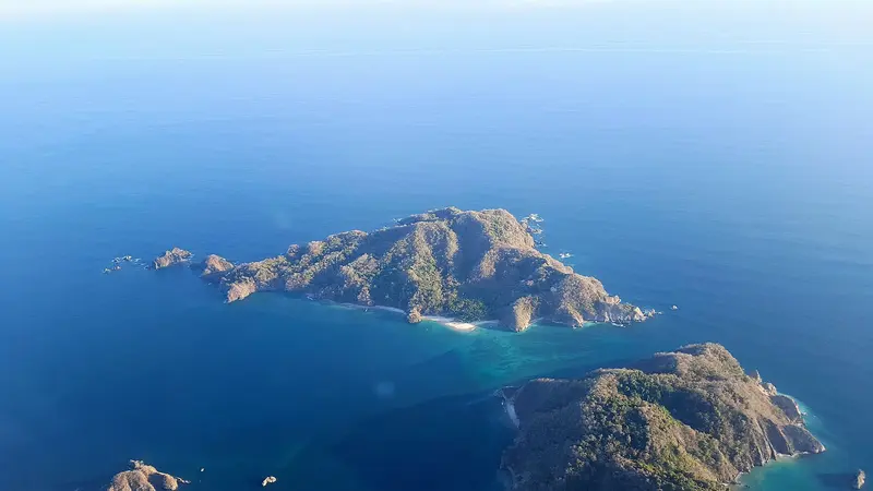
    Two small, adjacent islands, Alcatraz and Tolinga, off the east coast of the peninsula near the Curú Reserve. Boat trips from Montezuma take about 45 minutes, with snorkeling en route. At the main beach, the water is usually calm and clear; loungers, kayaks, and short hikes cost extra, and it gets crowded on days with many tour boats.
    Open in Google Maps

    Restaurants in Montezuma

    1

    Cocolores

    Open-air restaurant in a beachside garden. The menu features fajitas, pasta, salads, skewers, and seafood; in the evenings, you sit here with water views.
    Show on Google Maps
    2

    Soda Típica Las Palmeras

    Simple, open Soda just past the entrance to the waterfalls. Serving Costa Rican classics like Gallo Pinto and Casado, convenient before or after your hike.
    Show on Google Maps
    3

    Earth and Fire

    Italian restaurant in the hills above Montezuma, on the road towards Delicias. Specializing in wood-fired pizza, plus other Italian dishes. You'll need a vehicle to get there.
    Show on Google Maps
    4

    Beach of the Artists

    Restaurant right on the beach south of the center with a changing menu of fresh fish and seafood. Per current info, open for lunch only, Thursday to Sunday only; check beforehand.
    Show on Google Maps

    History and Nature Conservation

    The Wessbergs and Cabo BlancoNicolás Wessberg and Karen Mogensen arrived in Costa Rica in 1954 and bought land at the northern end of Montezuma beach. Their efforts against deforestation led to the protection of Cabo Blanco. After Wessberg's death, Karen Mogensen ran a small guesthouse in the village; today, a nature reserve north of the beach bears his name.Meeting Point for Free SpiritsFor several decades, Montezuma has attracted travelers seeking peace and simple accommodations. Yoga, vegetarian cuisine, and evening music on the beach are part of the village's character, even if almost every shop in the center today caters to visitors.

    Getting Here & Around

    Getting ThereBy car, take the ferry from Puntarenas to Paquera and continue via Cóbano. Buses connect Montezuma several times daily with Paquera and San José; the stop is in the town center. Shuttles run to popular destinations nationwide, and a water taxi crosses the gulf in about an hour to Playa Herradura, north of Jacó.Getting AroundThe town center, beaches, and path to the waterfalls are all within walking distance. Local buses continue to Cabuya, the starting point for Cabo Blanco. For trips to Santa Teresa, a car or quad is practical, as the route involves unpaved roads.

    Accommodations in Montezuma

    Find perfect stay in Montezuma

    Booking.com* (Affiliate link)
    Search Hotels
    Agoda* (Affiliate link)
    Search Hotels
    Airbnb
    Vacation Rentals

    * Affiliate link: if you book through it, we earn a small commission. The price stays the same for you.

    Plan your trip to Montezuma

    Save places, build a route and plan your city trip, all in one place.

    1. 1
      Sunrise over alpine peaks and a sea of clouds
      1234

      Round trip

      12 days · 4 stops

      Saved

      Pick a route

      Pick a ready-made one or save places and plan your own.

      Open bookmarks
    2. 2

      Trip to Montezuma

      Live
      • 1Waterfalls of Montezuma3 days
      • 2Absolute Natural Reserve Cabo Blanco4 days
      • 3Playa Montezuma5 days
      Budget

      Plan your trip

      The planner sorts stops, days and budget. Plan together in real time.

      Start trip planning
    3. 3
      9:41 No signal
      Montezuma
      Available offline

      Use it on the road

      Download the guide to your phone and use it on site, even offline.

    Nearby

    Santa Teresa

    Santa Teresa

    Santa Teresa is a surf town on the Pacific coast in the south of the Nicoya Peninsula, about five hours from San José by car and ferry. You come for the waves, which offer something for almost everyone from beginner to pro, and for the sunsets, where half the town gathers on the beach in the evenings.The town stretches along a single main road that runs from the fishing village of Mal País in the south, through Playa Carmen and Playa Santa Teresa, up to Playa Hermosa in the north. Most cafés, restaurants, and surf schools are located between Playa Carmen and Playa Santa Teresa.Until a few decades ago, Santa Teresa was a remote village that lived off agriculture, cattle farming, and fishing. Today, tourism is the main source of income for most families, and the audience is international: surfers, yoga tourists, digital nomads.For swimming, the beaches are often less suitable due to the surf and currents. At low tide, tidal pools form between the rocks of Santa Teresa and Mal País, where you can bathe; water shoes protect against the sharp stones.
    Nicoya Peninsula

    Nicoya Peninsula

    The Nicoya Peninsula, in northwestern Costa Rica, juts about 120 kilometers into the Pacific, separating the Gulf of Nicoya from the open ocean. You come for its long, sparsely developed beaches, the surf spots on the west coast, and the small towns where roads often still consist of gravel.Politically, the peninsula is divided: the north belongs to Guanacaste Province, while the south, with Santa Teresa, Mal País, and Montezuma, belongs to Puntarenas Province. Nosara is located on the west coast in the Nicoya Canton, near the turtle beach of Ostional.The peninsula is counted among the so-called Blue Zones, regions where many people live to be very old. In daily life, you notice little of this, but certainly the tranquil pace in the villages away from the surf towns.
    Jacó

    Jacó

    Jacó is the largest beach resort on the Central Pacific coast, about 100 kilometers and a two-hour drive from San José. You come here for surfing on a four-kilometer-long dark sand beach, for the nightlife, and as a base for Carara National Park with its wild macaws.The town is the main settlement of the Garabito canton in Puntarenas province and had just under 12,000 inhabitants in 2011. Life centers around Avenida Pastor Díaz, the main road running parallel to the beach, where bars, restaurants, surf shops, and tour operators are packed closely together.On the southern stretch of the beach, the waves are gentler and suitable for beginners; in the north, the sea is rougher. Experienced surfers head to Playa Hermosa a few kilometers south, where the waves break hard and fast.Jacó has a reputation as a party town, but in recent years, quieter accommodations and upscale restaurants have also emerged. From here, day trips can be made to Isla Tortuga, Carara, and the Crocodile Bridge on the Río Tárcoles.
    Nosara

    Nosara

    Nosara is a district on the west coast of the Nicoya Peninsula in Guanacaste Province, about two and a half hours' drive from Liberia Airport and approximately five hours from San José. You come here to surf at Playa Guiones, for yoga classes, and due to its proximity to Ostional's turtle beach.Nosara consists of several parts: the Costa Rican village about six kilometers inland by the Río Nosara, the quieter Playa Pelada, and the area around Playa Guiones, where most accommodations, cafés, and surf schools are located. A tangle of unpaved roads and paths connects the neighborhoods.In the 1960s, a US entrepreneur bought the coastal land to subdivide it for a residential development. The project failed, but the landowners founded the Nosara Civic Association, which to this day ensures that a forested strip is preserved along the beaches. That's why you barely see any buildings from the water.Playa Guiones is an approximately six-kilometer-long sandy beach with very consistent waves, where beginners and advanced surfers can surf. Since the founding of the Nosara Yoga Institute in 1994, the place has also been a center for yoga and retreats.
    Monteverde

    Monteverde

    Monteverde is the cloud forest highlands in the Arenal and Monteverde region, about a four-hour drive from the Valle Central around San José. You come here to hike through the Monteverde and Santa Elena cloud forest reserves, where mosses, epiphytes, and with a bit of luck, the quetzal can be seen.The settlement lies at around 1,300 to 1,400 meters. The main town and supply center is Santa Elena, with most accommodations, restaurants, and tour offices; along the road towards the reserve are Cerro Plano and the Quaker-founded Monteverde settlement.The climate is cool and often foggy. Besides the reserves, private parks like Selvatura offer hanging bridges and ziplines; several operators lead night walks in the evenings.Plan at least two nights. Early mornings are best for birdwatching, and a local guide increases your chances of spotting animals.

    Sources & method

    • Photos: Wikimedia Commons. Each photo carries its credit.
    • Place data such as addresses and ratings comes from Google Maps.
    • The content is based on web research from public, traceable sources. How the content is made · The role of AI