Fernweh: Home
    ExploreTravel GuidesPlan a tripMy tripLast visited
    de|en
    All Places & RegionsAll highlightsAbout FernwehFAQPrivacy PolicyImprint
    ExploreTravel GuidesPlan a tripMy tripLast visited
    Elafonissi

    Greece

    Elafonissi

    Point of Interest

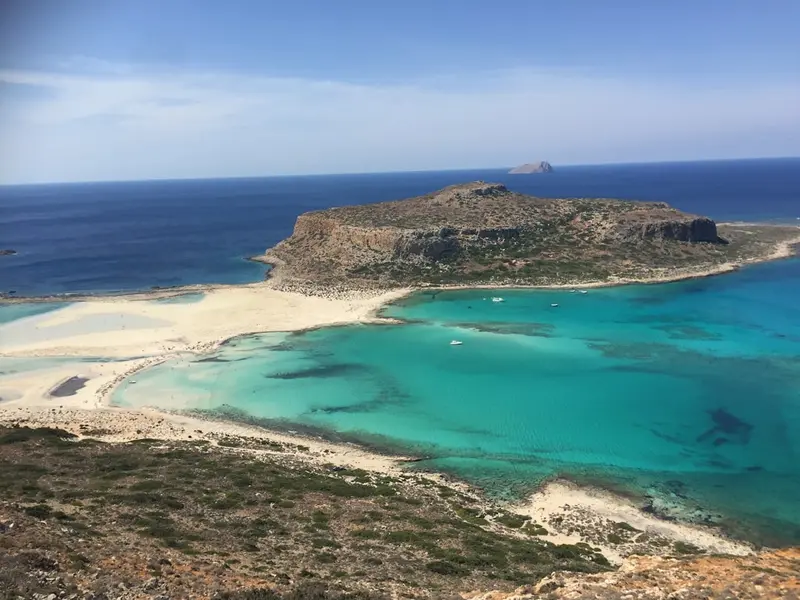
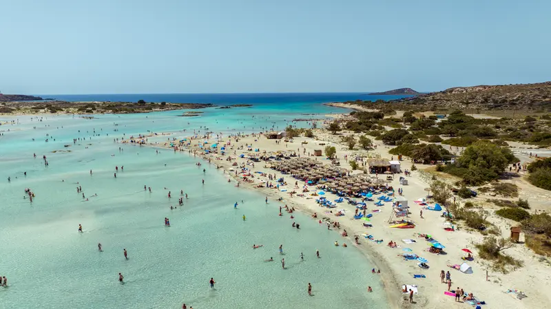
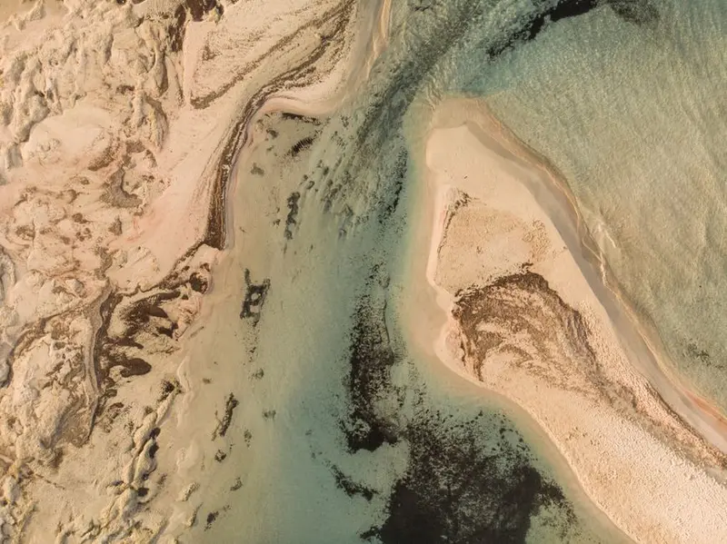
    Elafonissi is situated on the southwest tip of Crete, where the island tapers off and the nearest road is far away. A shallow lagoon lies between the mainland and an offshore island, its sand appearing pink in places.

    by Felix Gillen

    1. Home
    2. Destinations
    3. Greece
    4. Crete
    5. Elafonissi
    Elafonissi is situated on the southwest tip of Crete, where the island tapers off and the nearest road is far away. A shallow lagoon lies between the mainland and an offshore island, its sand appearing pink in places. The area is a Natura 2000 protected site; there's a car park, a canteen, and nothing else.

    Sehenswürdigkeiten

    Discover the most important sights and attractions

    Elafonissi Strand und Lagune

    1Elafonissi Strand und Lagune

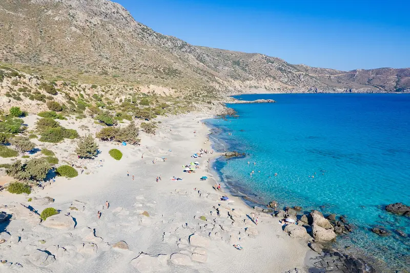
    A lagoon between mainland and offshore island is often knee- to hip-deep. The sand has crushed Homotrema rubrum foraminifer shells, making areas pink, notably near water and after storms. Main beach features sunbeds, showers, a canteen, and paid parking; the area is Natura 2000 protected. Taking sand is forbidden and controlled.
    Open in Google Maps
    Elafonissi Insel (Naturreservat)

    2Elafonissi Insel (Naturreservat)

    The actual island of Elafonisi lies behind the lagoon and is reachable on foot in a few minutes via the shallow sandbank. On it grow sand dunes with sea lilies and junipers; several areas are cordoned off to preserve the vegetation. A memorial stone commemorates the victims of the Ottoman raid on Easter Sunday 1824, in which several hundred people, predominantly women and children, were killed or enslaved. Those who walk across will find quieter bays without infrastructure on the far side.
    Open in Google Maps
    Kloster Panagia Chrisoskalitissa

    3Kloster Panagia Chrisoskalitissa

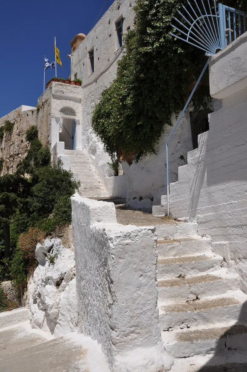
    The Chrisoskalitissa Monastery stands five kilometers north of Elafonissi, whitewashed on a rock above the sea. Its name means Golden Step: According to legend, one of the 90 steps is made of gold, visible only to people without sin. The current buildings date from the 17th century; a small museum displays icons and equipment from monastic life. From the terrace, the view extends over the entire southwest corner of the island.
    Open in Google Maps
    Kedrodasos Strand

    4Kedrodasos Strand

    Kedrodasos is located just over one kilometer east of Elafonissi and is accessible via an unpaved road and a short walk. It's named after the ancient juniper trees that grow right up to the sand and provide the only shade. There are no sunbeds, no canteen, and no showers; you must bring your own water and provisions. The beach is popular with campers, though officially overnight stays are not permitted in the protected area.
    Open in Google Maps
    Elos and the Chestnut Region of Innachoria

    5Elos and the Chestnut Region of Innachoria

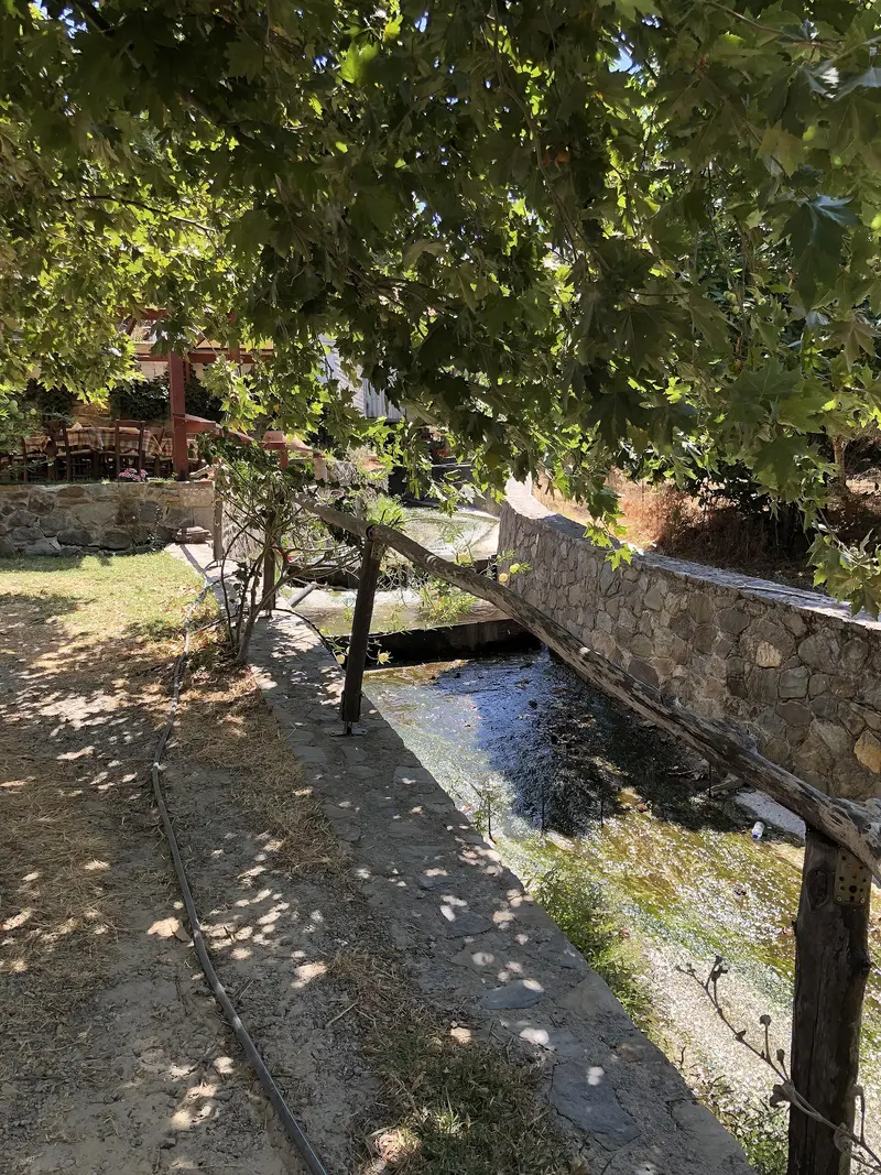
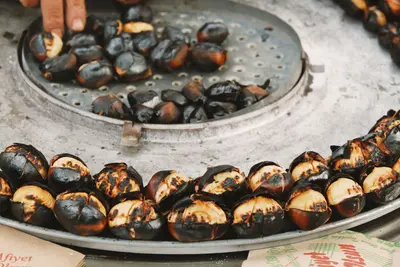
    The villages of Innachoria lie in the mountains between Topolia and Elafonissi and are surrounded by ancient chestnut forests, unusual for otherwise dry West Crete. Elos is the largest of these and has a square under plane trees with several Kafenia. In October, the Chestnut Festival takes place there, with roasted chestnuts, music, and dancing. On the way to Elafonissi, the villages are the only place where you can get something decent to eat along the way.
    Open in Google Maps
    Topolia Gorge and Agia Sofia Cave

    6Topolia Gorge and Agia Sofia Cave

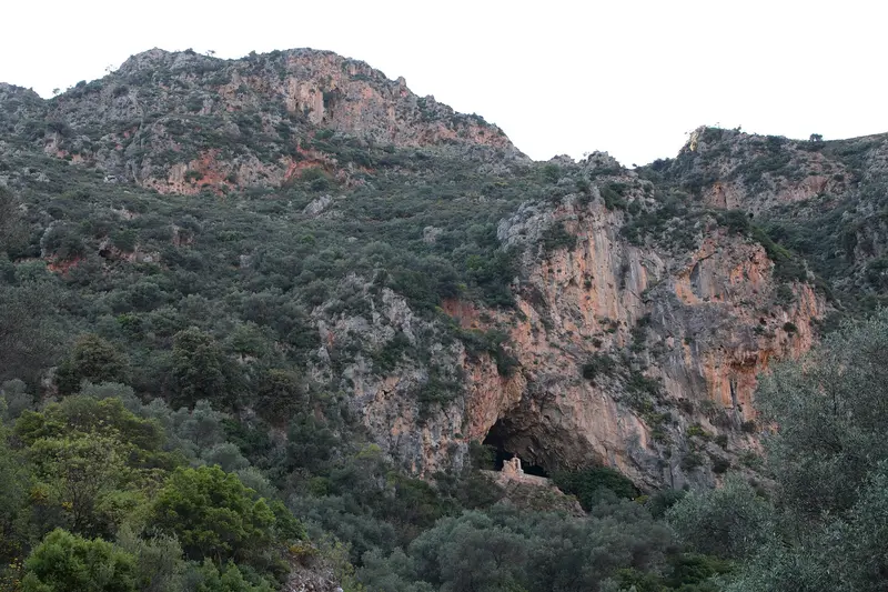
    The road from Kissamos to Elafonissi leads through the Topolia Gorge and a tunnel blasted into the rock. Above lies the Agia Sofia Cave with a chapel, accessible via a long staircase with well over a hundred steps. Finds prove that the cave was already used in the Neolithic Age. The stop takes half an hour and sensibly breaks up the winding journey.
    Open in Google Maps

    Restaurants & Cafés

    1

    Antonia's Panorama Restaurant

    The family-run Panorama is located on the access road just before Elafonissi Beach and has tables with views over the coast. The Cretan cuisine offers, among others, Antikristo lamb from the open fire, daily fresh fish, and Skaltsounia with Mizithra and honey.
    Show on Google Maps
    2

    Taverna Kalomirakis Family

    The Kalomirakis family tavern is part of the eponymous accommodation on the road to Elafonissi beach. It serves Cretan tavern cuisine, convenient for a meal before or after visiting the beach.
    Show on Google Maps
    3

    Glykeria

    Glykeria lies by the sea near Chrysoskalitissa Monastery, a few minutes' drive north of Elafonissi. The kitchen offers modern interpretations of Cretan dishes, with local vegetables, fresh fish, and olive oil. Open from breakfast until evening.
    Show on Google Maps

    Food and Drink

    Right by the bay, there's only the canteen at the parking lot and a taverna. Proper meals are had en route, in Innachoria's mountain villages, or up by the monastery. The region is known for chestnuts, goat cheese, and honey.
    Chestnuts from Elos

    Chestnuts from Elos

    Innachoria is one of Crete's few chestnut regions, with some trees having stood for centuries. In autumn, the chestnuts are sold roasted and processed into soups and desserts. The Chestnut Festival in Elos in October is the biggest event of the year in the area.

    Goat cheese and Anthotyros

    In the mountainous region west of Kissamos, goats and sheep are still kept on a small scale. The fresh Anthotyros is mild and is eaten with honey or in Sfakianopita; the aged one is salty. Many tavernas in Innachoria source it directly from the village.
    Honey from Crete

    Honey from Crete

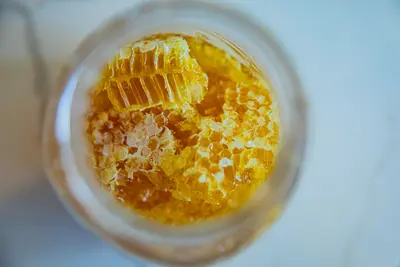
    The maquis of the southwest corner provides a thyme and wild herb honey, distinctly stronger than blossom honey. Available farm-gate and in small shops along the road to Elafonissi. Chrisoskalitissa Monastery also offers its own products.

    Grilled Fish in Paleochora

    Elafonissi itself has no fishing port; the nearest notable fresh fish can be found in Paleochora on the south coast. There, the day's catch is sold by weight and served simply grilled. It's the obvious choice for dinner after a day at the beach.

    History and Protection Status

    A Place with a Dark PastAs tranquil as the lagoon appears today, the name Elafonisi in Crete also signifies a massacre. On Easter Sunday, April 18, 1824, several hundred people from surrounding villages, predominantly women and children, fled to the island from Ottoman troops, believing the water would protect them. The soldiers crossed the shallow lagoon and killed most of them; the survivors were sold into slavery in Egypt. Estimates of the number of people on the island vary between 640 and 850. A memorial stone on the island commemorates this event. A few kilometers north stands the Chrisoskalitissa Monastery.Nature Conservation and UseElafonissi is part of the European Natura 2000 protected areas network. Protected are primarily the dunes with the sand lily Pancratium maritimum, the juniper stands, and the nesting sites of the loggerhead sea turtle. This leads to rules that are enforced locally: parts of the island are cordoned off, vehicles must remain in the car park, and taking sand is forbidden. Discussions regarding the number of sunbeds and vehicle access have been ongoing for years, as the high-season crowds visibly strain the area. Those who arrive early or travel outside the summer months will experience the area significantly quieter.

    Getting There and Around

    The Routes to ElafonissiThere are two access routes. The usual one leads from Chania via Kissamos, Topolia, and Elos, about 75 kilometers, the last 40 of which are winding and narrow. The second comes from Paleochora on the south coast via a partly unpaved track; it is shorter but slower and not suitable for every rental car. If you don't want to drive yourself, take the KTEL bus, which runs mornings from Chania and Kissamos during high season and returns in the afternoon. From Paleochora, an excursion boat also operates in summer.On SiteThe parking lot is located directly behind the beach and is subject to a fee; in high season, it is full by midday. Everything is accessible on foot from the parking lot: wooden walkways lead over the dunes, and crossing the lagoon to the island takes only a few minutes, reaching up to your knees depending on the water level. To the south, the beach becomes emptier the further you go. There is no shade outside the rows of umbrellas. Drinking water, toilets, and a canteen are available; there is no ATM.

    Accommodations in Elafonissi

    Find perfect stay in Elafonissi

    Booking.com* (Affiliate link)
    Search Hotels
    Agoda* (Affiliate link)
    Search Hotels
    Airbnb
    Vacation Rentals

    * Affiliate link: if you book through it, we earn a small commission. The price stays the same for you.

    Campgrounds in Elafonissi

    Find perfect campground in Elafonissi

    Search via Google Maps
    Campgrounds nearby (15km)
    Camping.info
    Find Campgrounds
    Park4Night
    RV Parks & Camping

    Nearby

    Loutro

    Loutro

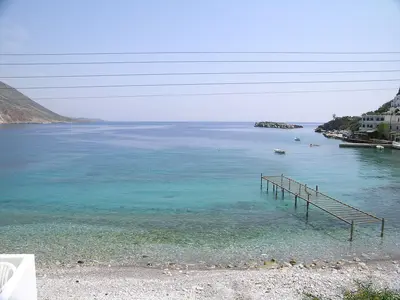
    Loutro is a small village on the south coast of Sfakia between Chora Sfakion and Agia Roumeli. No roads lead here; access is only on foot or by boat. The houses line a natural bay, used as a sheltered harbour since ancient times.
    Chania

    Chania

    Chania is Crete's second-largest city and western capital. An Old Town with Venetian, Ottoman, and Jewish quarters side-by-side surrounds its Venetian harbour, featuring a lighthouse, arsenals, and the Mosque of Küçük Hasan Pascha.You come for the Old Town, the Market Hall, and as a base for western Crete's Balos, Falassarna, Elafonissi, and Samaria Gorge.
    Rethymno

    Rethymno

    Rethymno is the third largest city on the north coast of Crete, located between Chania and Heraklion. Its Old Town, with Venetian portals, Ottoman wooden balconies and minarets, is one of the island's best preserved, topped by the Fortezza fortress.You come for the Old Town, the Venetian harbour, and the long sandy beach right in the centre. The university ensures that the city remains lively even off-season.
    Matala

    Matala

    Matala is located on the south coast of Crete, at the edge of the Messara Plain, and consists of a bay, a handful of alleys, and the cliff face with its caves. The chambers carved into the sandstone date back to antiquity and were used as tombs in Roman and early Christian times; in the 1960s, dropouts moved in. From the village, the Minoan sites of the Messara and several quiet coves are reachable within a short drive.
    Crete

    Crete

    Crete is the largest island in Greece and big enough for several trips. Along the north coast, Venetian-influenced port towns and resorts follow one another; in the south, the mountains drop steeply to the Libyan Sea, with plateaus, gorges and olive groves in between. Add the palaces of the Minoan culture, one of Europe's earliest civilisations, and a cuisine rooted in the island's own farming.

    Sources & method

    • Photos: Wikimedia Commons, Unsplash, Pexels. Each photo carries its credit.
    • The content is based on web research from public, traceable sources. How the content is made · The role of AI