Fernweh: Home
    ExploreTravel GuidesPlan a tripMy tripLast visited
    de|en
    All Places & RegionsAll highlightsAbout FernwehFAQPrivacy PolicyImprint
    ExploreTravel GuidesPlan a tripMy tripLast visited
    • Neighborhoods & highlights
    • Eat & drink
    • Food culture
    • Culture
    • Getting around
    • Accommodation
    • Plan trip
    • Nearby
    Krummhübel (Karpacz) and Giant Mountains
    Pudelek / Wikimedia Commons / CC BY-SA 4.0

    Poland

    Krummhübel (Karpacz) and Giant Mountains

    City

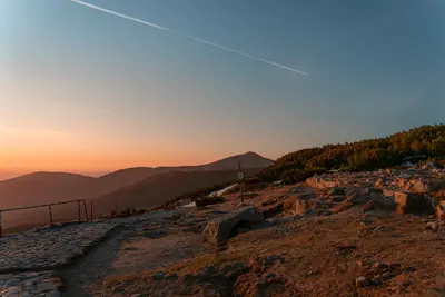
    Krummhübel (Karpacz) is located in the Giant Mountains, by the Lomnica river, at the foot of Sněžka (Śnieżka). At 1603 meters, Sněžka is the range's highest peak and lies on the Czech border.

    by Felix Gillen

    1. Home
    2. Destinations
    3. Poland
    4. Lower Silesia
    5. Krummhübel (Karpacz) and Giant Mountains
    Krummhübel (Karpacz) is located in the Giant Mountains, by the Lomnica river, at the foot of Sněžka (Śnieżka). At 1603 meters, Sněžka is the range's highest peak and lies on the Czech border. With just over 4,000 residents, the town is one of Lower Silesia's key holiday resorts, perfect for summer hiking and winter skiing.Karpacz stretches up the valley. The lower part holds the town center with churches, town hall, and museums. Further up is Brückenberg (Karpacz Górny), home to the Norwegian Wang Stave Church. Above the town, the Giant Mountains National Park (Karkonoski Park Narodowy) offers trails to Sněžka.Plan a full day for the ascent; check weather and lift operations beforehand, as ridge conditions can change rapidly.

    Sights in Krummhübel (Karpacz) and Giant Mountains

    Discover the most important sights and attractions

    Museum for Sport and Tourism
    Museum

    1Museum for Sport and Tourism

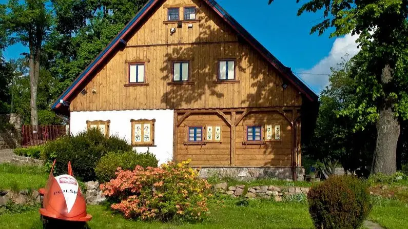
    Opened in 1974 and housed in a traditional 18th-century timber-framed house, the museum showcases the history of tourism, winter sports, and nature conservation in the Giant Mountains, including old skis, sleds, and bobs. After World War II, Karpacz became the Polish center for bobsleigh and luge.
    Open in Google Maps
    Schneekoppe (Śnieżka)
    Attraction

    2Schneekoppe (Śnieżka)

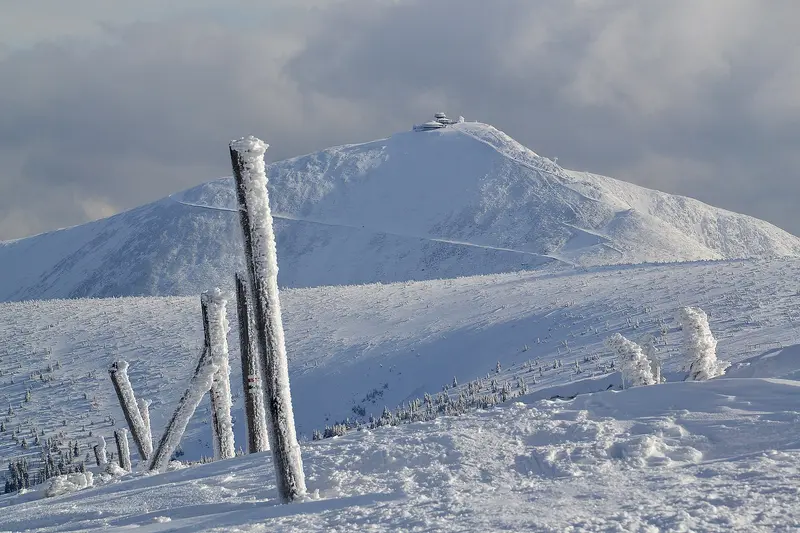
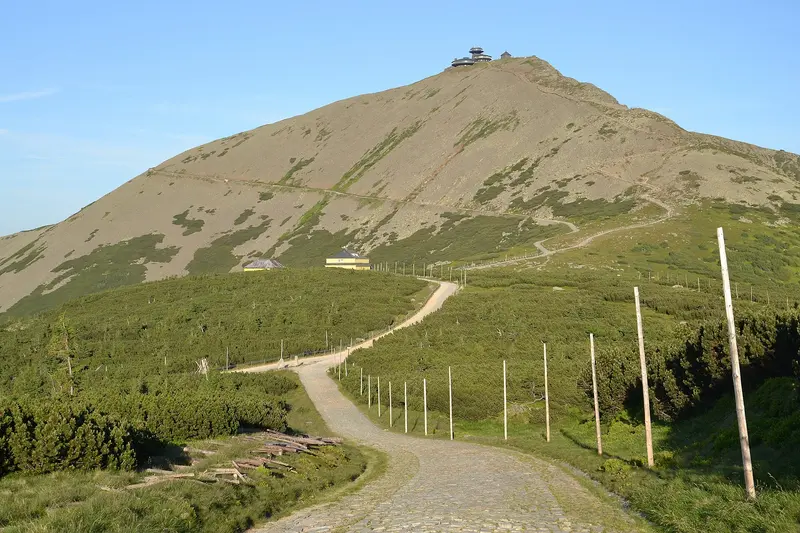
    At 1603 meters, Schneekoppe is the highest mountain of the Giant Mountains, with the Polish-Czech border running across its summit. At the top stand the St. Lawrence Chapel from 1665 and the distinctive Polish weather observatory from 1974, which has been closed since 2015 due to its structural condition. From Karpacz, you take the chairlift to Kleine Koppe (Kopa) and ascend the final approximately 225 vertical meters on foot. From the Czech side, a gondola lift has been running up from Pec pod Sněžkou since 2014.
    Open in Google Maps
    Wang Stave Church

    3Wang Stave Church

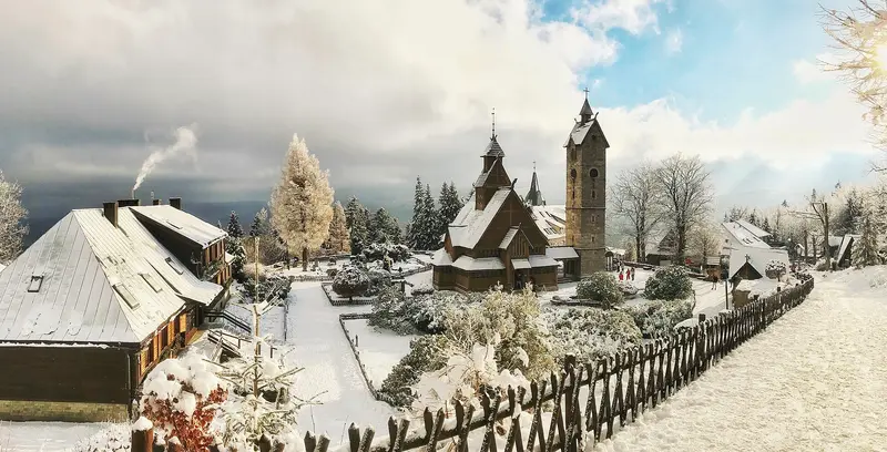
    The wooden stave church from Vang in Norwegian Valdres was built circa 1200. King Frederick William IV of Prussia bought it, and in 1842 it moved to the then Brückenberg, becoming the Protestant community's parish church on July 28, 1844, a role it still holds. A rectory and a Lazarus sculpture stand next to the church.
    Open in Google Maps

    Restaurants in Krummhübel (Karpacz) and Giant Mountains

    1

    Chata Karkonoska

    Local spot for Polish cuisine on ul. Wolna, with garlic soup among the menu items.
    Show on Google Maps
    2

    Polanka

    The restaurant at the Mövenpick Resort & Spa cooks according to old Polish recipes, using regional and seasonal products, including cheese from Łomnica, trout from Mysłakowice, and cranberry spirits from the area.
    Show on Google Maps
    3

    Restaurant at Peti's

    Family-run restaurant with hearty Polish cuisine, meat dishes, and pierogi.
    Show on Google Maps

    Food and Drinks

    Trout from the Hirschberg Valley

    Trout from local fish farms, for example from Mysłakowice, are on the menu in many restaurants in the Giant Mountains.

    Cheese of Łomnica

    Cheese is made in the neighbouring village of Łomnica, which restaurants in Karpacz serve as a regional product.

    Liquors made from cranberries

    From cranberries (Cranberrys), spirits are made in the region, which you can try in restaurants and hotel bars.

    History and Culture

    Apothecaries and Summer RetreatsAround 1500, silver and lead were mined here; during the Thirty Years' War, religious refugees from Bohemia settled. The place became known for its apothecaries, skilled herbalists who produced and widely sold medicines, until state regulations ended their guild in the early 19th century. From 1895, summer guests arrived by train.A Church from NorwayThe wooden Wang Stave Church originated around 1200 in Vang, Norway. In 1841, Prussian King Frederick William IV bought it; in 1842, it arrived in Brückenberg, and on July 28, 1844, it became the parish church of the Evangelical congregation. After 1945, the place became part of Poland and has since been called Karpacz; the German population was largely expelled in 1945/46. The stave church remains an Evangelical parish church to this day.

    Getting There and Around

    Getting ThereBuses run from Hirschberg (Jelenia Góra) to the town. As of June 2025, regional trains will again operate from Hirschberg to Karpacz.In the Town and the MountainsThe Zbyszek chairlift takes you from Karpacz to the Little Mount (Kopa) in about 7 minutes. From there, it's another approximately 225 meters in elevation to the summit of Schneekoppe. For the trails in the Giant Mountains National Park, you need an entrance ticket; day and multi-day tickets are available. The National Park publishes current prices and trail closures on kpn.gov.pl. If you come by car, it's best to ask your accommodation about parking.

    Accommodations in Krummhübel (Karpacz) and Giant Mountains

    Find perfect stay in Krummhübel (Karpacz) and Giant Mountains
    Booking.com* (Affiliate link)
    Search Hotels
    Agoda* (Affiliate link)
    Search Hotels
    Airbnb
    Vacation Rentals

    * Affiliate link: if you book through it, we earn a small commission. The price stays the same for you.

    Campgrounds in Krummhübel (Karpacz) and Giant Mountains
    Find perfect campground in Krummhübel (Karpacz) and Giant Mountains
    Search via Google Maps
    Campgrounds nearby (15km)
    Camping.info
    Find Campgrounds
    Park4Night
    RV Parks & Camping

    Plan your trip to Krummhübel (Karpacz) and Giant Mountains
    Save places, build a route and plan your city trip, all in one place.

    1. 1
      Sunrise over alpine peaks and a sea of clouds
      1234

      Round trip

      12 days · 4 stops

      Saved

      Pick a route

      Pick a ready-made one or save places and plan your own.

      Open bookmarks
    2. 2

      Trip to Krummhübel (Karpacz) and Giant Mountains

      Live
      • 1Museum for Sport and Tourism3 days
      • 2Schneekoppe (Śnieżka)4 days
      • 3Wang Stave Church5 days
      Budget

      Plan your trip

      The planner sorts stops, days and budget. Plan together in real time.

      Start trip planning
    3. 3
      9:41 No signal
      Krummhübel (Karpacz) and Giant Mountains
      Available offline

      Use it on the road

      Download the guide to your phone and use it on site, even offline.

    Nearby

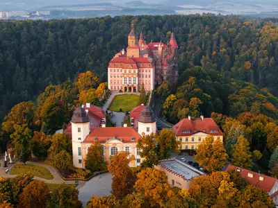
    Fürstenstein Castle (Zamek Książ)

    Fürstenstein Castle (Zamek Książ)

    Schloss Fürstenstein (Zamek Książ) is, after Marienburg and Wawel, the third largest castle in Poland. It thrones on the northern edge of Waldenburg (Wałbrzych) on a rock above the deep gorge of the Polsnitz (Pełcznica).The building combines medieval, Renaissance, Baroque, and Neo-Renaissance styles: Its core dates back to a castle of Duke Bolko I of Schweidnitz from the late 13th century; during the renovation from 1909 to 1923, a new wing and the 47-meter-high main tower were added. A visit includes the state rooms, the terraced gardens, the underground passages from World War II, the stud farm, and the palm house. Around the castle extends a landscape park, which you can explore on forest paths.
    Lower Silesia

    Lower Silesia

    Lower Silesia (Dolny Śląsk) in southwestern Poland borders Saxony and the Czech Republic. Approximately 2.9 million people live on its roughly 19,900 km², with Breslau (Wrocław) as its capital and largest city. To the south, the Sudetes Mountains rise, featuring the Giant Mountains, whose highest peak, Schneekoppe (Śnieżka), reaches 1603 meters. Northward, the land transitions into the flat Silesian Lowland along the Oder River.Throughout history, the region alternated between Bohemia, the Habsburgs, and Prussia, finally becoming part of Poland after 1945. Castles, churches, and historic towns bear witness to this past: the Churches of Peace in Schweidnitz (Świdnica) and Jauer (Jawor), the stately homes in the Hirschberg Valley, and Fürstenstein Castle near Waldenburg (Wałbrzych).
    Görlitz

    Görlitz

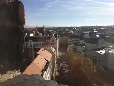
    Görlitz on the Lusatian Neisse is Germany's easternmost city. Since 1945, the river has formed the border with Poland; its eastern districts are now the independent Polish city of Zgorzelec, reachable on foot via the Altstadtbrücke.During World War II, Görlitz remained almost entirely spared from destruction, and its historic Old Town, including Untermarkt and Obermarkt, is consequently well-preserved. This makes the city a popular and frequently used film set.
    Breslau (Wrocław)

    Breslau (Wrocław)

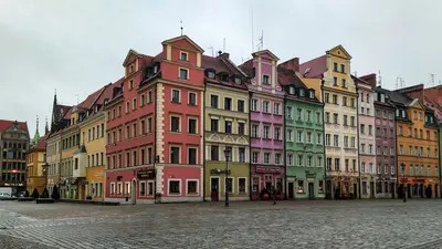
    Breslau (Wrocław) is, with around 673,000 inhabitants, Poland's third-largest city and the capital of Lower Silesia. The city lies on the upper Oder River and spans about twelve islands, connected by 100 to 300 bridges, depending on how they are counted. Around the year 1000, a bishopric was founded here, and in 1261, Wrocław was granted Magdeburg Law. In 2016, it was a European Capital of Culture.The heart of the Old Town is the Market Square (Rynek) with its Gothic Town Hall, surrounded by burgher houses and churches. North of the Old Town, bridges lead to Cathedral Island (Ostrów Tumski), the oldest part of the city, featuring a cathedral and churches. To the east, in Scheitniger Park, stands the Centennial Hall, which has been a UNESCO World Heritage site since 2006.As you stroll through the city, you'll repeatedly encounter small bronze gnomes on house walls, lampposts, and stairs. The first figure commemorates the anti-communist Orange Alternative movement; meanwhile, there are now more than 1,000 of them. You should plan at least two to three days for your visit to the city.
    Saxon Switzerland / Bastei

    Saxon Switzerland / Bastei

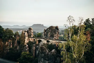
    Saxon Switzerland, the German part of the Elbe Sandstone Mountains, is located southeast of Dresden on both sides of the Elbe. Its bizarre rock formations are largely within the Saxon Switzerland National Park, established in September 1990, prior to German reunification. Climbing adheres to the Saxon Rules and is only allowed on designated climbing peaks.The most famous viewpoint is the Bastei near Rathen, which rises 194 meters above the Elbe. It is freely accessible year-round and at any time. Upriver on the Elbe, Königstein Fortress proudly sits atop its mesa, one of Europe's largest mountain fortresses.

    Sources & method

    • Photos: Wikimedia Commons, Google Maps. Each photo carries its credit.
    • Place data such as addresses and ratings comes from Google Maps.
    • The content is based on web research from public, traceable sources. How the content is made · The role of AI