Fernweh: Home
ExploreGuideDestinationsMy tripsMy trip
de|en
All Places & RegionsRound tripsNight trains in EuropeAll highlightsAbout FernwehFAQPrivacy PolicyImprint
Download on the App StoreGet it on Google Play
ExploreGuideDestinationsMy tripsMy trip
    • Tours
    • Eat & drink
    • Culture
    • Getting around
    • Accommodation
    • Plan trip
    • Nearby
    Coroico and the Yungas

    Alhen / Wikimedia Commons / CC BY-SA 4.0, mod.

    Bolivia

    Coroico and the Yungas

    CityNature

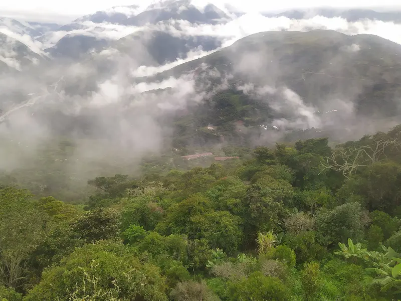
    Coroico is located at around 1,500 to 1,700 m in the Yungas, the subtropical valleys on the eastern slopes of the Andes, and is just two to four hours' drive from La Paz.

    by Felix Gillen

    1. Home
    2. Destinations
    3. Bolivia
    4. Coroico and the Yungas
    Coroico is located at around 1,500 to 1,700 m in the Yungas, the subtropical valleys on the eastern slopes of the Andes, and is just two to four hours' drive from La Paz. Here, you exchange the cold highland air for green slopes and a mild climate.Famous is the old Yungas Road, also known as Camino de la Muerte (Death Road): approximately 64 km of gravel track that descends over 3,000 vertical meters from La Cumbre Pass at about 4,650 m. Since the opening of a paved bypass, it is primarily used by cyclists for guided descents.
    Bolivia travel guideRound trips in BoliviaPlan a trip with Coroico and the Yungas

    Contents

    • Tours
    • Eat & drink
    • Culture
    • Getting around
    • Accommodation
    • Nearby

    Tours & experiences in Coroico and the Yungas

    Search tours for Coroico and the Yungas on GetYourGuide* (Affiliate link)On GetYourGuide, with reviews from other travellers

    * Affiliate link: if you book through it, we earn a small commission. The price stays the same for you.

    Restaurants in Coroico and the Yungas

    The Yungas

    Subtropical ValleysThe Yungas are the warm, humid valleys on the eastern slopes of the Andes, between the highlands and the Amazon lowlands. Coroico, in the Nor Yungas province, is a tranquil green spot and a popular destination for a few days' respite from the altitude.The Old RoadThe North Yungas Road was built in the 1930s. Today, most traffic uses the paved bypass, while the old track is primarily used for guided mountain bike descents.

    Arrival and Details

    ArrivalMinibuses and buses run from La Paz's Terminal Villa Fátima to Coroico in about two to four hours.Bike DescentAs a guided day trip from La Paz, the descent takes about four to five hoursBest time is the dry season from May to OctoberAt La Cumbre Pass, it's often below zero degrees; warm in the valley, dress in layersA road fee is collected in cash at the checkpointSafetyThe Federal Foreign Office lists Los Yungas among areas requiring increased caution due to crime. Consult current travel advisories before your trip.

    Accommodations in Coroico and the Yungas

    Find perfect stay in Coroico and the Yungas

    Booking.com* (Affiliate link)
    Search Hotels
    Agoda* (Affiliate link)
    Search Hotels
    Airbnb
    Vacation Rentals

    * Affiliate link: if you book through it, we earn a small commission. The price stays the same for you.

    Plan your trip to Coroico and the Yungas

    Save places, build a route and plan your city trip, all in one place.

    1. 1
      Sunrise over alpine peaks and a sea of clouds
      1234

      Round trip

      12 days · 4 stops

      Saved

      Pick a route

      Pick a ready-made one or save places and plan your own.

      Open bookmarks
    2. 2

      Chile trip

      Live
      • 1Santiago3 days
      • 2Atacama4 days
      • 3Torres del Paine5 days
      Budget

      Plan your trip

      The planner sorts stops, days and budget. Plan together in real time.

      Start trip planning
    3. 3
      9:41 No signal
      Coroico and the Yungas
      Available offline

      Alhen / Wikimedia Commons / CC BY-SA 4.0, mod.

      Use it on the road

      Download the guide to your phone and use it on site, even offline.

    Nearby
    La Paz

    La Paz

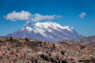
    La Paz is Bolivia's seat of government and lies at around 3,650 m in a deep valley, above whose rim the city of El Alto spreads out at over 4,000 m. You float with the Mi Teleférico cable car over rooftops and markets, visit the Witches' Market and the colonial street Calle Jaén, and experience the enormous Feria 16 de Julio market in El Alto.The city is a starting point for excursions to Tiwanaku, Lake Titicaca, and down into the Yungas. In recent years, a young culinary scene has also developed, working with ingredients from the Andes and the Amazon.

    Nair Cristopher Sánchez Muñoz·Pexels

    Tiwanaku

    Tiwanaku

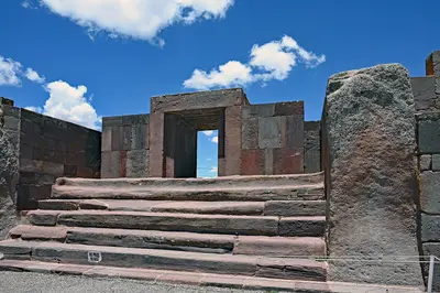
    Tiwanaku was the capital of a pre-Hispanic empire which, according to UNESCO, flourished on the Altiplano roughly between 400 and 900 AD, long before the Incas. The archaeological site, approximately 70 km west of La Paz, has been a UNESCO World Heritage site since 2000 and is a classic day trip from the capital.At around 3,850 m you will see the Akapana stepped pyramid, the Kalasasaya Temple with the Puerta del Sol, and the precisely carved stone blocks of Puma Punku. For the Aymara New Year on June 21, Tiwanaku is the scene of the central solstice ceremony.

    P. Hughes·CC BY 4.0

    Copacabana

    Copacabana

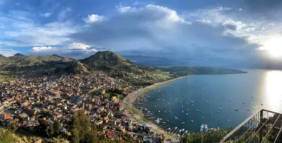
    Copacabana, on the shores of Lake Titicaca, is Bolivia's most important Catholic pilgrimage site and the port for boats to Isla del Sol. The lake lies at about 3,810 m and is considered the highest commercially navigable lake in the world.At its heart stands the Basilica of the Virgen de Copacabana, whose figure was carved around 1576. From Cerro Calvario, you look out over the bay; in the evenings, the sun colors the lake. The town is about four to five bus hours from La Paz.

    EEJCC·CC BY-SA 4.0

    Isla del Sol

    Isla del Sol

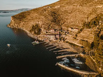
    In Inca myth, Isla del Sol in Lake Titicaca is considered the origin place of the sun and moon. The island, approximately 9 by 6 km, lies about 12 km northwest of Copacabana and has three settlements: Yumani in the south, Challa in the middle, and Challapampa in the north.You ascend the steep Inca staircase from Yumani, visit the ruins of Pilkokaina, and hike ancient paths across the island. The northern part with the Chincana Labyrinth has been repeatedly closed in recent years; inquire in Copacabana about its current status.

    Gabriel Ramos·Pexels

    Rurrenabaque and Madidi

    Rurrenabaque and Madidi

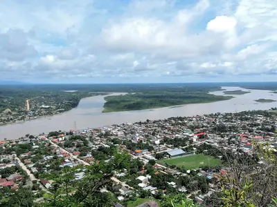
    Rurrenabaque on the Río Beni is the gateway to the Bolivian Amazon: From here, you travel by boat into the rainforest of Madidi National Park or into the wetlands of the Pampas del Yacuma. The small town lies at only about 274 m, a stark contrast to the highlands.Madidi covers approximately 19,000 km² from the lowlands up to elevations of around 6,000 m and is considered, according to the conservation organization WCS, one of the most biodiverse protected areas on Earth, with over 1,000 documented bird species. In the Pampas, you'll see Pink River Dolphins, Howler Monkeys, and Squirrel Monkeys.

    Rodrigo Mariaca·CC BY-SA 4.0

    Your next steps

    Coroico and the Yungas is in Bolivia. Ways to carry on from here.

    • More in Bolivia

      Highlights, areas, routes and the best time to travel for all of Bolivia.

      Bolivia travel guide
    • Round trips in Bolivia

      Ready-made routes through Bolivia, with stops, nights and a map.

      See the routes

    Sources & method

    • Photos: Wikimedia Commons. Each photo carries its credit.
    • The content is based on web research from public, traceable sources. How the content is made · The role of AI