Fernweh: Home
    ExploreTravel GuidesPlan a tripMy tripLast visited
    de|en
    All Places & RegionsAll highlightsAbout FernwehFAQPrivacy PolicyImprint
    ExploreTravel GuidesPlan a tripMy tripLast visited
    Pragser Wildsee

    Italy

    Pragser Wildsee

    Point of Interest

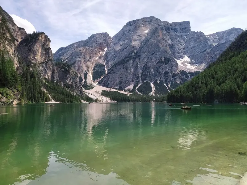
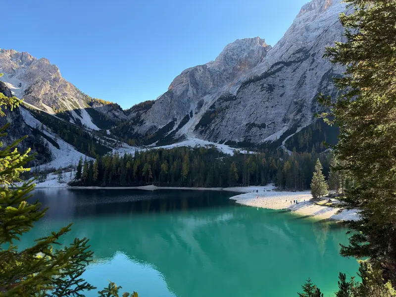
    Pragser Wildsee is situated at 1494 meters in the Pragser Tal, a few kilometers south of the Pustertal between Bruneck and Toblach. It belongs to the Fanes-Sennes-Prags Nature Park and is overlooked by the 2810-meter-high Seekofel.

    by Felix Gillen

    1. Home
    2. Destinations
    3. Italy
    4. Südtirol
    5. Pragser Wildsee
    Pragser Wildsee is situated at 1494 meters in the Pragser Tal, a few kilometers south of the Pustertal between Bruneck and Toblach. It belongs to the Fanes-Sennes-Prags Nature Park and is overlooked by the 2810-meter-high Seekofel. It also became known as a filming location for the TV series “Die Bergpolizei”.VisitA circular path of just under four kilometers leads around the lake in just over an hour. In summer, you can rent rowing boats at the boathouse. The Dolomite High Path No. 1 starts at the lake.Access in High SeasonIn 2026, a traffic regulation was in effect from July 1st to September 15th, between 9 AM and 4 PM: You could only enter the Pragser Tal with a parking space booked online in advance, with a scheduled bus service (also to be booked in advance), on foot, or by bike. The regulation is expected to return in summer 2027; details will be published in spring. Check them on the official website prags.bz before your arrival.

    Sehenswürdigkeiten

    Discover the most important sights and attractions

    Pragser Wildsee (Lago di Braies)
    Natural Feature

    1Pragser Wildsee (Lago di Braies)

    Mountain lake at 1494 meters at the foot of the Seekofel in the Pragser Dolomites, up to 36 meters deep.
    Open in Google Maps

    2Seerundweg Pragser Wildsee

    Circular path around the lake, nearly four kilometers long and takes about an hour. The western shore is flat and gravelled; on the eastern shore, stairs and steeper sections with handrails lead up around 100 meters to a viewpoint; this part is not stroller-friendly.
    Open in Google Maps
    Seekofel (2,810 m)

    3Seekofel (2,810 m)

    A 2810-meter-high massif above the south end of the lake. The Pragser Wildsee is also the starting point of the Dolomiten High Trail No. 1, which ascends towards Seekofelhütte.
    Open in Google Maps

    Restaurants & Cafés

    1

    Gasthof Seehof

    Inn just a few steps from the north shore with South Tyrolean dishes and a terrace.
    Show on Google Maps
    2

    Malga Foresta (Grünwaldalm)

    Alpine hut a short walk from the lake with simple South Tyrolean cuisine like dumplings and cake.
    Show on Google Maps

    Travel

    From Toblach and Niederdorf in Pustertal, bus line 442 goes directly to the lake; in high season, line 439 also runs from Welsberg train station. During summer traffic regulations, you must book and pay for bus tickets online in advance; bicycles are not allowed. By car, branch off into Pragser Tal; paid parking is available at the lake, which must be reserved in advance during regulated periods.Current safety and health information for Italy can be found via the link to the Foreign Office on the country page.

    Accommodations in Pragser Wildsee

    Find perfect stay in Pragser Wildsee

    Booking.com* (Affiliate link)
    Search Hotels
    Agoda* (Affiliate link)
    Search Hotels
    Airbnb
    Vacation Rentals

    * Affiliate link: if you book through it, we earn a small commission. The price stays the same for you.

    Campgrounds in Pragser Wildsee

    Find perfect campground in Pragser Wildsee
    Search via Google Maps
    Campgrounds nearby (15km)
    Camping.info
    Find Campgrounds
    Park4Night
    RV Parks & Camping

    Nearby

    Cortina d’Ampezzo

    Cortina d’Ampezzo

    Cortina d'Ampezzo is situated at around 1,200 meters in a wide valley basin of the Ampezzo Dolomites, surrounded by Tofane, Pomagagnon, Cristallo, Faloria, and Sorapiss.Winter and OlympicsThe Olympic Winter Games were held here in 1956, and in 2026, Cortina, together with Milan, will again host the Olympic and Paralympic Winter Games. The ski area is part of the Dolomiti Superski network.Summer in the MountainsCable cars ascend Faloria and Tofana, and from Passo Falzarego, to Lagazuoi. Popular destinations in the vicinity include the Cinque Torri, Lake Misurina, and the Drei Zinnen. During World War I, the front line ran along Lagazuoi, and tunnels and emplacements are preserved to this day.Mountain SafetyWeather and trail conditions in the high mountains change rapidly. Before tours, inquire with local sources; current safety and health advice for Italy can be found via the link to the Auswärtiges Amt on the country page.
    Dolomites

    Dolomites

    The Dolomites are a mountain range of the Southern Alps in northeastern Italy, spread across South Tyrol, Trentino, Veneto, and Friuli-Venezia Giulia. Their light limestone and dolomite rocks rise as towers and walls from green alpine meadows; since 2009, they have been a UNESCO World Natural Heritage site. The highest peak is the Marmolada at 3,343 meters, and among the most famous formations are the Three Peaks, the Sella, and the Rosengarten. In summer, hiking trails, via ferratas, and mountain huts attract visitors, while in winter, the ski resorts around the Sella do. In valleys like Val Gardena and Alta Badia, Ladin is spoken alongside German and Italian.
    Three Peaks

    Three Peaks

    The Drei Zinnen are three freestanding rock towers in the Sesto Dolomites, on the border between South Tyrol and the Province of Belluno. The Große Zinne reaches 2,999 meters. Their north faces are among the most famous climbing destinations in the Alps; for hikers, the circular trail around the towers is the main objective.HistoryDuring the First World War, the front line between Austria-Hungary and Italy ran through here. Remains of fortifications, tunnels, and paths can be found on Paternkofel and Monte Piana.VisitingMost visitors start at the Auronzo Hut, which is accessible via a toll road from Misurina; an online reservation is required for car access. The huts along the circular trail are generally open from June to September; outside this period, snow may be present on the paths. Check the weather and trail conditions before your tour; current safety and health advisories for Italy can be found via the link to the Federal Foreign Office on the country page.
    Seiser Alm

    Seiser Alm

    The Seiser Alm (Alpe di Siusi) is a wide high plateau at roughly 1,680 to 2,350 meters with an area of about 56 square kilometers, and is considered the largest high alpine meadow in Europe. Administratively it is a fraction of the municipality of Kastelruth. Its southern parts belong to the Schlern-Rosengarten Nature Park.SummerA dense network of trails, alpine pastures and huts makes the Alm a destination for families and leisurely hikers. The tours up the Schlern are more demanding.WinterIn winter the Seiser Alm is a ski area with about 60 kilometers of slopes, part of Dolomiti Superski and connected to St. Ulrich in Gröden by a gondola lift.AccessThe road from Seis to Compatsch is closed to private traffic uphill between 9 a.m. and 5 p.m., while you may drive downhill at any time. Since the end of June 2026, an online reservation is mandatory for the parking lots P1 Spitzbühl and P2 Compatsch. The easiest way is to take the cable car from Seis to Compatsch. Guests of accommodations on the Alm receive an access permit from their host. You can find the current rules at Seiser Alm Marketing.
    The Krimml Waterfalls

    The Krimml Waterfalls

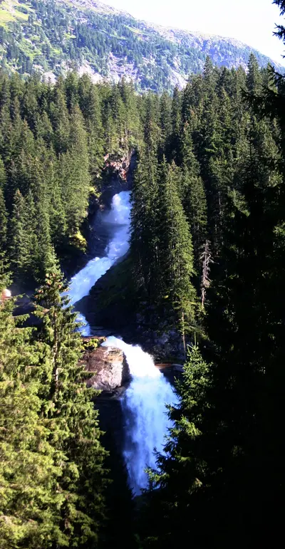
    With a total drop of 380 meters in three stages, the Krimmler Waterfalls are the highest in Austria. They are located in the Hohe Tauern National Park, and a wide, partly steep path leads upwards alongside the falls; they carry the most water in July and August.

    Sources & method

    • Photos: Unsplash, Google Maps. Each photo carries its credit.
    • Place data such as addresses and ratings comes from Google Maps.
    • The content is based on web research from public, traceable sources. How the content is made · The role of AI