Fernweh: Home
    ExploreTravel GuidesPlan a tripMy tripLast visited
    de|en
    All Places & RegionsAll highlightsAbout FernwehFAQPrivacy PolicyImprint
    ExploreTravel GuidesPlan a tripMy tripLast visited
    • Neighborhoods & highlights
    • Walking tours
    • Eat & drink
    • Food culture
    • Culture
    • Nightlife
    • Getting around
    • Accommodation
    • Plan trip
    • Nearby
    Cortina d’Ampezzo

    Italy

    Cortina d’Ampezzo

    CityMountainsNatureCulinaryFor Families

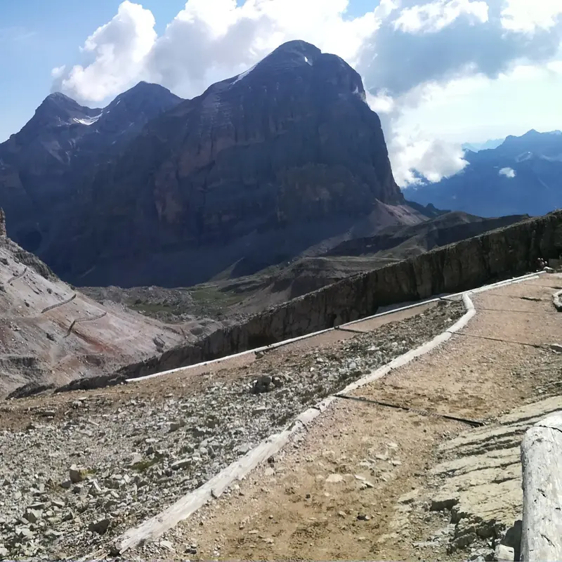
    Cortina d'Ampezzo is situated at around 1,200 meters in a wide valley basin of the Ampezzo Dolomites, surrounded by Tofane, Pomagagnon, Cristallo, Faloria, and Sorapiss.

    by Felix Gillen

    1. Home
    2. Destinations
    3. Italy
    4. Veneto
    5. Cortina d’Ampezzo
    Cortina d'Ampezzo is situated at around 1,200 meters in a wide valley basin of the Ampezzo Dolomites, surrounded by Tofane, Pomagagnon, Cristallo, Faloria, and Sorapiss.Winter and OlympicsThe Olympic Winter Games were held here in 1956, and in 2026, Cortina, together with Milan, will again host the Olympic and Paralympic Winter Games. The ski area is part of the Dolomiti Superski network.Summer in the MountainsCable cars ascend Faloria and Tofana, and from Passo Falzarego, to Lagazuoi. Popular destinations in the vicinity include the Cinque Torri, Lake Misurina, and the Drei Zinnen. During World War I, the front line ran along Lagazuoi, and tunnels and emplacements are preserved to this day.Mountain SafetyWeather and trail conditions in the high mountains change rapidly. Before tours, inquire with local sources; current safety and health advice for Italy can be found via the link to the Auswärtiges Amt on the country page.

    Sights in Cortina d’Ampezzo

    Discover the most important sights and attractions

    Corso Italia
    Attraction

    1Corso Italia

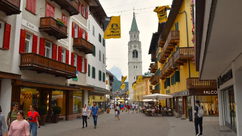
    Central street in the town centre, where the tourist office and other establishments are located. This is where local life unfolds.
    Open in Google Maps
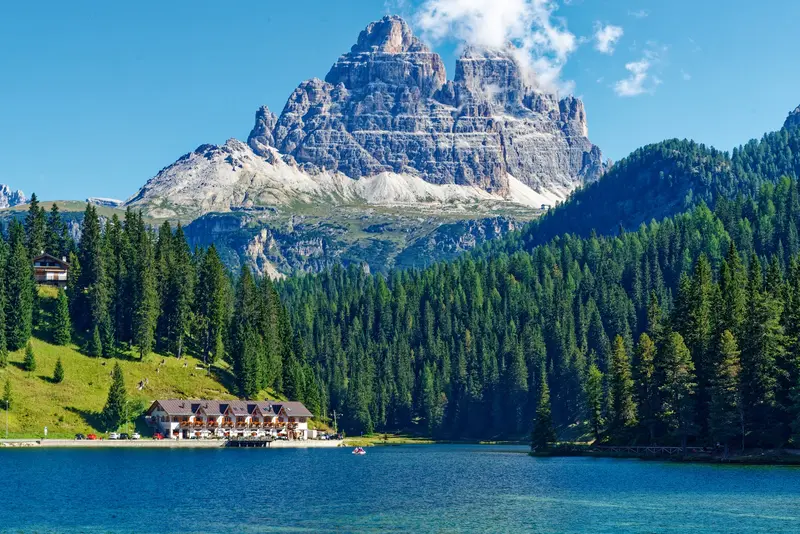
    Lago di Misurina
    Natural Feature

    2Lago di Misurina

    Mountain lake at approx. 1,750m altitude northeast of Cortina, reachable in summer by Dolomiti Bus. Just beyond, after Lago d'Antorno, starts the toll road to Auronzo Hut at the Three Peaks, for which an online reservation was required in 2026.
    Open in Google Maps
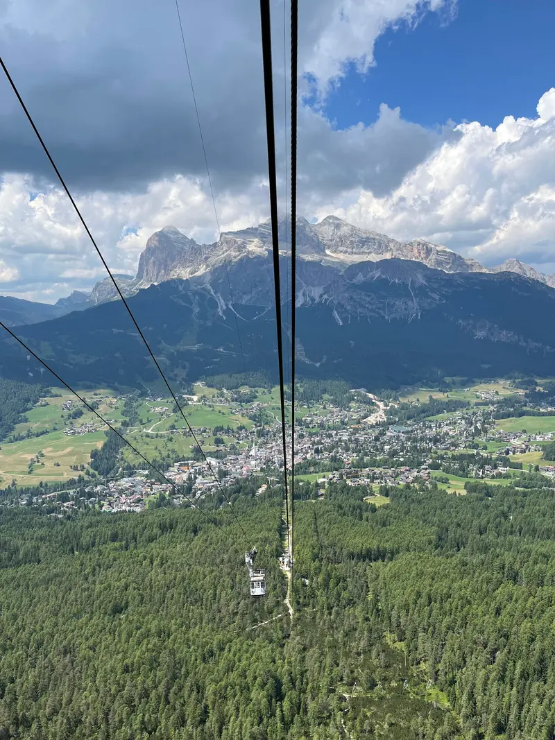
    Faloria Cable Car

    3Faloria Cable Car

    Cable car to Monte Faloria; the valley station is about a ten-minute walk southeast of the town center.
    Open in Google Maps
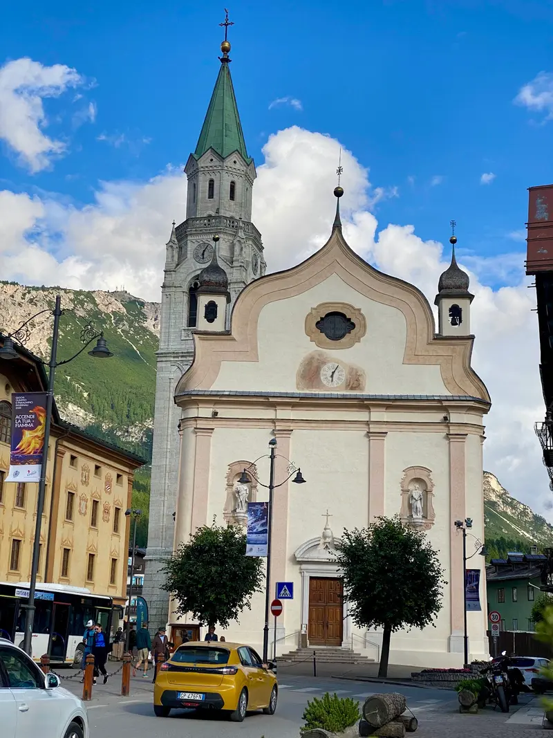
    Basilica of Saints Philip and James
    Church

    4Basilica of Saints Philip and James

    Centrally located parish church, built 1769–1775 on the site of two older churches from the 13th and 16th centuries.
    Open in Google Maps
    Lagazuoi
    Attraction

    5Lagazuoi

    Mountain west of Cortina. A cable car ascends from Passo Falzarego (2,117 m) to Rifugio Lagazuoi at 2,752 meters. During World War I, the front line ran here; Italian and Austro-Hungarian troops dug extensive tunnels, now accessible as an open-air museum.
    Open in Google Maps

    City walks in Cortina d’Ampezzo

    Curated walking tours through the city's highlights, handpicked by experienced travel journalists.

    Cortina's Charm: A Walk Through the Heart of the Dolomites

    On this two-hour walk, discover the elegance and history of Cortina d'Ampezzo. From the lively pedestrian zone to the historic sports venues and picturesque riverbanks, experience the soul of the Dolomites. Immerse yourself in the alpine atmosphere and the rich culture of this famous town.

    ~2 Std.
    Open in Google Maps
    Stops (7)

    Restaurants & Cafes

    1

    Ristorante Pizzeria Ariston

    Restaurant and Pizzeria in the town center with pizza and standard Italian dishes.
    Show on Google Maps
    2

    El Brite de Larieto

    Guesthouse with its own farm above the village on the road to Passo Tre Croci. Ampezzan mountain cuisine is served, much of it from their own production.
    Show on Google Maps
    3

    Ristorante Tivoli

    An upscale restaurant in the Lacedel district, situated on the western slope. Its cuisine blends Ampezzo tradition with creative flair.
    Show on Google Maps
    4

    SanBrite

    An upscale restaurant in the Alverà district, operated by the same family as El Brite de Larieto. The cuisine uses products from their own farm and the region.
    Show on Google Maps

    Food and Drink

    Ampezzo cuisine is a mountain cuisine with influences from Tyrol and Veneto. Many huts on the cable cars and passes serve it for lunch.

    Casunziei

    Crescent-shaped dumplings with beetroot filling, served with butter and poppy seeds.

    Polenta

    A classic side, often with game.

    Canederli

    Bread dumplings, filled with bacon, spinach or cheese, in broth or with melted butter.

    Strudel

    Apple strudel, served warm with vanilla sauce, cream or ice cream.

    Culture

    Ampezzo was under Habsburg rule from 1508 and belonged to Tyrol until after the First World War; in 1920 it became part of Italy, and in 1923 it joined the province of Belluno. Many locals, in addition to Italian, speak Ampezzano, a Ladin variety.A unique feature is the Regole d'Ampezzo, an ancient institution that manages the communal heritage of the valley, including forests and pastures. The Regole operate three museums in the town: the Mario Rimoldi Museum of Modern Art, the Rinaldo Zardini Palaeontological Museum, and an ethnographic museum.Since 2009, the Dolomites have been a UNESCO World Heritage site.

    Nightlife

    In Cortina d’Ampezzo, a nightlife awaits you, ranging from chic cocktail bars to cozy meeting spots. For a stylish start, try the Faro Cocktail Bar with its exquisite selection, while spots like Hierbas Cortina offer entertainment later.
    1

    Faro Cocktail bar

    Cocktail bar at Largo delle Poste in the town center, for an aperitif or an evening drink.
    Show on Google Maps
    2

    Belvedere

    Nightclub in Pocol above Cortina on the road to Passo Falzarego. Open mainly during the winter and summer seasons; check opening hours beforehand.
    Show on Google Maps

    Traveling

    The nearest train stations are Calalzo di Cadore (approx. 35 kilometers, with a connection by Dolomiti Bus) and Toblach (approx. 31 kilometers, with a connection by SAD). Cortina Express and ATVO operate daily to Venice Airport and Venice-Mestre, and during peak season, also to Treviso Airport. By car, you can reach the village via the SS51 and the Dolomite Road SS48bis.Within the village, you get around on foot. Dolomiti Bus serves the surrounding area, for example with a summer route to Misurina. The toll road to Auronzohütte at the Drei Zinnen begins just past Lago d'Antorno; in 2026, online reservation was mandatory for it.

    Accommodations in Cortina d’Ampezzo

    Find perfect stay in Cortina d’Ampezzo

    Booking.com* (Affiliate link)
    Search Hotels
    Agoda* (Affiliate link)
    Search Hotels
    Airbnb
    Vacation Rentals

    * Affiliate link: if you book through it, we earn a small commission. The price stays the same for you.

    Campgrounds in Cortina d’Ampezzo

    Find perfect campground in Cortina d’Ampezzo

    Search via Google Maps
    Campgrounds nearby (15km)
    Camping.info
    Find Campgrounds
    Park4Night
    RV Parks & Camping

    Plan your trip to Cortina d’Ampezzo

    Save places, build a route and plan your city trip, all in one place.

    1. 1
      Sunrise over alpine peaks and a sea of clouds
      1234

      Round trip

      12 days · 4 stops

      Saved

      Pick a route

      Pick a ready-made one or save places and plan your own.

      Open bookmarks
    2. 2

      Trip to Cortina d’Ampezzo

      Live
      • 1Corso Italia3 days
      • 2Lago di Misurina4 days
      • 3Faloria Cable Car5 days
      Budget

      Plan your trip

      The planner sorts stops, days and budget. Plan together in real time.

      Start trip planning
    3. 3
      9:41 No signal
      Cortina d’Ampezzo
      Available offline

      Use it on the road

      Download the guide to your phone and use it on site, even offline.

    Nearby

    Dolomites

    Dolomites

    The Dolomites are a mountain range of the Southern Alps in northeastern Italy, spread across South Tyrol, Trentino, Veneto, and Friuli-Venezia Giulia. Their light limestone and dolomite rocks rise as towers and walls from green alpine meadows; since 2009, they have been a UNESCO World Natural Heritage site. The highest peak is the Marmolada at 3,343 meters, and among the most famous formations are the Three Peaks, the Sella, and the Rosengarten. In summer, hiking trails, via ferratas, and mountain huts attract visitors, while in winter, the ski resorts around the Sella do. In valleys like Val Gardena and Alta Badia, Ladin is spoken alongside German and Italian.
    Three Peaks

    Three Peaks

    The Drei Zinnen are three freestanding rock towers in the Sesto Dolomites, on the border between South Tyrol and the Province of Belluno. The Große Zinne reaches 2,999 meters. Their north faces are among the most famous climbing destinations in the Alps; for hikers, the circular trail around the towers is the main objective.HistoryDuring the First World War, the front line between Austria-Hungary and Italy ran through here. Remains of fortifications, tunnels, and paths can be found on Paternkofel and Monte Piana.VisitingMost visitors start at the Auronzo Hut, which is accessible via a toll road from Misurina; an online reservation is required for car access. The huts along the circular trail are generally open from June to September; outside this period, snow may be present on the paths. Check the weather and trail conditions before your tour; current safety and health advisories for Italy can be found via the link to the Federal Foreign Office on the country page.
    Pragser Wildsee

    Pragser Wildsee

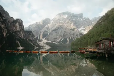
    Pragser Wildsee is situated at 1494 meters in the Pragser Tal, a few kilometers south of the Pustertal between Bruneck and Toblach. It belongs to the Fanes-Sennes-Prags Nature Park and is overlooked by the 2810-meter-high Seekofel. It also became known as a filming location for the TV series “Die Bergpolizei”.VisitA circular path of just under four kilometers leads around the lake in just over an hour. In summer, you can rent rowing boats at the boathouse. The Dolomite High Path No. 1 starts at the lake.Access in High SeasonIn 2026, a traffic regulation was in effect from July 1st to September 15th, between 9 AM and 4 PM: You could only enter the Pragser Tal with a parking space booked online in advance, with a scheduled bus service (also to be booked in advance), on foot, or by bike. The regulation is expected to return in summer 2027; details will be published in spring. Check them on the official website prags.bz before your arrival.
    Seiser Alm

    Seiser Alm

    The Seiser Alm (Alpe di Siusi) is a wide high plateau at roughly 1,680 to 2,350 meters with an area of about 56 square kilometers, and is considered the largest high alpine meadow in Europe. Administratively it is a fraction of the municipality of Kastelruth. Its southern parts belong to the Schlern-Rosengarten Nature Park.SummerA dense network of trails, alpine pastures and huts makes the Alm a destination for families and leisurely hikers. The tours up the Schlern are more demanding.WinterIn winter the Seiser Alm is a ski area with about 60 kilometers of slopes, part of Dolomiti Superski and connected to St. Ulrich in Gröden by a gondola lift.AccessThe road from Seis to Compatsch is closed to private traffic uphill between 9 a.m. and 5 p.m., while you may drive downhill at any time. Since the end of June 2026, an online reservation is mandatory for the parking lots P1 Spitzbühl and P2 Compatsch. The easiest way is to take the cable car from Seis to Compatsch. Guests of accommodations on the Alm receive an access permit from their host. You can find the current rules at Seiser Alm Marketing.
    Bozen

    Bozen

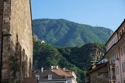
    Nestled in a valley basin at the confluence of the Talfer and Eisack, Bolzano is the capital of South Tyrol. The city is bilingual; unlike the rest of South Tyrol, the Italian language group is in the majority here: In the 2024 language census, about three-quarters of the inhabitants declared themselves part of the Italian language group and about one-quarter part of the German language group.Old TownThe heart of the Old Town features the over 300-meter-long Lauben (arcades) with their merchant houses, the Obstplatz (Fruit Square) with its market, and the Waltherplatz with the Gothic cathedral. Gothic frescoes are preserved in the Dominican Church, while the Franciscan Church boasts a winged altar and a cloister.MuseumsThe South Tyrol Museum of Archaeology exhibits the glacier mummy Ötzi. Additionally, there is the Museion for modern and contemporary art and the Messner Mountain Museum Firmian at Sigmundskron Castle.SurroundingsCable cars lead up to Ritten and Kohlern.

    Sources & method

    • Photos: Unsplash, Google Maps. Each photo carries its credit.
    • Place data such as addresses and ratings comes from Google Maps.
    • The content is based on web research from public, traceable sources. How the content is made · The role of AI