Fernweh: Home
    ExploreTravel GuidesPlan a tripMy tripLast visited
    de|en
    All Places & RegionsAll highlightsAbout FernwehFAQPrivacy PolicyImprint
    ExploreTravel GuidesPlan a tripMy tripLast visited
    • Overview
    • Nearby
    Colorado
    Rhododendrites / Wikimedia Commons / CC BY-SA 4.0

    United States

    Colorado

    Region

    Colorado sits in the southern Rocky Mountains between Utah and Kansas, with Denver as its capital and largest city.

    by Felix Gillen

    1. Home
    2. Destinations
    3. United States
    4. Colorado
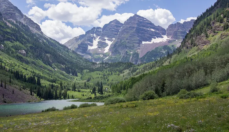
    Colorado sits in the southern Rocky Mountains between Utah and Kansas, with Denver as its capital and largest city. People come for the high mountain roads and trails, the 53 peaks above 14,000 feet, and four national parks ranging from Rocky Mountain to Mesa Verde.About six million people live here, most of them along the Front Range Urban Corridor, the string of cities at the eastern edge of the mountains around Denver. West of that line the Rockies rise fast; the highest summit is Mount Elbert at 14,440 feet. To the east the flat prairie of the High Plains begins.The four national parks are spread out across the state: Rocky Mountain (established 1915) northwest of Denver, Great Sand Dunes (2004), Black Canyon of the Gunnison (1999) and Mesa Verde (1906) in the southwest corner.
    Almost every trip starts in Denver, where a commuter train links the airport with downtown. For the mountains you'll want a car or RV. Expect weather to change quickly at altitude, and snow lingers on the high roads into early summer.Rocky Mountain National Park: In 2026 a timed-entry system runs from May 22 into mid-October. The Bear Lake Road Corridor requires a reservation from 5 a.m. to 6 p.m., the rest of the park from 9 a.m. to 2 p.m. Permits are released on recreation.gov ($2 fee) on the first of the preceding month at 8 a.m. Mountain Time.Altitude: Denver sits at about a mile above sea level, and many mountain towns and passes are much higher. For health guidance, check the CDC's travel health pages or, if you're visiting from abroad, the UK FCDO travel advice.Traveling by RVState parks: Colorado State Parks campsites open up to six months ahead on cpwshop.com or at 1-800-244-5613; the parks themselves don't take bookings. On top of the site fee you need a daily or annual vehicle pass.Near Denver: Chatfield State Park in Littleton has 146 full-hookup sites, and Cherry Creek State Park in Aurora is about 15 miles from downtown. Details are on the Denver page.Winter: Many parks shut off water hookups from mid-October to early April; at Chatfield you'll get electric only during that period.
    Nearby

    Moab

    Moab

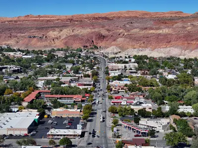
    Moab is a small town of about 5,000 people in eastern Utah, on the Colorado River and US 191, just under four hours' drive southeast of Salt Lake City. It's where you'll stay for Arches National Park, five minutes up the road, and Canyonlands' Island in the Sky district, about 45 minutes away.Main Street doubles as US 191: motels, outfitters, grocery stores and most restaurants are on it or a block or two off it. Jeep, rafting and mountain bike tours leave from here, and in the evening most visitors end up on the Main Street patios after a day on the trail.Good to knowPeak season: March through October, especially around Easter (Jeep Safari) and holiday weekends like Memorial Day and Labor Day. Book rooms and campsites weeks or months ahead.Heat: July and August regularly top 100°F. Hike early in the morning or in the evening.Groceries: City Market on Main Street is the biggest grocery store in the area. Stock up on water and supplies before heading into the parks.
    Arches National Park

    Arches National Park

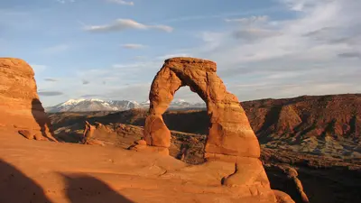
    Arches National Park lies in eastern Utah just north of the town of Moab, about four hours southeast of Salt Lake City. It holds more than 2,000 sandstone arches, and the most famous, including Delicate Arch and Landscape Arch, are within short to moderate hikes of the road.A 19-mile scenic drive runs through the park past the trailheads for the Windows Section, Balanced Rock, Wolfe Ranch and, at the far end, Devils Garden. You'll reach many arches within 15 minutes on foot, but there's almost no shade along the way.Moab as your baseMoab is five minutes from the park entrance and also the base for Canyonlands National Park and Dead Horse Point State Park. It has hotels at every price point, grocery stores, gas and outfitters for jeep, rafting and canyoneering trips. Rooms book up early in the March to October high season.What to know in 2026No timed entry: you don't need an entry reservation in 2026. Expect lines at the entrance on weekends and holidays, and lots that staff close temporarily when they fill up.Still reservation-only: Devils Garden Campground (March through October) and every Fiery Furnace hike, self-guided or ranger-led.Entrance fee: $30 per private vehicle. Arches does not charge the $100 nonresident surcharge. The $55 Southeast Utah Parks annual pass covers Arches, Canyonlands and two national monuments.Heat: July and August highs often pass 100°F. Hike early or late and carry at least two liters of water per person; water is only available at the visitor center.
    Canyonlands National Park (Island in the Sky)

    Canyonlands National Park (Island in the Sky)

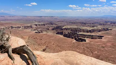
    Island in the Sky is the northern and most accessible district of Utah's Canyonlands National Park, about 32 miles west of Moab. You come for the view: from a mesa top you look roughly 2,200 feet down into the canyons of the Colorado and Green Rivers, and the best overlooks are just minutes from the car.The park splits into three districts that no road inside the park connects. The Needles to the south and the Maze to the west are separate trips; Island in the Sky makes an easy day trip from Moab. One road runs from the visitor center across the mesa to Grand View Point, with a spur to Upheaval Dome.Before you goEntrance fee: $30 per private vehicle. There's no nonresident surcharge here. The $55 Southeast Utah Parks pass also covers Arches.Supplies: no restaurants or gas in the park. Potable water is available at the visitor center only, spring through fall, and there's none on the trails. Fill the tank and pack lunch in Moab.Visitor center: open daily March through December from 9 a.m., with longer summer hours.Combine it: Dead Horse Point State Park is on the way, with its own fee, and its view of the Colorado River's gooseneck is worth the detour.
    Wyoming

    Wyoming

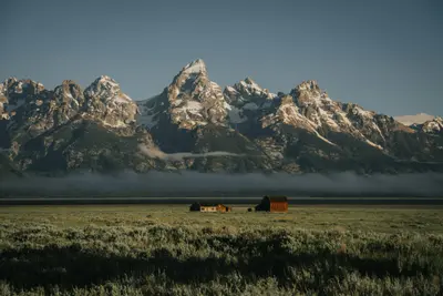
    Wyoming borders Montana, South Dakota, Nebraska, Colorado, Utah, and Idaho, and with about 589,000 residents it's the least populous state in the country. You come for the national parks, the mountains, and the old Western towns, and you drive long stretches of nearly empty country in between.In the northwest, Yellowstone and Grand Teton National Park sit end to end, linked by the John D. Rockefeller Jr. Memorial Parkway. Jackson, at the south end of Grand Teton, is the base for flights, hotels, and restaurants. Gannett Peak, the state's highest summit, rises in the remote Wind River Range.In the northeast, Devils Tower stands 867 feet above its base and 1,267 feet above the Belle Fourche River. Theodore Roosevelt made it the first national monument in 1906. Cody, named for Buffalo Bill, sits on the road to Yellowstone's East Entrance; the capital, Cheyenne, is in the southeast corner.
    Utah

    Utah

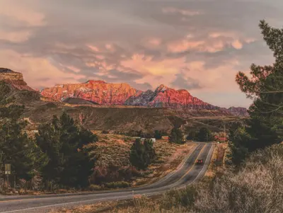
    Utah sits between Nevada, Arizona, Colorado, Wyoming, and Idaho. Most visitors come for the five national parks in the south, the "Mighty Five": Zion, Bryce Canyon, Capitol Reef, Arches, and Canyonlands. In winter, the draw is the Wasatch Range, with ski resorts less than an hour from Salt Lake City.Salt Lake City hosted the 2002 Winter Olympics and gets the Games again in 2034. Northwest of town lies the Great Salt Lake, a remnant of Ice Age Lake Bonneville. The state's high point is Kings Peak (13,518 ft) in the Uinta Mountains.Down south, the parks sit close together: Zion with the Narrows of the Virgin River, Bryce Canyon and its hoodoos, Capitol Reef along the Waterpocket Fold, and Arches and Canyonlands outside Moab. Monument Valley and Lake Powell are right on the Arizona line.

    Sources & method

    • Photos: Wikimedia Commons. Each photo carries its credit.
    • The content is based on web research from public, traceable sources. How the content is made · The role of AI