Fernweh: Home
    ExploreTravel GuidesPlan a tripMy tripLast visited
    de|en
    All Places & RegionsAll highlightsAbout FernwehFAQPrivacy PolicyImprint
    ExploreTravel GuidesPlan a tripMy tripLast visited
    • Overview
    • Places in the region
    • Best travel time
    • Round trips
    • Nearby
    Djerba & the Southeast

    Tunisia

    Djerba & the Southeast

    Region

    Southeastern Tunisia links the flat island of Djerba in the Gulf of Gabès with the arid mountainous region around Matmata, approximately 40 km southwest of Gabès.

    by Felix Gillen

    1. Home
    2. Destinations
    3. Tunisia
    4. Djerba & the Southeast
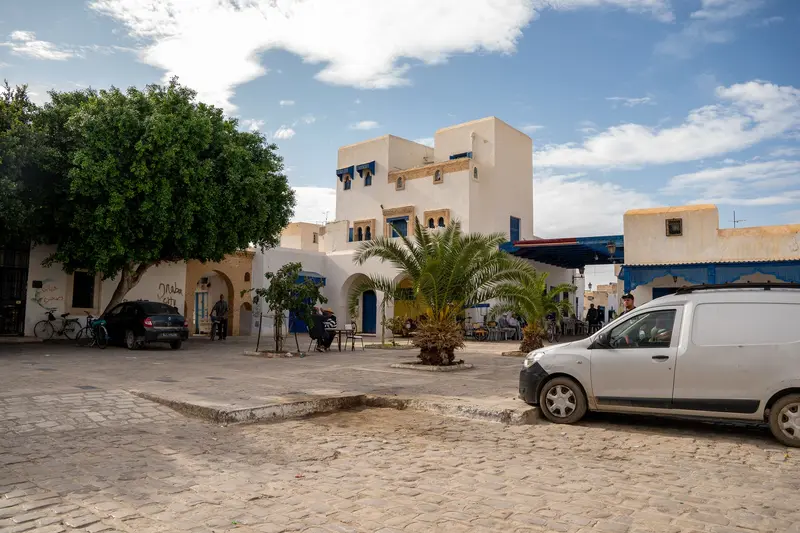
    Southeastern Tunisia links the flat island of Djerba in the Gulf of Gabès with the arid mountainous region around Matmata, approximately 40 km southwest of Gabès. You come for Djerba's beaches and its villages, whose settlement pattern has been a UNESCO World Heritage Site since 2023, and for the Berber cave dwellings dug into the ground. Djerba has its own international airport and is the usual base for the region.
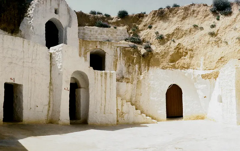
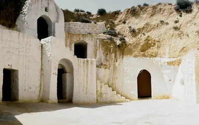
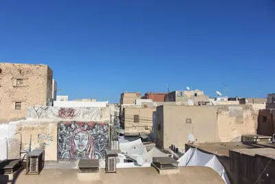
    Djerba The island measures approximately 514 km² and is connected to the mainland by a 7 km long causeway whose origins date back to antiquity. Since 2023, Djerba has been inscribed on the UNESCO World Heritage List as a "Testimony to a settlement pattern on an island region." Houmt Souk: Main town with souks, harbor, and the Borj El Kebir fortress Erriadh: Village with the La Ghriba synagogue and Djerbahood street art Guellala: Pottery village in the south of the island with a local museum Northeast Coast: Hotel zone and beaches around Sidi Mahrez Matmata and the Highlands Matmata is situated at an altitude of approximately 600 m. The town is famous for its dwellings dug into the ground around a deep courtyard; one of them, the Hotel Sidi Driss, served as a film set for "Star Wars." Tamezret: Berber village on a hill, about 10 km west of Matmata Toujane: Mountain village between Matmata and Médenine Getting there: Louages and buses from Gabès, by car from Djerba via Gabès Further South: Observe Safety Advisories South of Médenine lie Tataouine with its fortified granaries (Ksour) such as Chenini and Ksar Ouled Soltane, as well as the Ksar Ghilane oasis. These places are on or south of the line south of which the German Federal Foreign Office advises against travel. Before any journey to the south, check the current travel and safety advisories for Tunisia in the UK FCDO travel advice and from the German Federal Foreign Office. Additionally, a military restricted area exists along the Libyan border.
    Gabès
    The original uploader was Elcèd77 at French Wikipedia. / Wikimedia Commons / CC BY-SA 3.0

    Place 1 of 3

    Gabès

    Gabès, a port city on the Gulf of Gabès in southeastern Tunisia, lies about 400 km south of Tunis on the mainland west of Djerba.

    Discover
    Djerba

    Place 2 of 3

    Djerba

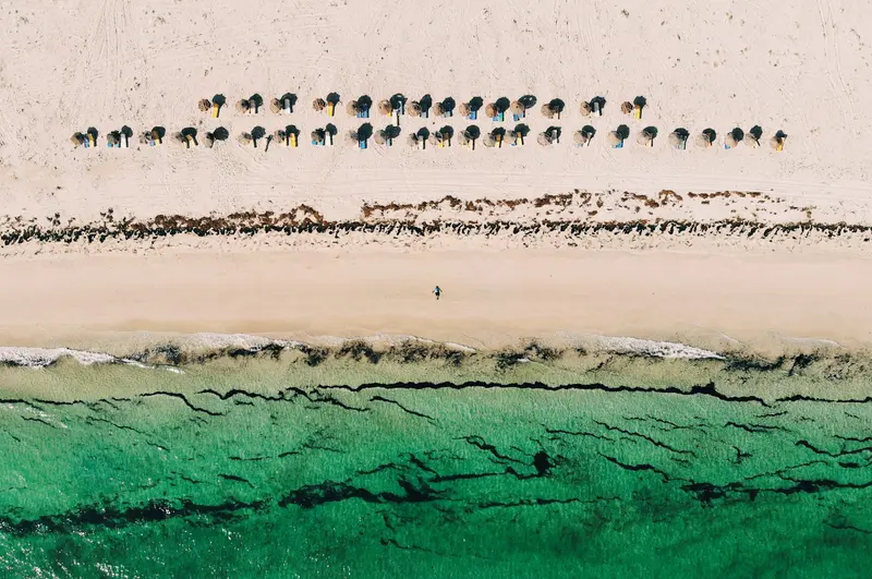
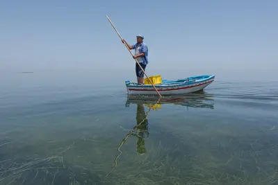
    Djerba is a flat island in the Gulf of Gabès, in southeastern Tunisia, and has been a UNESCO World Heritage site since 2023.

    Discover
    Matmata
    LBM1948 / Wikimedia Commons / CC BY-SA 4.0

    Place 3 of 3

    Matmata

    Matmata is a Berber village about 600 m high, 40 km southwest of Gabès in southern Tunisia. You visit to see the dwellings dug into the earth around a deep courtyard, including the Hotel Sidi Driss, a filming location for 'Star Wars'.

    Discover

    Best Time to Visit

    When is the best time for your trip?

    May
    June
    September
    October
    23–28°C·1–22 mm(little rain)
    In May, June, September, and October, daily highs range from 27 to 32 °C, with sea temperatures of 20 to 28 °C. July and August are hottest, reaching up to 34 °C.
    Djerba's climate data serves as a reference for the region.Djerba has a dry, mild climate. From May to August, there is hardly any rain, with most precipitation occurring from October to December. In winter, daily temperatures rise to 17 to 18 °C, while the sea cools to 14 to 15 °C.

    Seasons

    Jan
    Feb
    Mar
    Apr
    May
    Jun
    Jul
    Aug
    Sep
    Oct
    Nov
    Dec
    Swim season
    Transitional
    Winter
    Best Time to Visit
    ▶Show detailed monthly data
    MonthTemp (°C)Rain (mm)
    January13.518
    February14.516
    March17.017
    April19.512
    May23.04
    June26.51
    July29.50
    August30.01
    September28.013
    October24.522
    November19.519
    December15.025

    Round trips through this region

    The South: Djerba, Matmata and the Oases

    The South: Djerba, Matmata and the Oases

    Ten days in southern Tunisia: from the island of Djerba to the cave dwellings of Matmata, to Douz on the edge of the Grand Erg Oriental, and across the Chott el Djerid salt lake to Tozeur and Nefta. Parts of the route lie in areas covered by specific warnings in the UK FCDO Travel Advice. Check the current advice before you travel and only go into the desert on organised tours with local operators.

    10 Days
    7 stops

    Nearby

    Djerba

    Djerba

    Djerba is a flat island in the Gulf of Gabès, in southeastern Tunisia, and has been a UNESCO World Heritage site since 2023. You go there for long sandy beaches on the northeast coast, the souks of Houmt Souk, and villages like Erriadh and Guellala, where Jewish, Ibadite, and Berber traditions coexist. The island, covering approximately 514 km², has a population of just under 190,000 (2024 census). Its main town is Houmt Souk in the north, and hotels are primarily located along the coast around Sidi Mahrez. Public transport is limited; most journeys are made by taxi, rental car, or bicycle.
    Gabès

    Gabès

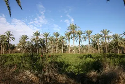
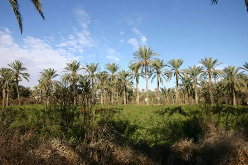
    Gabès, a port city on the Gulf of Gabès in southeastern Tunisia, lies about 400 km south of Tunis on the mainland west of Djerba. You come for its palm oasis right by the sea, considered the Mediterranean's sole coastal oasis, and for the henna market in the Jara quarter. The city, with over 100,000 inhabitants, is the terminus for the Tunis railway line and a starting point for Matmata. Worth seeing are the old quarters Jara and Menzel, the Mausoleum of patron saint Sidi Boulbaba, and the Chenini oasis.
    Matmata

    Matmata

    Matmata is a Berber village about 600 m high, 40 km southwest of Gabès in southern Tunisia. You visit to see the dwellings dug into the earth around a deep courtyard, including the Hotel Sidi Driss, a filming location for 'Star Wars'.The old village is small and easily explored on foot. New Matmata, the current main town, is approximately 15 km away.
    Sfax

    Sfax

    Sfax, with approximately 274,000 inhabitants (2024 Census), is Tunisia's second-largest city, located about 270 kilometers southeast of Tunis on the Gulf of Gabès. Its Medina is still completely enclosed by a roughly 2.75-kilometer-long city wall with 69 towers and is largely untouched by tourism.Sfax is a commercial and port city: Its port is one of the country's most important fishing ports, and about 40 percent of Tunisian olive oil originates from the surrounding area. You can explore the Old City with its Great Mosque, Kasbah, and Dar Jellouli on foot, and ferries depart from the port to the Kerkennah Islands.
    Kerkennah Islands

    Kerkennah Islands

    The Kerkennah Islands are located in the Gulf of Gabès off Sfax and are reachable by ferry from Sfax. This flat archipelago is a tranquil destination away from the major seaside resorts and is known for Charfia fishing, which has been a UNESCO Intangible Cultural Heritage since 2020.The two main islands, Gharbi and Chergui, together cover approximately 160 square kilometers and are home to around 15,400 people (2024 census). The largest town is Remla on Chergui, and sandy beaches are found primarily around Sidi Fredj.

    Sources & method

    • Photos: Pexels. Each photo carries its credit.
    • The content is based on web research from public, traceable sources. How the content is made · The role of AI