Fernweh: Home
ExploreGuideDestinationsMy tripsMy trip
de|en
All Places & RegionsRound tripsNight trains in EuropeAll highlightsAbout FernwehFAQPrivacy PolicyImprint
Download on the App StoreGet it on Google Play
ExploreGuideDestinationsMy tripsMy trip
    • Neighborhoods & highlights
    • Recommendations
    • Tours
    • Eat & drink
    • Culture
    • Getting around
    • Accommodation
    • Plan trip
    • Round trips
    • Nearby
    Potosí

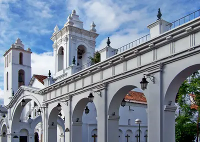
    Jbmurray / Wikimedia Commons / CC BY-SA 4.0, mod.

    Bolivia

    Potosí

    CityUNESCO

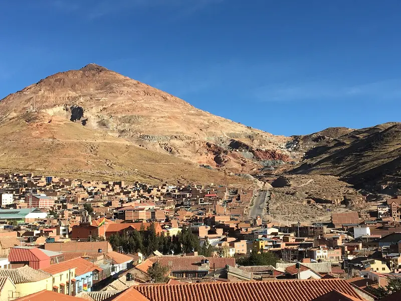
    Potosí is located at approximately 4,000 m (13,000 ft) at the foot of Cerro Rico, the Silver Mountain, which made the city one of the world's largest industrial centers from 1545.

    by Felix Gillen

    1. Home
    2. Destinations
    3. Bolivia
    4. Potosí
    Potosí is located at approximately 4,000 m (13,000 ft) at the foot of Cerro Rico, the Silver Mountain, which made the city one of the world's largest industrial centers from 1545. Its old town has been a UNESCO World Heritage site since 1987 and on the Red List of Endangered World Heritage since 2014.At the Casa Nacional de Moneda, you'll see how silver was turned into coins, and in the alleys, churches and colonial buildings from its heyday. Potosí is central to understanding South America's colonial history, and is three to four bus hours from Sucre.
    Bolivia travel guideSee the round tripPlan a trip with Potosí

    Contents

    • Neighborhoods & highlights
    • Recommendations
    • Tours
    • Eat & drink
    • Culture
    • Getting around
    • Accommodation
    • Round trips
    • Nearby

    Sights in Potosí

    Discover the most important sights and attractions

    Attraction

    1Cerro Rico

    The Silver Mountain south of the city was, from 1545, the basis for Potosí's wealth. Due to centuries of mining, it is porous and unstable, and parts of the summit have collapsed.
    Open in Google Maps
    Museum

    2National House of Coin

    Das heutige Münzhaus wurde 1773 fertiggestellt und ist seit 1940 Museum und Archiv. Bei der etwa zweistündigen Führung siehst du die von Maultieren angetriebenen hölzernen Walzwerke und das Gemälde La Virgen del Cerro. Ab September 2026 wird das Gebäude über mehrere Jahre restauriert, das Museum soll dabei geöffnet bleiben.
    Open in Google Maps

    Tours & experiences in Potosí

    Search tours for Potosí on GetYourGuide* (Affiliate link)On GetYourGuide, with reviews from other travellers

    * Affiliate link: if you book through it, we earn a small commission. The price stays the same for you.

    Restaurants in Potosí

    Silvertown

    The Cerro RicoSilver mining began on Cerro Rico in 1545. UNESCO describes Potosí as the largest industrial complex of the 16th century, with 22 reservoirs, 140 mills, and the mercury process. Due to mining, the mountain is now porous and unstable; parts of the summit have collapsed.Colonial HeritageBesides the Mint House, the World Heritage site includes the Church of San Lorenzo, the Mita workers' quarters, and the watermills (ingenios). Due to uncontrolled mining, the city has been on the Red List since 2014.Ch'utillosAround August 24, Potosí celebrates Ch'utillos in honor of San Bartolomé, a UNESCO cultural heritage since 2023.

    Getting Here & Info

    Getting ThereBus from Uyuni in about four hours (204 km)Bus from Sucre in about three to four hoursAltitudePotosí lies at around 4,000 m. Walking in the steep old town is strenuous; for altitude advice, consult the Foreign Office.Casa Nacional de MonedaVisits only with a guided tour, lasting about two hoursAdmission and photo permit payable on site; current prices are available at the ticket counterTour times vary, check beforehandDue to restoration work from September 2026, some areas may be closedIt's cool inside, bring a jacket

    Accommodations in Potosí

    Find perfect stay in Potosí

    Booking.com* (Affiliate link)
    Search Hotels
    Agoda* (Affiliate link)
    Search Hotels
    Airbnb
    Vacation Rentals

    * Affiliate link: if you book through it, we earn a small commission. The price stays the same for you.

    Plan your trip to Potosí

    Save places, build a route and plan your city trip, all in one place.

    1. 1
      Sunrise over alpine peaks and a sea of clouds
      1234

      Round trip

      12 days · 4 stops

      Saved

      Pick a route

      Pick a ready-made one or save places and plan your own.

      Open bookmarks
    2. 2

      Trip to Potosí

      Live
      • 1Cerro Rico3 days
      • 2National House of Coin4 days
      Budget

      Plan your trip

      The planner sorts stops, days and budget. Plan together in real time.

      Start trip planning
    3. 3
      9:41 No signal
      Potosí
      Available offline

      Jbmurray / Wikimedia Commons / CC BY-SA 4.0, mod.

      Use it on the road

      Download the guide to your phone and use it on site, even offline.

    Round trips with Potosí

    Classic Bolivia: Lake Titicaca, Salar de Uyuni and Colonial Cities

    Classic Bolivia: Lake Titicaca, Salar de Uyuni and Colonial Cities

    The route connects the major destinations of the Bolivian highlands: La Paz with cable car and Tiwanaku, Lake Titicaca with Copacabana and the Isla del Sol, the Salar de Uyuni with the Lagoon Route, and finally the World Heritage cities Potosí and Sucre. All stages are traveled by bus, boat, or guided 4x4.

    13 Days
    8 stops
    Open jaw

    Nair Cristopher Sánchez Muñoz·Pexels

    Nearby

    Sucre

    Sucre

    Sucre is Bolivia's constitutional capital, a whitewashed colonial city located at around 2,790 m. Its old town has been a UNESCO World Heritage site since 1991, where the country's independence was declared on August 6, 1825.You visit the Casa de la Libertad, 16th-century churches, and the rooftop terraces of San Felipe Neri, take in views of the city from La Recoleta, and on the outskirts, see thousands of dinosaur footprints on a rock face. On Sundays, a trip to Tarabuco Market is worthwhile.

    Tom D'Arby·Pexels

    Uyuni

    Uyuni

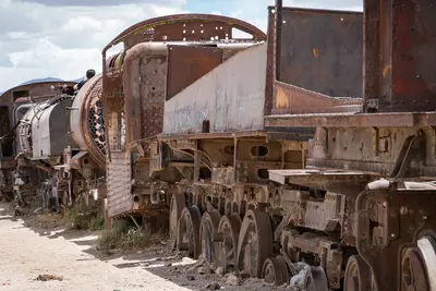
    The small town of Uyuni, at around 3,700 m in the Potosí Department, is the starting point for tours to the Salar de Uyuni and along the Lagoon Route south. This is where 4x4s depart, and where planes, night buses, and trains from the north arrive.On the town's edge, old steam locomotives and wagons rust at the Train Cemetery. By the Salar, Colchani's salt workers process their salt. The Foreign Office lists Uyuni among locations needing increased caution due to crime.

    PsamatheM·CC BY-SA 4.0

    Salar de Uyuni

    Salar de Uyuni

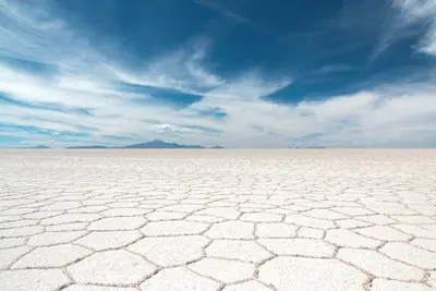
    The Salar de Uyuni in southwestern Bolivia is a salt flat covering approximately 10,582 km² at about 3,656 meters, a white, seemingly endless surface to the horizon. It is the country's most famous travel destination and the starting point for tours to the highland lagoons.In the dry season, you drive across the hard salt crust to the cactus island Incahuasi, and in the rainy season, a thin layer of water transforms the Salar into a giant mirror. Beneath the crust lie vast lithium reserves.

    Samuel Scrimshaw·Unsplash

    Salar de Surire

    Salar de Surire

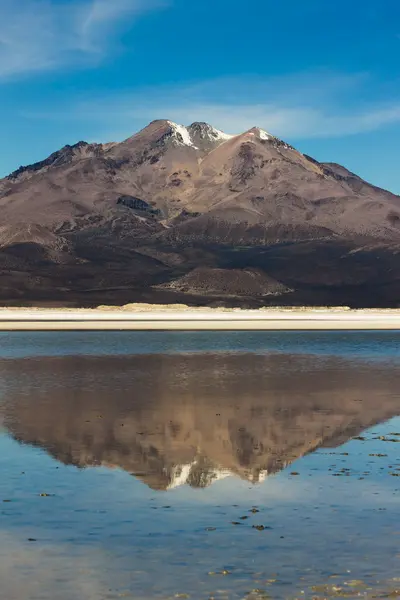
    The Salar de Surire lies at around 4,200 meters, south of Lauca National Park. The white salt flat with its shallow lagoons is a breeding ground for three flamingo species and has been protected as a Ramsar wetland since 1996.

    Chris malebran·CC BY-SA 4.0

    Reserva Eduardo Avaroa and Lagoon Route

    Reserva Eduardo Avaroa and Lagoon Route

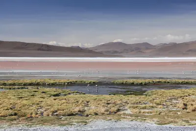
    The Reserva Nacional de Fauna Andina Eduardo Avaroa, in Bolivia's far southwest bordering Chile, covers approx. 7,150 km² of highland with colorful lagoons, volcanoes, and geysers. On the multi-day Lagoon Route from Uyuni, you'll experience some of the most impressive landscapes of the Andes.The reddish Laguna Colorada, at around 4,278 m, is home to flamingos, with three species found in the protected area. Further south, the Sol de Mañana geyser field steams at almost 5,000 m, and at Termas de Polques, you can bathe in thermal water around 29°C.

    Loïc Alejandro·Pexels

    Your next steps

    Potosí is in Bolivia. Ways to carry on from here.

    • More in Bolivia

      Highlights, areas, routes and the best time to travel for all of Bolivia.

      Bolivia travel guide
    • Round trips with Potosí

      One route passes through Potosí, with stops, nights and a map.

      See the round trip

    Sources & method

    • Photos: Wikimedia Commons. Each photo carries its credit.
    • Place data such as addresses and ratings comes from Google Maps.
    • The content is based on web research from public, traceable sources. How the content is made · The role of AI