Fernweh: Home
ExploreGuideDestinationsMy tripsMy trip
de|en
All Places & RegionsRound tripsNight trains in EuropeAll highlightsAbout FernwehFAQPrivacy PolicyImprint
Download on the App StoreGet it on Google Play
ExploreGuideDestinationsMy tripsMy trip
    • Places & highlights
    • Tours
    • Eat & drink
    • Culture
    • Getting around
    • Accommodation
    • Round trips
    • Nearby
    Reserva Eduardo Avaroa and Lagoon Route

    Photo by Loïc Alejandro on Pexels

    Bolivia

    Reserva Eduardo Avaroa and Lagoon Route

    Point of InterestNatureRoad Trip

    The Reserva Nacional de Fauna Andina Eduardo Avaroa, in Bolivia's far southwest bordering Chile, covers approx. 7,150 km² of highland with colorful lagoons, volcanoes, and geysers.

    by Felix Gillen

    1. Home
    2. Destinations
    3. Bolivia
    4. Reserva Eduardo Avaroa and Lagoon Route
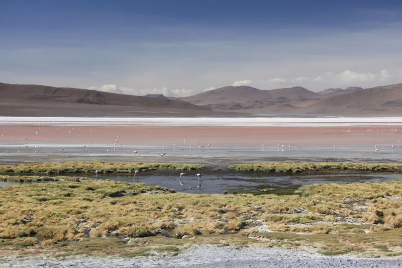
    The Reserva Nacional de Fauna Andina Eduardo Avaroa, in Bolivia's far southwest bordering Chile, covers approx. 7,150 km² of highland with colorful lagoons, volcanoes, and geysers. On the multi-day Lagoon Route from Uyuni, you'll experience some of the most impressive landscapes of the Andes.The reddish Laguna Colorada, at around 4,278 m, is home to flamingos, with three species found in the protected area. Further south, the Sol de Mañana geyser field steams at almost 5,000 m, and at Termas de Polques, you can bathe in thermal water around 29°C.
    Bolivia travel guideSee the round tripPlan a trip with Reserva Eduardo Avaroa and Lagoon Route

    Contents

    • Places & highlights
    • Tours
    • Eat & drink
    • Culture
    • Getting around
    • Accommodation
    • Round trips
    • Nearby

    More places in Reserva Eduardo Avaroa and Lagoon Route

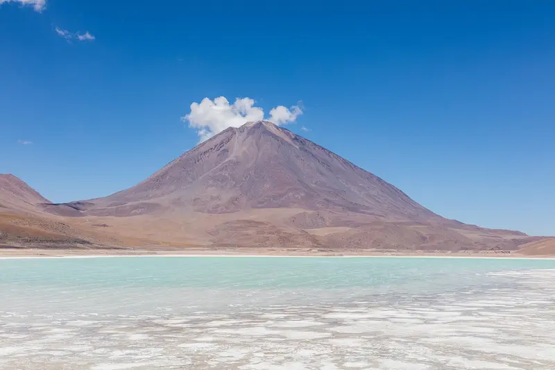
    Laguna Verde and Sol de Mañana

    Diego Delso·CC BY-SA 4.0

    Laguna Verde and Sol de Mañana

    The south of the Reserva Eduardo Avaroa, bordering Chile, is the highest section of the Lagunas Route. At the Sol de Mañana geyser field, at nearly 5,000 m, the earth steams; at Termas de Polques, you bathe in thermal water around 29 degrees warm.Further south lies Laguna Verde, at over 4,000 m. This section is part of the multi-day 4x4 tours starting from Uyuni.

    Sights in Reserva Eduardo Avaroa and Lagoon Route

    Discover the most important sights and attractions

    Point of Interest

    1Laguna Colorada

    The reddish lagoon at around 4,278 m provides a habitat for flamingos. From the viewpoint, you overlook the lake; opposite is the park post where entry is paid in cash.
    Open in Google Maps
    Natural Feature

    2Árbol de Piedra

    The wind-shaped rock formation in the high desert north of Laguna Colorada is an integral stop on the Laguna Route.
    Open in Google Maps

    Tours & experiences in Reserva Eduardo Avaroa and Lagoon Route

    Search tours for Reserva Eduardo Avaroa and Lagoon Route on GetYourGuide* (Affiliate link)On GetYourGuide, with reviews from other travellers

    * Affiliate link: if you book through it, we earn a small commission. The price stays the same for you.
    Restaurants in Reserva Eduardo Avaroa and Lagoon Route

    Sanctuary and Wildlife

    A Highland ReserveThe protected area was founded in 1973 and has been part of the Ramsar wetland Los Lípez since 2009. Andean, James, and Chilean flamingos live here.LandscapeThe area is mostly located between approximately 4,200 and 5,400 m. Along the way, you'll pass rock formations like the Árbol de Piedra, a stone shaped by the wind.

    Arrival and How-To

    Tours from UyuniThe Lagoon Route is explored via a guided 4x4 tour from Uyuni, typically combined with the Salar de Uyuni over several days.PracticalitiesEntry for foreigners: 150 Bolivianos, cash payable at the park post at Laguna Colorada. An official tariff for 2026 was not found, please verify the amount locally.Bring a total of 250 to 300 Bolivianos in cash, as there are no ATMs and hardly any card payment options.Limited mobile reception: Download offline maps and pack a power bank.Follow your guide's instructions at the geyser field.Nights at over 4,000 m are very cold; consult your Foreign Office for altitude sickness advice.

    Accommodations in Reserva Eduardo Avaroa and Lagoon Route

    Find perfect stay in Reserva Eduardo Avaroa and Lagoon Route

    Booking.com* (Affiliate link)
    Search Hotels
    Agoda* (Affiliate link)
    Search Hotels
    Airbnb
    Vacation Rentals

    * Affiliate link: if you book through it, we earn a small commission. The price stays the same for you.

    Round trips with Reserva Eduardo Avaroa and Lagoon Route

    Classic Bolivia: Lake Titicaca, Salar de Uyuni and Colonial Cities

    Classic Bolivia: Lake Titicaca, Salar de Uyuni and Colonial Cities

    The route connects the major destinations of the Bolivian highlands: La Paz with cable car and Tiwanaku, Lake Titicaca with Copacabana and the Isla del Sol, the Salar de Uyuni with the Lagoon Route, and finally the World Heritage cities Potosí and Sucre. All stages are traveled by bus, boat, or guided 4x4.

    13 Days
    8 stops
    Open jaw

    Nair Cristopher Sánchez Muñoz·Pexels

    Nearby

    El Tatio Geysers Area

    El Tatio Geysers Area

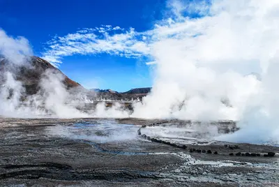
    The El Tatio geyser field lies at about 4,320 meters in the Andes, about 80 to 90 kilometers north of San Pedro de Atacama. Shortly after sunrise, steam columns rise from dozens of vents into the icy cold air, so tours begin in the middle of the night.

    Cristian Salinas Cisternas·Pexels

    Atacama Desert

    Atacama Desert

    The Atacama in northern Chile is one of the driest deserts on Earth: salt flats, volcanoes, high-altitude lakes, and geyser fields at over 4,000 meters. Almost all visitors stay in the oasis San Pedro de Atacama and explore the region from there on day trips.

    Diego Delso·CC BY-SA 4.0

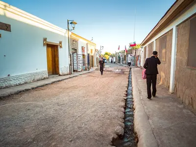
    San Pedro de Atacama Village

    San Pedro de Atacama Village

    San Pedro de Atacama is an adobe oasis village at approx. 2,450 meters in the Atacama Desert, northern Chile. Stay here to experience geysers, salt flats, highland lagoons, and the desert's starry sky: Most regional excursions depart from the Plaza and Calle Caracoles.

    David Vives·Pexels

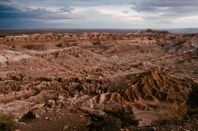
    Valle de la Luna

    Valle de la Luna

    The Valle de la Luna, some 13 kilometers west of San Pedro de Atacama, is a valley of salt, gypsum, and clay formations with sand dunes in the Cordillera de la Sal. Late afternoon sun tinges ridges and rock faces reddish.

    Eleanore Stohner·Pexels

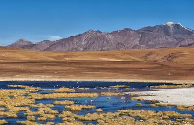
    Salar de Atacama

    Salar de Atacama

    The Salar de Atacama, south of San Pedro, is Chile's largest salt flat, a rough, white-grey crust before Andean volcanoes. Three flamingo species live in the shallow lagoons at its edge, especially Laguna Chaxa.

    André Ulysses De Salis·Pexels

    Your next steps

    Reserva Eduardo Avaroa and Lagoon Route is in Bolivia. Ways to carry on from here.

    • More in Bolivia

      Highlights, areas, routes and the best time to travel for all of Bolivia.

      Bolivia travel guide
    • Round trips with Reserva Eduardo Avaroa and Lagoon Route

      One route passes through Reserva Eduardo Avaroa and Lagoon Route, with stops, nights and a map.

      See the round trip
    • Plan a trip with Reserva Eduardo Avaroa and Lagoon Route

      The Guide asks about season, length and who is coming, and suggests a trip with Reserva Eduardo Avaroa and Lagoon Route.

      Plan the trip
    Sources & method

    • Photos: Pexels. Each photo carries its credit.
    • Place data such as addresses and ratings comes from Google Maps.
    • The content is based on web research from public, traceable sources. How the content is made · The role of AI