The Atacama in northern Chile is one of the driest deserts on Earth: salt flats, volcanoes, high-altitude lakes, and geyser fields at over 4,000 meters.
The Atacama in northern Chile is one of the driest deserts on Earth: salt flats, volcanoes, high-altitude lakes, and geyser fields at over 4,000 meters. Almost all visitors stay in the oasis San Pedro de Atacama and explore the region from there on day trips.
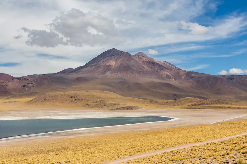
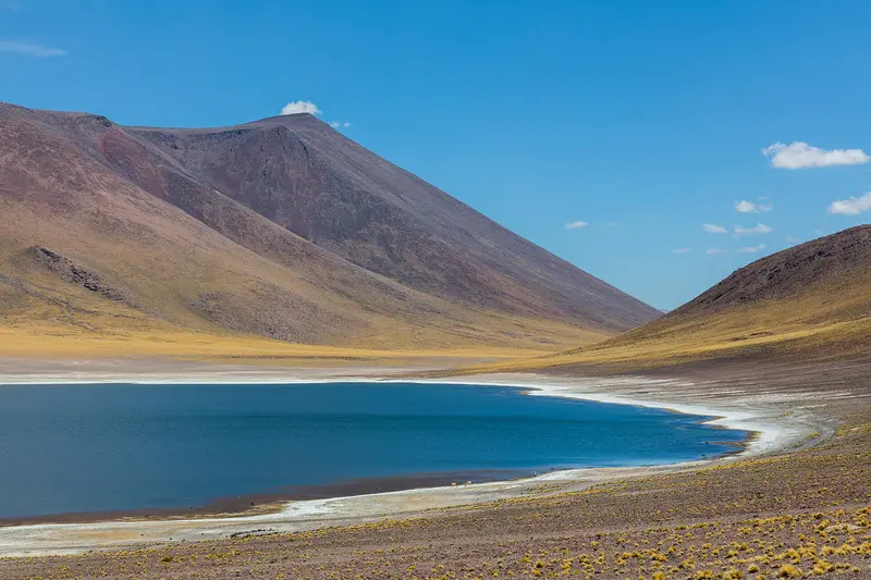
The Atacama Desert stretches across northern Chile between the Pacific and the Andes mountain range, ranking among the driest regions on Earth. From San Pedro de Atacama, you can reach the Valle de la Luna with its salt and clay formations, the Salar de Atacama with flamingos at Laguna Chaxa, and the Geysers del Tatio, which only truly steam in the early morning hours. Further south lie the highland lagoons Miscanti and Miñiques against a backdrop of volcanoes. The region is home to the Lickanantay (Atacameños) people, whose fortresses, adobe villages, and oasis fields still shape its landscape today. The dry, clear air has attracted astronomy: on the Chajnantor Plateau, about 40 kilometers from San Pedro, stands the ALMA radio telescope, whose public visits are currently suspended. Many destinations are located at 4,000 meters and more, so you should use your first days in San Pedro for acclimatization.
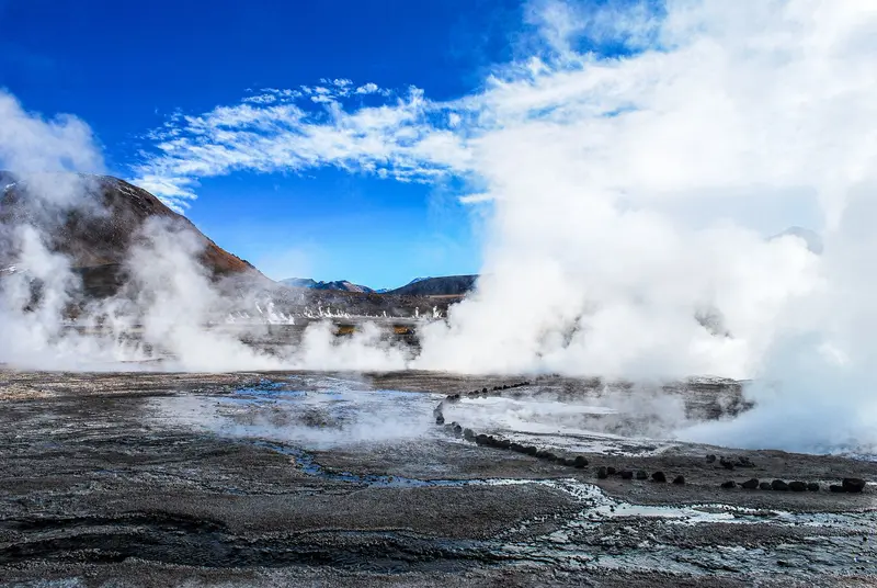
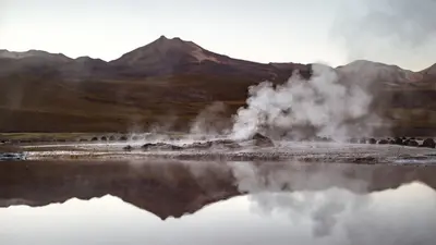
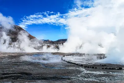
The El Tatio geyser field lies at about 4,320 meters in the Andes, about 80 to 90 kilometers north of San Pedro de Atacama. Shortly after sunrise, steam columns rise from dozens of vents into the icy cold air, so tours begin in the middle of the night.
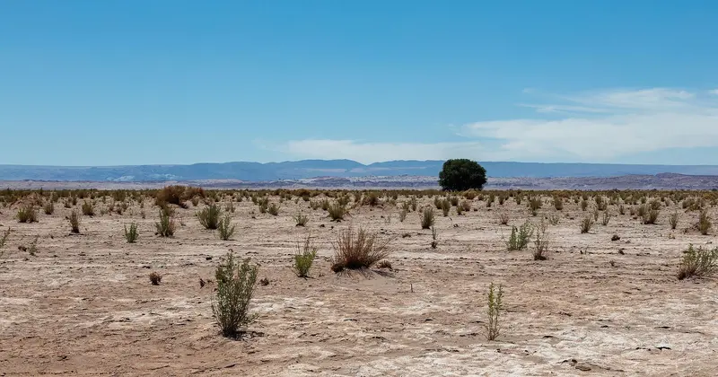
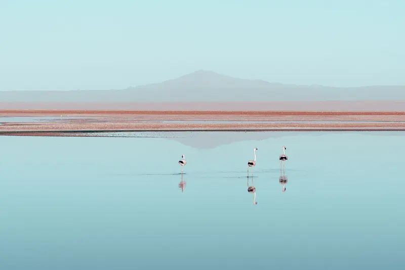
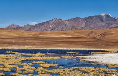
The Salar de Atacama, south of San Pedro, is Chile's largest salt flat, a rough, white-grey crust before Andean volcanoes. Three flamingo species live in the shallow lagoons at its edge, especially Laguna Chaxa.
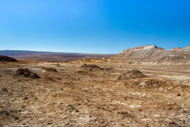
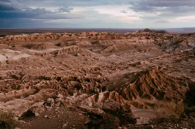
The Valle de la Luna, some 13 kilometers west of San Pedro de Atacama, is a valley of salt, gypsum, and clay formations with sand dunes in the Cordillera de la Sal. Late afternoon sun tinges ridges and rock faces reddish.
Sights in Atacama Desert
Discover the most important sights and attractions
Geysers El Tatio
The geyser field at an altitude of around 4300 meters north of San Pedro is one of the largest in the world. The steam plumes are most clearly visible shortly after sunrise, which is why most tours start in the middle of the night. Expect temperatures below zero.
The valley in the Cordillera de la Sal, approximately 13 kilometers west of San Pedro, is shaped by salt crusts, dunes, and wind-sculpted rocks. It belongs to the Reserva Nacional Los Flamencos. It's popular to visit in the late afternoon when the rocks take on color in the evening light. It's best to buy tickets online in advance.
The shallow lagoon in the Salar de Atacama is one of the best places to observe Andean, Chilean, and James flamingos up close. A short path leads across the salt crust to the shore; in the evening, the volcanoes reflect in the water.
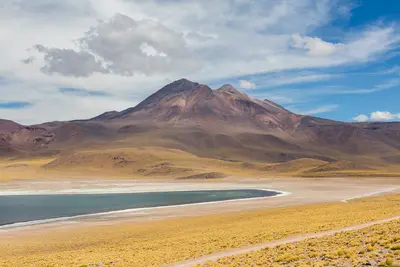
The two highland lagoons at around 4100 meters are located at the foot of the namesake volcanoes, about 100 kilometers southeast of San Pedro. A lava flow separates the deep blue lakes, on whose shores you can observe flamingos, Taguas, and vicuñas.
The selection focuses almost entirely on San Pedro. Prices are above the Chilean average because everything is brought in via Calama.
Patasca
The hearty holiday stew made from hominy with beef and pork, sometimes also lamb, simmers for hours. It is considered a typical dish of the Atacameño villages.
Quinoa and Andean veggies
The large-grained Quinoa real from the Highlands is available as soup, risotto-like Quinoto, or dessert. It's complemented by corn, pumpkin, and potatoes from the surrounding oases.
Llama meat
Llama meat is lean and mild in flavor. It is served as carpaccio, grilled fillet, or anticuchos, and also dried as charqui in Charquicán, a stew with pumpkin, potatoes, and corn.
Rica-Rica
This wild herb smells of mint, rosemary, and citrus, and was traditionally used for digestion. In San Pedro, you'll find it in the Rica-Rica Sour, a variant of the Pisco Sour, and in pastries.
Drinking at Altitude
In the high, dry air, you lose more fluid than you realize, so drink water regularly. Alcohol affects you more strongly at altitude than usual.
Best Time to Visit
When is the best time for your trip?
March
April
May
September
October
November
11–17°C·0–3 mm(little rain)
The Atacama can be visited year-round, with autumn and spring being particularly pleasant: mild days, clear nights, and fewer crowds than during holiday season. In January and February, the so-called Bolivian Winter brings occasional afternoon thunderstorms, which can make tracks impassable and cause tours to the geysers to be cancelled. Between June and August, it's pleasant during the day, but at night it's well below zero: those visiting Tatio will need warm clothing.
Die Atacama gilt als trockenste Wüste der Erde: In San Pedro fallen im Jahresmittel nur wenige Millimeter Niederschlag, manche Jahre bleiben ganz ohne. Der Ort liegt auf 2.400 Metern, die Ausflugsziele deutlich höher, die Geysire del Tatio auf 4.300 Metern.Entscheidend ist weniger die Jahreszeit als der Tagesgang: Zwischen Mittag und Nacht liegen oft 20 Grad Unterschied, und die Höhensonne brennt bei dünner Luft ungefiltert. Sonnenschutz, Kopfbedeckung und warme Schichten für die frühen Morgenstunden brauchst du in jedem Monat. Plane nach der Ankunft einen ruhigen Tag zur Höhenanpassung ein.
Seasons
Jan
Feb
Mar
Apr
May
Jun
Jul
Aug
Sep
Oct
Nov
Dec
Peak season, holiday period
Pleasant shoulder season
Cold nights, clear views
Best Time to Visit
▶Show detailed monthly data
Month
Temp (°C)
Rain (mm)
Sun (h)
January
18.5
10
10.0
February
18.0
10
10.0
March
16.5
3
10.0
April
14.0
1
10.0
May
11.0
0
9.0
June
9.0
0
9.0
July
8.5
0
9.0
August
10.0
0
10.0
September
12.5
0
10.0
October
14.5
0
11.0
November
16.5
0
11.0
December
18.0
3
11.0
History and Culture of the Atacama
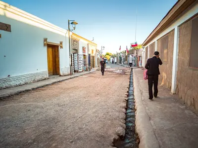
Millennia-Old SettlementDespite its aridity, the Atacama has been inhabited for millennia. On the coast near Arica, the Chinchorro culture left behind the oldest known artificially mummified dead. In the highlands and oases around San Pedro, the Lickanantay, also known as Atacameños, developed a culture of irrigated agriculture, llama herding, and caravan trade between the Pacific, the Altiplano, and the valleys of Northwest Argentina. In the 15th century, the region came under Inca control, followed by the Spanish from the 16th century.Adobe Construction and Living CustomsThe villages are characterized by houses and churches made of Adobe, sun-dried mud bricks that store heat during the day and slowly release it at night. Roofs were traditionally covered with beams of cactus wood and mud. Many families still cultivate small fields in the Ayllus, the hamlets around the oases, growing corn, quinoa, and alfalfa.Religious festivals combine Catholic saints' days with older rituals, in which the Pachamama, Mother Earth, plays a central role. During the Canal Cleaning Festival, the Limpia de Canales, communities collectively maintain their irrigation ditches. Show restraint at festivals and in churches, and ask before photographing people.
On-site adventures
Arrival almost always happens via Calama: El Loa Airport sees multiple daily flights from Santiago. From there, it's about 100 kilometers and roughly an hour and a half to San Pedro de Atacama. Transfers and buses operate following flights, and rental cars are also available at the airport.In San Pedro itself, you don't need a vehicle; the town is small and accessible on foot. All surrounding destinations are offered as tours by agencies on Caracoles, usually with pick-up. If you drive yourself, it's best to buy tickets for Valle de la Luna, the highland lagoons, and Laguna Chaxa online in advance, as prices and opening hours change regularly.While a rental car offers more independence, you should be prepared: The journey to the geysers reaches over 4,300 meters, roads are partly gravel, and gas stations are found almost exclusively in San Pedro and Calama. Keep your tank full, bring water, and plan for at least one acclimatization day due to the altitude. Before your trip, seek medical advice regarding the altitude and read the travel and security warnings from the Auswärtiges Amt, which, among other things, caution about thefts and robberies in Calama and San Pedro de Atacama.