Fernweh: Home
    ExploreTravel GuidesPlan a tripMy tripLast visited
    de|en
    All Places & RegionsAll highlightsAbout FernwehFAQPrivacy PolicyImprint
    ExploreTravel GuidesPlan a tripMy tripLast visited
    • Neighborhoods & highlights
    • Eat & drink
    • Culture
    • Getting around
    • Accommodation
    • Plan trip
    • Nearby
    Sidi Bou Saïd

    Tunisia

    Sidi Bou Saïd

    City

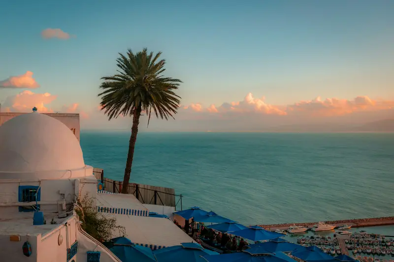
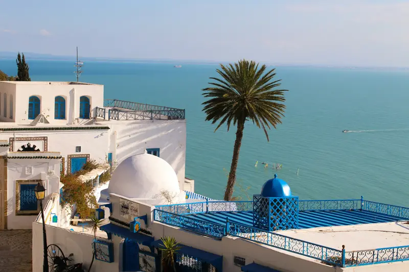
    Sidi Bou Saïd is a village on a cliff above the Gulf of Tunis, about 20 kilometers northeast of the capital and directly above Carthage.

    by Felix Gillen

    1. Home
    2. Destinations
    3. Tunisia
    4. Tunis & Carthage
    5. Sidi Bou Saïd
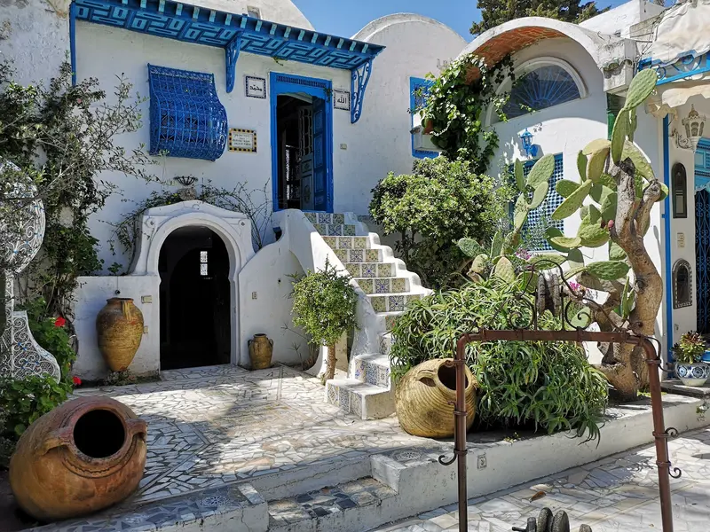
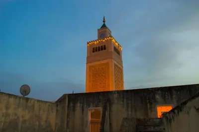
    Sidi Bou Saïd is a village on a cliff above the Gulf of Tunis, about 20 kilometers northeast of the capital and directly above Carthage. Its white houses with blue doors have been protected by a 1915 decree, and in July 2026, UNESCO added the village to its World Heritage List. Its alleys host traditional cafes overlooking the bay, and the palace of Baron d'Erlanger. The TGM suburban train takes about 35 minutes from Tunis Marine.

    Sights in Sidi Bou Saïd

    Discover the most important sights and attractions

    Ennejma Ezzahra (Palace of Baron d'Erlanger)

    1Ennejma Ezzahra (Palace of Baron d'Erlanger)

    Baron Rodolphe d'Erlanger had the palace built in the Moorish style in the 1910s. Today, it houses the Center for Arab and Mediterranean Music (CMAM). On display are original furnishings, paintings by the Baron, and historical musical instruments; regular concerts take place.
    Open in Google Maps
    Café des Nattes

    2Café des Nattes

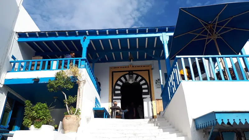
    The traditional café, also known as Café Halia, is located right in the town center. It's an ideal spot for a tea break while strolling through the alleys.
    Open in Google Maps
    Café of Delights
    Cafe

    3Café of Delights

    The café, also called Café Sidi Chabaane, is on the village's slope and overlooks the Gulf of Tunis.
    Open in Google Maps
    Yacht port
    Natural Feature

    4Yacht port

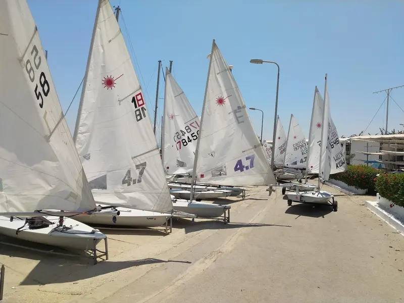
    Built in 1963, the harbor below the village offers hundreds of berths for boats.
    Open in Google Maps
    Dar El Annabi
    Museum

    5Dar El Annabi

    The 18th-century house belonged to Mufti Mohamed Taïeb El Annabi and was renovated in 1955. Today it is a museum displaying traditional everyday objects and clothing, including a 22-kilogram wedding dress.
    Open in Google Maps

    Restaurants in Sidi Bou Saïd

    1

    Au Bon Vieux Temps

    Traditional restaurant on Rue Hédi Zarrouk with water views from the terrace and dining room. The menu offers Tunisian and French dishes. Mid-range prices.
    Show on Google Maps
    2

    Dar Zarrouk

    Upscale restaurant on Rue Hédi Zarrouk with a large terrace overlooking the sea. Portions are rather small; the setting is formal.
    Show on Google Maps
    3

    DonPietro

    An Italian restaurant with a terrace located on Rue de la Méditerranée. Serves pizza and pasta.
    Show on Google Maps
    4

    Le Chergui

    Simple, inexpensive restaurant on Rue Hédi Zarrouk. The menu features Brik, fish couscous, and grilled Merguez.
    Show on Google Maps

    Culture

    Blue and WhiteA 1915 decree placed the village under protection, mandated the colors blue and white, and prohibited unregulated construction. This includes courtyards, studded wooden doors, and bougainvillea.Saint, Artists, and World HeritageThe name derives from the scholar Abou Saïd el-Béji (1156 to 1231), who taught on the hill and is buried here. Since the 19th century, artists and writers like Paul Klee, August Macke, Gustave Flaubert, and André Gide have visited. In July 2026, the village was designated as Tunisia's tenth World Heritage site, recognized as a center of cultural and spiritual inspiration in the Mediterranean region.Festivals and Current SituationKharja: In mid-August, religious brotherhoods process through the village.Storm Damage: Following heavy rains in January 2026, parts of the hillside slid, some buildings were temporarily evacuated, and roads were closed. Protective work on the hill was announced from August 2026.

    Getting There & Around

    Arrival TGM: approx. 35 minutes from Tunis Marine to Sidi Bou Said station; in 2026, due to construction, trains ran only every 45 minutes for a period From the station: 10 to 15 minutes uphill walk to the village Combine: The archaeological sites of Carthage are on the same train line; La Marsa is the terminus just a few stops further. On Site The village is small and located on a slope. You explore it on foot; the marina is below the village.

    Accommodations in Sidi Bou Saïd

    Find perfect stay in Sidi Bou Saïd

    Booking.com* (Affiliate link)
    Search Hotels
    Agoda* (Affiliate link)
    Search Hotels
    Airbnb
    Vacation Rentals

    * Affiliate link: if you book through it, we earn a small commission. The price stays the same for you.

    Plan your trip to Sidi Bou Saïd

    Save places, build a route and plan your city trip, all in one place.

    1. 1
      Sunrise over alpine peaks and a sea of clouds
      1234

      Round trip

      12 days · 4 stops

      Saved

      Pick a route

      Pick a ready-made one or save places and plan your own.

      Open bookmarks
    2. 2

      Trip to Sidi Bou Saïd

      Live
      • 1Ennejma Ezzahra (Palace of Baron d'Erlanger)3 days
      • 2Café des Nattes4 days
      • 3Café of Delights5 days
      Budget

      Plan your trip

      The planner sorts stops, days and budget. Plan together in real time.

      Start trip planning
    3. 3
      9:41 No signal
      Sidi Bou Saïd
      Available offline

      Use it on the road

      Download the guide to your phone and use it on site, even offline.

    Nearby

    La Marsa & Gammarth

    La Marsa & Gammarth

    La Marsa and the adjoining Gammarth to the north are Tunis's beach suburbs, located about 18 to 20 kilometers northeast of the capital on the Gulf of Tunis. In summer, Tunisians gather at the beach and around the Café Saf-Saf; in the evenings, life shifts to Gammarth's bars and clubs. La Marsa is the terminus of the TGM suburban train, coming from the city center via Carthage and Sidi Bou Saïd.
    Carthage

    Carthage

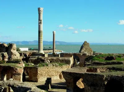
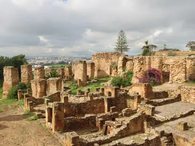
    The ruins of Carthage are scattered among residential areas on the coast northeast of Tunis and are directly accessible by the TGM suburban train. Traditionally founded by Phoenicians in 814 BC, the city was destroyed by Rome in 146 BC and later rebuilt as a Roman colony. Since 1979, the archaeological site has been a UNESCO World Heritage site. Visible attractions include the Antonine Baths by the sea, the Punic Ports, the Tophet, and the Amphitheater.
    Tunis & Carthage

    Tunis & Carthage

    The region Tunis & Carthage encompasses Tunisia's capital and its coastal suburbs on the Gulf of Tunis. Here, three UNESCO World Heritage Sites are close together: the Medina of Tunis, the Ruins of Carthage, and the blue-and-white village of Sidi Bou Saïd. Most travelers arrive at Tunis-Carthage Airport or by ferry at La Goulette port.
    Tunis

    Tunis

    Tunis, Tunisia's capital, lies on the Gulf of Tunis on the country's north coast. Its 698-founded Medina, with souks, mosques, and palaces, became a UNESCO World Heritage site in 1979. East of it, the colonial New Town with Avenue Habib Bourguiba adjoins; 4 km northwest is the Bardo National Museum with Roman mosaics. Tunis-Carthage International Airport is 8 km northeast; the TGM suburban train reaches Carthage and Sidi Bou Saïd in just over half an hour.
    Cap Bon & Hammamet

    Cap Bon & Hammamet

    The Cap Bon peninsula juts into the Mediterranean in northeast Tunisia, and on its southern edge, about 60 kilometers south of Tunis, lies the seaside resort of Hammamet. The region combines long sandy beaches with the Punic ruin city of Kerkouane, the pottery craft of Nabeul, and the falconry tradition of El Haouaria.Hammamet, Nabeul, and Kélibia are suitable as a base; all three are located on the coast.

    Sources & method

    • Photos: Wikimedia Commons, Unsplash, Google Maps. Each photo carries its credit.
    • Place data such as addresses and ratings comes from Google Maps.
    • The content is based on web research from public, traceable sources. How the content is made · The role of AI