Fernweh: Home
    ExploreTravel GuidesPlan a tripMy tripLast visited
    de|en
    All Places & RegionsAll highlightsAbout FernwehFAQPrivacy PolicyImprint
    ExploreTravel GuidesPlan a tripMy tripLast visited
    • Neighborhoods & highlights
    • Eat & drink
    • Culture
    • Getting around
    • Accommodation
    • Plan trip
    • Nearby
    Polonnaruwa

    Sri Lanka

    Polonnaruwa

    City

    Polonnaruwa, Sri Lanka's second great royal city after Anuradhapura, boasts an extensive ruined city, a UNESCO World Heritage site since 1982.

    by Felix Gillen

    1. Home
    2. Destinations
    3. Sri Lanka
    4. Culture Triad
    5. Polonnaruwa
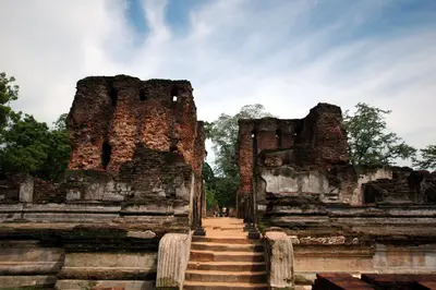
    Polonnaruwa, Sri Lanka's second great royal city after Anuradhapura, boasts an extensive ruined city, a UNESCO World Heritage site since 1982. Palace complexes, temples, and the rock sculptures of Gal Vihara can be easily explored by bike in a day.The city lies east of the Cultural Triangle, by the Parakrama Samudra reservoir. Its archaeological zone stretches north of the current city, while the modern center with train and bus stations is about three kilometers south in the Kaduruwela district.After Vijayabahu I captured the city in 1070, it flourished under Parakramabahu I in the 12th century. From this era derive the Royal Palace, the Sacred Quadrangle with the Vatadage, and irrigation systems surpassing those of the Anuradhapura period.

    Sights in Polonnaruwa

    Discover the most important sights and attractions

    Attraction

    1Archaeological Museum

    Starting point of the visit: Tickets available here; the exhibition introduces the city's history and finds.
    Open in Google Maps
    Parakramabahu's Royal Palace
    Historic Landmark

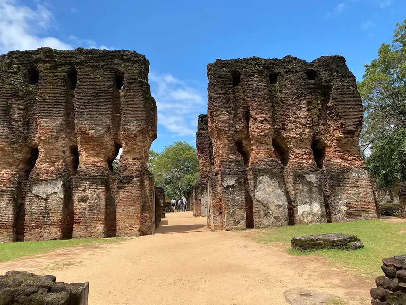
    2Parakramabahu's Royal Palace

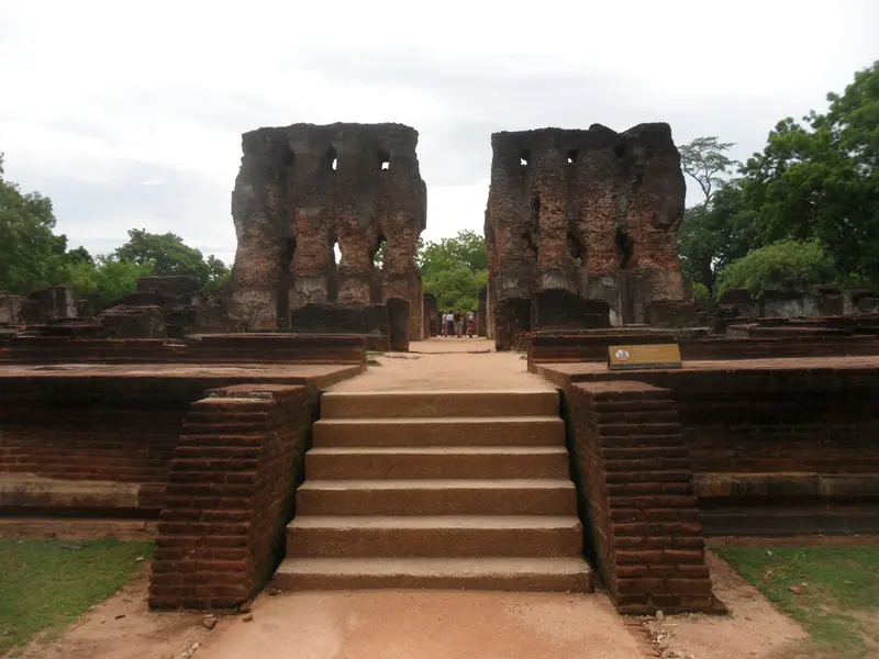
    The 12th-century ruins of the Palace of Parakramabahu I. are among the first stops after the museum.
    Open in Google Maps
    Rankoth Vehera
    Historic Landmark

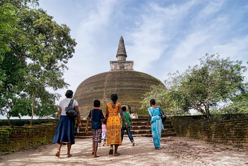
    3Rankoth Vehera

    One of the great dagobas of Polonnaruwa and an essential stop on the tour through the ruined city.
    Open in Google Maps
    Parakrama Samudra
    Attraction

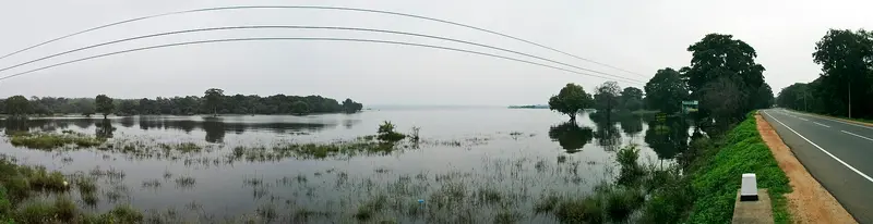
    4Parakrama Samudra

    The reservoir covers 22.6 square kilometers and connects five older tanks via narrow canals. The northern part was built around 386; Parakramabahu I had the lake expanded in the 12th century. On its shore lies the Pothgul-Vihara complex.
    Open in Google Maps
    Holy Quadrangle with Vatadage
    Place of Worship

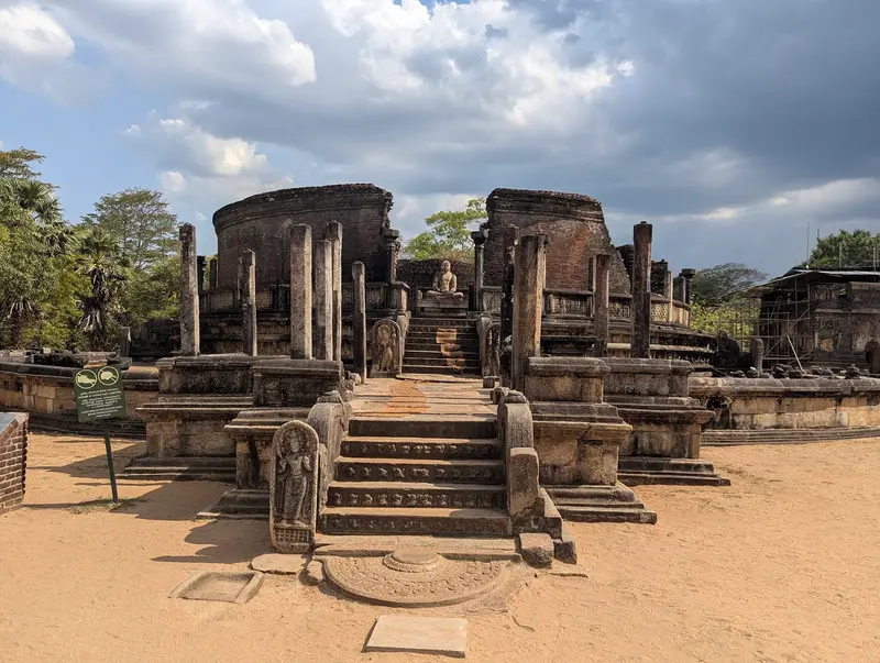
    5Holy Quadrangle with Vatadage

    The Sacred Quadrangle (Dalada Maluva) compactly brings together several sanctuaries, including Vatadage, Hatadage, Atadage, Thuparama and the Sathmahal Prasadaya. The circular Vatadage is considered the heart of the complex.
    Open in Google Maps
    Gal Vihara
    Place of Worship

    6Gal Vihara

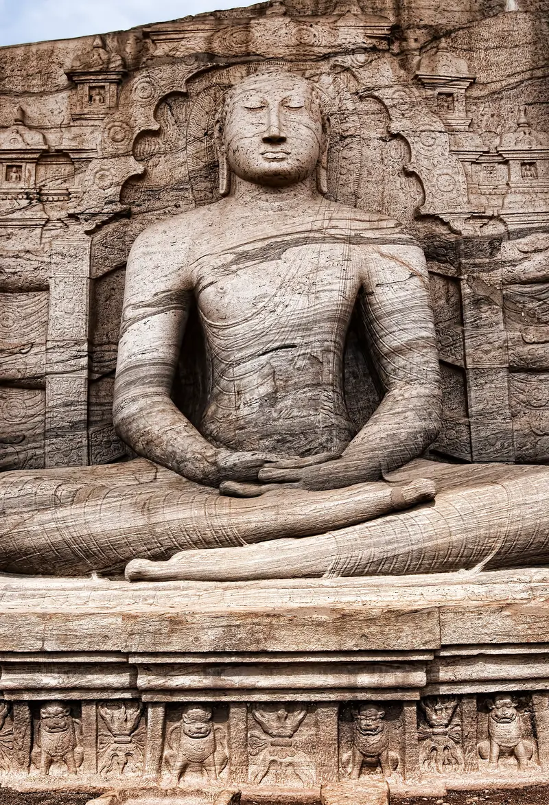
    Four Buddha figures, carved in the 12th century under Parakramabahu I. from a single rock face. The reclining Buddha measures 14.12 meters, the standing figure 6.93 meters, with some historians seeing the monk Ananda in it.
    Open in Google Maps

    Restaurants in Polonnaruwa

    1

    Priyamali Gedara

    Mentioned in travel reports as the place for local cuisine, with home-style rice and curry.
    Show on Google Maps
    2

    Jaga Food

    Family business with garden tables, focusing on local cuisine. Recommended are syrup pancakes, buffalo curd, and spicy fish curry.
    Show on Google Maps

    Admission and Visiting Rules

    Entry for foreign adults is 30 US dollars (according to the Central Cultural Fund, as of October 2026), SAARC nationals pay half. The ticket includes the ruins and the Archaeological Museum, which serves as a starting point and is located slightly outside the main zone.At the sanctuaries, cover shoulders and knees; remove shoes and hats. Socks protect against hot stone.It's best to arrive between 8 and 9 AM, before it gets crowded from around 10 AM.Bicycles can be rented at the entrance by the museum and in town for about 400 to 500 LKR per day.

    Getting There & Around

    From Dambulla, bus line 48 departs every 20 to 30 minutes, taking 1.5 to 2 hours to Kaduruwela. From Sigiriya, take a tuk-tuk to Inamaluwa and board the same bus there. The direct tuk-tuk ride costs approximately 5,000 LKR.The train from Colombo Fort on the Batticaloa line takes six hours or more; the Udaya Devi takes about 6 hours 20 minutes.There are no proper restaurants in the Ruin Zone; meals are eaten in town.

    Accommodations in Polonnaruwa

    Find perfect stay in Polonnaruwa

    Booking.com* (Affiliate link)
    Search Hotels
    Agoda* (Affiliate link)
    Search Hotels
    Airbnb
    Vacation Rentals

    * Affiliate link: if you book through it, we earn a small commission. The price stays the same for you.

    Plan your trip to Polonnaruwa

    Save places, build a route and plan your city trip, all in one place.

    1. 1
      Sunrise over alpine peaks and a sea of clouds
      1234

      Round trip

      12 days · 4 stops

      Saved

      Pick a route

      Pick a ready-made one or save places and plan your own.

      Open bookmarks
    2. 2

      Trip to Polonnaruwa

      Live
      • 1Archaeological Museum3 days
      • 2Parakramabahu's Royal Palace4 days
      • 3Rankoth Vehera5 days
      Budget

      Plan your trip

      The planner sorts stops, days and budget. Plan together in real time.

      Start trip planning
    3. 3
      9:41 No signal
      Polonnaruwa
      Available offline

      Use it on the road

      Download the guide to your phone and use it on site, even offline.

    Nearby

    Minneriya National Park

    Minneriya National Park

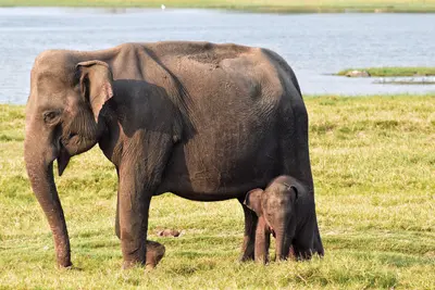
    Minneriya National Park, located in the Cultural Triangle, protects the catchment area of an ancient reservoir and is famous for the so-called Gathering: during the dry season, large numbers of elephants gather on its banks. Estimates range from 150 to 200 animals, with some reports mentioning up to 700.The park is situated approximately 182 kilometres from Colombo, between Sigiriya and Polonnaruwa, and covers nearly 8,900 hectares. King Mahasena commissioned the Minneriya Reservoir in the 3rd century.Declared a protected area in 1938, Minneriya became a National Park in 1997. Besides elephants, Sambar deer, White-bearded langurs, Toque macaques, and rarely leopards live here; additionally, around 160 bird species are recorded, including Grey Pelicans and Painted Storks.
    Sigiriya

    Sigiriya

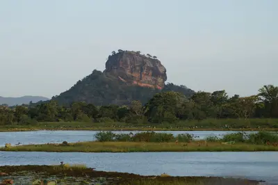
    Sigiriya is an approximately 180-meter-high granite rock in the Cultural Triangle, on whose summit plateau King Kashyapa had his palace built in the 5th century. The rock fortress, with water gardens, frescoes, and the Lion Gate, is one of Sri Lanka's most famous archaeological sites and has been on the UNESCO World Heritage List since 1982.The rock is located near the city of Dambulla. At the foot of the complex lies Sigiriya village, with accommodations and restaurants along a main road. Just under a kilometer north rises Pidurangala Rock, from which you can look out over Sigiriya.Kashyapa reigned, according to common dating, from 477 to 495 and made the rock both his palace and capital. The ascent leads through garden and terrace complexes, past the Mirror Wall and the Fresco Gallery to the Lion Gate, and from there up stairs to the plateau.
    Culture Triad

    Culture Triad

    The Cultural Triangle in the dry central north of the island brings together Sri Lanka's most significant ancient cities and sanctuaries, nestled between Anuradhapura, Polonnaruwa, and Dambulla. Those interested in early Sinhalese history will find several UNESCO World Heritage Sites here in a compact area, alongside national parks featuring large elephant herds.The region lies north of Kandy, with Anuradhapura approximately 205 kilometres north of Colombo. Sigiriya and Dambulla, owing to their central position, serve as convenient starting points for day trips.
    Dambulla

    Dambulla

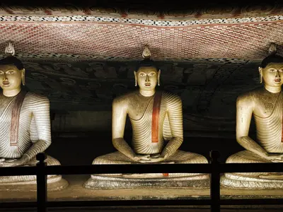
    Dambulla is a market town in the heart of the Cultural Triangle, renowned for its cave temple featuring 153 Buddha statues and approximately 2,100 square meters of wall paintings. Situated on the main road to Anuradhapura and close to Sigiriya, the town also serves as a convenient transport hub for the region.The cave temple is located at the foot and on the flank of a rock that rises 150 to 160 meters above the plain. Below it stands the golden Buddha statue of the newer temple and museum complex, separate from the historic site. The town center, with its bus station and shops, stretches along the main thoroughfares, while to the southwest, on the road to Kurunegala, lie the megalithic tombs of Ibbankatuwa.According to tradition, King Valagamba found refuge in the caves for 15 years in the 1st century BCE and later had them converted into a temple. Since 1991, the complex has been a UNESCO World Heritage site.
    East Coast

    East Coast

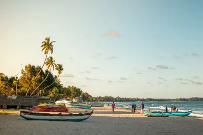
    Sri Lanka's east coast stretches from Trincomalee in the north to Arugam Bay in the south, forming the Eastern Province with the districts of Trincomalee, Batticaloa, and Ampara. This is where you travel primarily in summer: While the monsoon brings rain to the southwest coast, the east coast is dry and the sea calm from around May to September.The region combines long sandy beaches and shallow bays with a rich, layered history. Tamil, Muslim, and Sinhalese communities shape the towns and cuisine, while Portuguese and Dutch forts recall the colonial era.

    Sources & method

    • Photos: Wikimedia Commons, Unsplash, Google Maps. Each photo carries its credit.
    • Place data such as addresses and ratings comes from Google Maps.
    • The content is based on web research from public, traceable sources. How the content is made · The role of AI