Fernweh: Home
    ExploreTravel GuidesPlan a tripMy tripLast visited
    de|en
    All Places & RegionsAll highlightsAbout FernwehFAQPrivacy PolicyImprint
    ExploreTravel GuidesPlan a tripMy tripLast visited
    • Overview
    • Places in the region
    • Recommendations
    • Food culture
    • Best travel time
    • Culture
    • Getting around
    • Round trips
    • Nearby
    Bogotá & Boyacá
    Bernard Gagnon / Wikimedia Commons / CC BY-SA 4.0

    Colombia

    Bogotá & Boyacá

    Region

    The region comprises the capital Bogotá and the Andean highlands of Cundinamarca and Boyacá to its north.

    by Felix Gillen

    1. Home
    2. Destinations
    3. Colombia
    4. Bogotá & Boyacá
    The region comprises the capital Bogotá and the Andean highlands of Cundinamarca and Boyacá to its north. You come here for museums and colonial architecture in the capital, the underground Salt Cathedral of Zipaquirá, and Boyacá's white colonial towns. Bogotá lies at 2,640 meters, making the climate throughout the highlands accordingly cool.
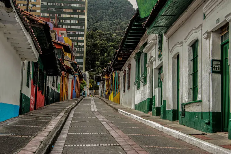
    With approximately eight million inhabitants, Bogotá is Colombia's largest city and the starting point for almost every trip to the Highlands. The historic center of La Candelaria, the Gold Museum, and Monserrate mountain are all close to each other.To the HighlandsApproximately 49 kilometers north of the capital lies Zipaquirá with its Salt Cathedral, a classic day trip. Further northeast, Boyacá begins with its capital Tunja. Approximately 40 kilometers west of Tunja lies Villa de Leyva, founded in 1572 and a national monument since 1954.Boyacá is also historically significant: On August 7, 1819, the Battle of Puente de Boyacá decided the struggle for independence against Spain.
    Zipaquirá
    Carlos Adampol Galindo from DF, México / Wikimedia Commons / CC BY-SA 2.0

    Place 1 of 3

    Zipaquirá

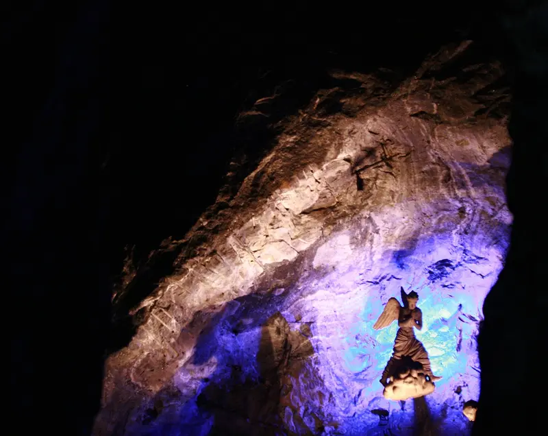
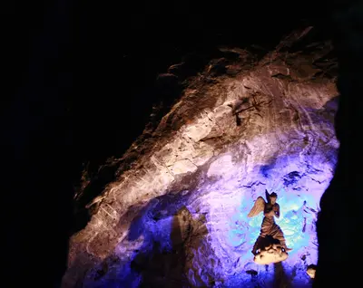
    Zipaquirá, about 49 kilometers north of Bogotá, is famous for its underground Salt Cathedral. The trip from the capital can be easily combined with a stroll through its colonial center.

    Discover
    Villa de Leyva

    Place 2 of 3

    Villa de Leyva

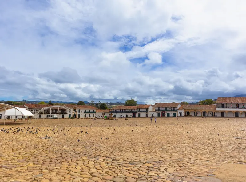
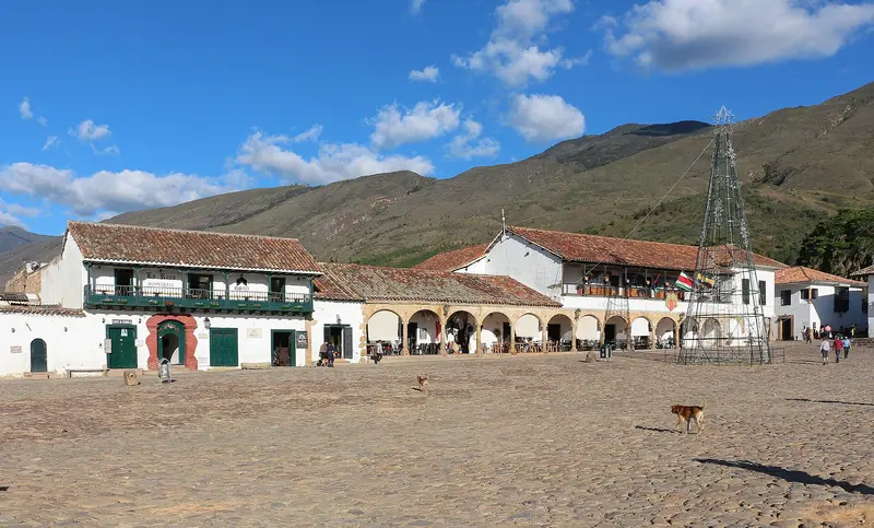
    Villa de Leyva is a colonial town in Boyacá, about 165 kilometers northeast of Bogotá and 40 kilometers west of Tunja.

    Discover
    Bogotá

    Place 3 of 3

    Bogotá

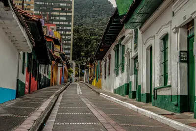
    Bogotá is the capital of Colombia and lies at 2,640 meters in the Andes. You come for the Gold Museum, the colonial streets of La Candelaria, and the views from its iconic mountain, Monserrate.

    Discover

    Food & Drink in Bogotá and Boyacá

    The cuisine of the cool Andean highlands features hearty soups made from potatoes, corn, wheat, and beans. Breakfast includes hot chocolate with cheese and corn flour pastries.

    Ajiaco santafereño

    Ajiaco santafereño

    Thick soup made from chicken, corn on the cob, and three types of potatoes, seasoned with the herb Guascas. In a survey by the city of Bogotá, it was chosen as the dish that tastes most like Bogotá.

    Cuchuco de trigo with backbone

    Soup with cracked wheat, vegetables and pork loin, typical of Boyacá's cold climate. In Tunja, it is considered the city's signature dish.

    Cocido boyacense

    Cocido boyacense

    Stew with beef, pork, and chicken, plus Andean tubers like Hibias and Cubios, peas, potatoes, and corn. It is considered Boyacá's most famous dish.

    Chocolate with cheese and almojábana

    Chocolate with cheese and almojábana

    Hot chocolate with cheese, with Almojábana, a cornmeal and cheese pastry. In Cundinamarca and Boyacá, it's a classic breakfast.

    Best Time to Visit

    When is the best time for your trip?

    December
    January
    February
    July
    August
    14–14°C·33–61 mm(little rain)
    Bogotá has similar temperatures around 14 degrees all year round, with seasons differing mainly in terms of rainfall. The driest months are December to February, as well as July and August. April and May, as well as October and November, bring more than 100 mm of precipitation each at El Dorado Airport.
    Nights are cool at 2,600 meters; bring a warm jacket even in the dry season. These figures apply to the airport; Villa de Leyva in Boyacá is lower at 2,149 meters.

    Seasons

    Jan
    Feb
    Mar
    Apr
    May
    Jun
    Jul
    Aug
    Sep
    Oct
    Nov
    Dec
    Dry season, High season
    A Drier Period
    Season Break
    Wet season
    Best Time to Visit
    ▶Show detailed monthly data
    MonthTemp (°C)Rain (mm)Sun (h)
    January13.6335.9
    February14.0515.3
    March14.1834.4
    April14.31173.5
    May14.31093.5
    June14.2573.9
    July13.8494.3
    August13.8444.4
    September13.8574.1
    October13.71083.8
    November13.81074.2
    December13.7615.1

    Culture and History

    The highlands were the territory of the Muisca. Their goldwork is displayed at the Museo del Oro in Bogotá, including the Muisca Raft, which is linked to the myth of El Dorado.Salt shaped the region even before the arrival of the Spanish: Zipaquirá was an important trading hub for salt. The colonial era left behind whitewashed houses and grand squares in La Candelaria, Zipaquirá, and Villa de Leyva.

    Getting to and Around

    Flight: The international airport is El Dorado (BOG) in Bogotá.Zipaquirá: On Saturdays, Sundays, and public holidays, the Tren de la Sabana departs from Gran Estación via Usaquén to Zipaquirá. Tickets are only sold at La Sabana station.Villa de Leyva: Bus from Bogotá (Terminal del Norte or Terminal Salitre), often with a transfer in Tunja; from there, about 45 minutes by Colectivo.
    Round trips through this region

    Colombia Classics: Bogotá, Medellín, Coffee Zone and Caribbean

    Colombia Classics: Bogotá, Medellín, Coffee Zone and Caribbean

    The route connects the capital in the highlands with Medellín, the coffee fincas around Salento, and the Caribbean coast from Cartagena to Santa Marta. You cover the long distances with short domestic flights, allowing more time for the destinations.

    14 Days
    5 stops
    Open jaw
    Highland colonial cities

    Highland colonial cities

    From Bogotá, via the Salt Cathedral of Zipaquirá and the white Villa de Leyva, to Santander, where Barichara and San Gil are. The route combines colonial architecture, Muisca history, and outdoor activities in the Andes.

    10 Days
    5 stops
    Open jaw

    Nearby

    Zipaquirá

    Zipaquirá

    Zipaquirá, about 49 kilometers north of Bogotá, is famous for its underground Salt Cathedral. The trip from the capital can be easily combined with a stroll through its colonial center. Founded in 1600, the city has over 160,000 inhabitants; white facades and wooden balconies earned it the nickname 'ciudad blanca' (white city).
    Bogotá

    Bogotá

    Bogotá is the capital of Colombia and lies at 2,640 meters in the Andes. You come for the Gold Museum, the colonial streets of La Candelaria, and the views from its iconic mountain, Monserrate. With around eight million inhabitants, the city, founded in 1538, is large and diverse: Chapinero and Zona T are the districts for restaurants and nightlife.
    Villa de Leyva

    Villa de Leyva

    Villa de Leyva is a colonial town in Boyacá, about 165 kilometers northeast of Bogotá and 40 kilometers west of Tunja. You come for its white houses, cobbled streets, and the Plaza Mayor, which, at about 14,000 square meters, is among South America's largest squares. The town, founded in 1572, is at 2,149 meters and has been a National Monument since 1954; its dry surroundings hold fossil finds and a Muisca site.
    Manizales

    Manizales

    Manizales is the capital of the Caldas Department, with around 475,000 inhabitants, and is located over 2,100 m on steep Andean slopes. You go there as a base for coffee fincas and Los Nevados National Park, featuring the Nevado del Ruiz volcano. Founded in 1849, the city is shaped by several universities.
    Valle de Cocora

    Valle de Cocora

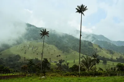
    The Valle de Cocora is a high valley (1,800-2,400 m) in Departamento Quindío's coffee region, north of Salento, roughly 20-30 minutes by jeep from the village. You go for the Quindío wax palms, which stand in great numbers on the pastures here. The valley lies within the influence area of Los Nevados National Park, at the headwaters of the Río Quindío.

    Sources & method

    • Photos: Wikimedia Commons. Each photo carries its credit.
    • The content is based on web research from public, traceable sources. How the content is made · The role of AI