Fernweh: Home
ExploreGuideDestinationsMy tripsMy trip
de|en
All Places & RegionsRound tripsNight trains in EuropeAll highlightsAbout FernwehFAQPrivacy PolicyImprint
Download on the App StoreGet it on Google Play
ExploreGuideDestinationsMy tripsMy trip
    • Neighborhoods & highlights
    • Tours
    • Eat & drink
    • Getting around
    • Accommodation
    • Plan trip
    • Nearby
    Rhodes

    Photo by Elif Kuş on Pexels

    Greece

    Rhodes

    CityCultureBeach

    Rhodes is the largest island of the Dodecanese and lies off the southwest coast of Turkey.

    by Felix Gillen

    1. Home
    2. Destinations
    3. Greece
    4. Dodecanese
    5. Rhodes
    Rhodes is the largest island of the Dodecanese and lies off the southwest coast of Turkey. Most travellers come for Rhodes Town's medieval Old Town, which the Knights Hospitaller fortified between 1309 and 1523 and is today a UNESCO World Heritage site, and for Lindos with its Acropolis, about 40 kilometres further south. Other attractions include ancient sites like Kamiros, the Valley of Butterflies (Petaloudes), and long beaches on the east coast.
    Greece travel guideRound trips in GreecePlan a trip with Rhodes

    Contents

    • Neighborhoods & highlights
    • Tours
    • Eat & drink
    • Getting around
    • Accommodation
    • Nearby
    Rhodes (City)

    Photo by Kader Azra Namuslu on Pexels

    District 1 of 2

    Rhodes (City)

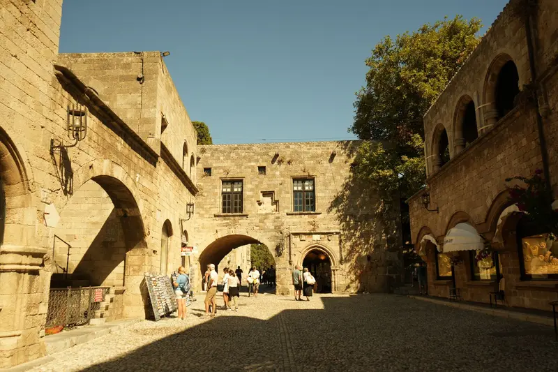
    The Old Town of Rhodes City is one of Europe's most completely preserved medieval cityscapes and has been a UNESCO World Heritage site since 1988.

    Discover
    Lindos

    Jebulon / Wikimedia Commons / CC0

    District 2 of 2

    Lindos

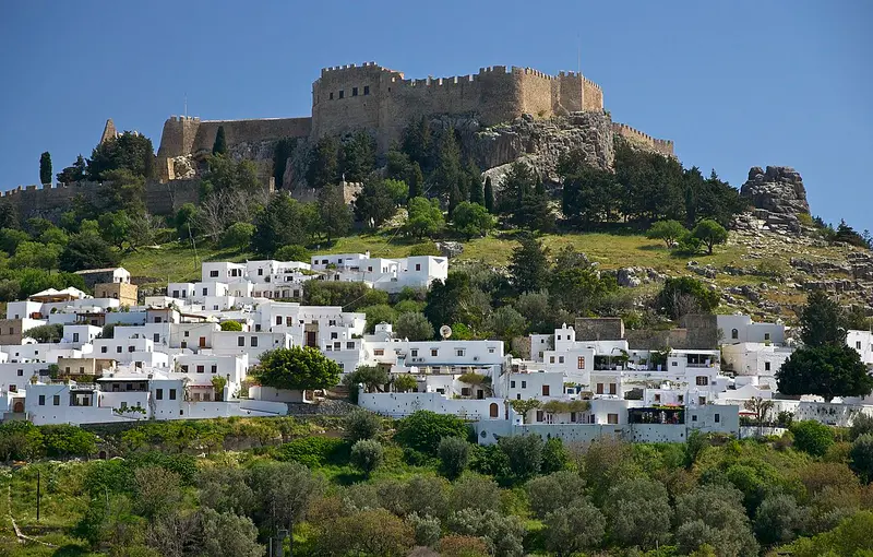
    Lindos is located on the east coast of Rhodes, about 40 kilometers south of the island capital, below a rock featuring an ancient acropolis and a castle of the Knights of St. John.

    Discover

    Sights in Rhodes

    Discover the most important sights and attractions

    Place of Worship

    1Filerimos and Ancient Ialysos

    The wooded hill Filerimos, above the village of Ialysos, was the acropolis of the ancient city of Ialysos. Preserved are the foundations of the Temple of Athena Polias from the 3rd or 2nd century BC. Above this, the Crusaders built a Catholic church and the Monastery of Panagia Filerimos, whose icon of the Virgin Mary was considered the most sacred relic by the Knights Hospitaller. On the southwest side, a Way of the Cross, the Golgatha Path, leads to a square with a cross and a wide view over the northwest coast. The hill is located a few kilometers from the airport and can be easily combined with the Valley of Butterflies.
    Open in Google Maps
    Park

    2Butterfly Valley Petaloudes

    In the wooded valley of Petaloudes in the island's northwest, many Jersey Tiger moths, a unique island sub-species, gather in summer. Attracted by the Oriental Sweetgum's scent, growing here along a stream, the moths arrive after the rainy season ends, from late May. A path with boardwalks and stairs leads up the valley. The animals rest by day on trunks and rocks. Noise and clapping startle them, costing energy vital for their survival. Please be quiet.
    Open in Google Maps
    Historic Landmark

    3Ancient Kamiros

    The city, founded by the Dorians, is located on the northwest coast, about 3 kilometers west of Kalavarda village, on a slope overlooking the sea. It was laid out on three terraces: At the top stood a temple of Athena Kameiras, whose foundations date back at least to the 8th century BC, and a cistern for about 600 cubic meters of water from the 6th century BC. In the middle lay the grid-patterned residential quarter; at the bottom, a fountain house with an Agora and a Dorian temple. Earthquakes destroyed the city in 226 BC and 142 AD. Because Kamiros was not built over later, its city plan is clearly discernible.
    Open in Google Maps
    Church

    4Monastery Panagia Tsambika and Tsambika Beach

    On a rock above the east coast, just behind Kolymbia, stands the small monastery of Panagia Tsambika. Around 300 steps lead up; from the top, you gaze far over the coast and the long sandy beach of Tsambika at the foot of the mountain. The monastery is a pilgrimage site: Childless women traditionally climb up barefoot and pray for a child; sons are often named Tsambikos afterwards, daughters Tsambika. The feast day is September 8th. Go up in the morning; the path lies in the sun.
    Open in Google Maps
    Prasonisi

    Tsui / Wikimedia Commons / CC BY-SA 4.0, mod.

    Natural Feature

    5Prasonisi

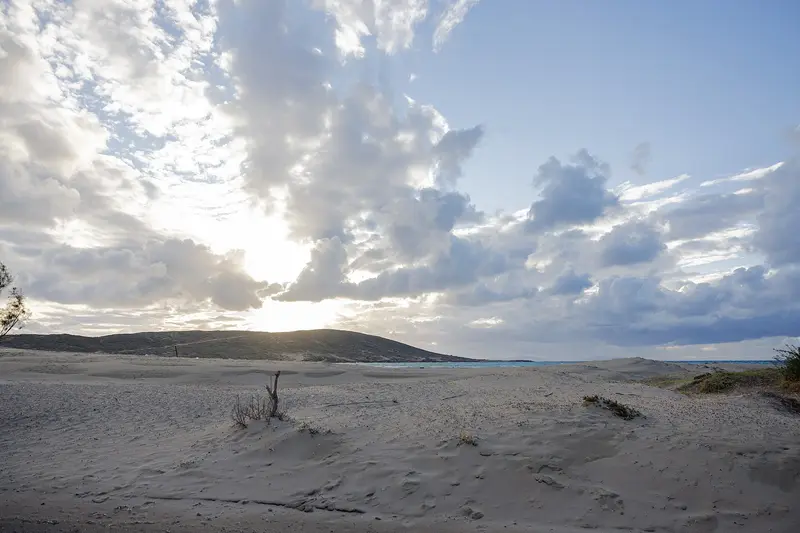
    At Rhodes' southern tip, some 90 km from Rhodes Town, a narrow sand spit links the small island of Prasonisi to the main island. In summer, with low water levels, Prasonisi is a walkable peninsula. Beaches flank the land bridge, with very different waters: one side usually choppy, the other calmer. The steady wind makes Prasonisi one of the island's premier wind and kitesurfing spots; schools and rentals are on site. Access is best by rental car.
    Open in Google Maps
    Castle

    6Monolithos Castle

    The Knights Hospitaller built the castle in the late 15th century on an isolated, approximately 100-meter-high rock on the southwest coast, near the village of Monolithos and about 70 kilometers from Rhodes Town. Little remains of the walls, but the small chapel of Agios Panteleimon stands within the ruins. The climb is short, and the view over the cliffs and the sea is among the most beautiful on the island, especially in the late afternoon. Below, a road leads to the pebble beaches of Fourni.
    Open in Google Maps

    Tours & experiences in Rhodes

    Search tours for Rhodes on GetYourGuide* (Affiliate link)On GetYourGuide, with reviews from other travellers

    * Affiliate link: if you book through it, we earn a small commission. The price stays the same for you.

    Restaurants in Rhodes

    1

    Taverna Platanos (Lachania)

    Classic village tavern in the mountain village of Lachania in the south of the island, hidden behind the church on the village square. Lonely Planet describes it as a well-known local spot for Greek home-style cooking, a good stop on a drive to the quiet south of the island.
    Show on Google Maps
    2

    To Pirofani (Stegna)

    Fish tavern with a terrace overlooking Stegna beach on the island's east coast. Lonely Planet highlights this well-kept tavern for its fish and seafood; it's ideal for combining with a beach day at the bay.
    Show on Google Maps

    Getting There and Exploring Rhodes

    Getting ThereDiagoras Airport is located approximately 14 kilometers southwest of Rhodes Town, near Paradisi. Ferries from Piraeus and the other Dodecanese islands dock at the central harbor of Rhodes Town, from where ships also depart for Turkey, for example to Marmaris. You can reach Chalki Island from the small port of Kamiros Skala on the west coast.Getting Around the IslandTwo bus companies operate on the island: RODA city buses serve the west coast, while KTEL buses cover the east coast, including Faliraki and Lindos. For Kamiros, Filerimos, Petaloudes, and the villages in the island's interior, a rental car is practical, as buses to these places are infrequent. In season, excursion boats connect Rhodes Town with Lindos and Symi.

    Accommodations in Rhodes

    Find perfect stay in Rhodes

    Booking.com* (Affiliate link)
    Search Hotels
    Agoda* (Affiliate link)
    Search Hotels
    Airbnb
    Vacation Rentals

    * Affiliate link: if you book through it, we earn a small commission. The price stays the same for you.

    Campgrounds in Rhodes

    Find perfect campground in Rhodes

    Search via Google Maps
    Campgrounds nearby (15km)
    Camping.info
    Find Campgrounds
    Park4Night
    RV Parks & Camping

    Plan your trip to Rhodes

    Save places, build a route and plan your city trip, all in one place.

    1. 1
      Sunrise over alpine peaks and a sea of clouds
      1234

      Round trip

      12 days · 4 stops

      Saved

      Pick a route

      Pick a ready-made one or save places and plan your own.

      Open bookmarks
    2. 2

      Trip to Rhodes

      Live
      • 1Filerimos and Ancient Ialysos3 days
      • 2Butterfly Valley Petaloudes4 days
      • 3Ancient Kamiros5 days
      Budget

      Plan your trip

      The planner sorts stops, days and budget. Plan together in real time.

      Start trip planning
    3. 3
      9:41 No signal
      Rhodes
      Available offline

      Photo by Elif Kuş on Pexels

      Use it on the road

      Download the guide to your phone and use it on site, even offline.

    Nearby

    Dodecanese

    Dodecanese

    The Dodecanese, a long chain of islands off the Turkish coast, only became part of Greece with the Treaty of Paris in 1947. More than elsewhere, the Knights Hospitaller, Ottomans, and Italians left their mark here, hence the architecture has little to do with the white cube houses of the Cyclades: knightly castles, mosques, fortified monasteries, and Italian administrative buildings.The group ranges from Rhodes, by far the largest and liveliest island, to islets with only a few hundred inhabitants. Visitors will find seaside resorts, ancient sites, and quiet harbour villages often just an hour's ferry ride apart.

    Unsplash

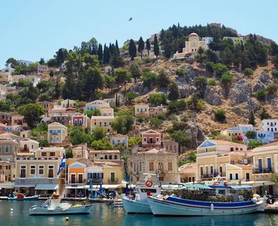
    Symi

    Symi

    Symi is located north of Rhodes, close to the Turkish coast, and is known for its harbor town Gialos, whose neoclassical houses in ochre, pink, and blue climb the hillsides. Restorations are subject to the regulations of the State Archaeological Service, which is why the townscape appears cohesive to this day.The town thrived on sponge diving and shipbuilding, which made the island wealthy in the 19th century and allowed its population to grow to over 20,000. Today, around 2,600 people live here. During the day, many excursion boats arrive from Rhodes; in the evenings, it becomes significantly quieter.

    Unsplash

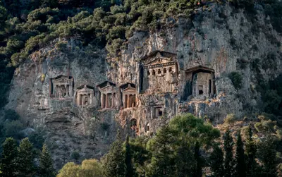
    Dalyan

    Dalyan

    Dalyan is a town on the river of the same name, located between Marmaris and Fethiye, about 30 km from Dalaman Airport. You come for the Lycian rock tombs above the river, the ancient city of Kaunos, and İztuzu Beach, where sea turtles lay their eggs. Boats connect the town with the beach, Köyceğiz Lake, and the thermal springs.

    Ray Harrington·Unsplash

    Kos

    Kos

    Kos, the third-largest Dodecanese island, lies just a few kilometers off the Turkish coast near Bodrum. In the island capital, ancient ruins, a Knights Hospitaller castle, and 1930s Italian buildings stand side by side. Inland, the Dikeos Ridge rises, its slopes home to mountain villages like Zia and Pyli.

    Wolfgang Weiser·Pexels

    Bodrum

    Bodrum

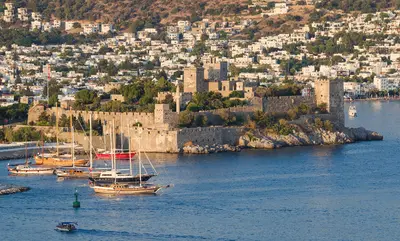
    Bodrum is located at the southern tip of the Turkish Aegean on the peninsula of the same name, at the site of ancient Halikarnassos. You come for the Castle of St. Peter with its Museum of Underwater Archaeology, the remains of the Mausoleum, and the evenings in the harbor and bar street. The Old Town with its castle, harbor, and bazaar is the focal point; on the peninsula are towns like Bitez, Gümüşlük, and Yalıkavak.

    Serhio Magpie·CC BY 4.0

    Your next steps

    Rhodes is in Greece. Ways to carry on from here.

    • More in Greece

      Highlights, areas, routes and the best time to travel for all of Greece.

      Greece travel guide
    • Round trips in Greece

      Ready-made routes through Greece, with stops, nights and a map.

      See the routes

    Sources & method

    • Photos: Wikimedia Commons, Pexels. Each photo carries its credit.
    • Place data such as addresses and ratings comes from Google Maps.
    • The content is based on web research from public, traceable sources. How the content is made · The role of AI