Fernweh: Home
    ExploreTravel GuidesPlan a tripMy tripLast visited
    de|en
    All Places & RegionsAll highlightsAbout FernwehFAQPrivacy PolicyImprint
    ExploreTravel GuidesPlan a tripMy tripLast visited
    • Neighborhoods & highlights
    • Eat & drink
    • Culture
    • Nightlife
    • Getting around
    • Accommodation
    • Plan trip
    • Nearby
    Singapore River
    Frank Schulenburg / Wikimedia Commons / CC BY-SA 4.0

    Singapore

    Singapore River

    City

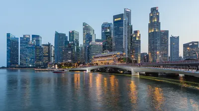
    The Singapore River is the city's historic lifeline. Along its banks today, the three quays, Boat Quay, Clarke Quay and Robertson Quay, brim with restaurants, bars, and clubs.

    by Felix Gillen

    1. Home
    2. Destinations
    3. Singapore
    4. Singapore
    5. Singapore River
    The Singapore River is the city's historic lifeline. Along its banks today, the three quays, Boat Quay, Clarke Quay and Robertson Quay, brim with restaurants, bars, and clubs. You come here to stroll along the promenades and historic bridges, take a bumboat ride, and dine and drink by the water in the evening.In the 19th century, the river served as Singapore's port: in the 1860s, Boat Quay handled three-quarters of all ship trade, with lighters transporting goods to warehouses upstream. After a ten-year cleanup from 1977 to 1987, trade and pollution disappeared. The warehouses and shophouses were placed under conservation and repurposed starting in 1989. Three colonial-era bridges have been national monuments since 2019.

    Sights in Singapore River

    Discover the most important sights and attractions

    Boat Quay
    Attraction

    1Boat Quay

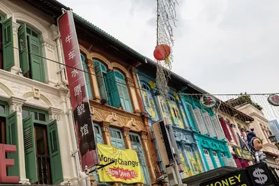
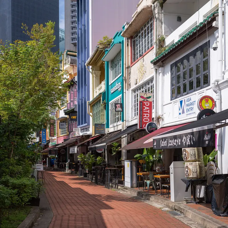
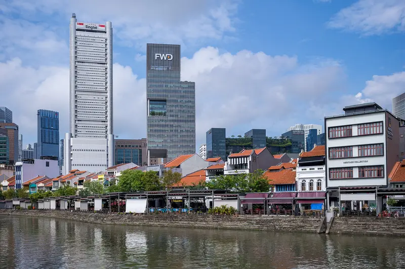
    The south bank at the river mouth was the busiest part of the port in the 19th century, handling three-quarters of the shipping trade in the 1860s. Since July 7, 1989, the row of two- and three-story shophouses has been protected. Today, they house restaurants and bars offering views of the financial district's skyscrapers.
    Open in Google Maps
    Elgin Bridge
    Attraction

    2Elgin Bridge

    The concrete bridge was opened on May 30, 1929, replacing several previous structures at the site where the first bridge across the river was built in 1822; North and South Bridge Road are named after it. The cast-iron lanterns were designed by Italian sculptor Rodolfo Nolli, and since 2019, it has been a National Monument.
    Open in Google Maps
    Clarke Quay
    Attraction

    3Clarke Quay

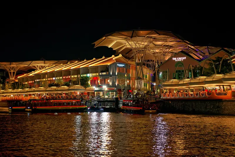
    The five blocks of restored warehouses, named after Governor Sir Andrew Clarke, opened in 1993 as Festival Village and are Singapore's largest surviving warehouse ensemble. Following a revamp, the complex reopened in April 2024 as CQ @ Clarke Quay, featuring restaurants, clubs, and the riverboat jetty.
    Open in Google Maps
    Cavenagh Bridge
    Historic Landmark

    4Cavenagh Bridge

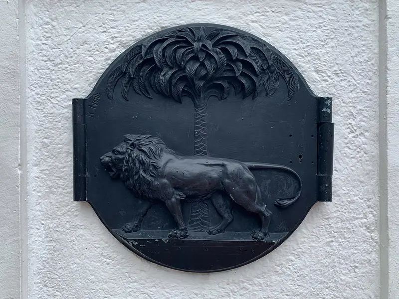
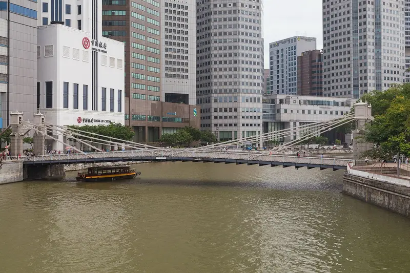
    Opened in November 1869, the suspension bridge is named after Governor Sir Orfeur Cavenagh and is considered Singapore's oldest bridge preserved in its original form; the steel parts were manufactured by P. & W. MacLellan in Glasgow. A police sign still stands at the bridgeheads, banning vehicles over 3 cwt (approx. 150 kg), including cattle and horses, from the bridge; since 2019, it has been a National Monument.
    Open in Google Maps
    Alkaff Bridge
    Point of Interest

    5Alkaff Bridge

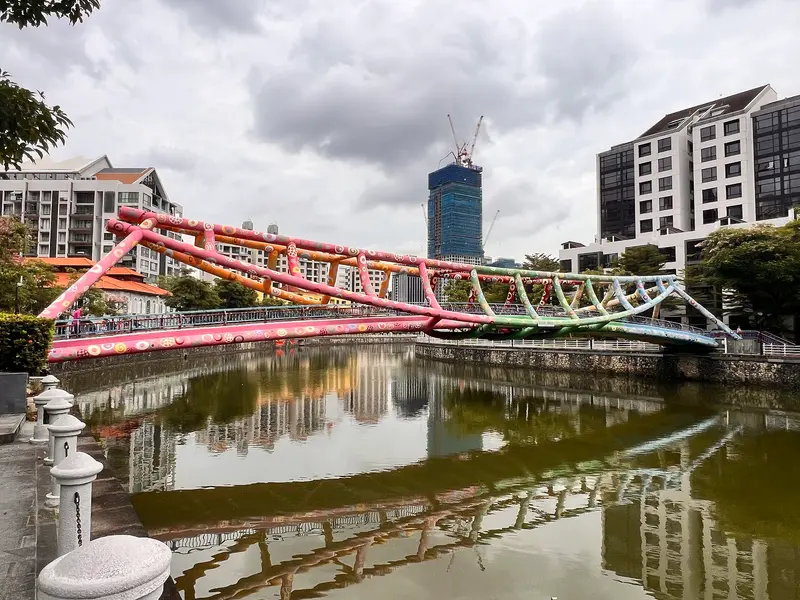
    The pedestrian bridge at Robertson Quay is shaped like a tongkang, a type of barge formerly used on the river. Filipino artist Pacita Abad painted it in vibrant colors in January 2004, and in 2019, the painting was renewed according to its original color scheme.
    Open in Google Maps

    Restaurants in Singapore River

    1

    Song Fa Bak Kut Teh

    Yeo Eng Song started out in 1969 with a pushcart on Johor Road, and in 2007 his son opened the first restaurant at 11 New Bridge Road, near Clarke Quay. The dish here is peppery pork rib broth (bak kut teh). The New Bridge Road branch is listed in the Michelin Guide's Bib Gourmand 2026, as it has been in all ten editions since 2016.
    Show on Google Maps
    2

    JUMBO Seafood Riverside Point

    Founded in 1987, the seafood chain operates a riverside restaurant at Riverside Point opposite Clarke Quay. It is known for Chili Crab, with Pepper Crab and prawns with salted egg yolk also on the menu.
    Show on Google Maps
    3

    Publico Ristorante

    The Italian restaurant on the ground floor of the InterContinental Robertson Quay has an open riverside garden. It offers wood-fired pizzas, such as one topped with black truffle, and homemade pasta.
    Show on Google Maps

    From Port to Promenade

    The Belly of the CarpThe south bank at the river mouth resembles the belly of a carp, considered in Chinese belief a place of wealth and prosperity. Accordingly, merchants packed their shophouses tightly together here. Clarke Quay, named after Sir Andrew Clarke, Governor of the Straits Settlements from 1873 to 1875, was a cargo transshipment hub with its warehouses. Robertson Quay, named after Councillor J. Murray Robertson, is the largest and furthest upstream of the three quays; here, swampland was reclaimed for warehouses in the 19th century.The Great CleanupAt the opening of the Upper Peirce Reservoir in February 1977, Prime Minister Lee Kuan Yew announced the goal of cleaning the polluted river within ten years. By September 1983, some 800 lighters had been relocated to the Port Authority's facilities in Pasir Panjang. On September 2, 1987, the cleanup was declared complete. Converted bumboats have since served as tour boats and water taxis.New UsesBoat Quay was designated a conservation area on July 7, 1989, its two- and three-story shophouses now housing restaurants and bars. In Clarke Quay, the "Festival Village" opened in 1993 in restored warehouses, which, according to URA, form the largest preserved ensemble of its kind in Singapore. Following a revamp from 2022 to 2024, the complex is now called CQ @ Clarke Quay.

    Nightlife

    1

    Zouk

    The club occupies a warehouse at CQ @ Clarke Quay, 3C River Valley Road, and reopened Mainroom and Phuture after a June 2026 renovation. Together with Club Capital, the venues hold up to 3,500 guests and are used for concerts and events.
    Show on Google Maps
    2

    Brewerkz Riverside Point

    The brewpub at Riverside Point on 30 Merchant Road brews its beers in its on-site microbrewery. Alongside the beers, there are Western and Asian-inspired dishes, and outdoor seating is by the riverbank opposite Clarke Quay.
    Show on Google Maps
    3

    Southbridge

    The rooftop bar on the fifth floor of Boat Quay 80 overlooks the river towards Parliament and the skyline. Specialties include oysters prepared in various ways and cocktails.
    Show on Google Maps

    Getting There and Around

    Uferpromenaden führen auf beiden Seiten von der Mündung bei Boat Quay über Clarke Quay bis Robertson Quay; der ganze Abschnitt lässt sich gut zu Fuß gehen, Fußgängerbrücken verbinden die Ufer.MRT Clarke Quay (NE5): Die Station der North East Line liegt am Südufer unter der Eu Tong Sen Street und der New Bridge Road und hat direkten Zugang zu Clarke Quay Central.Bootsfahrt: Die Bumboats von Singapore River Cruise starten unter anderem am Anleger Clarke Quay und fahren in rund 40 Minuten an Boat Quay vorbei bis zur Marina Bay und zurück. Laut Betreiber kostet die Fahrt 28 S$ für Erwachsene und 18 S$ für Kinder von 3 bis 11 Jahren (Stand Oktober 2026); aktuelle Zeiten und Preise beim Anbieter prüfen.Abends: Boat Quay und Clarke Quay sind abends am belebtesten, Robertson Quay ist ruhiger und eher von Restaurants und Cafés geprägt.
    Accommodations in Singapore River

    Find perfect stay in Singapore River

    Booking.com* (Affiliate link)
    Search Hotels
    Agoda* (Affiliate link)
    Search Hotels
    Airbnb
    Vacation Rentals

    * Affiliate link: if you book through it, we earn a small commission. The price stays the same for you.

    Plan your trip to Singapore River

    Save places, build a route and plan your city trip, all in one place.

    1. 1
      Sunrise over alpine peaks and a sea of clouds
      1234

      Round trip

      12 days · 4 stops

      Saved

      Pick a route

      Pick a ready-made one or save places and plan your own.

      Open bookmarks
    2. 2

      Trip to Singapore River

      Live
      • 1Boat Quay3 days
      • 2Elgin Bridge4 days
      • 3Clarke Quay5 days
      Budget

      Plan your trip

      The planner sorts stops, days and budget. Plan together in real time.

      Start trip planning
    3. 3
      9:41 No signal
      Singapore River
      Available offline

      Use it on the road

      Download the guide to your phone and use it on site, even offline.

    Nearby

    Chinatown

    Chinatown

    Chinatown is Singapore's historic Chinese quarter southwest of the Singapore River. You come for its temples of three religions, the restored shophouses, and the Maxwell and Chinatown Complex Hawker Centres. Raffles' 1822 town plan allocated the area to Chinese immigrants; the Chinese name Niu Che Shui, 'Bullock-Cart Water', recalls the water carts that supplied the district in the 19th century. Since 1989, it has been a conservation area; the urban planning authority URA divides it into four districts: Kreta Ayer, Telok Ayer, Tanjong Pagar, and Bukit Pasoh.Standing close together are the Buddha Tooth Relic Temple, the Hindu Sri Mariamman Temple, and the Masjid Jamae Mosque. The district is accessible via Chinatown and Maxwell MRT stations.
    Civic District

    Civic District

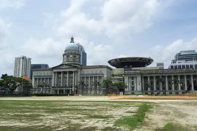
    The Civic District on the north bank of the Singapore River is Singapore's government and museum quarter. You come for the National Gallery, the Asian Civilisations Museum, and the colonial buildings around the Padang, including St Andrew's Cathedral and the Raffles Hotel. The city's history began here: a port settlement existed by the river as early as the 13th and 14th centuries, and in 1819, the British settled at the same spot. The Padang, a sports field fronting the colony's former administrative buildings, was declared the 75th National Monument in 2022.The National Gallery occupies the former Supreme Court and City Hall, while the Asian Civilisations Museum is situated directly by the river. Fort Canning Park, located on the former King's Hill, is green and shady. Key MRT stations are City Hall (North-South and East-West Line), plus Esplanade on the Circle Line.
    Marina Bay

    Marina Bay

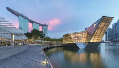
    Marina Bay is Singapore's iconic skyline district: The Marina Bay Sands hotel, the ArtScience Museum, the Supertrees of Gardens by the Bay, and the towers of the financial district frame the bay here. You'll come for the gardens, the view from the SkyPark, and in the evening for the light shows on the water. The approximately 360-hectare area was reclaimed from the sea starting in 1971; the last 38 hectares at Bayfront were added in 1994. Since the construction of the Marina Barrage in 2008, the bay has been a freshwater reservoir.The best way to explore here is to walk along the waterfront promenade around the bay, from the Merlion across the Helix Bridge to the gardens. Five MRT lines serve the district; the most important stations are Bayfront, Marina Bay, Gardens by the Bay, and Esplanade.
    Singapore

    Singapore

    Singapore is both a city and a state: Across 744.3 square kilometers, colonial buildings, temples, skyscrapers, and rainforests are often just a few MRT stations apart. You come for its districts shaped by Chinese, Malay and Indian communities, its Hawker Centres, and its gardens. According to the statistics authority, approximately 6.1 million people lived in the city-state by mid-2025. In 1819, Stamford Raffles established a British trading post here, and on August 9, 1965, Singapore gained independence after separating from Malaysia. Official languages are English, Malay, Mandarin, and Tamil, and this diversity continues to shape the city's districts today.The city center is divided into clearly distinct quarters: the skyscrapers and gardens of Marina Bay, the colonial buildings and museums in the Civic District, the temples and shophouses of Chinatown, and the spice shops of Little India. Beyond these, highlights include the UNESCO-listed Singapore Botanic Gardens, the Bukit Timah rainforest, and the Hawker Centres in residential areas. The MRT reaches almost all these destinations.
    Tiong Bahru

    Tiong Bahru

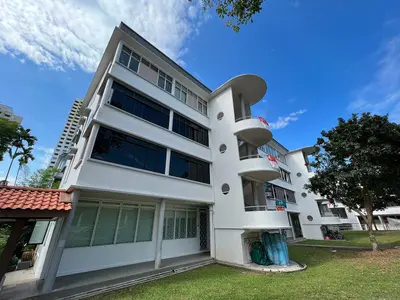
    Tiong Bahru is Singapore's oldest public housing estate, a tranquil neighbourhood of curved 1930s Art Deco blocks southwest of Chinatown. You come for the architecture, the Tiong Bahru Market, home to some of the city's most renowned hawker stalls, and the cafés and bakeries that have set up shop on the ground floors.The name means 'new cemetery', from the Hokkien word 'tiong' for cemetery and the Malay 'bahru' for new. In 1927, the Singapore Improvement Trust (SIT) acquired around 70 acres of land to build the country's first public housing estate here; the first block was ready for occupation in December 1936. Today, 20 pre-war blocks are heritage-listed. Between the blocks, you'll find a Monkey God Temple, murals depicting scenes from old Singapore, and one of the last surviving World War II air raid shelters.

    Sources & method

    • Photos: Wikimedia Commons, Google Maps. Each photo carries its credit.
    • Place data such as addresses and ratings comes from Google Maps.
    • The content is based on web research from public, traceable sources. How the content is made · The role of AI