Fernweh: Home
    ExploreTravel GuidesPlan a tripMy tripLast visited
    de|en
    All Places & RegionsAll highlightsAbout FernwehFAQPrivacy PolicyImprint
    ExploreTravel GuidesPlan a tripMy tripLast visited
    • Neighborhoods & highlights
    • Eat & drink
    • Culture
    • Getting around
    • Accommodation
    • Plan trip
    • Nearby
    Marina Bay
    Basile Morin / Wikimedia Commons / CC BY-SA 4.0

    Singapore

    Marina Bay

    CityArchitecture

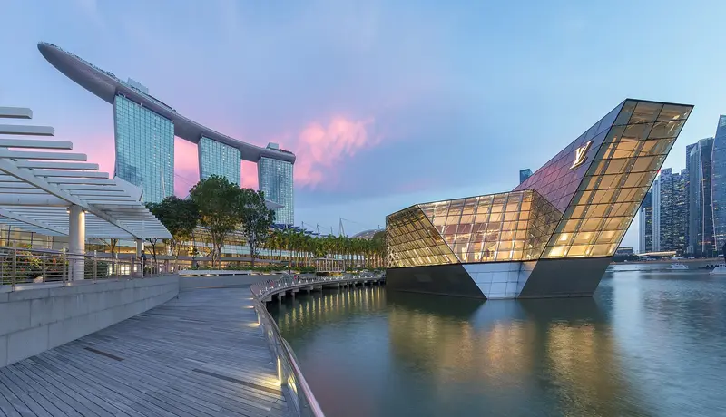
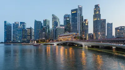
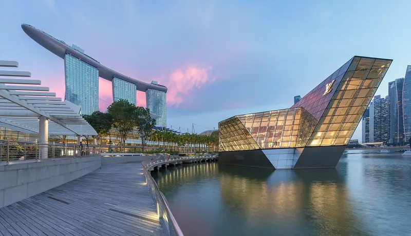
    Marina Bay is Singapore's iconic skyline district: The Marina Bay Sands hotel, the ArtScience Museum, the Supertrees of Gardens by the Bay, and the towers of the financial district frame the bay here.

    by Felix Gillen

    1. Home
    2. Destinations
    3. Singapore
    4. Singapore
    5. Marina Bay
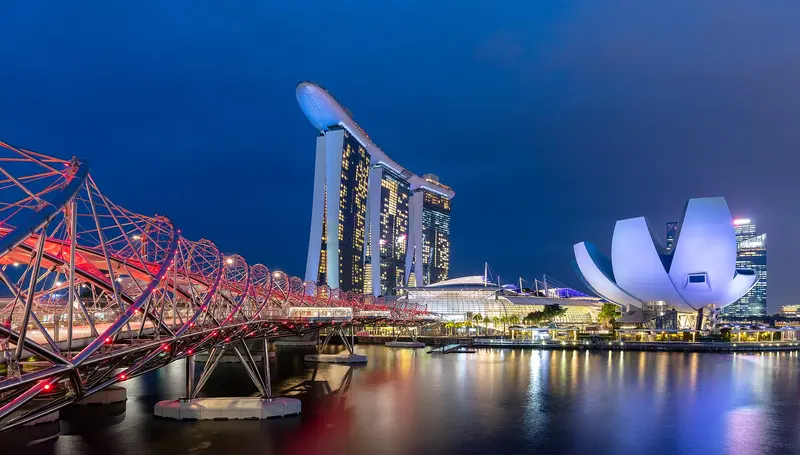
    Marina Bay is Singapore's iconic skyline district: The Marina Bay Sands hotel, the ArtScience Museum, the Supertrees of Gardens by the Bay, and the towers of the financial district frame the bay here. You'll come for the gardens, the view from the SkyPark, and in the evening for the light shows on the water. The approximately 360-hectare area was reclaimed from the sea starting in 1971; the last 38 hectares at Bayfront were added in 1994. Since the construction of the Marina Barrage in 2008, the bay has been a freshwater reservoir.The best way to explore here is to walk along the waterfront promenade around the bay, from the Merlion across the Helix Bridge to the gardens. Five MRT lines serve the district; the most important stations are Bayfront, Marina Bay, Gardens by the Bay, and Esplanade.

    Sights in Marina Bay

    Discover the most important sights and attractions

    Gardens by the Bay
    Park

    1Gardens by the Bay

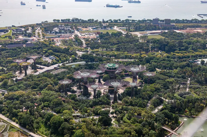
    The 101-hectare garden, opened on June 29, 2012, is known for its 18 Supertrees, plant-covered steel structures 25 to 50 meters tall, two of which are linked by the 128-meter OCBC Skyway. Next to the Flower Dome stands the second glasshouse, the Cloud Forest, with a 35-meter waterfall.
    Open in Google Maps
    Marina Bay Sands with SkyPark
    Attraction

    2Marina Bay Sands with SkyPark

    The Moshe Safdie-designed hotel complex opened in 2010; its three 55-storey towers support the SkyPark at around 200 metres, one of the world's largest public cantilevers. From the observation deck, you overlook the bay, gardens, and financial district.
    Open in Google Maps
    Helix Bridge
    Attraction

    3Helix Bridge

    The 280-meter-long pedestrian bridge by Cox Architecture, Arup, and Architects 61 is modeled after the DNA double helix and was fully opened on July 18, 2010. Guinness World Records lists it as the largest double helix bridge.
    Open in Google Maps
    ArtScience Museum
    Museum

    4ArtScience Museum

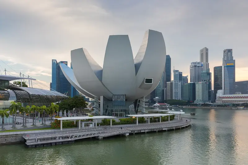
    Moshe Safdie's museum, opened in 2011, resembles a lotus flower with its ten asymmetrical petals and stands directly on the water in front of Marina Bay Sands. Each petal houses its own gallery, with 21 in total.
    Open in Google Maps
    Merlion Park
    Park

    5Merlion Park

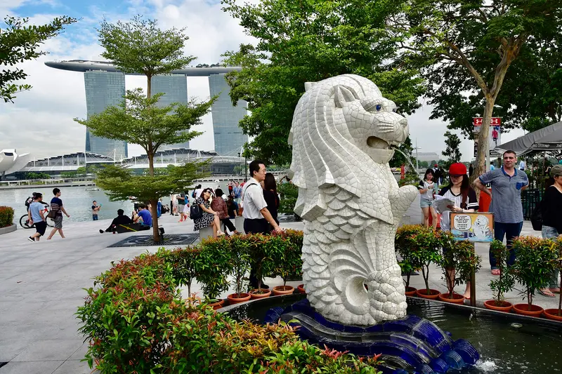
    The 8.6-meter-tall and 70-ton Merlion statue by sculptor Lim Nang Seng was unveiled in September 1972 by Prime Minister Lee Kuan Yew. In April 2002, it was relocated approximately 120 meters to its present spot in front of the Fullerton Hotel.
    Open in Google Maps

    Restaurants in Marina Bay

    1

    Rasapura Masters

    This food court on basement level B2 of The Shoppes at Marina Bay Sands was redesigned in November 2025 and now brings together five Michelin Guide-recommended brands. Stalls include Kok Kee Wonton Noodle, Thye Hong Hokkien Mee, and Ju Fu Bak Kut Teh.
    Show on Google Maps
    2

    Lau Pa Sat

    The octagonal cast-iron market hall, completed in 1894 to James MacRitchie's designs, became a National Monument in 1973. At night, the adjacent Boon Tat Street becomes Satay Street, where grill stalls sell satay.
    Show on Google Maps
    3

    Waku Ghin

    Tetsuya Wakuda's restaurant on Level 2 of The Shoppes at Marina Bay Sands serves Japanese-European cuisine exclusively as a degustation menu, known for its marinated Botan shrimp with sea urchin and caviar. In the Michelin Guide Singapore 2026, it retained its star.
    Show on Google Maps

    A District Built on Reclaimed Land

    From Sea to SkylineAccording to the URA, Singapore began land reclamation along the downtown shoreline in 1971, with the final 38 hectares at the Bayfront reclaimed in 1994. The new land became home to the financial district around Marina Bay Financial Centre and Asia Square, the Esplanade, the Singapore Flyer, and eventually Gardens by the Bay. Significant portions of the Formula 1 Marina Bay Street Circuit also stand on reclaimed land.The Bay as a Water ReservoirIn 2008, the Marina Channel was dammed with the Marina Barrage. Since then, Marina Bay and the Kallang Basin have formed a freshwater reservoir that supplies additional drinking water, maintains stable water levels for water sports, and protects areas like Chinatown from flooding.

    Arrival & Routes

    The North-South Line, East-West Line, Circle Line, Downtown Line, and Thomson-East Coast Line serve Marina Bay. For the main destinations, take these stations:Bayfront (CC34/DT16): for Marina Bay Sands, the ArtScience Museum, and Gardens by the Bay; Helix Bridge and Merlion Park are also nearby.Gardens by the Bay (TE22): Thomson-East Coast Line station directly at the Gardens.Marina Bay (NS27/CC33/TE20): Interchange station for the financial district; the Circle Line code has been CC33 instead of CE2 since July 2026.Esplanade (CC3): for Esplanade, Makansutra Gluttons Bay, and Suntec City.
    Accommodations in Marina Bay

    Find perfect stay in Marina Bay

    Booking.com* (Affiliate link)
    Search Hotels
    Agoda* (Affiliate link)
    Search Hotels
    Airbnb
    Vacation Rentals

    * Affiliate link: if you book through it, we earn a small commission. The price stays the same for you.

    Plan your trip to Marina Bay

    Save places, build a route and plan your city trip, all in one place.

    1. 1
      Sunrise over alpine peaks and a sea of clouds
      1234

      Round trip

      12 days · 4 stops

      Saved

      Pick a route

      Pick a ready-made one or save places and plan your own.

      Open bookmarks
    2. 2

      Trip to Marina Bay

      Live
      • 1Gardens by the Bay3 days
      • 2Marina Bay Sands with SkyPark4 days
      • 3Helix Bridge5 days
      Budget

      Plan your trip

      The planner sorts stops, days and budget. Plan together in real time.

      Start trip planning
    3. 3
      9:41 No signal
      Marina Bay
      Available offline

      Use it on the road

      Download the guide to your phone and use it on site, even offline.

    Nearby

    Civic District

    Civic District

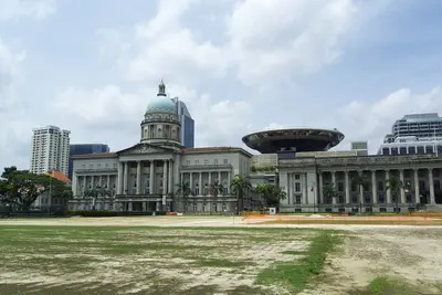
    The Civic District on the north bank of the Singapore River is Singapore's government and museum quarter. You come for the National Gallery, the Asian Civilisations Museum, and the colonial buildings around the Padang, including St Andrew's Cathedral and the Raffles Hotel. The city's history began here: a port settlement existed by the river as early as the 13th and 14th centuries, and in 1819, the British settled at the same spot. The Padang, a sports field fronting the colony's former administrative buildings, was declared the 75th National Monument in 2022.The National Gallery occupies the former Supreme Court and City Hall, while the Asian Civilisations Museum is situated directly by the river. Fort Canning Park, located on the former King's Hill, is green and shady. Key MRT stations are City Hall (North-South and East-West Line), plus Esplanade on the Circle Line.
    Singapore River

    Singapore River

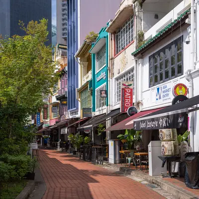
    The Singapore River is the city's historic lifeline. Along its banks today, the three quays, Boat Quay, Clarke Quay and Robertson Quay, brim with restaurants, bars, and clubs. You come here to stroll along the promenades and historic bridges, take a bumboat ride, and dine and drink by the water in the evening.In the 19th century, the river served as Singapore's port: in the 1860s, Boat Quay handled three-quarters of all ship trade, with lighters transporting goods to warehouses upstream. After a ten-year cleanup from 1977 to 1987, trade and pollution disappeared. The warehouses and shophouses were placed under conservation and repurposed starting in 1989. Three colonial-era bridges have been national monuments since 2019.
    Chinatown

    Chinatown

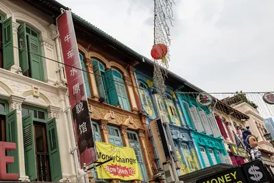
    Chinatown is Singapore's historic Chinese quarter southwest of the Singapore River. You come for its temples of three religions, the restored shophouses, and the Maxwell and Chinatown Complex Hawker Centres. Raffles' 1822 town plan allocated the area to Chinese immigrants; the Chinese name Niu Che Shui, 'Bullock-Cart Water', recalls the water carts that supplied the district in the 19th century. Since 1989, it has been a conservation area; the urban planning authority URA divides it into four districts: Kreta Ayer, Telok Ayer, Tanjong Pagar, and Bukit Pasoh.Standing close together are the Buddha Tooth Relic Temple, the Hindu Sri Mariamman Temple, and the Masjid Jamae Mosque. The district is accessible via Chinatown and Maxwell MRT stations.
    Kampong Glam

    Kampong Glam

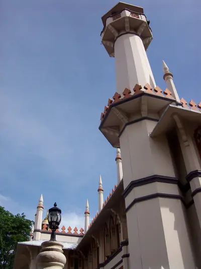
    Kampong Glam is Singapore's historic Malay-Muslim quarter, located north of the Singapore River. You come here for the Sultan Mosque, the fabric shops on Arab Street, the murals in Haji Lane, and the murtabak eateries along North Bridge Road. Following the 1819 treaty between the East India Company, Sultan Hussein Shah of Johor, and Temenggong Abdul Rahman, the Sultan settled here with his entourage. The 1822 town plan allocated the area to the Sultan's court and to Malay, Arab, and Bugis traders; street names like Arab Street, Bussorah Street, and Muscat Street serve as a reminder of this.The golden domes of the Sultan Mosque are the focal point, surrounded by restored shophouses housing cafés and boutiques. The Malay Heritage Centre in the former Sultan's palace reopened in April 2026. Kampong Glam is a few minutes' walk from Bugis MRT station.
    Singapore

    Singapore

    Singapore is both a city and a state: Across 744.3 square kilometers, colonial buildings, temples, skyscrapers, and rainforests are often just a few MRT stations apart. You come for its districts shaped by Chinese, Malay and Indian communities, its Hawker Centres, and its gardens. According to the statistics authority, approximately 6.1 million people lived in the city-state by mid-2025. In 1819, Stamford Raffles established a British trading post here, and on August 9, 1965, Singapore gained independence after separating from Malaysia. Official languages are English, Malay, Mandarin, and Tamil, and this diversity continues to shape the city's districts today.The city center is divided into clearly distinct quarters: the skyscrapers and gardens of Marina Bay, the colonial buildings and museums in the Civic District, the temples and shophouses of Chinatown, and the spice shops of Little India. Beyond these, highlights include the UNESCO-listed Singapore Botanic Gardens, the Bukit Timah rainforest, and the Hawker Centres in residential areas. The MRT reaches almost all these destinations.

    Sources & method

    • Photos: Wikimedia Commons, Google Maps. Each photo carries its credit.
    • Place data such as addresses and ratings comes from Google Maps.
    • The content is based on web research from public, traceable sources. How the content is made · The role of AI