Fernweh: Home
    ExploreTravel GuidesPlan a tripMy tripLast visited
    de|en
    All Places & RegionsAll highlightsAbout FernwehFAQPrivacy PolicyImprint
    ExploreTravel GuidesPlan a tripMy tripLast visited
    • Neighborhoods & highlights
    • Eat & drink
    • Culture
    • Nightlife
    • Getting around
    • Accommodation
    • Plan trip
    • Nearby
    Singapore
    Basile Morin / Wikimedia Commons / CC BY-SA 4.0

    Singapore

    Singapore

    CityArchitectureNature

    Singapore is both a city and a state: Across 744.3 square kilometers, colonial buildings, temples, skyscrapers, and rainforests are often just a few MRT stations apart.

    by Felix Gillen

    1. Home
    2. Destinations
    3. Singapore
    4. Singapore
    Singapore is both a city and a state: Across 744.3 square kilometers, colonial buildings, temples, skyscrapers, and rainforests are often just a few MRT stations apart. You come for its districts shaped by Chinese, Malay and Indian communities, its Hawker Centres, and its gardens. According to the statistics authority, approximately 6.1 million people lived in the city-state by mid-2025. In 1819, Stamford Raffles established a British trading post here, and on August 9, 1965, Singapore gained independence after separating from Malaysia. Official languages are English, Malay, Mandarin, and Tamil, and this diversity continues to shape the city's districts today.The city center is divided into clearly distinct quarters: the skyscrapers and gardens of Marina Bay, the colonial buildings and museums in the Civic District, the temples and shophouses of Chinatown, and the spice shops of Little India. Beyond these, highlights include the UNESCO-listed Singapore Botanic Gardens, the Bukit Timah rainforest, and the Hawker Centres in residential areas. The MRT reaches almost all these destinations.
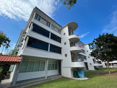
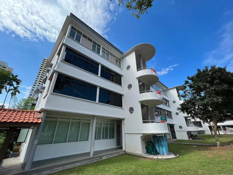
    Tiong Bahru
    Wzhkevin / Wikimedia Commons / CC BY-SA 4.0

    District 1 of 4

    Tiong Bahru

    Tiong Bahru is Singapore's oldest public housing estate, a tranquil neighbourhood of curved 1930s Art Deco blocks southwest of Chinatown.

    Discover
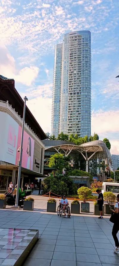
    Orchard Road
    Uzoma Ozurumba / Wikimedia Commons / CC BY-SA 4.0

    District 2 of 4

    Orchard Road

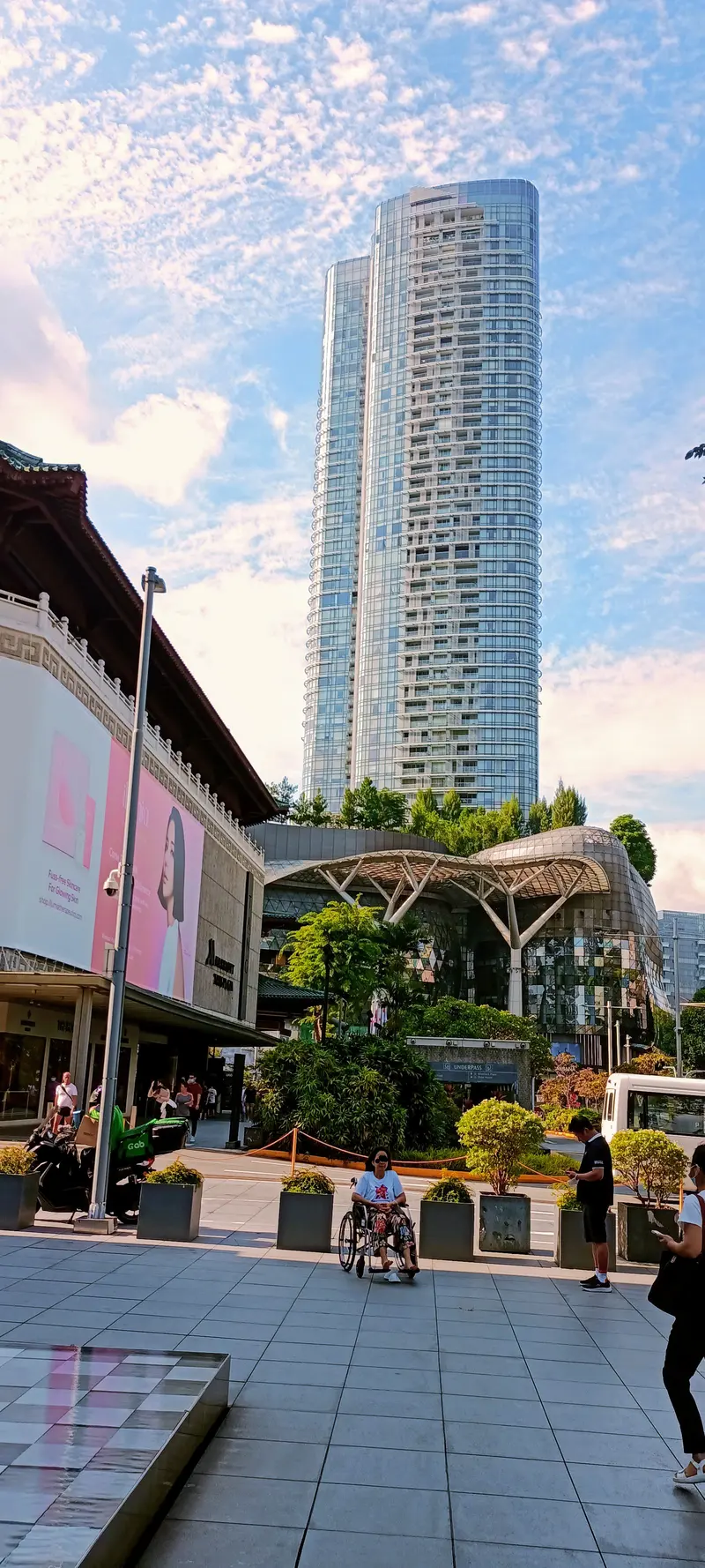
    Orchard Road is Singapore's most famous shopping street, stretching approximately 2.5 kilometers through the city center.

    Discover
    Katong and Joo Chiat
    Firzafp / Wikimedia Commons / CC BY 4.0

    District 3 of 4

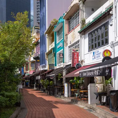
    Katong and Joo Chiat

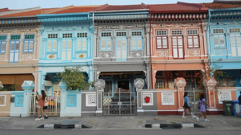
    Katong and Joo Chiat form Singapore's eastern Peranakan district, a residential area of vibrantly decorated shophouses, old coffee houses, and small family businesses.

    Discover
    Chinatown
    Dietmar Rabich / Wikimedia Commons / CC BY-SA 4.0

    District 4 of 4

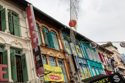
    Chinatown

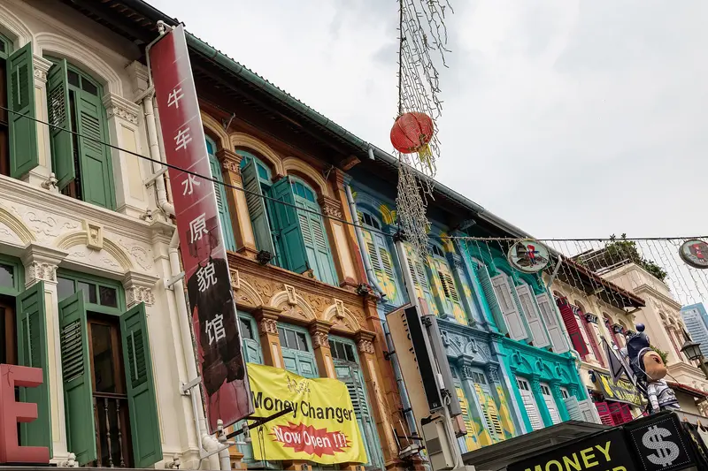
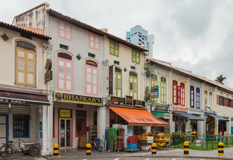
    Chinatown is Singapore's historic Chinese quarter southwest of the Singapore River. You come for its temples of three religions, the restored shophouses, and the Maxwell and Chinatown Complex Hawker Centres.

    Discover

    More districts in Singapore

    Kampong Glam

    Kampong Glam

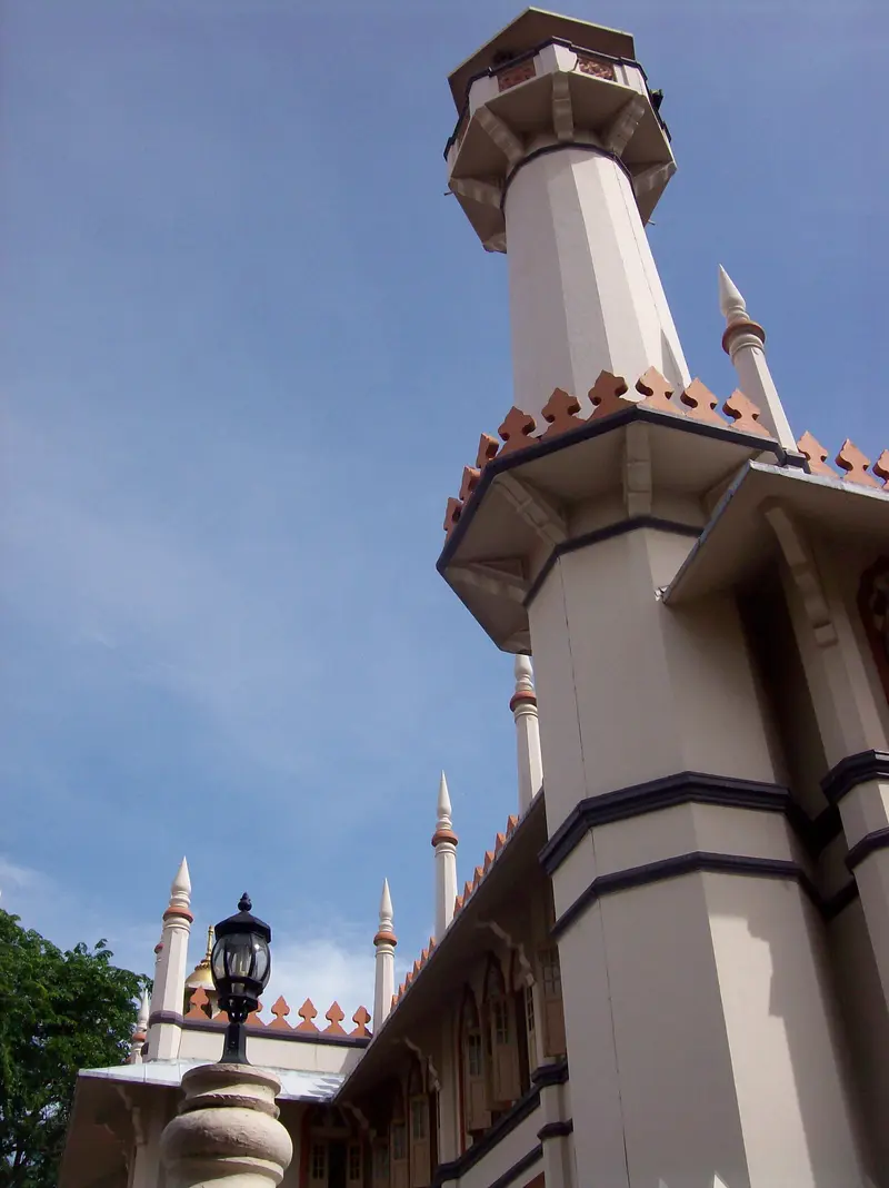
    Kampong Glam is Singapore's historic Malay-Muslim quarter, located north of the Singapore River. You come here for the Sultan Mosque, the fabric shops on Arab Street, the murals in Haji Lane, and the murtabak eateries along North Bridge Road. Following the 1819 treaty between the East India Company, Sultan Hussein Shah of Johor, and Temenggong Abdul Rahman, the Sultan settled here with his entourage. The 1822 town plan allocated the area to the Sultan's court and to Malay, Arab, and Bugis traders; street names like Arab Street, Bussorah Street, and Muscat Street serve as a reminder of this.The golden domes of the Sultan Mosque are the focal point, surrounded by restored shophouses housing cafés and boutiques. The Malay Heritage Centre in the former Sultan's palace reopened in April 2026. Kampong Glam is a few minutes' walk from Bugis MRT station.
    Pulau Ubin

    Pulau Ubin

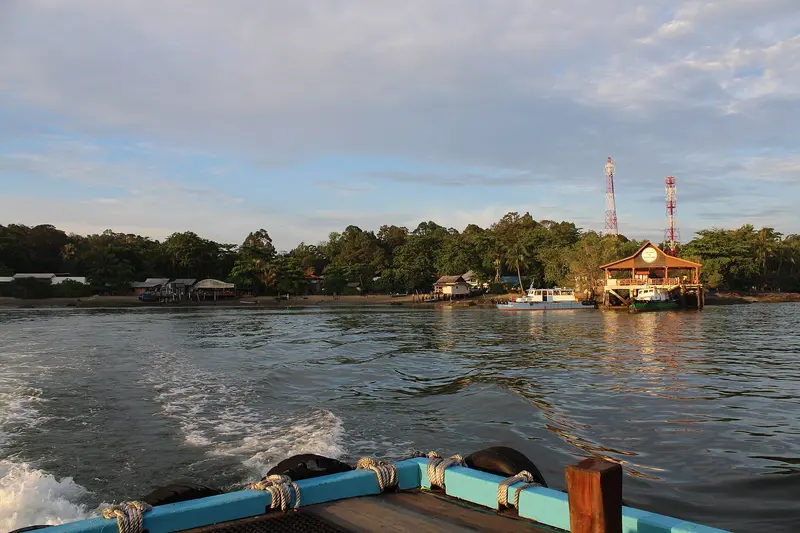
    Pulau Ubin is an island of just over ten square kilometers off Singapore's northeast coast, and one of the country's last kampongs, or traditional villages. You come to cycle a rented bike through forests and past flooded quarries to the mangroves and mudflats of Chek Jawa. Its Malay name means 'Granite Island': From the 19th century onwards, its quarries supplied granite for projects including the Johor Causeway and Horsburgh Lighthouse. In the 1970s, several thousand people still lived here; most moved away after the quarries closed.You can rent bikes in the village at the jetty. From there, paths lead to Chek Jawa in the east and to the mountain bike park at Ketam Quarry. The crossing by bumboat from Changi Point Ferry Terminal takes about ten minutes.
    Singapore River

    Singapore River

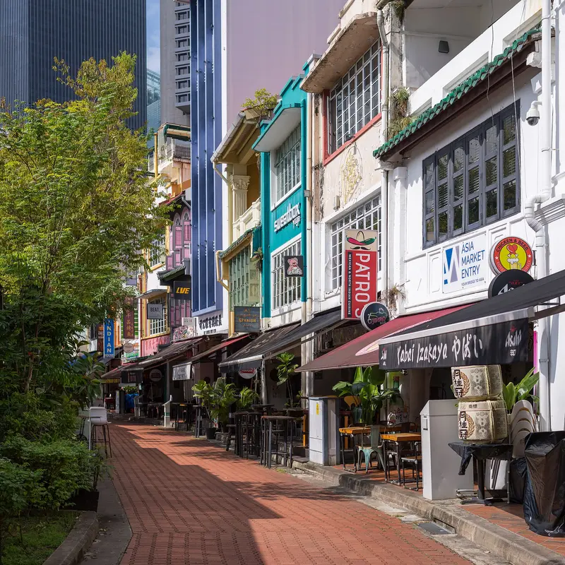
    The Singapore River is the city's historic lifeline. Along its banks today, the three quays, Boat Quay, Clarke Quay and Robertson Quay, brim with restaurants, bars, and clubs. You come here to stroll along the promenades and historic bridges, take a bumboat ride, and dine and drink by the water in the evening.In the 19th century, the river served as Singapore's port: in the 1860s, Boat Quay handled three-quarters of all ship trade, with lighters transporting goods to warehouses upstream. After a ten-year cleanup from 1977 to 1987, trade and pollution disappeared. The warehouses and shophouses were placed under conservation and repurposed starting in 1989. Three colonial-era bridges have been national monuments since 2019.
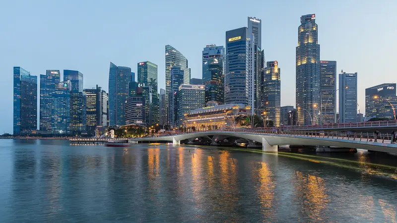
    Marina Bay

    Marina Bay

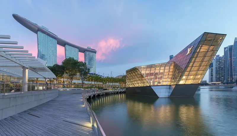
    Marina Bay is Singapore's iconic skyline district: The Marina Bay Sands hotel, the ArtScience Museum, the Supertrees of Gardens by the Bay, and the towers of the financial district frame the bay here. You'll come for the gardens, the view from the SkyPark, and in the evening for the light shows on the water. The approximately 360-hectare area was reclaimed from the sea starting in 1971; the last 38 hectares at Bayfront were added in 1994. Since the construction of the Marina Barrage in 2008, the bay has been a freshwater reservoir.The best way to explore here is to walk along the waterfront promenade around the bay, from the Merlion across the Helix Bridge to the gardens. Five MRT lines serve the district; the most important stations are Bayfront, Marina Bay, Gardens by the Bay, and Esplanade.
    Sentosa

    Sentosa

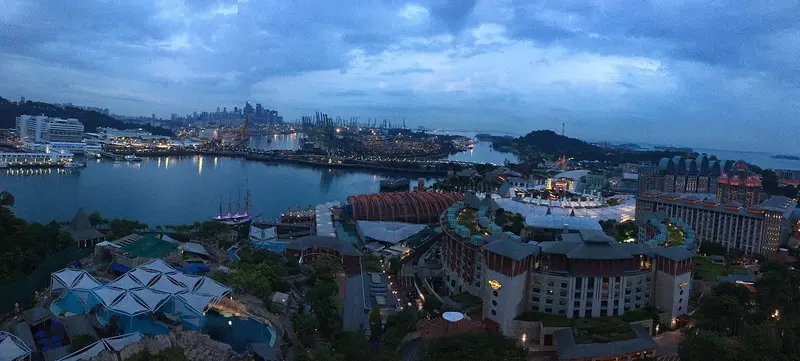
    Sentosa is Singapore's leisure island, nearly five square kilometers in size and located about half a kilometer off the south coast. You come for the beaches in the south, the attractions of Resorts World Sentosa, or the military history of Fort Siloso. Until the early 1970s, it was called Pulau Blakang Mati and served the British as a fortress protecting the harbor entrance; during World War II, the Japanese used Fort Siloso as a prisoner-of-war camp. The new name comes from the Sanskrit word Santosha and means peace and tranquility.In the north lies Resorts World Sentosa with Universal Studios and the Singapore Oceanarium, which opened in 2025; in the south are Siloso, Palawan, and Tanjong beaches. In between, the Sensoryscape walkway connects both sides. You can reach the island on foot via the Sentosa Boardwalk, by monorail on the Sentosa Express from VivoCity, or by cable car from Mount Faber.
    Little India

    Little India

    Little India along Serangoon Road is Singapore's historic Indian quarter. You come for the Hindu temples, the biryani eateries, the Tekka Centre, and the 24-hour Mustafa Centre. It began as a cattle trading district: Indian immigrants, many of them cattle farmers, settled here, and in 1915, the Kandang Kerbau Market, named after the cattle trade, was established. The area was only named Little India in the 1980s at the initiative of the Singapore Tourism Board; in 1989, it was heritage listed. Many Singaporeans still call it Tekka today.Between the temples, eat at the Tekka Centre or Bismillah Biryani on Dunlop Street; afterwards, the Indian Heritage Centre is worth a visit. During Deepavali and Thaipusam, the district becomes a festival ground. The Little India MRT station is located on the North East Line and the Downtown Line.
    Civic District

    Civic District

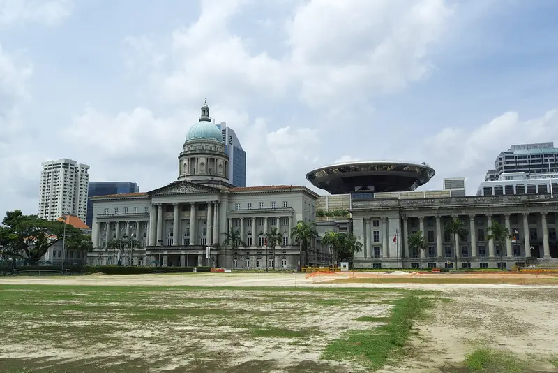
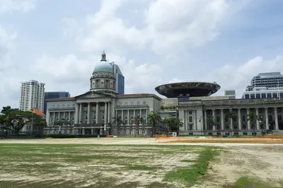
    The Civic District on the north bank of the Singapore River is Singapore's government and museum quarter. You come for the National Gallery, the Asian Civilisations Museum, and the colonial buildings around the Padang, including St Andrew's Cathedral and the Raffles Hotel. The city's history began here: a port settlement existed by the river as early as the 13th and 14th centuries, and in 1819, the British settled at the same spot. The Padang, a sports field fronting the colony's former administrative buildings, was declared the 75th National Monument in 2022.The National Gallery occupies the former Supreme Court and City Hall, while the Asian Civilisations Museum is situated directly by the river. Fort Canning Park, located on the former King's Hill, is green and shady. Key MRT stations are City Hall (North-South and East-West Line), plus Esplanade on the Circle Line.
    Mandai

    Mandai

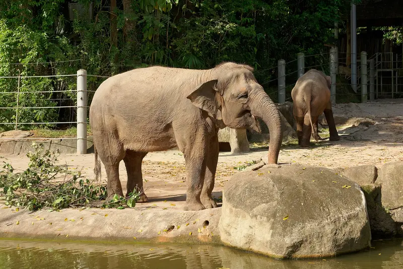
    Mandai in northern Singapore is the city-state's hub for zoological parks. On the edge of the Upper Seletar Reservoir, in the Central Catchment area, there are now five parks: the Singapore Zoo (opened 1973), Night Safari (1994), River Wonders, Bird Paradise (moved from Jurong in 2023), and the newest park, Rainforest Wild Adventure. They are operated by the Mandai Wildlife Group, known as Wildlife Reserves Singapore until 2021.With the opening of Rainforest Wild Adventure's eastern section in May 2026, the roughly ten-year transformation into Mandai Wildlife Reserve is complete. You can spend a full day here and switch to the Night Safari in the evening. The Mandai Wildlife West and East entrance areas, with restaurants, are accessible without a ticket. You can reach Mandai by MRT and shuttle buses.
    Singapore Botanic Gardens

    Singapore Botanic Gardens

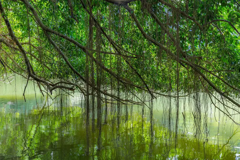
    The Botanic Gardens in the Tanglin district is an approximately 82-hectare park featuring lakes, themed gardens, and the National Orchid Garden. Since July 4, 2015, it has been listed as the first and, to date, only tropical botanical garden on the UNESCO World Heritage list. It was established in 1859 by an Agricultural and Horticultural Society at its current location. Under Director Henry Nicholas Ridley, who took office in 1888, research into rubber cultivation was conducted here; his methods helped Malaya become the world's largest natural rubber producer.The Gardens are freely accessible daily from 5 AM to midnight. You can stroll from Swan Lake at Tanglin Gate across lawns and themed gardens to the National Orchid Garden, which is the only paid-admission area. Two MRT stations are located directly at the entrances: Botanic Gardens in the north and Napier in the south.

    Sights in Singapore

    Discover the most important sights and attractions

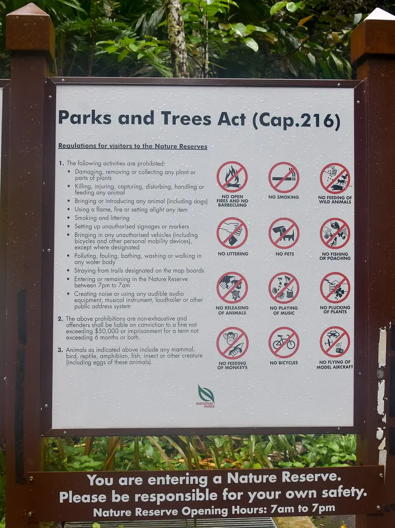
    Bukit Timah Nature Reserve
    Park

    1Bukit Timah Nature Reserve

    This 163-hectare nature reserve encompasses the 163-meter-high Bukit Timah Hill, Singapore's highest natural peak, and one of the country's last primary rainforests. Since 2011, it has been designated an ASEAN Heritage Park.
    Open in Google Maps
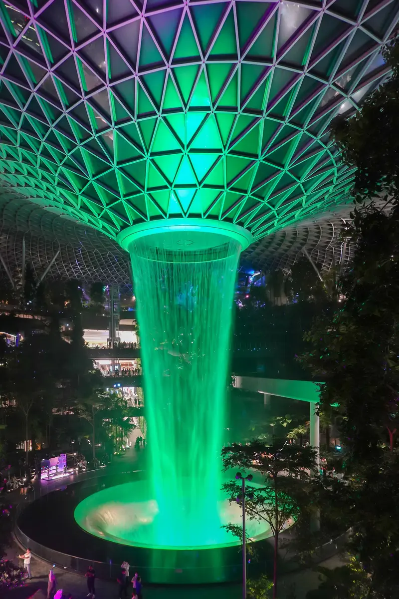
    Jewel Changi Airport with Rain Vortex
    Shopping Mall

    2Jewel Changi Airport with Rain Vortex

    The glass structure designed by Moshe Safdie at Changi Airport opened in April 2019 and is connected to Terminals 1, 2 and 3. At its heart, the 40-metre-high Rain Vortex plunges through an opening in the roof, surrounded by the terraced indoor garden Forest Valley.
    Open in Google Maps
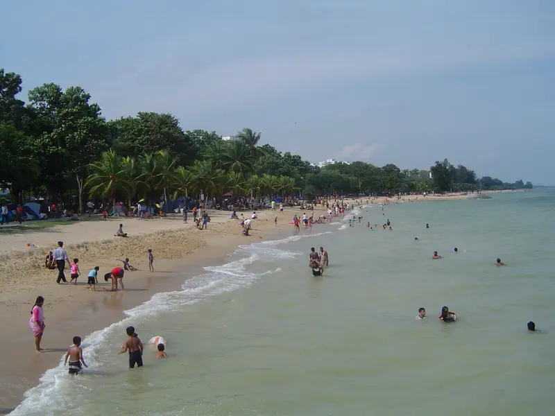
    East Coast Park
    Park

    3East Coast Park

    At 185 hectares, East Coast Park is Singapore's largest park; it is entirely located on reclaimed land and features an artificial beach. A bike and skate path stretches for over 15 kilometers along the coast.
    Open in Google Maps
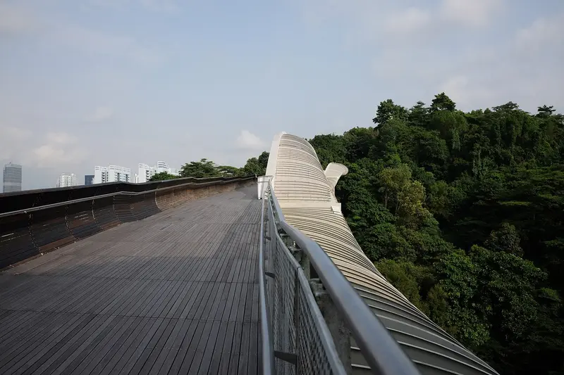
    Henderson Waves
    Point of Interest

    4Henderson Waves

    The 274-meter pedestrian bridge, with its undulating timber structure, runs 36 meters above Henderson Road and is considered Singapore's highest pedestrian bridge. It forms part of the roughly 10-kilometer Southern Ridges.
    Open in Google Maps

    Restaurants in Singapore

    1

    Old Airport Road Food Centre

    The Hawker Centre was established in 1972 on the site of the Kallang Airport, closed in 1955, to accommodate the area's street hawkers. Several of its stalls, including Nam Sing Hokkien Fried Mee and To-Ricos Kway Chap, are listed in the 2026 Michelin Guide's Bib Gourmand.
    Show on Google Maps
    2

    Newton Food Centre

    Newton opened in 1971 as Singapore's first Hawker Centre without an attached wet market and reopened on July 1, 2006, after a renovation. It is known for seafood and satay; several stalls, including Alliance Seafood, are featured in the Michelin Guide 2026 Bib Gourmand.
    Show on Google Maps

    Culture and Life

    Hawker Culture as World HeritageHawker Centres, covered food halls with dozens of small stalls, are Singapore's communal dining room. In December 2020, UNESCO inscribed Singapore's Hawker Culture on the Representative List of the Intangible Cultural Heritage of Humanity; it was the country's first entry. UNESCO describes the centres as places where people of different backgrounds gather to eat breakfast, lunch, and dinner together. Numerous stalls are listed in the Michelin Guide's Bib Gourmand.Many Cultures, Four Official LanguagesEnglish, Malay, Mandarin, and Tamil are equally recognized official languages; Malay is also the national language. The ethnic quarters trace back to the 1822 town plan, with which Raffles assigned specific districts to different population groups: The Chinese received the area southwest of the Singapore River, which became Chinatown.

    Nightlife

    1

    Jigger & Pony

    The cocktail bar at Amara Hotel (165 Tanjong Pagar Road), founded in 2012 by Indra Kantono and Guoyi Gan, focuses on precisely mixed classics. It ranked 9th in Asia's 50 Best Bars 2026, making it Singapore's highest-ranked bar, and 18th in The World's 50 Best Bars 2026.
    Show on Google Maps
    2

    Atlas

    The bar in the Art Deco lobby of Parkview Square (600 North Bridge Road) is built around an eight-meter-high gin tower with over 1,300 bottles. Atlas ranked 38th in the Top 500 Bars 2025, and its house drink is the Atlas Martini.
    Show on Google Maps
    3

    Nutmeg & Clove

    The bar at 8 Purvis Street has been dedicated to Singaporean identity since 2014; its current menu names its cocktails after Singlish expressions. In 2026, it ranked 12th on Asia's 50 Best Bars and 38th on the worldwide list.
    Show on Google Maps
    4

    Native

    Founder Vijay Mudaliar built the bar at 52A Amoy Street around local and regional ingredients; in 2026, it celebrates its tenth anniversary. On the third floor, the team ferments its own beverages like starfruit sake.
    Show on Google Maps
    5

    Offtrack

    The music-focused bar at 34 North Canal Road, established in 2022, plays everything from jazz to soul through restored Klipsch La Scala speakers and serves pan-Asian food. It was ranked 16th in Asia's 50 Best Bars 2026.
    Show on Google Maps

    Exploring Singapore

    The backbone of public transport is the MRT. In the city centre, the North-South Line, East-West Line, North East Line, Circle Line, Downtown Line, and Thomson-East Coast Line intersect, allowing you to reach most downtown districts without detours.Circle Line: Since July 2026, Stage 6 of the Circle Line has been in operation; the stations Marina Bay (CC33) and Bayfront (CC34) therefore have new codes.Airport: Jewel Changi Airport is directly connected to Terminals 1, 2, and 3.Botanic Gardens: Botanic Gardens station (CC19/DT9) is located at Bukit Timah Gate in the north of the gardens.

    Accommodations in Singapore

    Find perfect stay in Singapore

    Booking.com* (Affiliate link)
    Search Hotels
    Agoda* (Affiliate link)
    Search Hotels
    Airbnb
    Vacation Rentals

    * Affiliate link: if you book through it, we earn a small commission. The price stays the same for you.

    Plan your trip to Singapore

    Save places, build a route and plan your city trip, all in one place.

    1. 1
      Sunrise over alpine peaks and a sea of clouds
      1234

      Round trip

      12 days · 4 stops

      Saved

      Pick a route

      Pick a ready-made one or save places and plan your own.

      Open bookmarks
    2. 2

      Trip to Singapore

      Live
      • 1Bukit Timah Nature Reserve3 days
      • 2Jewel Changi Airport with Rain Vortex4 days
      • 3East Coast Park5 days
      Budget

      Plan your trip

      The planner sorts stops, days and budget. Plan together in real time.

      Start trip planning
    3. 3
      9:41 No signal
      Singapore
      Available offline

      Use it on the road

      Download the guide to your phone and use it on site, even offline.

    Nearby

    Tiong Bahru

    Tiong Bahru

    Tiong Bahru is Singapore's oldest public housing estate, a tranquil neighbourhood of curved 1930s Art Deco blocks southwest of Chinatown. You come for the architecture, the Tiong Bahru Market, home to some of the city's most renowned hawker stalls, and the cafés and bakeries that have set up shop on the ground floors.The name means 'new cemetery', from the Hokkien word 'tiong' for cemetery and the Malay 'bahru' for new. In 1927, the Singapore Improvement Trust (SIT) acquired around 70 acres of land to build the country's first public housing estate here; the first block was ready for occupation in December 1936. Today, 20 pre-war blocks are heritage-listed. Between the blocks, you'll find a Monkey God Temple, murals depicting scenes from old Singapore, and one of the last surviving World War II air raid shelters.
    Chinatown

    Chinatown

    Chinatown is Singapore's historic Chinese quarter southwest of the Singapore River. You come for its temples of three religions, the restored shophouses, and the Maxwell and Chinatown Complex Hawker Centres. Raffles' 1822 town plan allocated the area to Chinese immigrants; the Chinese name Niu Che Shui, 'Bullock-Cart Water', recalls the water carts that supplied the district in the 19th century. Since 1989, it has been a conservation area; the urban planning authority URA divides it into four districts: Kreta Ayer, Telok Ayer, Tanjong Pagar, and Bukit Pasoh.Standing close together are the Buddha Tooth Relic Temple, the Hindu Sri Mariamman Temple, and the Masjid Jamae Mosque. The district is accessible via Chinatown and Maxwell MRT stations.
    Singapore River

    Singapore River

    The Singapore River is the city's historic lifeline. Along its banks today, the three quays, Boat Quay, Clarke Quay and Robertson Quay, brim with restaurants, bars, and clubs. You come here to stroll along the promenades and historic bridges, take a bumboat ride, and dine and drink by the water in the evening.In the 19th century, the river served as Singapore's port: in the 1860s, Boat Quay handled three-quarters of all ship trade, with lighters transporting goods to warehouses upstream. After a ten-year cleanup from 1977 to 1987, trade and pollution disappeared. The warehouses and shophouses were placed under conservation and repurposed starting in 1989. Three colonial-era bridges have been national monuments since 2019.
    Civic District

    Civic District

    The Civic District on the north bank of the Singapore River is Singapore's government and museum quarter. You come for the National Gallery, the Asian Civilisations Museum, and the colonial buildings around the Padang, including St Andrew's Cathedral and the Raffles Hotel. The city's history began here: a port settlement existed by the river as early as the 13th and 14th centuries, and in 1819, the British settled at the same spot. The Padang, a sports field fronting the colony's former administrative buildings, was declared the 75th National Monument in 2022.The National Gallery occupies the former Supreme Court and City Hall, while the Asian Civilisations Museum is situated directly by the river. Fort Canning Park, located on the former King's Hill, is green and shady. Key MRT stations are City Hall (North-South and East-West Line), plus Esplanade on the Circle Line.
    Orchard Road

    Orchard Road

    Orchard Road is Singapore's most famous shopping street, stretching approximately 2.5 kilometers through the city center. You'll come here to shop at malls like ION Orchard and Ngee Ann City, and for the Peranakan terraced houses of Emerald Hill right next door. The street presumably owes its name to the nutmeg, pepper, and fruit plantations that the dirt path led to from the 1830s onwards. After the decline of the plantations, villas and residential buildings emerged, but the major development into a shopping mile only began in the 1960s.Away from the main street, you'll find quieter corners: the terraced houses of Emerald Hill Road, the restored shophouses of Peranakan Place, and at the southeast end, the Istana presidential palace with Istana Park. You can reach the street via several MRT stations, including Orchard, Somerset, and Dhoby Ghaut.
    Sources & method

    • Photos: Wikimedia Commons, Google Maps. Each photo carries its credit.
    • Place data such as addresses and ratings comes from Google Maps.
    • The content is based on web research from public, traceable sources. How the content is made · The role of AI