Fernweh: Home
    ExploreTravel GuidesPlan a tripMy tripLast visited
    de|en
    All Places & RegionsAll highlightsAbout FernwehFAQPrivacy PolicyImprint
    ExploreTravel GuidesPlan a tripMy tripLast visited
    • Neighborhoods & highlights
    • Eat & drink
    • Culture
    • Getting around
    • Accommodation
    • Plan trip
    • Nearby
    Little India
    Marcin Konsek / Wikimedia Commons / CC BY-SA 4.0

    Singapore

    Little India

    City

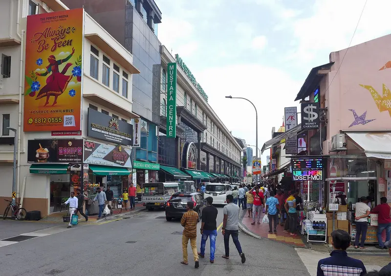
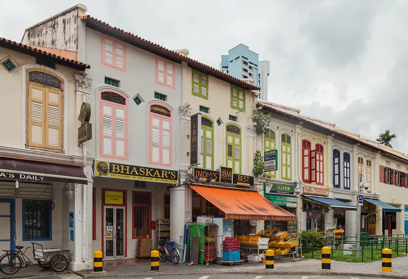
    Little India along Serangoon Road is Singapore's historic Indian quarter. You come for the Hindu temples, the biryani eateries, the Tekka Centre, and the 24-hour Mustafa Centre.

    by Felix Gillen

    1. Home
    2. Destinations
    3. Singapore
    4. Singapore
    5. Little India
    Little India along Serangoon Road is Singapore's historic Indian quarter. You come for the Hindu temples, the biryani eateries, the Tekka Centre, and the 24-hour Mustafa Centre. It began as a cattle trading district: Indian immigrants, many of them cattle farmers, settled here, and in 1915, the Kandang Kerbau Market, named after the cattle trade, was established. The area was only named Little India in the 1980s at the initiative of the Singapore Tourism Board; in 1989, it was heritage listed. Many Singaporeans still call it Tekka today.Between the temples, eat at the Tekka Centre or Bismillah Biryani on Dunlop Street; afterwards, the Indian Heritage Centre is worth a visit. During Deepavali and Thaipusam, the district becomes a festival ground. The Little India MRT station is located on the North East Line and the Downtown Line.

    Sights in Little India

    Discover the most important sights and attractions
    Sri Veeramakaliamman Temple
    Temple

    1Sri Veeramakaliamman Temple

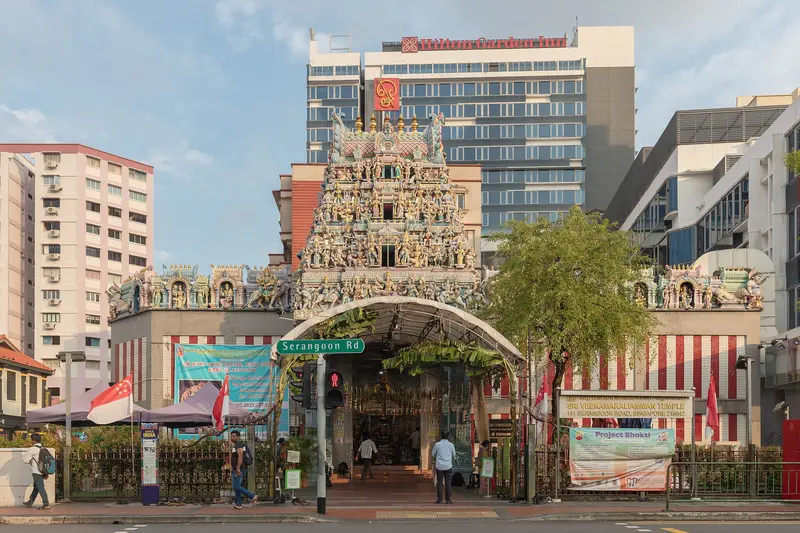
    The temple at 141 Serangoon Road originated as a shrine dedicated to the goddess Kali by Tamil lime workers around 1855; Bengali workers built the temple in 1881. It was Singapore's first temple dedicated to Kali.
    Open in Google Maps
    Indian Heritage Centre
    Museum

    2Indian Heritage Centre

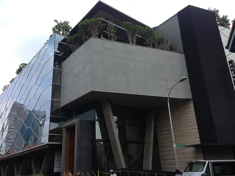
    The museum at 5 Campbell Lane opened on May 7, 2015; its glass facade is inspired by the Indian stepwells, the Baolis. Five permanent exhibitions span the period from the 1st to the 21st century.
    Open in Google Maps
    Mustafa Centre
    Point of Interest

    3Mustafa Centre

    The department store, opened in 1995 on Syed Alwi Road, sells over 300,000 items across eight floors; its roots trace back to a small shop opened by Mustaq Ahmad in 1971 in Campbell Lane. Since September 2024, it has once again been open around the clock.
    Open in Google Maps
    Sri Srinivasa Perumal Temple
    Temple

    4Sri Srinivasa Perumal Temple

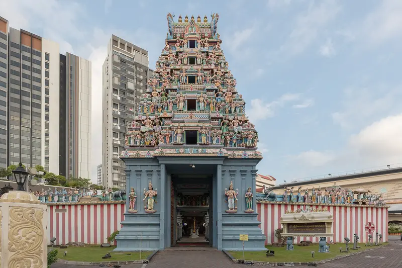
    Built in 1855, the Vishnu Temple received its 20-meter-high, five-tiered Gopuram in 1966 and has been a National Monument since November 10, 1978. Every year, the Thaipusam procession begins here.
    Open in Google Maps

    Restaurants in Little India

    1

    Tekka Centre

    Opened in 1982, the complex on Buffalo Road combines a wet market, textile shops, and on the ground floor, a Hawker Centre featuring Indian, Malay, and Chinese cuisine. It is known, among other things, for Allauddin's Biryani.
    Show on Google Maps
    2

    Bismillah Biryani

    The restaurant at 50 Dunlop Street is one of 17 establishments that received a Bib Gourmand in all ten editions of the Michelin Guide Singapore, most recently in 2026. Its specialty is Biryani, for example with lamb shank, along with Haleem and Mutton Nihari.
    Show on Google Maps
    3

    The Banana Leaf Apolo

    S. Chellappan founded the restaurant in 1974 with a thosai stand in Cuff Road, later moving to 54 Race Course Road. Its most famous dish is the fish head curry, traditionally served on banana leaves.
    Show on Google Maps

    Faith and Festivals

    Temples on Serangoon RoadIn 1855, Tamil labourers from the lime kilns in Kampong Kapor erected a shrine to the goddess Kali, which later became the Sri Veeramakaliamman Temple; its original name, Soonambu Kambam Kovil, means Temple in the Lime Village. Also on Serangoon Road is the Vishnu Temple Sri Srinivasa Perumal, dating from 1855.Thaipusam and DeepavaliFor Thaipusam, a procession begins at the Sri Srinivasa Perumal Temple, leading to the Sri Thendayuthapani Temple on Tank Road; devotees carry Kavadis. Deepavali, the Hindu festival of lights, is the most important festival in the district alongside Thaipusam.

    Access and Routes

    Little India stretches along Serangoon Road; four MRT stations serve the district.Little India (NE7/DT12): Interchange station for the North East Line and Downtown Line, right next to Tekka Centre.Farrer Park (North East Line): nearest station to Mustafa Centre on Syed Alwi Road.Rochor and Jalan Besar (Downtown Line): serve other parts of the district.

    Accommodations in Little India

    Find perfect stay in Little India

    Booking.com* (Affiliate link)
    Search Hotels
    Agoda* (Affiliate link)
    Search Hotels
    Airbnb
    Vacation Rentals

    * Affiliate link: if you book through it, we earn a small commission. The price stays the same for you.

    Plan your trip to Little India

    Save places, build a route and plan your city trip, all in one place.

    1. 1
      Sunrise over alpine peaks and a sea of clouds
      1234

      Round trip

      12 days · 4 stops

      Saved

      Pick a route

      Pick a ready-made one or save places and plan your own.

      Open bookmarks
    2. 2

      Trip to Little India

      Live
      • 1Sri Veeramakaliamman Temple3 days
      • 2Indian Heritage Centre4 days
      • 3Mustafa Centre5 days
      Budget

      Plan your trip

      The planner sorts stops, days and budget. Plan together in real time.

      Start trip planning
    3. 3
      9:41 No signal
      Little India
      Available offline

      Use it on the road

      Download the guide to your phone and use it on site, even offline.

    Nearby

    Kampong Glam

    Kampong Glam

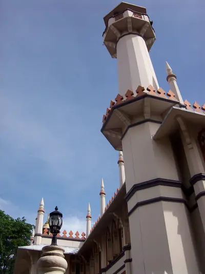
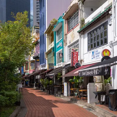
    Kampong Glam is Singapore's historic Malay-Muslim quarter, located north of the Singapore River. You come here for the Sultan Mosque, the fabric shops on Arab Street, the murals in Haji Lane, and the murtabak eateries along North Bridge Road. Following the 1819 treaty between the East India Company, Sultan Hussein Shah of Johor, and Temenggong Abdul Rahman, the Sultan settled here with his entourage. The 1822 town plan allocated the area to the Sultan's court and to Malay, Arab, and Bugis traders; street names like Arab Street, Bussorah Street, and Muscat Street serve as a reminder of this.The golden domes of the Sultan Mosque are the focal point, surrounded by restored shophouses housing cafés and boutiques. The Malay Heritage Centre in the former Sultan's palace reopened in April 2026. Kampong Glam is a few minutes' walk from Bugis MRT station.
    Civic District

    Civic District

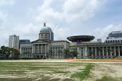
    The Civic District on the north bank of the Singapore River is Singapore's government and museum quarter. You come for the National Gallery, the Asian Civilisations Museum, and the colonial buildings around the Padang, including St Andrew's Cathedral and the Raffles Hotel. The city's history began here: a port settlement existed by the river as early as the 13th and 14th centuries, and in 1819, the British settled at the same spot. The Padang, a sports field fronting the colony's former administrative buildings, was declared the 75th National Monument in 2022.The National Gallery occupies the former Supreme Court and City Hall, while the Asian Civilisations Museum is situated directly by the river. Fort Canning Park, located on the former King's Hill, is green and shady. Key MRT stations are City Hall (North-South and East-West Line), plus Esplanade on the Circle Line.
    Singapore River

    Singapore River

    The Singapore River is the city's historic lifeline. Along its banks today, the three quays, Boat Quay, Clarke Quay and Robertson Quay, brim with restaurants, bars, and clubs. You come here to stroll along the promenades and historic bridges, take a bumboat ride, and dine and drink by the water in the evening.In the 19th century, the river served as Singapore's port: in the 1860s, Boat Quay handled three-quarters of all ship trade, with lighters transporting goods to warehouses upstream. After a ten-year cleanup from 1977 to 1987, trade and pollution disappeared. The warehouses and shophouses were placed under conservation and repurposed starting in 1989. Three colonial-era bridges have been national monuments since 2019.
    Orchard Road

    Orchard Road

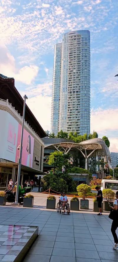
    Orchard Road is Singapore's most famous shopping street, stretching approximately 2.5 kilometers through the city center. You'll come here to shop at malls like ION Orchard and Ngee Ann City, and for the Peranakan terraced houses of Emerald Hill right next door. The street presumably owes its name to the nutmeg, pepper, and fruit plantations that the dirt path led to from the 1830s onwards. After the decline of the plantations, villas and residential buildings emerged, but the major development into a shopping mile only began in the 1960s.Away from the main street, you'll find quieter corners: the terraced houses of Emerald Hill Road, the restored shophouses of Peranakan Place, and at the southeast end, the Istana presidential palace with Istana Park. You can reach the street via several MRT stations, including Orchard, Somerset, and Dhoby Ghaut.
    Chinatown

    Chinatown

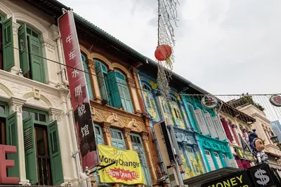
    Chinatown is Singapore's historic Chinese quarter southwest of the Singapore River. You come for its temples of three religions, the restored shophouses, and the Maxwell and Chinatown Complex Hawker Centres. Raffles' 1822 town plan allocated the area to Chinese immigrants; the Chinese name Niu Che Shui, 'Bullock-Cart Water', recalls the water carts that supplied the district in the 19th century. Since 1989, it has been a conservation area; the urban planning authority URA divides it into four districts: Kreta Ayer, Telok Ayer, Tanjong Pagar, and Bukit Pasoh.Standing close together are the Buddha Tooth Relic Temple, the Hindu Sri Mariamman Temple, and the Masjid Jamae Mosque. The district is accessible via Chinatown and Maxwell MRT stations.

    Sources & method

    • Photos: Wikimedia Commons, Google Maps. Each photo carries its credit.
    • Place data such as addresses and ratings comes from Google Maps.
    • The content is based on web research from public, traceable sources. How the content is made · The role of AI