Fernweh: Home
    ExploreTravel GuidesPlan a tripMy tripLast visited
    de|en
    All Places & RegionsAll highlightsAbout FernwehFAQPrivacy PolicyImprint
    ExploreTravel GuidesPlan a tripMy tripLast visited
    • Neighborhoods & highlights
    • Eat & drink
    • Culture
    • Getting around
    • Accommodation
    • Plan trip
    • Nearby
    Sentosa
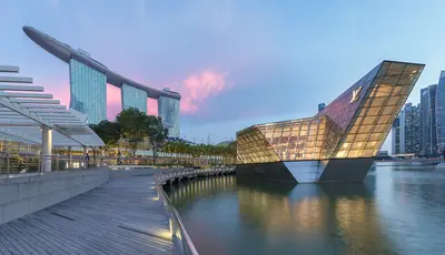
    Banej / Wikimedia Commons / CC BY-SA 4.0

    Singapore

    Sentosa

    City

    Sentosa is Singapore's leisure island, nearly five square kilometers in size and located about half a kilometer off the south coast.

    by Felix Gillen

    1. Home
    2. Destinations
    3. Singapore
    4. Singapore
    5. Sentosa
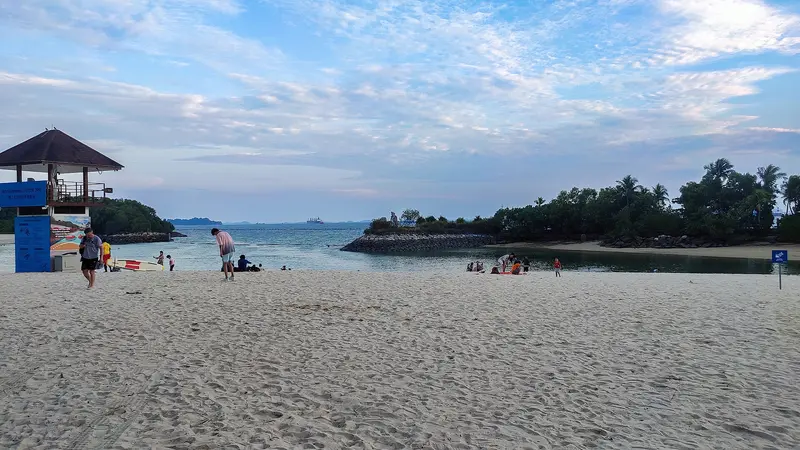
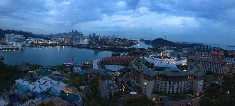
    Sentosa is Singapore's leisure island, nearly five square kilometers in size and located about half a kilometer off the south coast. You come for the beaches in the south, the attractions of Resorts World Sentosa, or the military history of Fort Siloso. Until the early 1970s, it was called Pulau Blakang Mati and served the British as a fortress protecting the harbor entrance; during World War II, the Japanese used Fort Siloso as a prisoner-of-war camp. The new name comes from the Sanskrit word Santosha and means peace and tranquility.In the north lies Resorts World Sentosa with Universal Studios and the Singapore Oceanarium, which opened in 2025; in the south are Siloso, Palawan, and Tanjong beaches. In between, the Sensoryscape walkway connects both sides. You can reach the island on foot via the Sentosa Boardwalk, by monorail on the Sentosa Express from VivoCity, or by cable car from Mount Faber.

    Sights in Sentosa

    Discover the most important sights and attractions

    Singapore Oceanarium
    Aquarium

    1Singapore Oceanarium

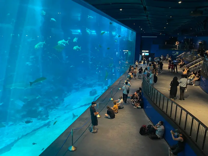
    The mega-aquarium at Resorts World Sentosa opened in July 2025 as an expanded successor to the S.E.A. Aquarium. Three times larger than its predecessor, it showcases habitats from shallow coastal waters to the deep sea across 22 themed zones.
    Open in Google Maps
    Southernmost Point of Continental Asia
    Point of Interest

    2Southernmost Point of Continental Asia

    A suspension bridge leads from Palawan Beach to a small islet with two four-story wooden towers, from which you can gaze at the freighters in the Singapore Strait. The title “Southernmost Point of Continental Asia” on the Sentosa administration’s sign is disputed, as the islet is only connected to Sentosa by a bridge.
    Open in Google Maps
    Fort Siloso
    Museum

    3Fort Siloso

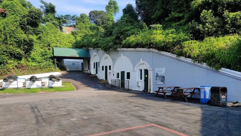
    The British coastal battery from the 1870s was part of "Fortress Singapore" during World War II and later a Japanese prisoner-of-war camp. Since 1974, it has been an open-air military museum with the Surrender Chambers, redesigned in 2017. Admission is free.
    Open in Google Maps
    Universal Studios Singapore
    Theme Park

    4Universal Studios Singapore

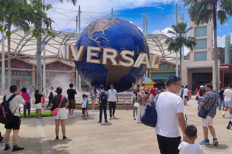
    The theme park in Resorts World Sentosa opened in March 2010 as Southeast Asia's first Universal park. In February 2025, Minion Land, featuring the simulator ride Despicable Me Minion Mayhem, replaced the former Madagascar area.
    Open in Google Maps
    Sentosa Sensoryscape
    Garden

    5Sentosa Sensoryscape

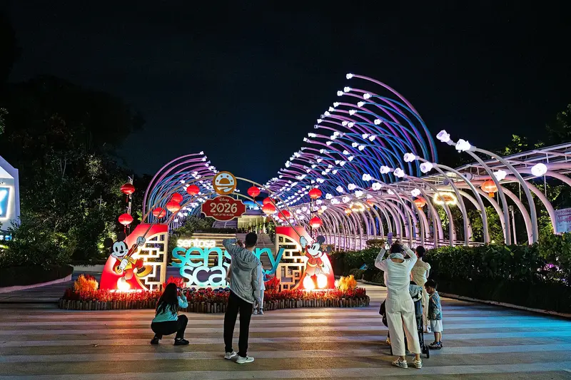
    Opened in March 2024, this path spans approximately 30,000 square meters, linking Resorts World Sentosa in the north with the southern beaches. Six zones engage various senses; access is free, step-free, and available 24/7.
    Open in Google Maps

    Restaurants in Sentosa

    1

    FEAST at WEAVE

    The Food Hall on Level 2 of the WEAVE Enclave at Resorts World Sentosa opened on September 30, 2025, with ten stalls across three zones. Stalls include Grain & Padang and Woksmith, with satay available at a grill station; open daily from 8 AM to 8 PM.
    Show on Google Maps
    2

    Coastes

    The beach restaurant at Siloso Beach Walk 50 is right on Siloso Beach, just a short walk from Sentosa Express' Beach Station. The menu offers breakfast, burgers, pasta, and sharing plates.
    Show on Google Maps
    3

    Tanjong Beach Club

    Opened in 2010, the beach club at Tanjong Beach Walk 120 reopened in early 2025 after a four-month refurbishment and combines a restaurant, bar and pool right on the beach. Since then the menu has featured wood-fired dishes such as a half chicken and barramundi dry-aged for a week.
    Show on Google Maps

    Fortress Island and Leisure Hub

    Military HistoryIn the 19th century, the British built several coastal forts on the island to secure the entrance to New Harbour, today's Keppel Harbour. Fort Siloso was built in the 1870s and, at the beginning of World War II, was one of the twelve batteries of "Fortress Singapore". After the Japanese occupation in 1942, it served as a camp for Australian and British prisoners of war. In 1967, the British handed over the island to the armed forces of independent Singapore, after which its development into a tourist destination began.Resorts World and New AttractionsResorts World Sentosa opened in 2010, and in March of the same year, Universal Studios Singapore, the first Universal park in Southeast Asia, also opened. In 2025, Minion Land and the Singapore Oceanarium, successor to the S.E.A. Aquarium, were added. The Sentosa Sensoryscape walking trail is the first component of the Sentosa-Brani Master Plan.

    Access and Transport on Sentosa

    The starting point is HarbourFront MRT Station (North-East Line and Circle Line) located directly beneath VivoCity and HarbourFront Centre malls.Sentosa Boardwalk: an approximately 700-meter long, elevated pedestrian walkway from VivoCity to Beach Station, free of charge, about 10–15 minutes.Sentosa Express: monorail from VivoCity, Level 3; S$4 including island admission, operating approximately 7 AM to midnight.Singapore Cable Car: Mount Faber Line plus Sentosa Line S$35 for adults, S$25 for children.Bus 123: standard bus fare to the island.On the island: Sentosa buses, Beach Trams, and the Sentosa Express between island stations are free.
    Accommodations in Sentosa

    Find perfect stay in Sentosa

    Booking.com* (Affiliate link)
    Search Hotels
    Agoda* (Affiliate link)
    Search Hotels
    Airbnb
    Vacation Rentals

    * Affiliate link: if you book through it, we earn a small commission. The price stays the same for you.

    Plan your trip to Sentosa

    Save places, build a route and plan your city trip, all in one place.

    1. 1
      Sunrise over alpine peaks and a sea of clouds
      1234

      Round trip

      12 days · 4 stops

      Saved

      Pick a route

      Pick a ready-made one or save places and plan your own.

      Open bookmarks
    2. 2

      Trip to Sentosa

      Live
      • 1Singapore Oceanarium3 days
      • 2Southernmost Point of Continental Asia4 days
      • 3Fort Siloso5 days
      Budget

      Plan your trip

      The planner sorts stops, days and budget. Plan together in real time.

      Start trip planning
    3. 3
      9:41 No signal
      Sentosa
      Available offline

      Use it on the road

      Download the guide to your phone and use it on site, even offline.

    Nearby

    Singapore

    Singapore

    Singapore is both a city and a state: Across 744.3 square kilometers, colonial buildings, temples, skyscrapers, and rainforests are often just a few MRT stations apart. You come for its districts shaped by Chinese, Malay and Indian communities, its Hawker Centres, and its gardens. According to the statistics authority, approximately 6.1 million people lived in the city-state by mid-2025. In 1819, Stamford Raffles established a British trading post here, and on August 9, 1965, Singapore gained independence after separating from Malaysia. Official languages are English, Malay, Mandarin, and Tamil, and this diversity continues to shape the city's districts today.The city center is divided into clearly distinct quarters: the skyscrapers and gardens of Marina Bay, the colonial buildings and museums in the Civic District, the temples and shophouses of Chinatown, and the spice shops of Little India. Beyond these, highlights include the UNESCO-listed Singapore Botanic Gardens, the Bukit Timah rainforest, and the Hawker Centres in residential areas. The MRT reaches almost all these destinations.
    Tiong Bahru

    Tiong Bahru

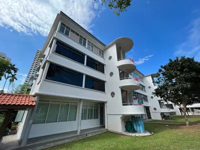
    Tiong Bahru is Singapore's oldest public housing estate, a tranquil neighbourhood of curved 1930s Art Deco blocks southwest of Chinatown. You come for the architecture, the Tiong Bahru Market, home to some of the city's most renowned hawker stalls, and the cafés and bakeries that have set up shop on the ground floors.The name means 'new cemetery', from the Hokkien word 'tiong' for cemetery and the Malay 'bahru' for new. In 1927, the Singapore Improvement Trust (SIT) acquired around 70 acres of land to build the country's first public housing estate here; the first block was ready for occupation in December 1936. Today, 20 pre-war blocks are heritage-listed. Between the blocks, you'll find a Monkey God Temple, murals depicting scenes from old Singapore, and one of the last surviving World War II air raid shelters.
    Chinatown

    Chinatown

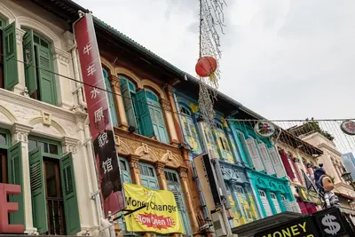
    Chinatown is Singapore's historic Chinese quarter southwest of the Singapore River. You come for its temples of three religions, the restored shophouses, and the Maxwell and Chinatown Complex Hawker Centres. Raffles' 1822 town plan allocated the area to Chinese immigrants; the Chinese name Niu Che Shui, 'Bullock-Cart Water', recalls the water carts that supplied the district in the 19th century. Since 1989, it has been a conservation area; the urban planning authority URA divides it into four districts: Kreta Ayer, Telok Ayer, Tanjong Pagar, and Bukit Pasoh.Standing close together are the Buddha Tooth Relic Temple, the Hindu Sri Mariamman Temple, and the Masjid Jamae Mosque. The district is accessible via Chinatown and Maxwell MRT stations.
    Singapore River

    Singapore River

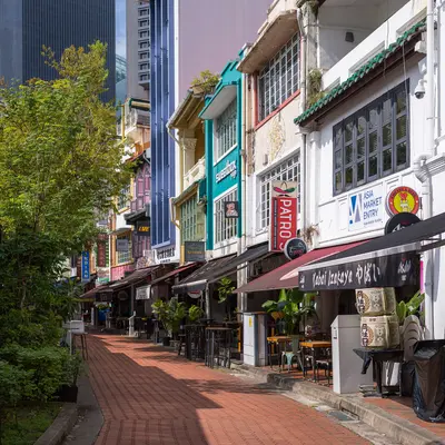
    The Singapore River is the city's historic lifeline. Along its banks today, the three quays, Boat Quay, Clarke Quay and Robertson Quay, brim with restaurants, bars, and clubs. You come here to stroll along the promenades and historic bridges, take a bumboat ride, and dine and drink by the water in the evening.In the 19th century, the river served as Singapore's port: in the 1860s, Boat Quay handled three-quarters of all ship trade, with lighters transporting goods to warehouses upstream. After a ten-year cleanup from 1977 to 1987, trade and pollution disappeared. The warehouses and shophouses were placed under conservation and repurposed starting in 1989. Three colonial-era bridges have been national monuments since 2019.
    Marina Bay

    Marina Bay

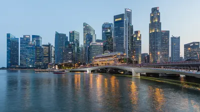
    Marina Bay is Singapore's iconic skyline district: The Marina Bay Sands hotel, the ArtScience Museum, the Supertrees of Gardens by the Bay, and the towers of the financial district frame the bay here. You'll come for the gardens, the view from the SkyPark, and in the evening for the light shows on the water. The approximately 360-hectare area was reclaimed from the sea starting in 1971; the last 38 hectares at Bayfront were added in 1994. Since the construction of the Marina Barrage in 2008, the bay has been a freshwater reservoir.The best way to explore here is to walk along the waterfront promenade around the bay, from the Merlion across the Helix Bridge to the gardens. Five MRT lines serve the district; the most important stations are Bayfront, Marina Bay, Gardens by the Bay, and Esplanade.

    Sources & method

    • Photos: Wikimedia Commons, Google Maps. Each photo carries its credit.
    • Place data such as addresses and ratings comes from Google Maps.
    • The content is based on web research from public, traceable sources. How the content is made · The role of AI