Fernweh: Home
    ExploreTravel GuidesPlan a tripMy tripLast visited
    de|en
    All Places & RegionsAll highlightsAbout FernwehFAQPrivacy PolicyImprint
    ExploreTravel GuidesPlan a tripMy tripLast visited
    • Neighborhoods & highlights
    • Eat & drink
    • Culture
    • Getting around
    • Accommodation
    • Plan trip
    • Nearby
    Pulau Ubin
    DonQue / Wikimedia Commons / CC BY-SA 3.0

    Singapore

    Pulau Ubin

    City

    Pulau Ubin is an island of just over ten square kilometers off Singapore's northeast coast, and one of the country's last kampongs, or traditional villages.

    by Felix Gillen

    1. Home
    2. Destinations
    3. Singapore
    4. Singapore
    5. Pulau Ubin
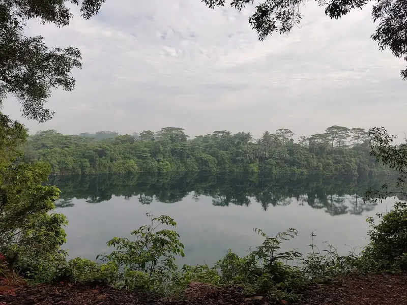
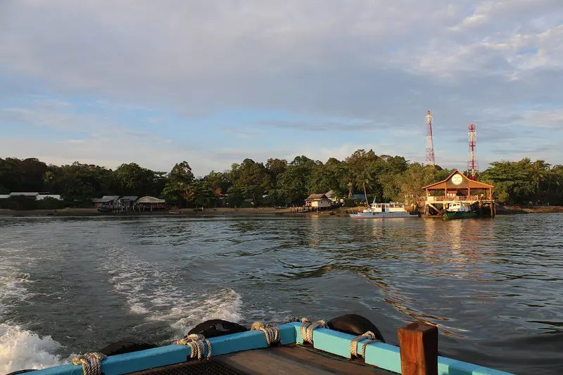
    Pulau Ubin is an island of just over ten square kilometers off Singapore's northeast coast, and one of the country's last kampongs, or traditional villages. You come to cycle a rented bike through forests and past flooded quarries to the mangroves and mudflats of Chek Jawa. Its Malay name means 'Granite Island': From the 19th century onwards, its quarries supplied granite for projects including the Johor Causeway and Horsburgh Lighthouse. In the 1970s, several thousand people still lived here; most moved away after the quarries closed.You can rent bikes in the village at the jetty. From there, paths lead to Chek Jawa in the east and to the mountain bike park at Ketam Quarry. The crossing by bumboat from Changi Point Ferry Terminal takes about ten minutes.

    Sights in Pulau Ubin

    Discover the most important sights and attractions

    Jejawi Tower
    Attraction

    1Jejawi Tower

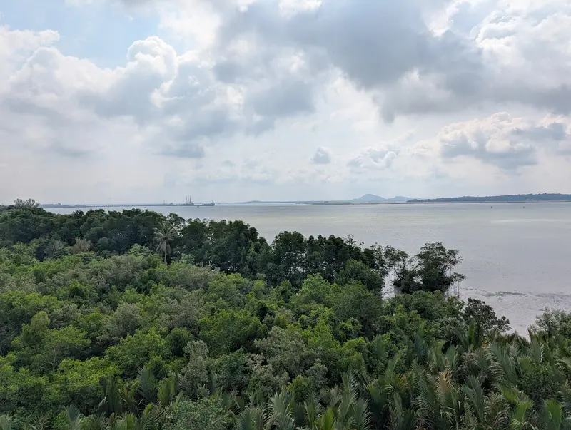
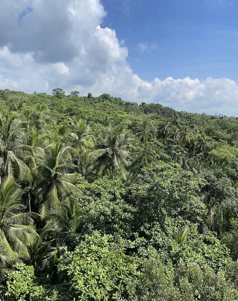
    The 21-meter, seven-story observation tower on Chek Jawa's Mangrove Loop is named after the Malayan banyan (jejawi) growing right beside it and looks out over the forest canopy. After maintenance work that lasted until spring 2026, it has reopened and, according to NParks, is open daily from 7 AM to 7 PM.
    Open in Google Maps
    Ketam Mountain Bike Park
    Park

    2Ketam Mountain Bike Park

    Around the former Ketam Quarry, NParks has created approximately 10 kilometers of mountain bike trails of varying difficulty levels. From the viewpoint, you'll look out over the flooded quarry, though there's hardly any shade.
    Open in Google Maps
    Chek Jawa Wetlands
    Park

    3Chek Jawa Wetlands

    The approximately 100-hectare wetland at the eastern tip combines six habitats, including sandy beach, seagrass lagoon, coral rubble, and mangroves, and is accessible daily from 7 AM to 7 PM. The approximately 1.1-kilometer boardwalk comprises the Coastal Loop and Mangrove Loop; a section of the Coastal Loop will be closed for maintenance, according to NParks, from September 15, 2026, until approximately April 30, 2027.
    Open in Google Maps
    German Girl Shrine
    Place of Worship

    4German Girl Shrine

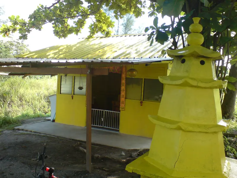
    The small shrine in the Ketam area is said to commemorate a young German woman who died on the island in 1914. Her identity is unknown, but believers revere her here to this day.
    Open in Google Maps

    Restaurants in Pulau Ubin

    1

    Cheong Lian Yuen

    This small eatery a few steps from the Ubin jetty serves seafood and has a small outdoor area. Its specialty is fried garlic prawns, and cashless payment is now also accepted.
    Show on Google Maps
    2

    Season Live Seafood

    The restaurant on the road to the Ubin Volunteer Hub has a terrace overlooking the Ubin Jetty and the main island. According to Time Out, regulars often order the Drunken Prawns.
    Show on Google Maps
    3

    Sin Lam Huat

    The small restaurant Sin Lam Huat is located opposite the Wayang stage in the village and its walls are decorated with photos from Ubin's history. Run by two sisters, it serves seafood as well as traditional Kopi and Teh.
    Show on Google Maps

    Granite, Kampong and Mudflats

    Quarrymen and FishermenChinese settlers operated private quarries from about 1847 onwards; later, the colonial administration extensively mined granite for structures like the Pedra Branca lighthouse, Fort Canning, and the harbor. The workers were predominantly Hakka, later also Hokkien and Teochew; from the 1880s, Malay fishermen joined them. Today, only a few dozen people live permanently on the island. In the Ketam area stands the German Girl Shrine, a small shrine that, according to tradition, commemorates a young German woman who died in 1914.The Rescue of Chek JawaThe approximately 100-hectare wetland at the eastern tip was slated for reclamation from 1992. After its biodiversity became known in late 2000, the government halted the land reclamation in 2001. Since 2007, a visitor center, a boardwalk, and an observation tower have made the area accessible. Six habitats converge here, from sandy beaches and seagrass meadows to mangroves.

    Crossing and Paths on the Island

    The starting point is the Changi Point Ferry Terminal (51 Lorong Bekukong) next to the Changi Village Bus Terminal. There is no public transport on the island; bicycles can be rented at the jetty in the village.Bus: Lines 2, 29, 59 or 109 to Changi Village Bus Terminal.MRT: Tanah Merah (East-West Line) via Bus 2, Tampines (East-West and Downtown Line) via Bus 29, Tampines East (Downtown Line) via Bus 59.Bumboat: approx. 6 AM–7 PM as needed, departure once 12 passengers are on board; around S$4 per person each way, plus S$2 per bicycle, cash on board. Arrange later return trips with the boatmen in advance.Chek Jawa: approx. 3 kilometers from the jetty, about 40 minutes on foot or by bike; best visited at low tide of 0.5 meters or less.

    Accommodations in Pulau Ubin

    Find perfect stay in Pulau Ubin

    Booking.com* (Affiliate link)
    Search Hotels
    Agoda* (Affiliate link)
    Search Hotels
    Airbnb
    Vacation Rentals

    * Affiliate link: if you book through it, we earn a small commission. The price stays the same for you.

    Plan your trip to Pulau Ubin

    Save places, build a route and plan your city trip, all in one place.

    1. 1
      Sunrise over alpine peaks and a sea of clouds
      1234

      Round trip

      12 days · 4 stops

      Saved

      Pick a route

      Pick a ready-made one or save places and plan your own.

      Open bookmarks
    2. 2

      Trip to Pulau Ubin

      Live
      • 1Jejawi Tower3 days
      • 2Ketam Mountain Bike Park4 days
      • 3Chek Jawa Wetlands5 days
      Budget

      Plan your trip

      The planner sorts stops, days and budget. Plan together in real time.

      Start trip planning
    3. 3
      9:41 No signal
      Pulau Ubin
      Available offline

      Use it on the road

      Download the guide to your phone and use it on site, even offline.

    Nearby

    Katong and Joo Chiat

    Katong and Joo Chiat

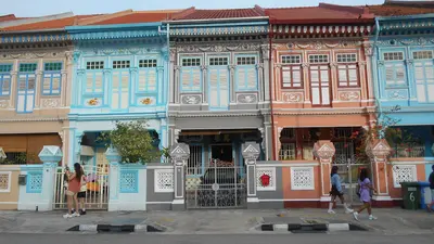
    Katong and Joo Chiat form Singapore's eastern Peranakan district, a residential area of vibrantly decorated shophouses, old coffee houses, and small family businesses. You come here to see the shophouses along Koon Seng Road and eat Peranakan cuisine like Katong Laksa and Nyonya rice dumplings right where it originated.Until the 19th century, this area housed coconut and cotton plantations. Entrepreneur Chew Joo Chiat, dubbed the 'King of Katong,' acquired vast tracts of land, gifted the city the street now bearing his name in 1917, and sold plots to developers. In the early 20th century, wealthy Peranakan families settled, constructing the district's characteristic houses. In 2011, Joo Chiat was designated Singapore's first 'Heritage Town'. Since 2024, you can easily reach the district via the Thomson-East Coast Line.
    Kampong Glam

    Kampong Glam

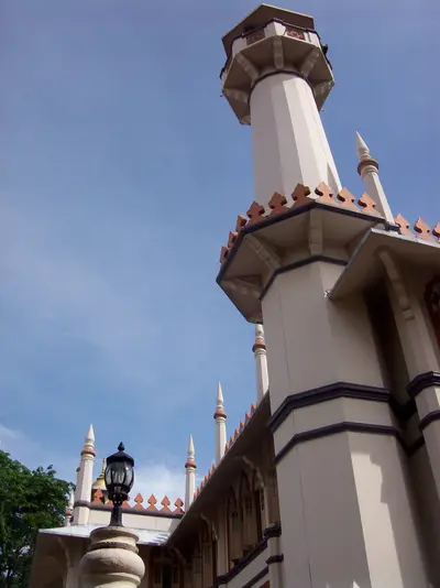
    Kampong Glam is Singapore's historic Malay-Muslim quarter, located north of the Singapore River. You come here for the Sultan Mosque, the fabric shops on Arab Street, the murals in Haji Lane, and the murtabak eateries along North Bridge Road. Following the 1819 treaty between the East India Company, Sultan Hussein Shah of Johor, and Temenggong Abdul Rahman, the Sultan settled here with his entourage. The 1822 town plan allocated the area to the Sultan's court and to Malay, Arab, and Bugis traders; street names like Arab Street, Bussorah Street, and Muscat Street serve as a reminder of this.The golden domes of the Sultan Mosque are the focal point, surrounded by restored shophouses housing cafés and boutiques. The Malay Heritage Centre in the former Sultan's palace reopened in April 2026. Kampong Glam is a few minutes' walk from Bugis MRT station.
    Little India

    Little India

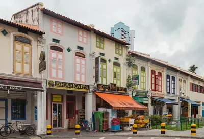
    Little India along Serangoon Road is Singapore's historic Indian quarter. You come for the Hindu temples, the biryani eateries, the Tekka Centre, and the 24-hour Mustafa Centre. It began as a cattle trading district: Indian immigrants, many of them cattle farmers, settled here, and in 1915, the Kandang Kerbau Market, named after the cattle trade, was established. The area was only named Little India in the 1980s at the initiative of the Singapore Tourism Board; in 1989, it was heritage listed. Many Singaporeans still call it Tekka today.Between the temples, eat at the Tekka Centre or Bismillah Biryani on Dunlop Street; afterwards, the Indian Heritage Centre is worth a visit. During Deepavali and Thaipusam, the district becomes a festival ground. The Little India MRT station is located on the North East Line and the Downtown Line.
    Civic District

    Civic District

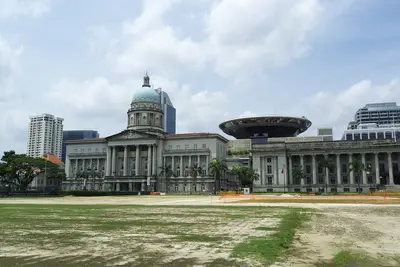
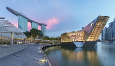
    The Civic District on the north bank of the Singapore River is Singapore's government and museum quarter. You come for the National Gallery, the Asian Civilisations Museum, and the colonial buildings around the Padang, including St Andrew's Cathedral and the Raffles Hotel. The city's history began here: a port settlement existed by the river as early as the 13th and 14th centuries, and in 1819, the British settled at the same spot. The Padang, a sports field fronting the colony's former administrative buildings, was declared the 75th National Monument in 2022.The National Gallery occupies the former Supreme Court and City Hall, while the Asian Civilisations Museum is situated directly by the river. Fort Canning Park, located on the former King's Hill, is green and shady. Key MRT stations are City Hall (North-South and East-West Line), plus Esplanade on the Circle Line.
    Marina Bay

    Marina Bay

    Marina Bay is Singapore's iconic skyline district: The Marina Bay Sands hotel, the ArtScience Museum, the Supertrees of Gardens by the Bay, and the towers of the financial district frame the bay here. You'll come for the gardens, the view from the SkyPark, and in the evening for the light shows on the water. The approximately 360-hectare area was reclaimed from the sea starting in 1971; the last 38 hectares at Bayfront were added in 1994. Since the construction of the Marina Barrage in 2008, the bay has been a freshwater reservoir.The best way to explore here is to walk along the waterfront promenade around the bay, from the Merlion across the Helix Bridge to the gardens. Five MRT lines serve the district; the most important stations are Bayfront, Marina Bay, Gardens by the Bay, and Esplanade.

    Sources & method

    • Photos: Wikimedia Commons, Google Maps. Each photo carries its credit.
    • Place data such as addresses and ratings comes from Google Maps.
    • The content is based on web research from public, traceable sources. How the content is made · The role of AI