Fernweh: Home
ExploreGuideDestinationsMy tripsMy trip
de|en
All Places & RegionsRound tripsNight trains in EuropeAll highlightsAbout FernwehFAQPrivacy PolicyImprint
Download on the App StoreGet it on Google Play
ExploreGuideDestinationsMy tripsMy trip
    • Eat & drink
    • Accommodation
    • Plan trip
    • Nearby
    Fishguard

    Photo by Nick Russill on Unsplash

    Great Britain

    Fishguard

    City

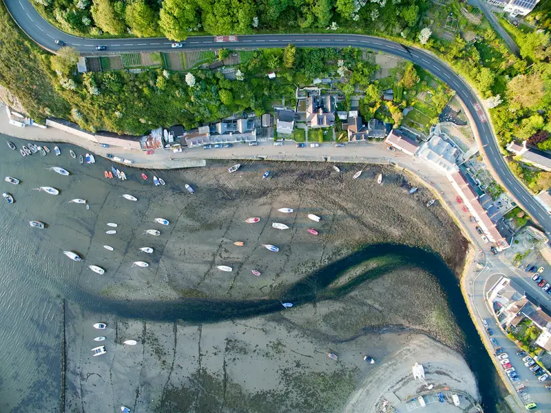
    Fishguard is a coastal town in Pembrokeshire, Southwest Wales, from whose harbour in Goodwick ferries depart for Ireland. Down in the valley lies the old harbour of Lower Town, with its fishing houses.

    by Felix Gillen

    1. Home
    2. Destinations
    3. Great Britain
    4. Wales
    5. Fishguard
    Fishguard is a coastal town in Pembrokeshire, Southwest Wales, from whose harbour in Goodwick ferries depart for Ireland. Down in the valley lies the old harbour of Lower Town, with its fishing houses.In 1797, the last invasion force on British soil landed here, a tapestry in the town tells the story. The Pembrokeshire Coast National Park path runs directly past the town.
    Great Britain travel guideRound trips in Great BritainPlan a trip with Fishguard

    Contents

    • Eat & drink
    • Accommodation
    • Nearby

    Restaurants in Fishguard

    Accommodations in Fishguard

    Find perfect stay in Fishguard

    Booking.com* (Affiliate link)
    Search Hotels
    Agoda* (Affiliate link)
    Search Hotels
    Airbnb
    Vacation Rentals

    * Affiliate link: if you book through it, we earn a small commission. The price stays the same for you.

    Campgrounds in Fishguard

    Find perfect campground in Fishguard

    Search via Google Maps
    Campgrounds nearby (15km)
    Camping.info
    Find Campgrounds
    Park4Night
    RV Parks & Camping

    Plan your trip to Fishguard

    Save places, build a route and plan your city trip, all in one place.

    1. 1
      Sunrise over alpine peaks and a sea of clouds
      1234

      Round trip

      12 days · 4 stops

      Saved

      Pick a route

      Pick a ready-made one or save places and plan your own.

      Open bookmarks
    2. 2

      Chile trip

      Live
      • 1Santiago3 days
      • 2Atacama4 days
      • 3Torres del Paine5 days
      Budget

      Plan your trip

      The planner sorts stops, days and budget. Plan together in real time.

      Start trip planning
    3. 3
      9:41 No signal
      Fishguard
      Available offline

      Photo by Nick Russill on Unsplash

      Use it on the road

      Download the guide to your phone and use it on site, even offline.

    Nearby
    Pembrokeshire Coast National Park

    Pembrokeshire Coast National Park

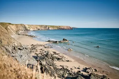
    The Pembrokeshire Coast National Park in southwest Wales is Great Britain's only national park consisting predominantly of coastline. It stretches as a narrow strip for over 400 kilometres of coastline and is in places only a few hundred metres wide.The rock types vary over short distances between Precambrian volcanite, Old Red Sandstone, and limestone, creating bays, rock arches, and sea cliffs in close proximity. The Pembrokeshire Coast Path follows the entire route; whoever walks its full length ascends more metres in elevation than climbing Everest.Off the coast lie Skomer and Skokholm, two islands with one of the world's largest colonies of Manx Shearwaters; in early summer, tens of thousands of puffins also breed here. On land, the density of prehistoric monuments is striking, including the Pentre Ifan Dolmen. The bluestones of Stonehenge demonstrably originate from the Preseli Hills in the north of the park.

    Dominik Gryzbon·Pexels

    Wales

    Wales

    Wales, just over 20,000 square kilometers, is smaller than Hesse, yet it packs in three national parks, five mountain ranges, and a continuously accessible coastline. The country was conquered by England in 1284 and formally incorporated in 1536, but has retained its language: About a fifth of the population speaks Welsh, significantly more in the northwest. All place signs are bilingual, and since 2022 and 2023, two of the three national parks, Eryri and Bannau Brycheiniog, primarily use their Welsh names.Mountains, Coast, CastlesThe north is dominated by Eryri, formerly Snowdonia, with the 1,085-meter-high Yr Wyddfa. To the south are the Bannau Brycheiniog, formerly Brecon Beacons, with their wide sandstone ridges. Between them lies sparsely populated Mid Wales. The Wales Coast Path, established in 2012, covers some 1,400 kilometers along the entire coast; together with the Offa's Dyke Path along the English border, it forms a circular route around the country. Wales also has one of Europe's highest castle densities: Around 600 structures, many from Edward I's campaign.Industry and SongThe valleys south of Merthyr Tydfil supplied a significant portion of the world's coal production in the 19th century. Mining rapidly declined after the 1984/85 strike; the last deep mine in the valleys, Tower Colliery, closed in 2008. Yet its culture endured: The male voice choirs, rugby enthusiasm, and the Eisteddfod festival trace their roots to this period and older bardic traditions. Today, the former industrial facilities of Blaenavon and the slate landscape of North Wales are UNESCO World Heritage Sites.When to VisitWales is among Britain's rainiest regions, with over 3,000 millimeters of rainfall annually on Eryri's western slopes. May to September are the most reliable months. In the mountains, the weather changes quickly, making waterproof clothing a year-round necessity, not a luxury.

    Boys in Bristol Photography·Pexels

    Bannau Brycheiniog (Brecon Beacons)

    Bannau Brycheiniog (Brecon Beacons)

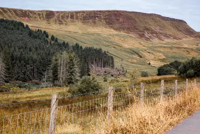
    Bannau Brycheiniog, known as Brecon Beacons until 2023, is located in South Wales and consists of four distinct mountain ranges of Old Red Sandstone. The characteristic shape is uniform throughout: gently sloping southern slopes and abruptly dropping northern faces, carved out by glaciers. The highest point is Pen y Fan at 886 metres.The reversion to the Welsh name was a deliberate decision by the park authorities: Beacon refers to signal fires and thus to fossil fuels, which no longer seemed appropriate given the park's climate goals. Bannau simply means peaks.To the south, Waterfall Country around Ystradfellte is a zone where limestone and sandstone meet; several waterfalls cascade over rock steps, and behind Sgwd yr Eira, one can walk through. Beneath these lie extensive cave systems. The entire park is designated as an International Dark Sky Reserve, where the Milky Way is visible to the naked eye on clear nights.

    Tony Zohari·Pexels

    Cardiff

    Cardiff

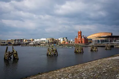
    Cardiff has only been the official capital of Wales since 1955, having been an insignificant coastal town until the 19th century. Coal from the valleys to its north then transformed the city into the world's largest coal port. The Bute family, controlling the docks and mines, was for a time considered Britain's richest family.This wealth is reflected in the opulently designed Cardiff Castle and the Coal Exchange in the Bay, where the first million-pound contract was allegedly signed in 1904. After coal exports ceased, the docks fell into disrepair; since the 1990s, Cardiff Bay has been transformed by a dam into a freshwater basin and revitalized with cultural buildings like the Wales Millennium Centre.The city centre is compact and easily walkable, crisscrossed by covered Victorian shopping arcades. On rugby match days at the Principality Stadium, located right in the city centre, Cardiff becomes a single human tide.

    Balazs Bezeczky·Pexels

    Eryri (Snowdonia) National Park

    Eryri (Snowdonia) National Park

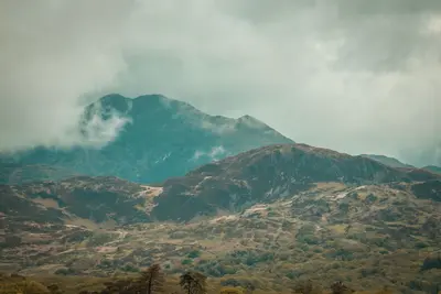
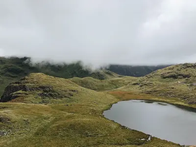
    Eryri, officially Snowdonia until the end of 2022, is Wales' oldest national park, covering 2,130 square kilometres of mountains, lakes, and coastline in the country's northwest. Here stands Yr Wyddfa, Snowdon, Wales' highest mountain at 1,085 metres, surrounded by glacial valleys, old slate quarries, and villages where Welsh is the everyday language.Unlike German national parks, Eryri is a cultural landscape: around 26,000 people live here, over half of whom speak Welsh, and its slopes have been grazed for centuries. Six marked paths lead up Yr Wyddfa, along with a rack railway from Llanberis. The rock is predominantly of Ordovician volcanic origin, shaped by glaciers that left behind characteristic cirques and U-shaped valleys.Slate mining is also a defining feature. The quarries of Blaenau Ffestiniog and Llanberis once roofed half of Europe; the landscape, with its grey spoil heaps, has been on the World Heritage List since 2021. Yr Wyddfa is heavily frequented, while the Carneddau in the north and the Rhinogydd in the south are quieter.

    Lina Kivaka·Pexels

    Your next steps

    Fishguard is in Great Britain. Ways to carry on from here.

    • More in Great Britain

      Highlights, areas, routes and the best time to travel for all of Great Britain.

      Great Britain travel guide
    • Round trips in Great Britain

      Ready-made routes through Great Britain, with stops, nights and a map.

      See the routes

    Sources & method

    • Photos: Unsplash. Each photo carries its credit.
    • The content is based on web research from public, traceable sources. How the content is made · The role of AI