ExploreTravel GuidesPlan a trip
    de|en
    All Places & RegionsAbout FernwehFAQPrivacy PolicyImprint
    ExploreTravel GuidesPlan a trip
    • Neighborhoods & highlights
    • Eat & drink
    • Accommodation
    • Plan trip
    • Nearby
    Sylt

    Germany

    Sylt

    CityBeach

    Sylt is the largest North Frisian and northernmost German island, 38 kilometers long and 12.6 kilometers wide at its broadest point.

    1. Home
    2. Destinations
    3. Germany
    4. North Sea Coast, Islands
    5. Sylt
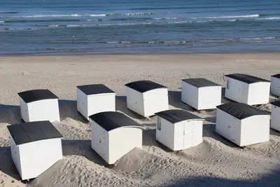
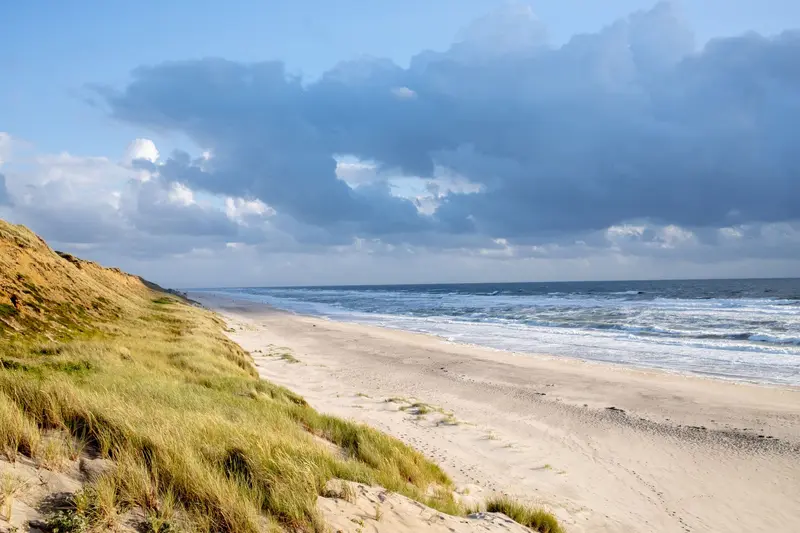
    Sylt is the largest North Frisian and northernmost German island, 38 kilometers long and 12.6 kilometers wide at its broadest point. You reach it via the 11 km Hindenburgdamm (opened 1927) by train or car shuttle from Niebüll, or by ferry from Rømø to List.An almost 40-kilometer-long sandy beach stretches along the west side. Between Wenningstedt and Kampen, the approx. 30-meter-high Red Cliff glows, with the Uwe-Düne, the island's highest point, rising directly behind it. Westerland is the main town, while Keitum boasts old captain's houses.

    Sights in Sylt

    Discover the most important sights and attractions

    The Red Cliff
    Attraction

    1The Red Cliff

    The 30-meter-high cliff between Wenningstedt and Kampen owes its rust-red color to oxidized iron components in the glacial till. The area above the cliff has been a nature reserve since 1979.
    Open in Google Maps
    Uwe Dune
    Attraction

    2Uwe Dune

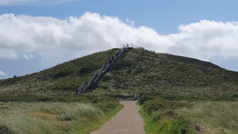
    At 52.5 meters, the Uwe-Düne near Kampen is Sylt's highest point; a wooden staircase with 110 steps leads to the viewing platform. On a clear day, you can see across the island to Rømø and the mainland.
    Open in Google Maps
    St. Severin in Keitum
    Church

    3St. Severin in Keitum

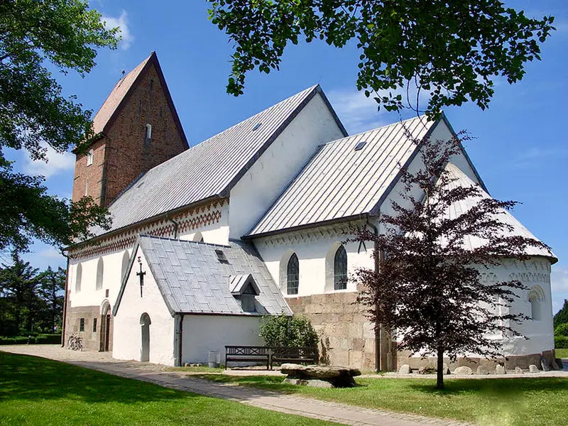
    The Romanesque church of granite, Rhenish tuff and brick stands in Keitum, the island's main town until the late 19th century. Guided church tours are offered.
    Open in Google Maps
    Germany's Northernmost Point
    Attraction

    4Germany's Northernmost Point

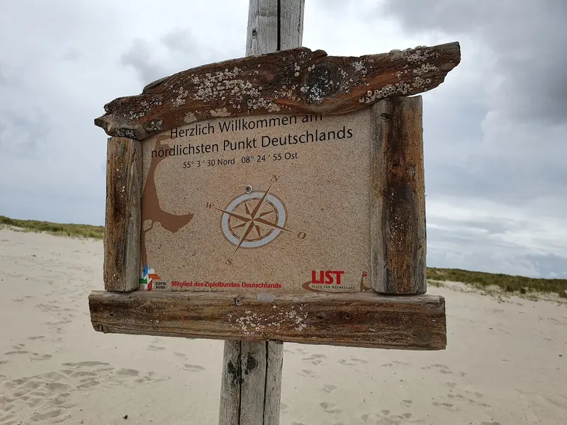
    In the municipality of List, Germany's northernmost municipality, this point marks the northern end of the country.
    Open in Google Maps

    Restaurants in Sylt

    1

    Sea Chest Restaurant

    Upscale, stylish restaurant with a terrace. The menu features fish and meat dishes.
    Show on Google Maps
    2

    Web Christel

    Stylish restaurant with fish, meat and pasta dishes, desserts and wine.
    Show on Google Maps
    3

    Restaurant Tobis Hüs

    Restaurant located on Gaadt Street.
    Show on Google Maps

    Accommodations in Sylt

    Find perfect stay in Sylt

    Booking.com* (Affiliate link)
    Search Hotels
    Agoda* (Affiliate link)
    Search Hotels
    Airbnb
    Vacation Rentals

    * Affiliate link: if you book through it, we earn a small commission. The price stays the same for you.

    Campgrounds in Sylt

    Find perfect campground in Sylt

    Search via Google Maps
    Campgrounds nearby (15km)
    Camping.info
    Find Campgrounds
    Park4Night
    RV Parks & Camping

    Plan your trip to Sylt

    Save places, build a route and plan your city trip, all in one place.

    1. 1
      1234

      Round trip

      12 days · 4 stops

      Saved

      Pick a route

      Pick a ready-made one or save places and plan your own.

      Open bookmarks
    2. 2

      Trip to Sylt

      Live
      • 1The Red Cliff3 days
      • 2Uwe Dune4 days
      • 3St. Severin in Keitum5 days
      Budget

      Plan your trip

      The planner sorts stops, days and budget. Plan together in real time.

      Start trip planning
    3. 3
      9:41 No signal
      Available offline

      Use it on the road

      Download the guide to your phone and use it on site, even offline.

    Nearby

    Rømø

    Rømø

    Rømø is the southernmost Danish island in the Wadden Sea, directly north of Sylt. To the west lies Lakolk's kilometre-wide beach, where cars are permitted, and to the east, the mudflats. In between are dune heath, pine forest, and small villages with thatched captain's houses from the whaling era.
    Vadehavet (Wadden Sea)

    Vadehavet (Wadden Sea)

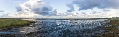
    The Danish Wadden Sea spans Jutland's southwest coast, Esbjerg to the German border. Twice daily, mudflats dry. Seals on sandbanks; millions of migratory birds rest in spring and autumn. This includes the islands Fanø, Mandø, Rømø, and Ribe, Denmark's oldest city.
    Ribe

    Ribe

    Ribe is considered Denmark's oldest town; a Viking Age trading post emerged here in the 8th century. Its old town, with cobblestones, half-timbered houses and cathedral, lies on the Ribe Å river amid the flat marsh. The Wadden Sea begins a few kilometers west.
    St. Peter-Ording

    St. Peter-Ording

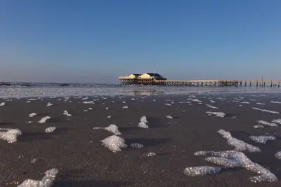
    Sankt Peter-Ording is in southwestern Eiderstedt peninsula, Nordfriesland, a seaside resort since 1877. The town's districts are Böhl, Dorf, Bad, and Ording. It is the terminus of the railway from Husum.In front of the town lies a beach up to 12 kilometers long, becoming 2 kilometers wide at low tide. Landmarks include the 1911-built pile dwellings and the 1095-meter-long pier in the Bad district.
    Wadden Sea National Park

    Wadden Sea National Park

    The Schleswig-Holstein Wadden Sea National Park was established in 1985 and, with 4,410 square kilometers, is by far Germany's largest national park. Since 2009, the Wadden Sea has been a UNESCO World Heritage site; approximately 30 percent of its area periodically falls dry at low tide.In spring and autumn, around ten million migratory birds rest in the Wadden Sea. In 2017, about 13,000 seals were counted. The best way to experience the seabed is on a guided mudflat hike; the main information center is the Multimar Wattforum in Tönning.