Fernweh: Home
    ExploreTravel GuidesPlan a tripMy tripLast visited
    de|en
    All Places & RegionsAll highlightsAbout FernwehFAQPrivacy PolicyImprint
    ExploreTravel GuidesPlan a tripMy tripLast visited
    • Overview
    • Places in the region
    • Eat & drink
    • Food culture
    • Culture
    • Getting around
    • Round trips
    • Nearby
    Vadehavet (Wadden Sea)

    Denmark

    Vadehavet (Wadden Sea)

    Region

    The Danish Wadden Sea spans Jutland's southwest coast, Esbjerg to the German border. Twice daily, mudflats dry.

    by Felix Gillen

    1. Home
    2. Destinations
    3. Denmark
    4. Vadehavet (Wadden Sea)
    The Danish Wadden Sea spans Jutland's southwest coast, Esbjerg to the German border. Twice daily, mudflats dry. Seals on sandbanks; millions of migratory birds rest in spring and autumn. This includes the islands Fanø, Mandø, Rømø, and Ribe, Denmark's oldest city.
    The Danish Wadden Sea has been a National Park since 2010, a UNESCO World Heritage site since 2014. You reach Fanø by ferry from Esbjerg, Rømø via a causeway, and Mandø only at low tide via a tidal path. The Vadehavscentret near Ribe is the best starting point; guided mudflat walks depart from there. In spring and autumn, flocks of starlings form the Black Sun above the marsh. For many destinations, a car or bike is necessary.
    Ribe

    Place 1 of 2

    Ribe

    Ribe is considered Denmark's oldest town; a Viking Age trading post emerged here in the 8th century. Its old town, with cobblestones, half-timbered houses and cathedral, lies on the Ribe Å river amid the flat marsh.

    Discover
    Rømø

    Place 2 of 2

    Rømø

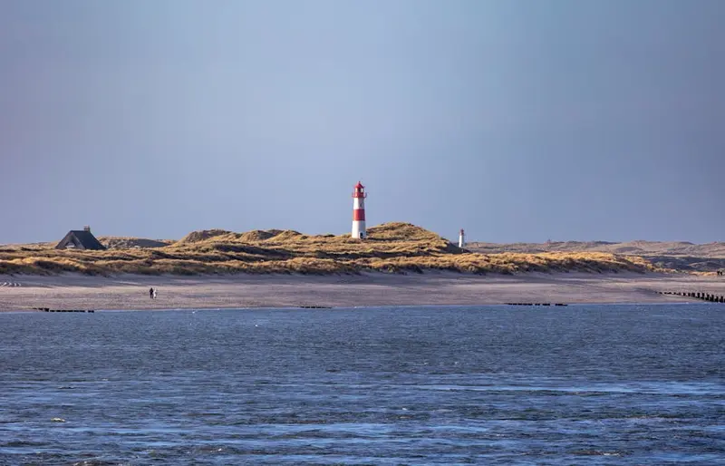
    Rømø is the southernmost Danish island in the Wadden Sea, directly north of Sylt. To the west lies Lakolk's kilometre-wide beach, where cars are permitted, and to the east, the mudflats.

    Discover

    Sights in Vadehavet (Wadden Sea)

    Discover the most important sights and attractions

    Storm Surge Pillar Mandø

    Storm Surge Pillar Mandø

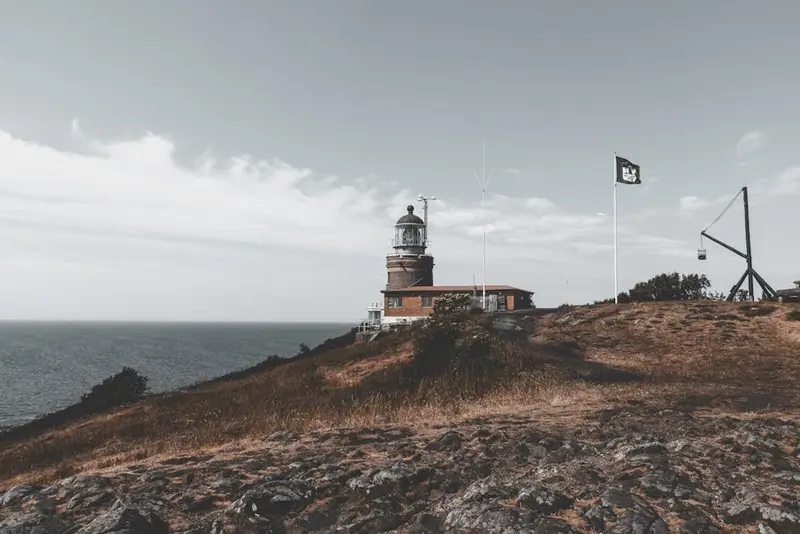
    The storm surge column on Mandø indicates with markings how high the water rose during severe storm surges. Nearby, you have an unobstructed view over the Wadden Sea. You can only reach Mandø at low tide via the tidal causeway, most conveniently by tractor bus. Check tides beforehand.
    Open in Google Maps
    Mandø Mølle

    Mandø Mølle

    The windmill is the landmark of the small island of Mandø and stands freely in the flat marshland. It is visible from afar and a popular photo subject against the vast sky above the mudflats.
    Open in Google Maps
    Mosedalsbjerg

    Mosedalsbjerg

    High dune in the south of Fanø with views over Sønderho, the mill, the beach and the Wadden Sea, often with seals on the sandbanks at low tide. Among them are bunkers of the Atlantic Wall.
    Open in Google Maps
    Vadehavscentret
    Museum

    Vadehavscentret

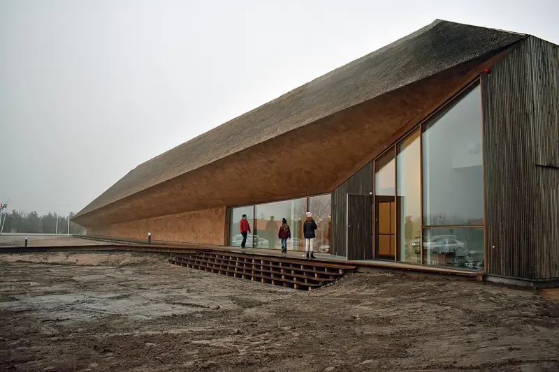
    Ribe National Park Visitor Center interactively explains tides, bird migration & Wadden Sea life; building by Dorte Mandrup. Guided Wadden Sea walks and Black Sun tours start here.
    Open in Google Maps

    Dining & Drinks

    1

    Sønderho Kro

    1722 historic inn in Sønderho, Fanø, with fine regional cuisine. Dine in old rooms or garden; dogs allowed. Overnight stays possible, reserve.
    Show on Google Maps
    2

    Restaurant Aroma – Fanø Bio Beer

    Restaurant with its own eco-brewery in Nordby on Fanø. Open kitchen, pasta, burgers and seafood, along with the house beers.
    Show on Google Maps
    3

    Restaurant/Café Fajancen

    Restaurant and café in Sønderho with rustic decor. Known for Bakskuld, a traditional smoked and grilled dab from Fanø, plus fish menus. Dogs are welcome.
    Show on Google Maps
    4

    Restaurant Parking

    Danish restaurant in a park in Esbjerg, surrounded by trees. Classic dishes with attentive service, good for a stop before or after the ferry to Fanø.
    Show on Google Maps
    5

    KlitHus Mandø

    Restaurant, café, and small hotel on Mandø, one of the island's few places for refreshment. The menu mainly features fish dishes like Stjerneskud, plus vegetarian options. It's usually open from Easter until the end of October, timed with the Mandø Bus schedule.
    Show on Google Maps

    Food and Drink

    The region's cuisine comes from the mudflats and the salt marshes beyond. It is simple, salty, and highly seasonal.

    Wild Oysters

    From autumn to spring, wild oysters grow abundantly in the tidal flats. At low tide, they can be collected; guided safaris start from several locations during the season.

    Marsh mud

    On the salt marshes, sheep graze, their meat gaining a distinct flavour from the salty herbs. Many farms sell directly from the farm, as do lamb sausage and hides.

    Fish from the North Sea ports

    In Esbjerg, Havneby and smaller ports, crabs, plaice, herring are landed. Sold direct from quay or smokehouses, often without fuss.

    Dikes, Storm Surges, and a Human-Made Landscape

    The Wadden Sea is not a naturally evolved cultural landscape in the usual sense, but one that was wrested from the sea. Since the Middle Ages, the inhabitants of the marsh have erected dikes, built up artificial mounds, and reclaimed land. Storm surges repeatedly undid this, and the great flood of 1634 claimed thousands of lives and permanently altered the coastline.In Ribe stands Denmark's oldest city, founded around 700 as a Viking Age trading post. The cathedral, the cobblestone alleys, and the high-water marks on the house walls tell both stories: the prosperity from maritime trade and the constant threat from the water. On Rømø, whaling brought money into the country in the 18th century, while on Fanø it was sailing, evident in the thatched captains' houses.Since 2014, the Danish section of the Wadden Sea has also been part of the UNESCO World Heritage, and it has been a National Park since 2010. Twice a year, hundreds of thousands of starlings gather over the marsh in flocks, forming dense formations just before sunset. The Danes call this spectacle Sort Sol, black sun.

    Exploring Locally

    The region is sprawling and sparsely populated; without a car, getting around can be a hassle. The Esbjerg–Ribe–Tønder railway line connects the main towns on the mainland, with buses taking over from the stations, sometimes with infrequent service.The islands have varying connections. Rømø is reached via an approximately nine-kilometer-long causeway, and Fanø by ferry from Esbjerg in twelve minutes. Mandø has neither a causeway nor a ferry; only a tidal path leads there, which is submerged at high tide.The tide calendar is crucial everywhere. Mudflat hikes only with a guide, tidal paths only within the specified time windows. The cycling network is well-developed and flat; however, the west wind almost always blows, making choosing your direction a matter of planning.

    Round trips through this region

    Jutland West Coast

    Jutland West Coast

    You drive from the island of Rømø on the North Sea coast north via Hvide Sande and Ringkøbing to Thy National Park and further to Skagen. Most stages take less than two hours; only from Thy to Skagen will you be traveling for about two and a half hours.

    13 Days
    5 stops

    Nearby

    Ribe

    Ribe

    Ribe is considered Denmark's oldest town; a Viking Age trading post emerged here in the 8th century. Its old town, with cobblestones, half-timbered houses and cathedral, lies on the Ribe Å river amid the flat marsh. The Wadden Sea begins a few kilometers west.
    Rømø

    Rømø

    Rømø is the southernmost Danish island in the Wadden Sea, directly north of Sylt. To the west lies Lakolk's kilometre-wide beach, where cars are permitted, and to the east, the mudflats. In between are dune heath, pine forest, and small villages with thatched captain's houses from the whaling era.
    Sylt

    Sylt

    Sylt is the largest North Frisian and northernmost German island, 38 kilometers long and 12.6 kilometers wide at its broadest point. You reach it via the 11 km Hindenburgdamm (opened 1927) by train or car shuttle from Niebüll, or by ferry from Rømø to List.An almost 40-kilometer-long sandy beach stretches along the west side. Between Wenningstedt and Kampen, the approx. 30-meter-high Red Cliff glows, with the Uwe-Düne, the island's highest point, rising directly behind it. Westerland is the main town, while Keitum boasts old captain's houses.
    Hvide Sande

    Hvide Sande

    The fishing village sits on the narrow Holmsland Klit spit, where a lock joins Ringkøbing Fjord to the North Sea. Harbour, smokehouses and wide beaches set the scene.
    Ringkøbing

    Ringkøbing

    The small market town on the eastern shore of Ringkøbing Fjord has a well-preserved old town with a market square, cobblestone streets, and old merchant houses. The North Sea is about ten kilometers away.

    Sources & method

    • Photos: Wikimedia Commons, Unsplash. Each photo carries its credit.
    • Place data such as addresses and ratings comes from Google Maps.
    • The content is based on web research from public, traceable sources. How the content is made · The role of AI