Fernweh: Home
    ExploreTravel GuidesPlan a tripMy tripLast visited
    de|en
    All Places & RegionsAll highlightsAbout FernwehFAQPrivacy PolicyImprint
    ExploreTravel GuidesPlan a tripMy tripLast visited
    • Neighborhoods & highlights
    • Eat & drink
    • Food culture
    • Culture
    • Getting around
    • Accommodation
    • Plan trip
    • Nearby
    Rømø

    Denmark

    Rømø

    City

    Rømø is the southernmost Danish island in the Wadden Sea, directly north of Sylt. To the west lies Lakolk's kilometre-wide beach, where cars are permitted, and to the east, the mudflats.

    by Felix Gillen

    1. Home
    2. Destinations
    3. Denmark
    4. Vadehavet (Wadden Sea)
    5. Rømø
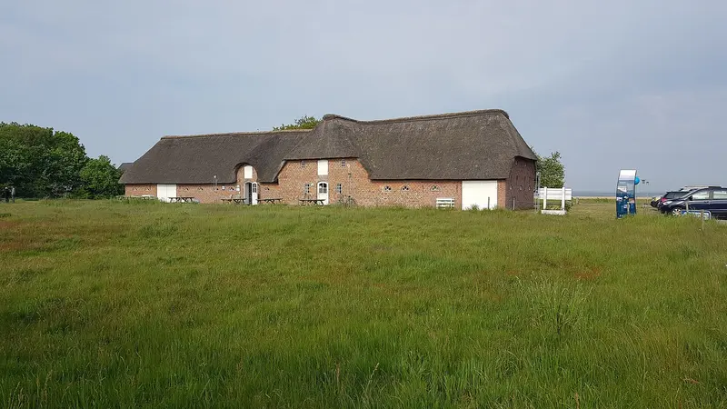
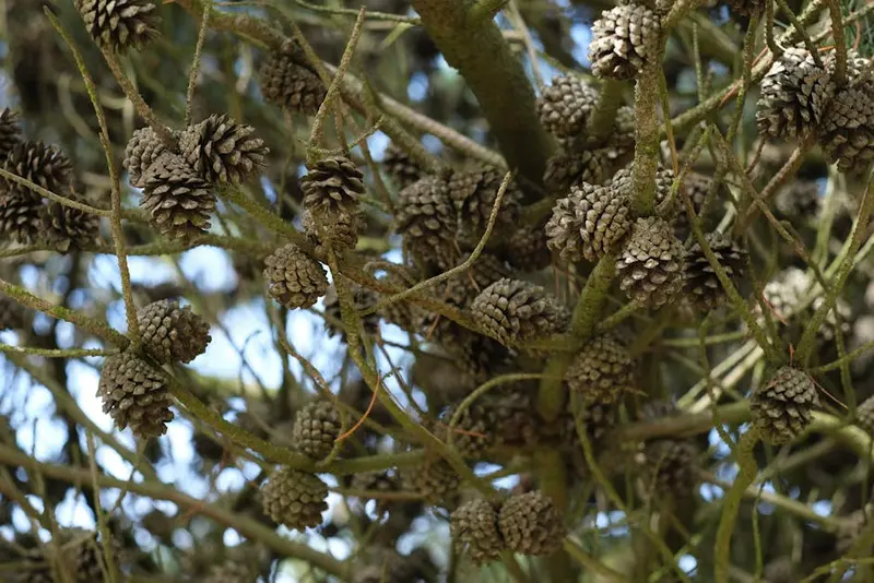
    Rømø is the southernmost Danish island in the Wadden Sea, directly north of Sylt. To the west lies Lakolk's kilometre-wide beach, where cars are permitted, and to the east, the mudflats. In between are dune heath, pine forest, and small villages with thatched captain's houses from the whaling era.

    Sights in Rømø

    Discover the most important sights and attractions

    Lakolk Strand

    1Lakolk Strand

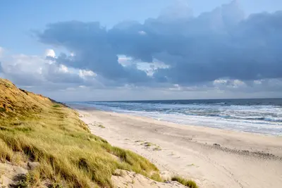
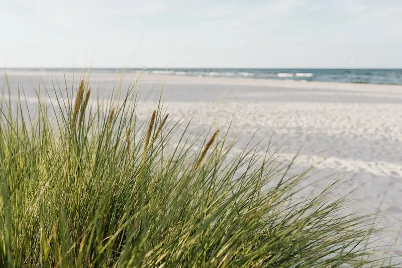
    The West Beach near Lakolk is in places several kilometers wide and so firm that cars are allowed to drive and park on it. Sand yachts and kites make use of the wind, yet the area rarely feels crowded. Keep your car on the firm sand.
    Open in Google Maps
    Naturcenter Tønnisgård

    2Naturcenter Tønnisgård

    The Nature Centre showcases the island's nature and history, with many interactive stations for children. From here, guided mudflat walks, crab catching, and bunker tours begin. Texts are mostly in Danish and German.
    Open in Google Maps
    Rømø Church

    3Rømø Church

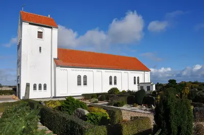
    St. Clement's Church in Kirkeby is dedicated to the patron saint of seafarers. Model ships hang from the ceiling, and on the churchyard wall stand the tombstones of commanders who sailed as whaling captains in the 18th century.
    Open in Google Maps
    Kommandørgården (Museum)

    4Kommandørgården (Museum)

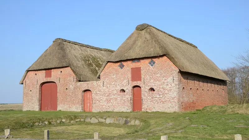
    The thatched Captain's House in Toftum, built in 1748, is part of the National Museum. Dutch wall tiles, painted beams, and the furnishings reveal the prosperous lives of the island's whaling captains. Open only during the season.
    Open in Google Maps
    Havneby Hafen

    5Havneby Hafen

    Fishing and ferry port in the south of the island; from here, the ferry departs for List on Sylt. Around the harbour, fish shops sell smoked fish and fresh catches, and snack stalls offer fish rolls.
    Open in Google Maps

    Restaurants & Cafés

    1

    Otto & Ani's Fish

    Fish shop and restaurant at the harbour in Havneby. Order inside, sit wind-sheltered outside or indoors. Fish and Chips, plaice, pickled herring, and warm smoked fish from their own smokehouse, plus platters for two. In high season, expect waiting times.
    Show on Google Maps
    2

    Havneby Kro

    Traditional inn in Havneby in the south of the island, with Danish cuisine and generous portions. Please check the menu and opening hours on their website beforehand.
    Show on Google Maps
    3

    Café Fru Dax

    Cafe in Lakolk shopping center, a few minutes from the beach. Fish and Chips, sausages, large portions, and ice cream with a fresh waffle. Busy in summer.
    Show on Google Maps
    4

    Café Hattesgaard

    Café in an old, mossy thatched farmhouse with country views. Large selection of cakes, also vegan, and a second-hand shop with curiosities. Prices are high.
    Show on Google Maps

    Food & Drink

    The island lives from the sea and the marsh. Accordingly, almost everything revolves around fish, shellfish, and lamb.

    Fish in Havneby

    At the fishing port in the south of the island, you'll find crabs, smoked fish, and fried plaice right at the quayside. The Sylt Ferry also departs from here.

    Marsh mud

    Sheep graze on the salt marshes, their meat tasting herby and salty. Several island and mainland farms sell direct.

    Wadden Sea Oysters

    From autumn to spring, wild oysters grow in the Wadden Sea and can be collected at low tide. Guided oyster safaris run regularly during the season, after which the finds are immediately prepared.

    Whaling, Commanders and Bone Fences

    Rømø was wealthier in the 18th century than its barren landscape would suggest. The island's men signed on with Dutch and Hamburg whaling fleets, many of them as captains. Money from the Greenland hunt flowed back into home construction, and this brief period of wealth still shapes the local landscape today.The most visible testament is the Kommandørgården in Toftum, a thatched captain's farm from 1748, now furnished as a museum. Dutch wall tiles, painted ceiling beams, and imported furniture show where the prosperity came from. Opposite stands the Toftum Skole from 1784, one of Denmark's oldest preserved schoolhouses, with a single classroom.Near Juvre, a fence made of whale jawbones stands by the roadside, erected in the 18th century from the jaws of hunted Greenland whales. Such fences were common on the Wadden Sea islands, but hardly any others remain. The Church of Sankt Clemens in Kirkeby, named after the patron saint of seafarers, preserves gravestones of the commanders.

    Local discoveries

    Rømø is connected to the mainland by an approximately nine-kilometer causeway, which you can cross by car in a few minutes. To the right and left is the open Wadden Sea; at high tide, water reaches the roadway. The nearest train station is Skærbæk on the Bramming–Tønder line, from there a bus goes to the island.A special feature is the beach of Lakolk: It is firm enough that you can drive and park directly on it. With a width of several kilometers in places, traffic disperses, but you should pay attention to the tides and avoid getting into soft sand.Within the island, distances are short; towns are no more than ten kilometers apart. Cycle paths lead through dunes and pine plantations, though the wind makes direction a crucial factor. From Havneby in the south, the ferry operates to List on Sylt.

    Accommodations in Rømø

    Find perfect stay in Rømø

    Booking.com* (Affiliate link)
    Search Hotels
    Agoda* (Affiliate link)
    Search Hotels
    Airbnb
    Vacation Rentals

    * Affiliate link: if you book through it, we earn a small commission. The price stays the same for you.

    Campgrounds in Rømø

    Find perfect campground in Rømø

    Search via Google Maps
    Campgrounds nearby (15km)
    Camping.info
    Find Campgrounds
    Park4Night
    RV Parks & Camping

    Plan your trip to Rømø

    Save places, build a route and plan your city trip, all in one place.

    1. 1
      Sunrise over alpine peaks and a sea of clouds
      1234

      Round trip

      12 days · 4 stops

      Saved

      Pick a route

      Pick a ready-made one or save places and plan your own.

      Open bookmarks
    2. 2

      Trip to Rømø

      Live
      • 1Lakolk Strand3 days
      • 2Naturcenter Tønnisgård4 days
      • 3Rømø Church5 days
      Budget

      Plan your trip

      The planner sorts stops, days and budget. Plan together in real time.

      Start trip planning
    3. 3
      9:41 No signal
      Rømø
      Available offline

      Use it on the road

      Download the guide to your phone and use it on site, even offline.

    Nearby

    Vadehavet (Wadden Sea)

    Vadehavet (Wadden Sea)

    The Danish Wadden Sea spans Jutland's southwest coast, Esbjerg to the German border. Twice daily, mudflats dry. Seals on sandbanks; millions of migratory birds rest in spring and autumn. This includes the islands Fanø, Mandø, Rømø, and Ribe, Denmark's oldest city.
    Ribe

    Ribe

    Ribe is considered Denmark's oldest town; a Viking Age trading post emerged here in the 8th century. Its old town, with cobblestones, half-timbered houses and cathedral, lies on the Ribe Å river amid the flat marsh. The Wadden Sea begins a few kilometers west.
    Sylt

    Sylt

    Sylt is the largest North Frisian and northernmost German island, 38 kilometers long and 12.6 kilometers wide at its broadest point. You reach it via the 11 km Hindenburgdamm (opened 1927) by train or car shuttle from Niebüll, or by ferry from Rømø to List.An almost 40-kilometer-long sandy beach stretches along the west side. Between Wenningstedt and Kampen, the approx. 30-meter-high Red Cliff glows, with the Uwe-Düne, the island's highest point, rising directly behind it. Westerland is the main town, while Keitum boasts old captain's houses.
    Hvide Sande

    Hvide Sande

    The fishing village sits on the narrow Holmsland Klit spit, where a lock joins Ringkøbing Fjord to the North Sea. Harbour, smokehouses and wide beaches set the scene.
    St. Peter-Ording

    St. Peter-Ording

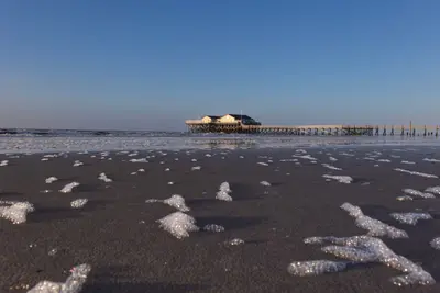
    Sankt Peter-Ording is in southwestern Eiderstedt peninsula, Nordfriesland, a seaside resort since 1877. The town's districts are Böhl, Dorf, Bad, and Ording. It is the terminus of the railway from Husum.In front of the town lies a beach up to 12 kilometers long, becoming 2 kilometers wide at low tide. Landmarks include the 1911-built pile dwellings and the 1095-meter-long pier in the Bad district.

    Sources & method

    • Photos: Wikimedia Commons, Unsplash. Each photo carries its credit.
    • The content is based on web research from public, traceable sources. How the content is made · The role of AI