Fernweh: Home
ExploreGuideDestinationsMy tripsMy trip
de|en
All Places & RegionsRound tripsNight trains in EuropeAll highlightsAbout FernwehFAQPrivacy PolicyImprint
Download on the App StoreGet it on Google Play
ExploreGuideDestinationsMy tripsMy trip
    • Places & highlights
    • Tours
    • Eat & drink
    • Getting around
    • Accommodation
    • Nearby
    Carara National Park

    Reinrosemary / Wikimedia Commons / CC BY-SA 4.0, mod.

    Costa Rica

    Carara National Park

    Point of Interest

    Carara National Park protects a transitional forest where dry forest and rainforest species converge, and is known for its Scarlet Macaws.

    by Felix Gillen

    1. Home
    2. Destinations
    3. Costa Rica
    4. Central Pacific
    5. Carara National Park
    Carara National Park protects a transitional forest where dry forest and rainforest species converge, and is known for its Scarlet Macaws. Just before the park, you'll usually see dozens of American Crocodiles from the bridge over the Tárcoles River. From San José, you're here in just over an hour.
    Costa Rica travel guideRound trips in Costa RicaPlan a trip with Carara National Park

    Contents

    • Places & highlights
    • Tours
    • Eat & drink
    • Getting around
    • Accommodation
    • Nearby

    Sights in Carara National Park

    Discover the most important sights and attractions

    National Park

    1Carara National Park

    In the park's transition forest, dry and rainforest species converge, and it is known for its Scarlet Macaws. The 1.4 km long Sendero Quebrada Bonita leads through primary forest and is mostly wheelchair accessible, while the approximately 4 km long Sendero Laguna Meándrica follows the Río Tárcoles and is ideal for waterfowl.
    Open in Google Maps
    Attraction

    2Bridge over the Tárcoles River

    From the Ruta 34 bridge, just before the park, you often see dozens of American crocodiles on the riverbank, Tico Times reports.
    Open in Google Maps

    Tours & experiences in Carara National Park

    Search tours for Carara National Park on GetYourGuide* (Affiliate link)On GetYourGuide, with reviews from other travellers

    * Affiliate link: if you book through it, we earn a small commission. The price stays the same for you.

    Restaurants in Carara National Park

    Arrival and Opening Hours

    Getting there from San JoséTake Ruta 27 towards Caldera, then onto Ruta 34 towards Tárcoles and Jacó. The park is just after the bridge over the Río Grande de Tárcoles; the drive takes just over an hour.Opening HoursDecember to April daily 7 AM to 4 PM, May to November 8 AM to 4 PM.

    Accommodations in Carara National Park

    Find perfect stay in Carara National Park

    Booking.com* (Affiliate link)
    Search Hotels
    Agoda* (Affiliate link)
    Search Hotels
    Airbnb
    Vacation Rentals

    * Affiliate link: if you book through it, we earn a small commission. The price stays the same for you.

    Nearby

    Jacó

    Jacó

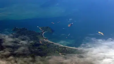
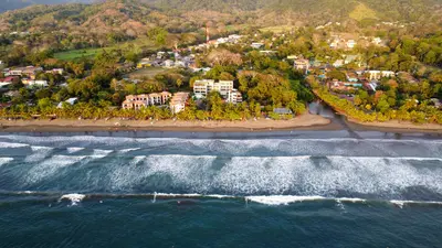
    Jacó is the largest beach resort on the Central Pacific coast, about 100 kilometers and a two-hour drive from San José. You come here for surfing on a four-kilometer-long dark sand beach, for the nightlife, and as a base for Carara National Park with its wild macaws.The town is the main settlement of the Garabito canton in Puntarenas province and had just under 12,000 inhabitants in 2011. Life centers around Avenida Pastor Díaz, the main road running parallel to the beach, where bars, restaurants, surf shops, and tour operators are packed closely together.On the southern stretch of the beach, the waves are gentler and suitable for beginners; in the north, the sea is rougher. Experienced surfers head to Playa Hermosa a few kilometers south, where the waves break hard and fast.Jacó has a reputation as a party town, but in recent years, quieter accommodations and upscale restaurants have also emerged. From here, day trips can be made to Isla Tortuga, Carara, and the Crocodile Bridge on the Río Tárcoles.

    Jake Marsee·Pexels

    Central Pacific

    Central Pacific

    The Central Pacific is the stretch of coast between the Tárcoles River and Quepos, the quickest to reach from San José. You come here for Manuel Antonio National Park with its rainforest right on the beach, the surf beaches around Jacó, and sport fishing off Quepos.Jacó is approximately 100 kilometers from San José, about a two-hour drive via Route 27 and coastal Route 34. You reach Quepos and Manuel Antonio by continuing further south on the same road, a journey of around 157 kilometers from San José.The region is more developed than the Nicoya Peninsula: Paved roads, regular bus services, and a domestic airport near Quepos make it practical even for short stays.

    Mariordo (Mario Roberto Durán Ortiz)·CC BY-SA 4.0

    Montezuma

    Montezuma is a small coastal town on the eastern side of the southern tip of the Nicoya Peninsula, approximately 40 kilometers southwest of the Paquera ferry terminal. You come here for the waterfalls just behind the town, the beaches along the coast, and its proximity to the Cabo Blanco Nature Reserve.For a long time, Montezuma was a remote fishing village. In the 1950s, Swedish Nicolás Wessberg and Danish Karen Mogensen settled here; their efforts led to the establishment of Cabo Blanco in 1963, Costa Rica's first protected area. Later, expats and backpackers arrived, giving the town its somewhat alternative character that persists to this day.The center consists of a few streets with restaurants, accommodations, shops, and tour operators. To the north and south, rocky coves and sandy beaches line the coast, accessible on foot.From Montezuma, boat trips depart for Isla Tortuga in the Gulf of Nicoya, and a water taxi connects the town with Playa Herradura near Jacó on the opposite coast.
    Central Valley

    Central Valley

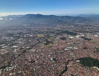
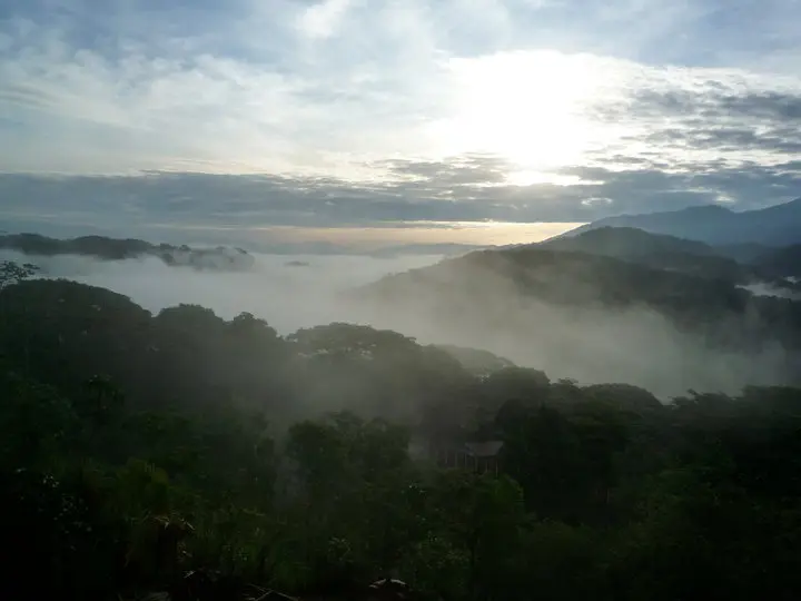
    The Valle Central is the highlands in the heart of Costa Rica, home to the capital San José and the cities of Alajuela, Heredia, and Cartago. Almost every trip begins here, as the international airport is located in Alajuela, and from here you can quickly reach active volcanoes, museums, and colonial churches.The valley lies at an altitude of about 800 to 1,500 meters. To the north, it is bounded by the Cordillera Central with the volcanoes Poás, Barva, Irazú, and Turrialba, and to the south by the Cordillera de Talamanca. Temperatures are mostly between 18 and 30 degrees, significantly milder than on the coasts.Almost three-quarters of the population lives in the Valle Central; consequently, roads, traffic, and services are dense. For travelers, this means: short distances to the Poás and Irazú Volcano Parks, a good day for the museums in San José, and a side trip to Cartago for the Basilica.
    Mariordo (Mario Roberto Durán Ortiz)·CC BY-SA 4.0

    San José

    San José

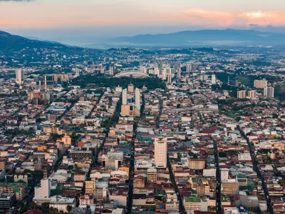
    San José is the capital of Costa Rica and the heart of the Central Valley. Almost all travelers arrive here. One to two days are sufficient to visit the museums of pre-Columbian gold and jade, the National Theater, and the market halls before continuing on to volcanoes and coasts. The city lies at an altitude of approximately 1,030 meters and has been the capital since 1823; Juan Santamaría International Airport is located a good 20 kilometers away in Alajuela.The center around the Plaza de la Cultura is compact and easily explored on foot. Here you'll find the Teatro Nacional, which opened in 1897, and below it the Museo del Oro Precolombino. A few blocks to the east are the Museo del Jade and the Museo Nacional, located in the former Bellavista army barracks. West of the Cathedral, the Mercado Central has occupied an entire block on Avenida Central since 1880, featuring over 200 stalls and simple sodas in narrow passageways.Barrio Amón, north of the center, emerged in the late 19th century as a residential quarter for the coffee oligarchy. Among low wooden houses with verandas and wrought-iron railings stand buildings like the 1930 Mudéjar-style Castillo del Moro or the prefabricated metal building from 1890, which has housed the Alianza Francesa since 1965. Many of the restored villas now accommodate small hotels, cafés, and galleries. Some streets are considered sparsely populated in the evenings, so you're better off taking a taxi at night there.Barrio Escalante in the east is the city's restaurant district. Around Calle 33, eateries have set up shop in old residential buildings: vegan cafés, specialty coffee, craft beer pubs, and cuisines ranging from Mediterranean to Mexican. This area is liveliest in the evenings, and accordingly, most of the city's bars are located in this neighborhood.

    César Badilla Miranda·Unsplash

    Your next steps

    Carara National Park is in Costa Rica. Ways to carry on from here.

    • More in Costa Rica

      Highlights, areas, routes and the best time to travel for all of Costa Rica.

      Costa Rica travel guide
    • Round trips in Costa Rica

      Ready-made routes through Costa Rica, with stops, nights and a map.

      See the routes
    • Plan a trip with Carara National Park

      The Guide asks about season, length and who is coming, and suggests a trip with Carara National Park.

      Plan the trip

    Sources & method

    • Photos: Wikimedia Commons. Each photo carries its credit.
    • Place data such as addresses and ratings comes from Google Maps.
    • The content is based on web research from public, traceable sources. How the content is made · The role of AI