Fernweh: Home
ExploreGuideDestinationsMy tripsMy trip
de|en
All Places & RegionsRound tripsNight trains in EuropeAll highlightsAbout FernwehFAQPrivacy PolicyImprint
Download on the App StoreGet it on Google Play
ExploreGuideDestinationsMy tripsMy trip
    • Neighborhoods & highlights
    • Recommendations
    • Tours
    • Eat & drink
    • Culture
    • Getting around
    • Accommodation
    • Plan trip
    • Round trips
    • Nearby
    Janjanbureh

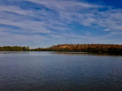
    Wmtribe2015 / Wikimedia Commons / CC BY-SA 4.0, mod.

    Gambia

    Janjanbureh

    City

    Janjanbureh, formerly Georgetown, is located on an island in the River Gambia, approximately 300 kilometers upstream from Banjul, and is the most important starting point in the interior.

    by Felix Gillen

    1. Home
    2. Destinations
    3. Gambia
    4. Gambia River
    5. Janjanbureh
    Janjanbureh, formerly Georgetown, is located on an island in the River Gambia, approximately 300 kilometers upstream from Banjul, and is the most important starting point in the interior. From here you can reach the Wassu Stone Circles, the River Gambia National Park, and take boat trips on the river.In 1823, Captain Alexander Grant founded a settlement here for freed slaves; since 1995, the town and island have carried the name Janjanbureh. On the banks, warehouses and colonial buildings recall the trading era, and a Bantang tree in the town is considered a freedom tree.
    Gambia travel guideSee the round tripPlan a trip with Janjanbureh

    Contents

    • Neighborhoods & highlights
    • Recommendations
    • Tours
    • Eat & drink
    • Culture
    • Getting around
    • Accommodation
    • Round trips
    • Nearby

    Sights in Janjanbureh

    Discover the most important sights and attractions

    Attraction

    1Freedom Tree

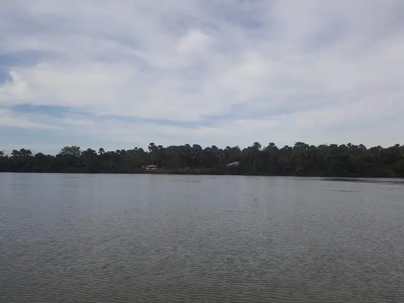
    A Bantang tree in a small park in the town. According to legend, a runaway slave became free as soon as he touched the tree; it commemorates Georgetown's founding as a settlement for freed people.
    Open in Google Maps

    Tours & experiences in Janjanbureh

    Search tours for Janjanbureh on GetYourGuide* (Affiliate link)On GetYourGuide, with reviews from other travellers

    * Affiliate link: if you book through it, we earn a small commission. The price stays the same for you.

    Restaurants in Janjanbureh

    History

    Settlement for Liberated SlavesThe island was formerly known as Lemain Island. In 1823, Captain Alexander Grant acquired it by treaty and founded Georgetown as a settlement for liberated slaves. According to the Director General of the National Centre for Arts and Culture, the island stands for freedom from slavery and played no role in the transatlantic slave trade. The warehouses on the shore, often referred to as slave houses, were built only after 1807.Festival and TraditionIn January 2026, Janjanbureh hosted the ninth Kankurang Festival, organized by the National Centre for Arts and Culture. The Kankurang is a masked figure of the Mandinka tradition.

    Access

    About the South Bank RoadThe paved South Bank Road runs from Brikama via Soma eastward; the turn-off to the island is at Yoro Beri Kunda. A local driving report says you can do the journey from Brikama without stops in about four hours, with many checkpoints along the way.To the IslandFrom the south bank, an approx. 100-meter-long bridge leads to the island; from the north bank at Lamin Koto, a small ferry crosses over.

    Accommodations in Janjanbureh

    Find perfect stay in Janjanbureh

    Booking.com* (Affiliate link)
    Search Hotels
    Agoda* (Affiliate link)
    Search Hotels
    Airbnb
    Vacation Rentals

    * Affiliate link: if you book through it, we earn a small commission. The price stays the same for you.

    Plan your trip to Janjanbureh

    Save places, build a route and plan your city trip, all in one place.

    1. 1
      Sunrise over alpine peaks and a sea of clouds
      1234

      Round trip

      12 days · 4 stops

      Saved

      Pick a route

      Pick a ready-made one or save places and plan your own.

      Open bookmarks
    2. 2

      Trip to Janjanbureh

      Live
      • 1Freedom Tree3 days
      Budget

      Plan your trip

      The planner sorts stops, days and budget. Plan together in real time.

      Start trip planning
    3. 3
      9:41 No signal
      Janjanbureh
      Available offline

      Wmtribe2015 / Wikimedia Commons / CC BY-SA 4.0, mod.

      Use it on the road

      Download the guide to your phone and use it on site, even offline.

    Round trips with Janjanbureh

    Gambia: Atlantic Coast and River in 10 Days

    Gambia: Atlantic Coast and River in 10 Days

    Ten days from the coast near Kololi, across the South Coast to Kartong, then upstream via Kiang West to Janjanbureh, with detours to the Wassu Stone Circles and the River Gambia National Park. You visit Kunta Kinteh Island as a day trip from the coast.

    11 Days
    4 stops

    Ben Tatlow bentatlow·CC0

    Nearby

    Stone Circles of Wassu

    The Wassu Stone Circles on the north bank, located about 20 kilometers from Lamin Koto across from Janjanbureh, are Gambia's most impressive megalithic site. These eleven circles of laterite pillars are part of the UNESCO World Heritage Site Stone Circles of Senegambia and feature the tallest stones of the entire group.The World Heritage Site was inscribed in 2006 and comprises four sites across Gambia and Senegal, totaling 93 circles. Excavations date the Wassu site to between 927 and 1305 AD, and a small museum housed in thatched round buildings explains the finds.
    River Gambia National Park

    River Gambia National Park

    The River Gambia National Park protects a group of forested river islands a few kilometers upstream from Kuntaur, where the Chimpanzee Rehabilitation Project has allowed chimpanzees to live freely since the late 1970s. You can observe the animals exclusively from a boat, often alongside hippos, crocodiles, and waterbirds.The park was founded in 1978 and comprises one large and four small islands, often called Baboon Islands, totaling around 585 hectares. Entering the islands is forbidden.

    Wmtribe2015·CC BY-SA 4.0

    Gambia River

    Gambia River

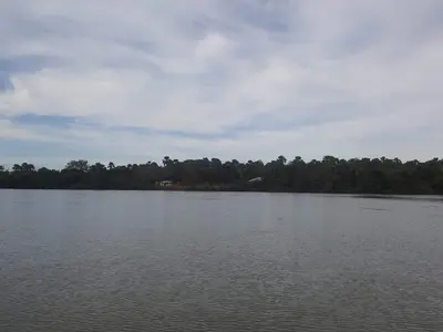
    Upriver, Gambia reveals its rural face: mangroves, rice fields, and villages line the wide river. On the north bank are the World Heritage Site Kunta Kinteh Island and Juffureh; further east, the island town of Janjanbureh, the Stone Circles of Wassu, and the River Gambia National Park with its chimpanzee islands.

    Wmtribe2015·CC BY-SA 4.0

    Kiang West National Park

    The Kiang West National Park, on the south bank of the Gambia River, about 145 kilometers from Banjul, protects Guinea savanna, dry forest, mudflats, and mangrove creeks across 115 square kilometers. It is a peaceful destination for birdwatching; according to Wikipedia, over 300 bird species have been recorded here.The park was established in 1987; its headquarters are located in Dumbuto, about an 18-minute drive from Tendaba Camp on the riverbank, which has existed since the 1970s.
    Kunta Kinteh Island and Juffureh

    Kunta Kinteh Island and Juffureh

    Kunta Kinteh Island, formerly James Island, is a small island in the Gambia River, around 30 kilometres upstream from its mouth, opposite the villages of Albreda and Juffureh on the north bank. With the ruins of its fort and the trading posts on the bank, it has been a UNESCO World Heritage site since 2003 and is one of the most important memorial sites for the transatlantic slave trade in West Africa.From 1651, Courlanders built a fort here; it was later taken over by the British, and in 1779, it was destroyed by the French. Due to erosion, the island has shrunk to a fraction of its former size. In 2011, it was named after Kunta Kinte, the main character from Alex Haley's novel "Roots," whose family is said to originate from Juffureh.

    Kenneth Aitchison·CC BY-SA 4.0

    Your next steps

    Janjanbureh is in Gambia. Ways to carry on from here.

    • More in Gambia

      Highlights, areas, routes and the best time to travel for all of Gambia.

      Gambia travel guide
    • Round trips with Janjanbureh

      One route passes through Janjanbureh, with stops, nights and a map.

      See the round trip

    Sources & method

    • Photos: Wikimedia Commons. Each photo carries its credit.
    • Place data such as addresses and ratings comes from Google Maps.
    • The content is based on web research from public, traceable sources. How the content is made · The role of AI