Fernweh: Home
ExploreGuideDestinationsMy tripsMy trip
de|en
All Places & RegionsRound tripsNight trains in EuropeAll highlightsAbout FernwehFAQPrivacy PolicyImprint
Download on the App StoreGet it on Google Play
ExploreGuideDestinationsMy tripsMy trip
    • Neighborhoods & highlights
    • Recommendations
    • Eat & drink
    • Culture
    • Getting around
    • Accommodation
    • Plan trip
    • Nearby
    Bluefields and Pearl Lagoon

    Ridiculopathy / Wikimedia Commons / CC0

    Nicaragua

    Bluefields and Pearl Lagoon

    CityCultureNature

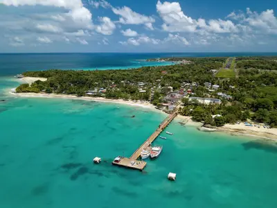
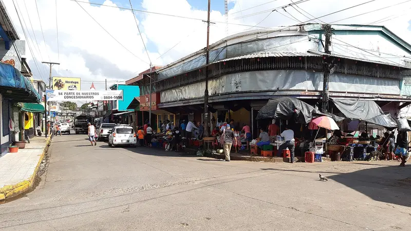
    Bluefields is the capital of the South Caribbean Coast Autonomous Region and lies on a bay at the mouth of the Río Escondido, about 440 km from Managua.

    by Felix Gillen

    1. Home
    2. Destinations
    3. Nicaragua
    4. Caribbean
    5. Bluefields and Pearl Lagoon
    Bluefields is the capital of the South Caribbean Coast Autonomous Region and lies on a bay at the mouth of the Río Escondido, about 440 km from Managua. The town has no beaches, but it is the starting point for boat trips to El Bluff, Pearl Lagoon and the Pearl Cays, and many travellers pass through on their way to the Corn Islands. Pearl Lagoon is a quiet, mostly Creole fishing village on a large, shallow lagoon, surrounded by mangroves and small Miskito and Garífuna villages.For information on crime in the South Caribbean region and on boat safety, see the UK FCDO travel advice.
    Nicaragua travel guideRound trips in NicaraguaPlan a trip with Bluefields and Pearl Lagoon

    Contents

    • Neighborhoods & highlights
    • Recommendations
    • Eat & drink
    • Culture
    • Getting around
    • Accommodation
    • Nearby

    Sights in Bluefields and Pearl Lagoon

    Discover the most important sights and attractions

    1El Bluff

    You reach the harbor town on a headland opposite Bluefields by panga across the bay. North of the town, a long, unassuming beach stretches, with occasional food stalls on weekends. From here, passenger ships also sail to the Corn Islands.
    Open in Google Maps

    2Pearl Lagoon

    You reach the village at the southern tip of a large, shallow lagoon by boat through mangroves. Its predominantly Creole inhabitants live from fishing and tourism; Pearl Lagoon is the usual starting point for boat trips to the Pearl Cays, a chain of small islands with white beaches, as well as to Awas and Orinoco. On the Cays, supplies are scarce, so bring water and food.
    Open in Google Maps

    Restaurants in Bluefields and Pearl Lagoon

    Culture & Events

    Afro-Caribbean CultureBluefields is the center of Nicaragua's Afro-Caribbean culture; many people speak Creole English. Pearl Lagoon is primarily home to Creoles, along with Miskito, Mestizos, and some Garifuna.Palo de Mayo and Garifuna FestivalThroughout May, Bluefields celebrates Palo de Mayo with music, dance, and parades, the highlight being the last week of May. In Orinoco, the southernmost Garifuna settlement, the Garifuna Festival from November 17 to 19 is characterized by drumming and dancing.

    Getting there and around

    Getting thereLa Costeña flies daily from Managua to Bluefields; the flight takes about 45 minutes.A bus runs once a day from Mercado Mayoreo in Managua to Bluefields and takes about 7 to 8 hours.By boatPangas to Pearl Lagoon leave Bluefields harbour in the morning and take about 1.5 to 2 hours; they leave when full. Ask about departures the day before, and expect far fewer boats on Sundays.From Pearl Lagoon, Orinoco, Awas and the Pearl Cays can only be reached by boat.For information on boat safety, including between El Bluff and the Corn Islands, see the UK FCDO travel advice.

    Accommodations in Bluefields and Pearl Lagoon

    Find perfect stay in Bluefields and Pearl Lagoon

    Booking.com* (Affiliate link)
    Search Hotels
    Agoda* (Affiliate link)
    Search Hotels
    Airbnb
    Vacation Rentals

    * Affiliate link: if you book through it, we earn a small commission. The price stays the same for you.

    Plan your trip to Bluefields and Pearl Lagoon

    Save places, build a route and plan your city trip, all in one place.

    1. 1
      Sunrise over alpine peaks and a sea of clouds
      1234

      Round trip

      12 days · 4 stops

      Saved

      Pick a route

      Pick a ready-made one or save places and plan your own.

      Open bookmarks
    2. 2

      Trip to Bluefields and Pearl Lagoon

      Live
      • 1El Bluff3 days
      • 2Pearl Lagoon4 days
      Budget

      Plan your trip

      The planner sorts stops, days and budget. Plan together in real time.

      Start trip planning
    3. 3
      9:41 No signal
      Bluefields and Pearl Lagoon
      Available offline

      Ridiculopathy / Wikimedia Commons / CC0

      Use it on the road

      Download the guide to your phone and use it on site, even offline.

    Nearby

    Caribbean

    Caribbean

    The Caribbean side is rainy, sparsely populated and culturally distinct: many people speak English Creole, alongside Indigenous languages such as Miskito. For travellers the main draw is the Corn Islands, about 70 km offshore, which you reach from Managua with La Costeña in a little over an hour. For information on boats and safety in the region, see the UK FCDO travel advice.

    INTUR Corn Island·CC BY-SA 4.0

    Corn Islands

    Corn Islands

    The Corn Islands are located about 70 km off the Caribbean coast: Great Corn (Big Corn, approx. 10 km²) and the smaller, car-free Little Corn. Travelers come for white sandy beaches, reefs for snorkeling and diving, and the English-speaking Creole culture. The flight time from Managua is just over an hour.

    Roberto Zuniga·Pexels

    El Castillo

    El Castillo

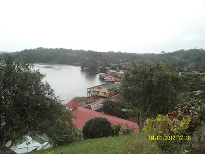
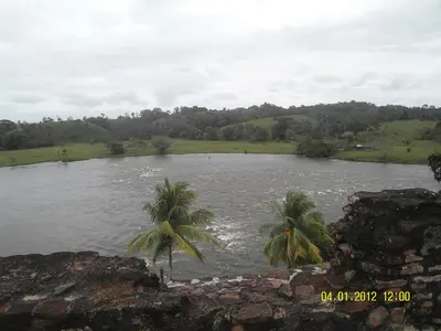
    The river village of El Castillo, on the Río San Juan in southeastern Nicaragua, near the border with Costa Rica, is overlooked by the Spanish fortress Inmaculada Concepción, built from 1673 to 1675 against pirates. Travelers come for the boat trip on the river, the fortress, and the rainforest; the village is only accessible by boat. It is a starting point for tours into the Indio Maíz rainforest reserve.

    Hobbitschuster·CC BY-SA 4.0

    Río San Juan

    Río San Juan

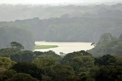
    The Río San Juan flows from Lake Nicaragua to the Caribbean and for long stretches forms the border with Costa Rica. The starting point is San Carlos on the south-eastern shore of the lake, from where boats run to the Spanish fortress of El Castillo and to the Solentiname archipelago with its well-known school of painters. The area is remote and has hardly any roads, so allow plenty of time and cash. For safety information on Río San Juan department, see the UK FCDO travel advice.

    Hobbitschuster·CC BY-SA 4.0

    Tortuguero

    Tortuguero

    Tortuguero is a national park and a small village on Costa Rica's northern Caribbean coast, accessible only by boat or small plane. You come here for boat tours through a network of rainforest canals and lagoons, and for the sea turtles that lay their eggs on the beaches.The national park was founded in 1975 and covers approximately 312 square kilometers. On its beaches, Green Sea Turtles, Leatherback Sea Turtles, Hawksbill Sea Turtles, and Loggerhead Sea Turtles nest. The Green Sea Turtle is the most common and arrives from July to October, peaking in September and October; Leatherback Turtles nest less frequently and from March to May.The village, with around 1,200 inhabitants, is located on a narrow strip of land between the Caribbean and the canal. A car-free path connects the boat dock with the ranger station at the south end of the village. At the north end, the Sea Turtle Conservancy, which began its research in Tortuguero in 1959, operates a small visitor center with a museum.The park is best experienced via its waterways. Guided canoe or boat tours show you monkeys, sloths, birds, and caimans, which you often miss on your own; you can also rent kayaks yourself. On land, there are only a few, often muddy paths. Admission for foreign visitors costs 15 US dollars and is purchased online from SINAC; the ticket is valid for land and water trails.Turtle observation on the beach is only permitted at night with a certified guide. Cameras and white light are prohibited, and dark clothing is expected. Not far from the village rises the 119-meter-high Cerro Tortuguero, an old volcanic cone with panoramic views over canals and coastline.

    Frank Eiffert·Unsplash

    Your next steps

    Bluefields and Pearl Lagoon is in Nicaragua. Ways to carry on from here.

    • More in Nicaragua

      Highlights, areas, routes and the best time to travel for all of Nicaragua.

      Nicaragua travel guide
    • Round trips in Nicaragua

      Ready-made routes through Nicaragua, with stops, nights and a map.

      See the routes

    Sources & method

    • Photos: Wikimedia Commons. Each photo carries its credit.
    • Place data such as addresses and ratings comes from Google Maps.
    • The content is based on web research from public, traceable sources. How the content is made · The role of AI