Fernweh: Home
ExploreGuideDestinationsMy tripsMy trip
de|en
All Places & RegionsRound tripsNight trains in EuropeAll highlightsAbout FernwehFAQPrivacy PolicyImprint
Download on the App StoreGet it on Google Play
ExploreGuideDestinationsMy tripsMy trip
    • Neighborhoods & highlights
    • Recommendations
    • Tours
    • Eat & drink
    • Culture
    • Getting around
    • Accommodation
    • Plan trip
    • Nearby
    El Castillo

    Hobbitschuster / Wikimedia Commons / CC BY-SA 4.0, mod.

    Nicaragua

    El Castillo

    CityCultureNature

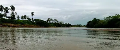
    The river village of El Castillo, on the Río San Juan in southeastern Nicaragua, near the border with Costa Rica, is overlooked by the Spanish fortress Inmaculada Concepción, built from 1673 to 1675 against pirates.

    by Felix Gillen

    1. Home
    2. Destinations
    3. Nicaragua
    4. Río San Juan
    5. El Castillo
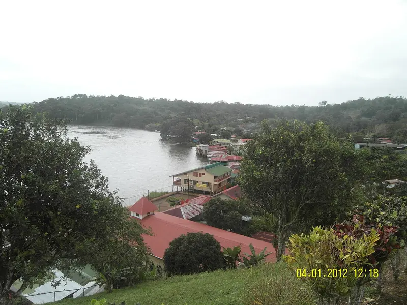
    The river village of El Castillo, on the Río San Juan in southeastern Nicaragua, near the border with Costa Rica, is overlooked by the Spanish fortress Inmaculada Concepción, built from 1673 to 1675 against pirates. Travelers come for the boat trip on the river, the fortress, and the rainforest; the village is only accessible by boat. It is a starting point for tours into the Indio Maíz rainforest reserve.
    Nicaragua travel guideRound trips in NicaraguaPlan a trip with El Castillo

    Contents

    • Neighborhoods & highlights
    • Recommendations
    • Tours
    • Eat & drink
    • Culture
    • Getting around
    • Accommodation
    • Nearby

    Sights in El Castillo

    Discover the most important sights and attractions

    Attraction

    1Fortress of the Immaculate Conception

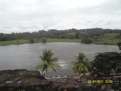
    The Spanish fortress above the rapids of the Río San Juan was built from 1673 to 1675 to block pirates' access from the Caribbean Sea to Lake Nicaragua and Granada. 1762, young Rafaela Herrera helped repel a British attack. 1780, British troops under John Polson and the young Horatio Nelson captured the fortress and held it until early 1781. Today, it houses a museum with a Spanish-language exhibition; a guided tour is included with admission. Since 1995, the fortress has been on the UNESCO World Heritage Tentative List.
    Open in Google Maps
    Raudal El Diablo

    Hobbitschuster / Wikimedia Commons / CC BY-SA 4.0, mod.

    2Raudal El Diablo

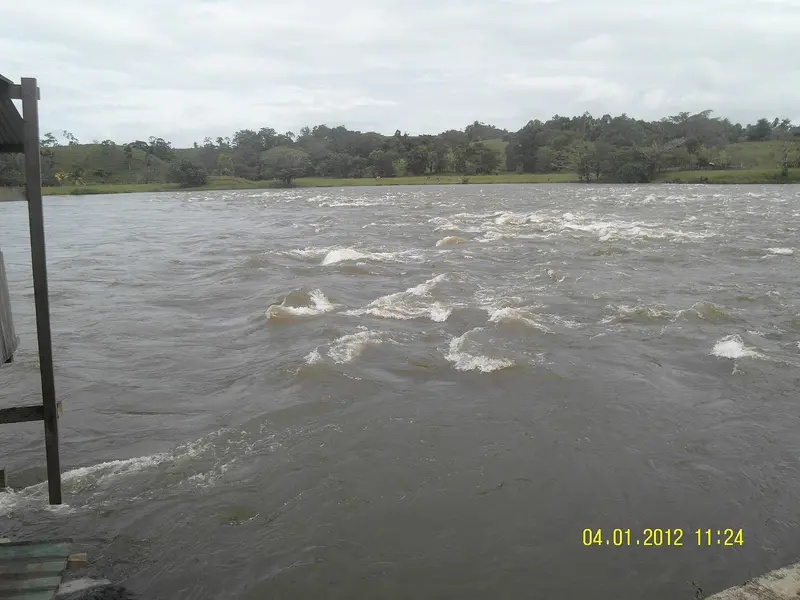
    The village lies directly on these rapids of the Río San Juan, formerly called Raudal de Santa Cruz. This made it a strategic point for the Spanish fortress, from whose walls you can now look out on the river and rapids. In the car-free village of around 1,500 residents, the roaring is audible almost everywhere.
    Open in Google Maps
    Park

    3Refugio Bartola and Reserva Biológica Indio Maíz

    Where the Río Bartola flows into the Río San Juan, downstream from El Castillo, lie a private protected area with a simple lodge and, opposite, the Ranger Station of the Indio Maíz Reserve, which Lonely Planet calls the country's second-largest contiguous primary forest area. An approximately 3 km long path leads into the rainforest; you can explore the Río Bartola by kayak. You may only enter the reserve with a local guide; the paths are often deeply muddy; guides usually provide rubber boots.
    Open in Google Maps

    Tours & experiences in El Castillo

    Search tours for El Castillo on GetYourGuide* (Affiliate link)On GetYourGuide, with reviews from other travellers

    * Affiliate link: if you book through it, we earn a small commission. The price stays the same for you.

    Restaurants in El Castillo

    1

    Comedor Vanessa

    Simple riverside eatery overlooking rapids below the fortress. According to Lonely Planet, it serves typical Nicaraguan dishes with fish, chicken, beef, and pork.
    Show on Google Maps

    The Story

    Fortress on the River RouteDuring the colonial era, the Río San Juan connected Lake Nicaragua with the Caribbean, thus serving as the gateway to Granada. To ward off pirates and British attacks, the Spanish built the Inmaculada Concepción fortress between 1673 and 1675 at a site featuring rapids. Its most famous episodes include the defense by Rafaela Herrera in 1762 and the attack led by Horatio Nelson in 1780.

    Getting there and practical tips

    Getting thereBuses from Mercado Mayoreo in Managua take about six hours to San Carlos. Whether there are scheduled flights to San Carlos in 2026 is unclear: La Costeña does not currently list the route.From San Carlos, slow and faster boats run several times a day to El Castillo; tickets are sold at the municipal pier. For the early-morning boat, buy your ticket the day before.On siteThe Indio Maíz rainforest reserve may only be entered with a local guide; trails are often muddy, so sturdy shoes and long trousers are needed. Do not swim because of bull sharks in the river.Schedules change often, check the day before. Bring cash. For the region, see the FCDO travel advice.

    Accommodations in El Castillo

    Find perfect stay in El Castillo

    Booking.com* (Affiliate link)
    Search Hotels
    Agoda* (Affiliate link)
    Search Hotels
    Airbnb
    Vacation Rentals

    * Affiliate link: if you book through it, we earn a small commission. The price stays the same for you.

    Plan your trip to El Castillo

    Save places, build a route and plan your city trip, all in one place.

    1. 1
      Sunrise over alpine peaks and a sea of clouds
      1234

      Round trip

      12 days · 4 stops

      Saved

      Pick a route

      Pick a ready-made one or save places and plan your own.

      Open bookmarks
    2. 2

      Trip to El Castillo

      Live
      • 1Fortress of the Immaculate Conception3 days
      • 2Raudal El Diablo4 days
      • 3Refugio Bartola and Reserva Biológica Indio Maíz5 days
      Budget

      Plan your trip

      The planner sorts stops, days and budget. Plan together in real time.

      Start trip planning
    3. 3
      9:41 No signal
      El Castillo
      Available offline

      Hobbitschuster / Wikimedia Commons / CC BY-SA 4.0, mod.

      Use it on the road

      Download the guide to your phone and use it on site, even offline.

    Nearby

    Río San Juan

    Río San Juan

    The Río San Juan flows from Lake Nicaragua to the Caribbean and for long stretches forms the border with Costa Rica. The starting point is San Carlos on the south-eastern shore of the lake, from where boats run to the Spanish fortress of El Castillo and to the Solentiname archipelago with its well-known school of painters. The area is remote and has hardly any roads, so allow plenty of time and cash. For safety information on Río San Juan department, see the UK FCDO travel advice.

    Hobbitschuster·CC BY-SA 4.0

    La Fortuna

    La Fortuna

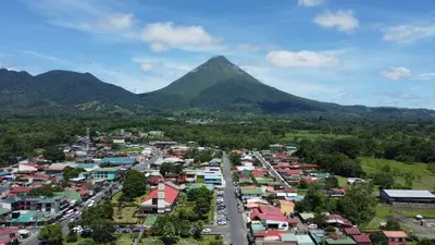
    La Fortuna is the main town at the foot of Arenal Volcano in the Arenal and Monteverde region, about three to three-and-a-half hours' drive northwest of San José. You come here because the Arenal Volcano National Park, the Río Fortuna waterfall, and the surrounding hot springs are all easily accessible from the town.The town was founded in the mid-1930s by settlers from Ciudad Quesada, Grecia, and Alajuela, and was originally called El Burío. It owes its current name to the fertile soil, not, as is often recounted, to the 1968 eruption which hit the villages west of the volcano and spared La Fortuna.The town center spans just a few streets. Most accommodations, restaurants, and tour operators are located along the main road and around Parque Central with its church, behind which the cone of Arenal rises on clear days.The range of activities is wide: horseback riding, rafting, canyoning, ziplines, and hanging bridges are all available, as are the warm springs, which emerge at around 30 to 50 degrees Celsius, including along the Río Tabacón. Plan at least two full days, as the peak region is often shrouded in clouds.

    Pável Tuc·Pexels

    Arenal Volcano National Park

    Arenal Volcano National Park

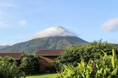
    Arenal Volcano National Park protects the roughly 1,630-meter-high cone of Arenal and its forested flanks in the Arenal and Monteverde region, about 30 minutes drive west of La Fortuna. You come here to hike across solidified lava fields and see the volcano up close.Arenal erupted unexpectedly on July 29, 1968, burying the villages of Tabacón, Pueblo Nuevo, and San Luís and claiming dozens of lives. It remained continuously active until 2010, and has been dormant since. The park was established in 1991 and covers approximately 121 square kilometers.Visitors can access two sectors. In the Volcán sector, near the visitor center, short, mostly flat trails like Las Coladas (approx. 2 km) lead over lava flows from the 1992 eruption, while El Ceibo (approx. 3 km) goes through secondary forest. The Península sector is a few minutes' drive away on Lake Arenal and offers views of the lake and volcano via the Los Miradores trail and an observation tower.The summit itself is closed to visitors; the national protected area authority SINAC explicitly warns against illegal summit hikes. Admission is charged at the sectors, with current prices and opening hours published by SINAC. Come as early as possible, as the summit often becomes cloud-covered as the day progresses.

    Bernard Gagnon·CC0

    Río Celeste

    Río Celeste

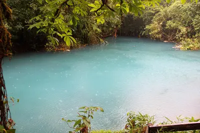
    The Río Celeste is a glowing light blue river in the Tenorio Volcano National Park in Guanacaste, near the town of Bijagua de Upala in the north of the country. You come here for its turquoise waterfall and the spot where two clear rivers mix and the water suddenly turns blue.The color appears when the volcanically influenced Río Buenavista meets the acidic Quebrada Agria: Tiny aluminum silicate particles clump together and scatter sunlight. After heavy rains, the water is murkier and less blue.The Misterios del Tenorio hiking trail starts at El Pilón Station and leads to a viewpoint, Laguna Azul, the Borbollones where gas bubbles from the riverbed, and the Teñideros where the rivers meet. The stairs to the waterfall were only partially open from mid-2025 after damage; check before visiting which sections are open.Swimming is prohibited in the National Park. Tickets are booked online through the protected area authority SINAC, and entry is granted in time slots; in case of bad weather, the park may close at short notice.

    Cephas·CC BY-SA 4.0

    Sarapiquí

    Sarapiquí

    Sarapiquí is a tropical lowland at the foot of the Cordillera Central, where the Río Sarapiquí and Río Puerto Viejo converge. You come for the rainforest, the La Selva research station, and the rafting tours on the Río Sarapiquí. The area around Puerto Viejo de Sarapiquí is located approximately 80 km northeast of San José.

    Wayne77·CC BY-SA 4.0

    Your next steps

    El Castillo is in Nicaragua. Ways to carry on from here.

    • More in Nicaragua

      Highlights, areas, routes and the best time to travel for all of Nicaragua.

      Nicaragua travel guide
    • Round trips in Nicaragua

      Ready-made routes through Nicaragua, with stops, nights and a map.

      See the routes

    Sources & method

    • Photos: Wikimedia Commons. Each photo carries its credit.
    • Place data such as addresses and ratings comes from Google Maps.
    • The content is based on web research from public, traceable sources. How the content is made · The role of AI