Fernweh: Home
ExploreGuideDestinationsMy tripsMy trip
de|en
All Places & RegionsRound tripsNight trains in EuropeAll highlightsAbout FernwehFAQPrivacy PolicyImprint
Download on the App StoreGet it on Google Play
ExploreGuideDestinationsMy tripsMy trip
    • Places in the region
    • Getting around
    • Nearby
    Río San Juan

    Hobbitschuster / Wikimedia Commons / CC BY-SA 4.0, mod.

    Nicaragua

    Río San Juan

    Region

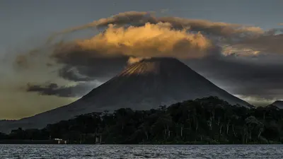
    The Río San Juan flows from Lake Nicaragua to the Caribbean and for long stretches forms the border with Costa Rica. The starting point is San Carlos on the south-eastern shore of the lake, from where boats run to the Spanish fortress of…

    by Felix Gillen

    1. Home
    2. Destinations
    3. Nicaragua
    4. Río San Juan
    The Río San Juan flows from Lake Nicaragua to the Caribbean and for long stretches forms the border with Costa Rica. The starting point is San Carlos on the south-eastern shore of the lake, from where boats run to the Spanish fortress of El Castillo and to the Solentiname archipelago with its well-known school of painters. The area is remote and has hardly any roads, so allow plenty of time and cash. For safety information on Río San Juan department, see the UK FCDO travel advice.
    Nicaragua travel guideRound trips in NicaraguaPlan a trip with Río San Juan

    Contents

    • Places in the region
    • Getting around
    • Nearby

    More places in Río San Juan

    El Castillo

    Hobbitschuster·CC BY-SA 4.0

    El Castillo

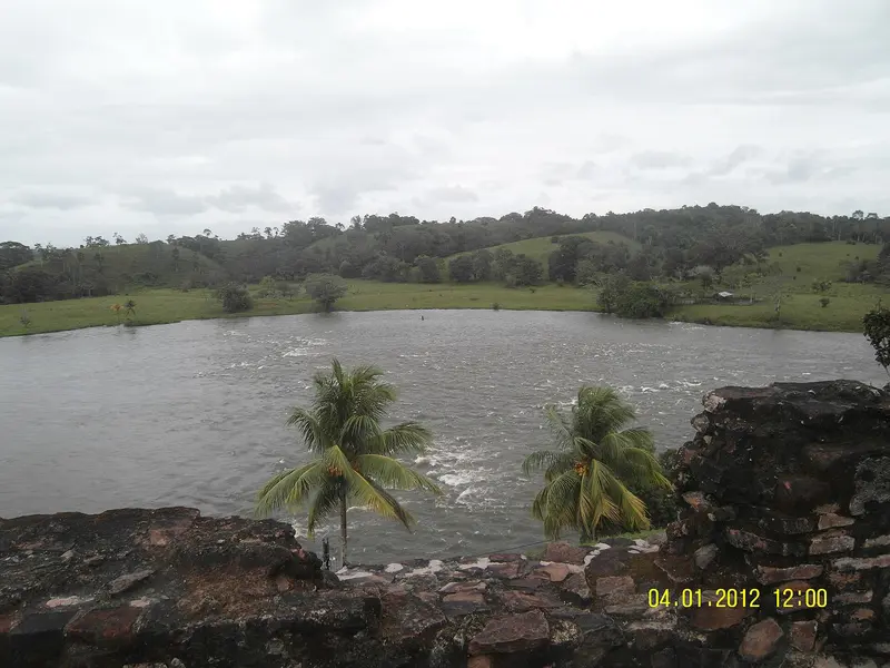
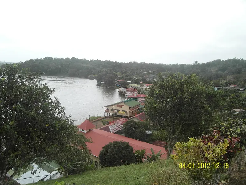
    The river village of El Castillo, on the Río San Juan in southeastern Nicaragua, near the border with Costa Rica, is overlooked by the Spanish fortress Inmaculada Concepción, built from 1673 to 1675 against pirates. Travelers come for the boat trip on the river, the fortress, and the rainforest; the village is only accessible by boat. It is a starting point for tours into the Indio Maíz rainforest reserve.

    Sights in Río San Juan

    Discover the most important sights and attractions

    Archipelago of Solentiname

    “Nicaraguasee03” by Stoschmidt / Wikimedia Commons / CC BY 3.0, mod.

    Natural Feature

    Archipelago of Solentiname

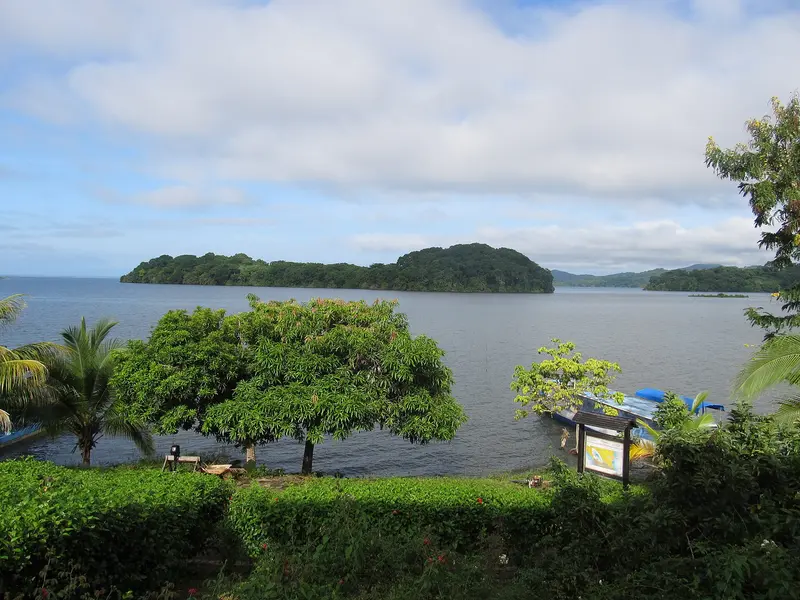
    The approximately 36 islands in the southeast of Lake Nicaragua are known for their primitivist painting. In the mid-1960s, the priest and poet Ernesto Cardenal founded a community on the main island of Mancarrón, from which the painting school emerged; La Venada is considered the island of painters. Boats depart from San Carlos on a few days per week; the journey takes two to three hours.
    Open in Google Maps
    Park

    Refuge for Wild Living Things Los Guatuzos

    The wetland on the south shore of Lake Nicaragua, bordering Costa Rica, has been a Ramsar protected area since 1997. In its rivers and swamps live caimans, monkeys, and numerous bird species; it is explored by boat from San Carlos.
    Open in Google Maps

    Getting Here & Around

    Getting ThereBuses travel from Managua to San Carlos, at the southern tip of Lake Nicaragua, in about six hours. La Costeña currently offers no scheduled flights to San Carlos.On the RiverFrom San Carlos, boats depart several times a day for El Castillo and the Solentiname Islands. Tickets are available at the municipal dock; for the first boat of the day, it's best to buy them the day before.Schedules often change, so check them the day before. Bring enough cash.For advice on the region, see the UK FCDO travel advice for Nicaragua.

    Nearby

    Río Celeste

    Río Celeste

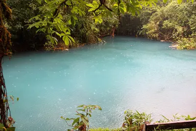
    The Río Celeste is a glowing light blue river in the Tenorio Volcano National Park in Guanacaste, near the town of Bijagua de Upala in the north of the country. You come here for its turquoise waterfall and the spot where two clear rivers mix and the water suddenly turns blue.The color appears when the volcanically influenced Río Buenavista meets the acidic Quebrada Agria: Tiny aluminum silicate particles clump together and scatter sunlight. After heavy rains, the water is murkier and less blue.The Misterios del Tenorio hiking trail starts at El Pilón Station and leads to a viewpoint, Laguna Azul, the Borbollones where gas bubbles from the riverbed, and the Teñideros where the rivers meet. The stairs to the waterfall were only partially open from mid-2025 after damage; check before visiting which sections are open.Swimming is prohibited in the National Park. Tickets are booked online through the protected area authority SINAC, and entry is granted in time slots; in case of bad weather, the park may close at short notice.

    Cephas·CC BY-SA 4.0

    La Fortuna

    La Fortuna

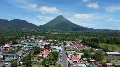
    La Fortuna is the main town at the foot of Arenal Volcano in the Arenal and Monteverde region, about three to three-and-a-half hours' drive northwest of San José. You come here because the Arenal Volcano National Park, the Río Fortuna waterfall, and the surrounding hot springs are all easily accessible from the town.The town was founded in the mid-1930s by settlers from Ciudad Quesada, Grecia, and Alajuela, and was originally called El Burío. It owes its current name to the fertile soil, not, as is often recounted, to the 1968 eruption which hit the villages west of the volcano and spared La Fortuna.The town center spans just a few streets. Most accommodations, restaurants, and tour operators are located along the main road and around Parque Central with its church, behind which the cone of Arenal rises on clear days.The range of activities is wide: horseback riding, rafting, canyoning, ziplines, and hanging bridges are all available, as are the warm springs, which emerge at around 30 to 50 degrees Celsius, including along the Río Tabacón. Plan at least two full days, as the peak region is often shrouded in clouds.
    Pável Tuc·Pexels

    Arenal Volcano National Park

    Arenal Volcano National Park

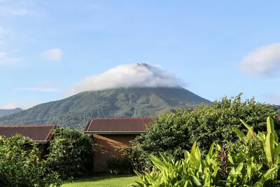
    Arenal Volcano National Park protects the roughly 1,630-meter-high cone of Arenal and its forested flanks in the Arenal and Monteverde region, about 30 minutes drive west of La Fortuna. You come here to hike across solidified lava fields and see the volcano up close.Arenal erupted unexpectedly on July 29, 1968, burying the villages of Tabacón, Pueblo Nuevo, and San Luís and claiming dozens of lives. It remained continuously active until 2010, and has been dormant since. The park was established in 1991 and covers approximately 121 square kilometers.Visitors can access two sectors. In the Volcán sector, near the visitor center, short, mostly flat trails like Las Coladas (approx. 2 km) lead over lava flows from the 1992 eruption, while El Ceibo (approx. 3 km) goes through secondary forest. The Península sector is a few minutes' drive away on Lake Arenal and offers views of the lake and volcano via the Los Miradores trail and an observation tower.The summit itself is closed to visitors; the national protected area authority SINAC explicitly warns against illegal summit hikes. Admission is charged at the sectors, with current prices and opening hours published by SINAC. Come as early as possible, as the summit often becomes cloud-covered as the day progresses.

    Bernard Gagnon·CC0

    Rincón de la Vieja National Park

    Rincón de la Vieja National Park

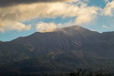
    Rincón de la Vieja National Park protects the volcanic massif of the same name in Guanacaste, approximately 25 kilometers northeast of Liberia. You come here to hike through tropical forest amidst fumaroles, bubbling mud pots, and waterfalls.Founded in 1973, the park covers approximately 141 square kilometers and is part of the UNESCO World Heritage Area de Conservación Guanacaste. The volcano is active: Following numerous minor eruptions, the national emergency management agency CNE issued a green alert for surrounding districts in early September 2026 and raised it to yellow on October 1, 2026, for five districts in Upala and Liberia. The hiking trail to the crater is closed.Most visitors access the park via the Las Pailas sector, which, according to the Tico Times (as of November 2026), is open Tuesday through Sunday. A roughly three-kilometer loop trail here passes fumaroles, a steaming lagoon, and mud pots; longer trails lead to the La Cangreja and Escondida waterfalls. The quieter Santa María sector further north is only easily accessible by 4x4 vehicle.The park is closed on Mondays; admission fees and current access regulations are published by the protected areas authority SINAC. Due to volcanic activity, access may be restricted at short notice; check the current status before your visit and read the UK government's FCDO travel advice.

    Jean Paul Montanaro·Pexels

    Arenal and Monteverde

    Arenal and Monteverde

    Arenal and Monteverde form the green highlands in northwestern Costa Rica, about three to four hours' drive northwest of San José. You travel here for the cone-shaped Arenal Volcano with its hot springs and for the cloud forests of Monteverde, two of the country's most visited natural destinations.Arenal was continuously active from 1968 to 2010; today it is dormant, and around the town of La Fortuna, hiking trails over old lava fields, suspension bridges, a waterfall, and numerous hot springs have developed. Southwest of it, beyond Lake Arenal, lies the Monteverde highlands with its privately and communally managed cloud forest reserves.By road around the lake, the drive between both destinations is longer than the map suggests. Many travelers therefore combine it with a transfer by boat across Lake Arenal.

    Jordan Corrales·Pexels

    Your next steps

    Río San Juan is in Nicaragua. Ways to carry on from here.

    • More in Nicaragua

      Highlights, areas, routes and the best time to travel for all of Nicaragua.

      Nicaragua travel guide
    • Round trips in Nicaragua

      Ready-made routes through Nicaragua, with stops, nights and a map.

      See the routes
    • Plan a trip with Río San Juan

      The Guide asks about season, length and who is coming, and suggests a trip with Río San Juan.

      Plan the trip

    Sources & method

    • Photos: Wikimedia Commons. Each photo carries its credit.
    • Place data such as addresses and ratings comes from Google Maps.
    • The content is based on web research from public, traceable sources. How the content is made · The role of AI