Fernweh: Home
ExploreGuideDestinationsMy tripsMy trip
de|en
All Places & RegionsRound tripsNight trains in EuropeAll highlightsAbout FernwehFAQPrivacy PolicyImprint
Download on the App StoreGet it on Google Play
ExploreGuideDestinationsMy tripsMy trip
    • Neighborhoods & highlights
    • Recommendations
    • Eat & drink
    • Culture
    • Getting around
    • Accommodation
    • Plan trip
    • Nearby
    Rocamadour

    Photo by SlimMars 13 on Pexels

    France

    Rocamadour

    CityCultureNature

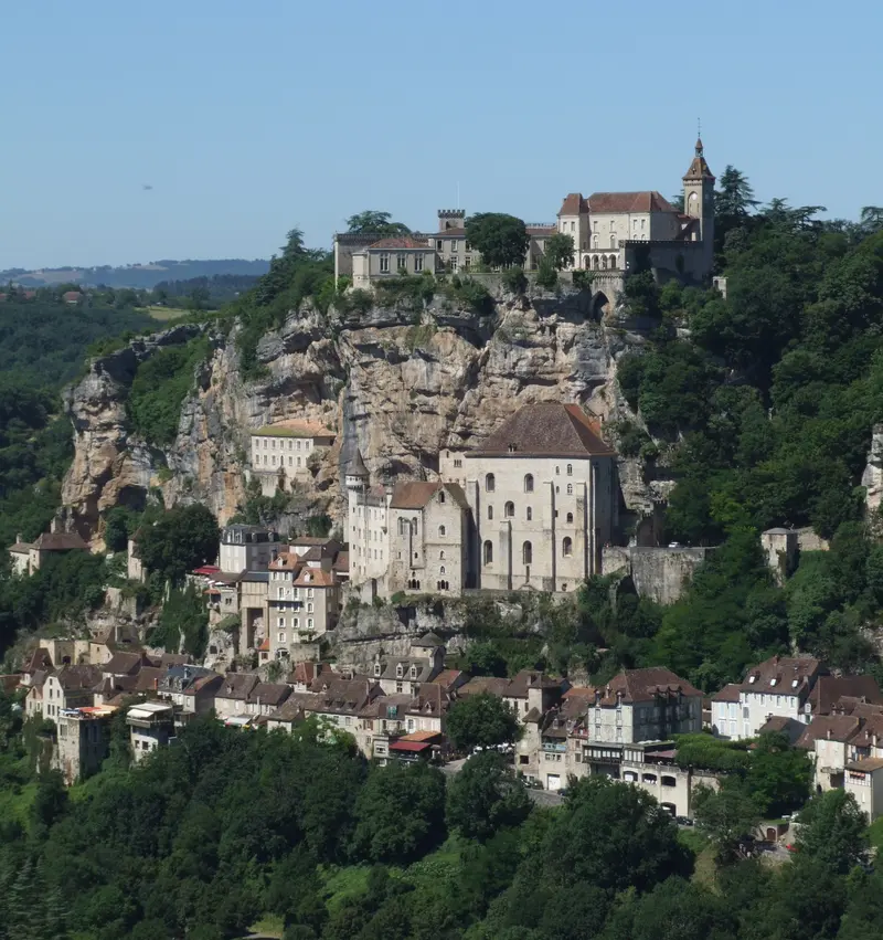
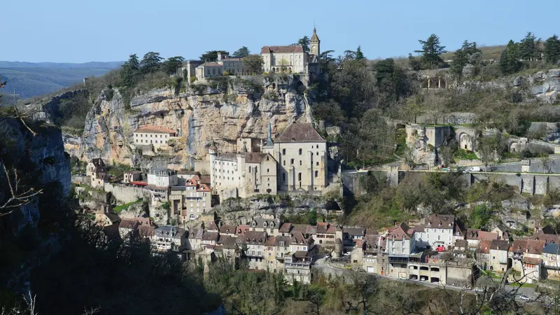
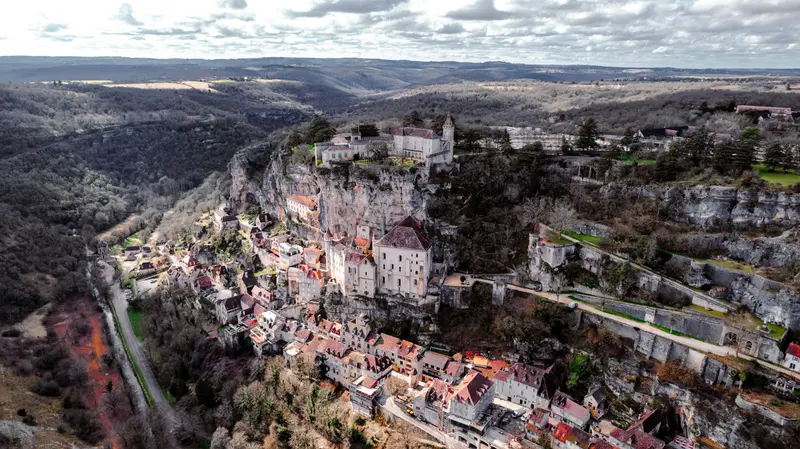
    Rocamadour clings to an approx. 120 m high cliff face above the Alzou canyon in the Lot department, on the edge of the Dordogne valley.

    by Felix Gillen

    1. Home
    2. Destinations
    3. France
    4. Dordogne (Périgord)
    5. Rocamadour
    Rocamadour clings to an approx. 120 m high cliff face above the Alzou canyon in the Lot department, on the edge of the Dordogne valley. The pilgrimage site, with its 12th-century Black Madonna, is one of Southwest France's most iconic sights.Since 1166, when Saint Amadour's body was found, pilgrims came in great numbers; the Saint-Sauveur Church and Saint-Amadour Crypt have belonged since 1998 to the UNESCO World Heritage Routes of Santiago de Compostela in France. The site rises in three levels: below, the car-free Cité; above, the sanctuaries; and at the top, the Château's defensive walls.
    France travel guideRound trips in FrancePlan a trip with Rocamadour

    Contents

    • Neighborhoods & highlights
    • Recommendations
    • Eat & drink
    • Culture
    • Getting around
    • Accommodation
    • Nearby

    Sights in Rocamadour

    Discover the most important sights and attractions

    Ramparts of the Château (Remparts)

    Photo by Jacques Dillies on Unsplash

    Historic Landmark

    1Ramparts of the Château (Remparts)

    Perched on the rock edge above the sanctuaries are the remains of a 14th-century fortress; today's castle dates from the 19th century and is not open to visitors. The ramparts are accessible, offering views over the Alzou Canyon. Entrance 2 € (2-€ coins only).
    Open in Google Maps
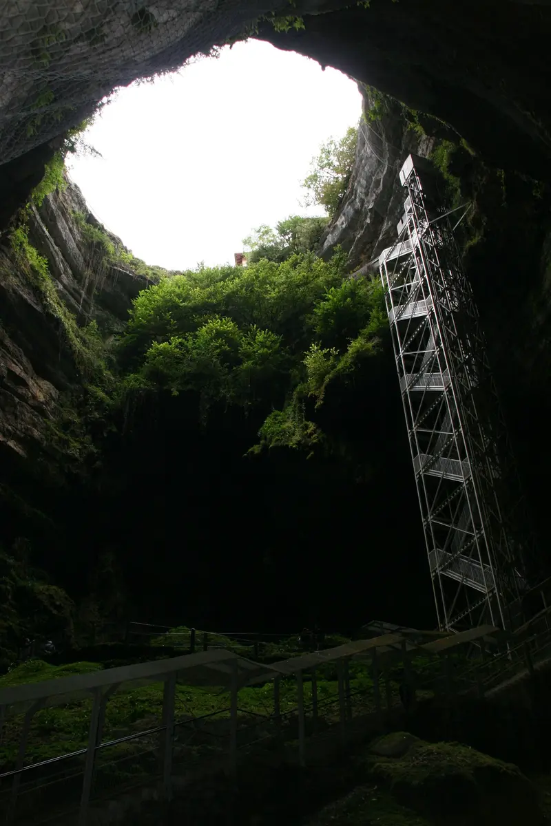
    Gouffre de Padirac

    “Padirac 17” by Sail over / Wikimedia Commons / CC BY-SA 3.0, mod.

    Attraction

    2Gouffre de Padirac

    About 12 km northeast of Rocamadour, a chasm opens to an underground river, explored by Édouard-Alfred Martel in 1889; it has been open to visitors since 1899. The route descends to a depth of 103 m; part of the visit is by boat. The 2026 season runs from March 28 to November 1, closed in winter; book tickets online in advance.
    Open in Google Maps
    Sanctuaries of Rocamadour (Sanctuaire)

    “Rocamadour - vue générale 03” by Christophe.Finot / Wikimedia Commons / CC BY-SA 2.5, mod.

    Place of Worship

    3Sanctuaries of Rocamadour (Sanctuaire)

    The 12th-century sanctuaries, half-built into the rock, are the pilgrimage destination: The Chapel of Notre-Dame, newly constructed from 1479, houses the Black Madonna, and the Crypt of Saint-Amadour dates from 1166. From the Cité, the Grand Escalier with 216 steps leads up; an elevator offers an alternative; open year-round from 2026.
    Open in Google Maps
    Natural Feature

    4Grotto of Marvels

    The small stalactite cave above the village shows cave paintings over 20,000 years old, including hand stencils, horses, a deer, and a big cat. The cave has a constant 13 °C, admission from €9.50.
    Open in Google Maps

    5Cité médiévale and Porte du Figuier

    The car-free main street of the lower level is structured by four medieval gates: Porte du Figuier, Porte Salmon, Porte de la Cabilière and Porte de l'Hôpital. From here, you ascend to the sanctuaries.
    Open in Google Maps

    Restaurants in Rocamadour

    Pilgrim site on the Camino

    The Black MadonnaSince 1148, miracles have been reported in Rocamadour, and in 1166, the body of Saint Amadour was found. The pilgrimage was dedicated to the 12th-century Black Madonna, which stands in the Notre-Dame chapel, rebuilt from 1479.World Heritage SiteThe Church of Saint-Sauveur and the Crypt of Saint-Amadour have been part of the UNESCO World Heritage Site 'Santiago de Compostela Pilgrim Routes in France' since 1998. The Grand Escalier, with 216 steps, leads to the sanctuaries.

    Arrival, Parking and Routes

    Getting ThereRocamadour has no TGV stop. Rocamadour-Padirac station on the Brive–Toulouse line is about 3 km from L'Hospitalet.The D22 tunnels have a height limit of 3.8 m, important for motorhomes.Parking and AccessFive car parks, €6 per car per day. The Cité is closed to cars, except for hotel guests and deliveries.Lifts connect the Cité and sanctuaries; an inclined lift ascends to the Château.In July and August, seasonal buses 876 and 877 run daily for €2 per ride.TipsIt's quietest in June and late afternoon.The 'Le canyon de l'Alzou' loop trail (12.5 km, approx. 4 hours, 404 m elevation gain) passes by mill ruins; inaccessible during high water.

    Accommodations in Rocamadour

    Find perfect stay in Rocamadour

    Booking.com* (Affiliate link)
    Search Hotels
    Agoda* (Affiliate link)
    Search Hotels
    Airbnb
    Vacation Rentals

    * Affiliate link: if you book through it, we earn a small commission. The price stays the same for you.

    Campgrounds in Rocamadour

    Find perfect campground in Rocamadour

    Search via Google Maps
    Campgrounds nearby (15km)
    Camping.info
    Find Campgrounds
    Park4Night
    RV Parks & Camping

    Plan your trip to Rocamadour

    Save places, build a route and plan your city trip, all in one place.

    1. 1
      Sunrise over alpine peaks and a sea of clouds
      1234

      Round trip

      12 days · 4 stops

      Saved

      Pick a route

      Pick a ready-made one or save places and plan your own.

      Open bookmarks
    2. 2

      Trip to Rocamadour

      Live
      • 1Ramparts of the Château (Remparts)3 days
      • 2Gouffre de Padirac4 days
      • 3Sanctuaries of Rocamadour (Sanctuaire)5 days
      Budget

      Plan your trip

      The planner sorts stops, days and budget. Plan together in real time.

      Start trip planning
    3. 3
      9:41 No signal
      Rocamadour
      Available offline

      Photo by SlimMars 13 on Pexels

      Use it on the road

      Download the guide to your phone and use it on site, even offline.

    Nearby

    Domme

    Domme

    Domme, a 13th-century bastide, perches on a rocky plateau with expansive views over the Dordogne Valley. Its golden stone houses define the town's character, which you can explore through its narrow streets and the central Place de la Halle, where the Porte des Tours features historical Templar graffiti. A highlight is the Grottes de Domme, a cave system beneath the town, accessible by elevator. The Belvédère de la Barre offers panoramic views of the river's meanders and surrounding villages. Visit Domme in the early morning or late afternoon to savour its special atmosphere in peace.

    Unsplash

    Dordogne (Périgord)

    Dordogne (Périgord)

    The Dordogne, historically known as Périgord, is located in southwest France. The region is renowned for prehistoric cave art, medieval castles overlooking the river valley, villages of pale limestone, and a cuisine featuring duck, truffles, and walnuts.

    Unsplash

    Sarlat-la-Canéda

    Sarlat-la-Canéda

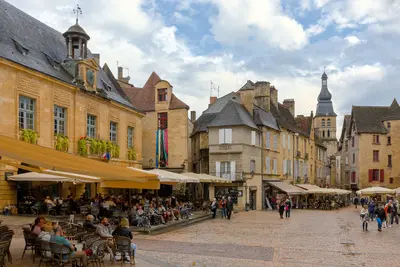
    Sarlat-la-Canéda, the capital of the Périgord Noir, captivates with its exceptionally well-preserved medieval and Renaissance architecture. Here you'll find an abundance of golden stone buildings, winding alleys, and charming squares that reflect the region's history. Highlights include the Place de la Liberté with its bustling market activity, especially on Saturdays, and the impressive Cathédrale Saint-Sacerdos. Explore the narrow passages leading to hidden courtyards, and discover historic buildings such as the birthplace of Étienne de La Boétie. The city is also a hub for regional gastronomy, renowned for truffles, foie gras, and walnuts, which you can find in the local markets. To experience the authentic atmosphere without large crowds, a visit during the off-season is recommended, ideally in spring or autumn. For a comprehensive impression of the old town, you should take your time to appreciate the architectural details and sample the local specialties.
    Benjamin Smith·CC BY-SA 4.0

    La Roque-Gageac

    La Roque-Gageac

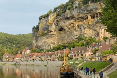
    La Roque-Gageac lies approximately 10 kilometers south of Sarlat on the Dordogne and is one of the Plus Beaux Villages de France. Its houses, made of golden-yellow limestone, line up in a narrow strip between the river and the cliff face; down by the bank stand the old houses of the Gabarriers, the river boatmen.High in the cliff above the village lies the Fort troglodytique, a 12th-century fortification built into the rock, to which a wooden staircase with 140 steps leads up. On the slope grows a narrow exotic garden with palms, papyrus, cycads, and oleander, laid out by Gérard Dorin. The row of houses is best viewed from a Gabarre, the boat trip also tells the story of the place.

    Benjamin Smith·CC BY-SA 4.0

    Castelnaud-la-Chapelle

    Castelnaud-la-Chapelle

    Castelnaud-la-Chapelle in the Périgord Noir is known for its castle perched high above the Dordogne. The Château de Castelnaud was repeatedly held by the English during the Hundred Years' War, facing the French-held Château de Beynac. The complex, temporarily in ruins, was restored from the 1960s and now hosts the Musée de la Guerre au Moyen Âge with weapons, armour, and recreated siege engines. The village, with its stone houses and narrow alleys, nestles against the castle rock. It's best to combine your visit with Beynac on the opposite river bank. During the off-season, it is significantly quieter than in summer.

    Unsplash

    Your next steps

    Rocamadour is in France. Ways to carry on from here.

    • More in France

      Highlights, areas, routes and the best time to travel for all of France.

      France travel guide
    • Round trips in France

      Ready-made routes through France, with stops, nights and a map.

      See the routes

    Sources & method

    • Photos: Wikimedia Commons, Unsplash, Pexels. Each photo carries its credit.
    • Place data such as addresses and ratings comes from Google Maps.
    • The content is based on web research from public, traceable sources. How the content is made · The role of AI