Fernweh: Home
ExploreGuideDestinationsMy tripsMy trip
de|en
All Places & RegionsRound tripsNight trains in EuropeAll highlightsAbout FernwehFAQPrivacy PolicyImprint
Download on the App StoreGet it on Google Play
ExploreGuideDestinationsMy tripsMy trip
    • Neighborhoods & highlights
    • Eat & drink
    • Culture
    • Getting around
    • Accommodation
    • Plan trip
    • Nearby
    Föhr

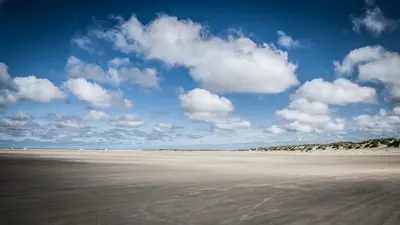
    Photo by Ralf Heinecke on Pexels

    Germany

    Föhr

    CityBeach

    Föhr, covering almost 83 square kilometers, is the second-largest North Frisian island, sheltered in the Wadden Sea behind Sylt and Amrum. Due to its mild climate and marsh meadows, it is known as "the green island.

    by Felix Gillen

    1. Home
    2. Destinations
    3. Germany
    4. North Sea Coast & Islands
    5. Föhr
    Föhr, covering almost 83 square kilometers, is the second-largest North Frisian island, sheltered in the Wadden Sea behind Sylt and Amrum. Due to its mild climate and marsh meadows, it is known as "the green island."The only town is Wyk in the southeast, a seaside health resort featuring the Sandwall beach promenade. In 1819, Schleswig-Holstein's first seaside resort was founded here. From 1842 to 1847, the Danish King Christian VIII spent his summers in Wyk. The island's interior and western parts are home to Frisian villages with thatched-roof houses and medieval churches.
    Germany travel guideRound trips in GermanyPlan a trip with Föhr

    Contents

    • Neighborhoods & highlights
    • Eat & drink
    • Culture
    • Getting around
    • Accommodation
    • Nearby

    Sights in Föhr

    Discover the most important sights and attractions

    1Sandwall in Wyk

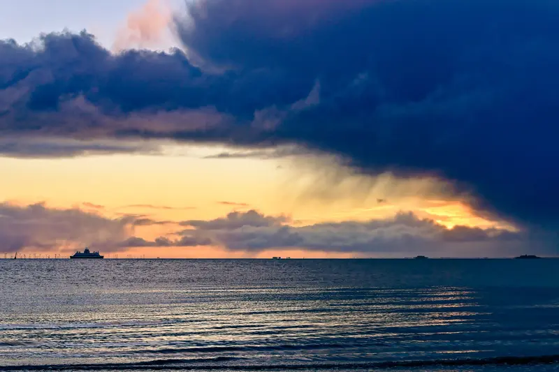
    Wyk's beach promenade runs along Südstrand, lined with spa architecture, cafés, and the bell tower built in 1886. From here, you look out over the Wadden Sea to the Halligen and Amrum.
    Open in Google Maps
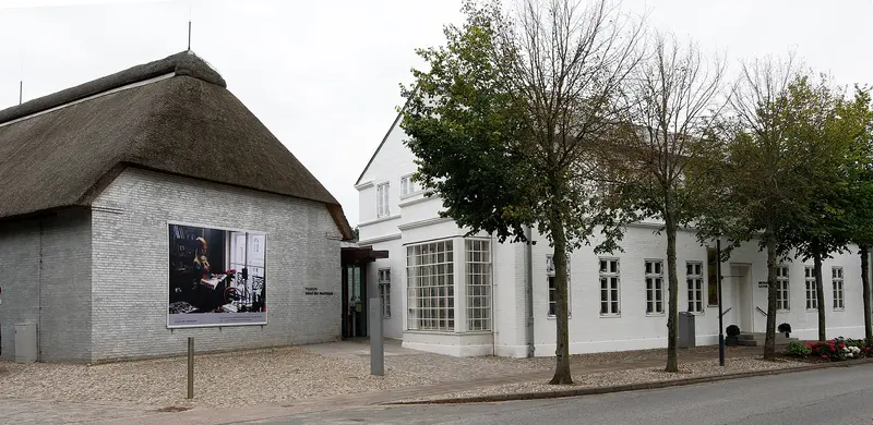
    Museum of West Coast Art

    “Alkersum Kunstmuseum 1” by E-W / Wikimedia Commons / CC BY-SA 3.0, mod.
    Museum

    2Museum of West Coast Art

    Opened in 2009, the Art Museum in Alkersum focuses on paintings of the sea and coast: Danish, German, Dutch, and Norwegian works from 1830 to 1930, along with changing exhibitions. An island bus runs there from Wyk.
    Open in Google Maps
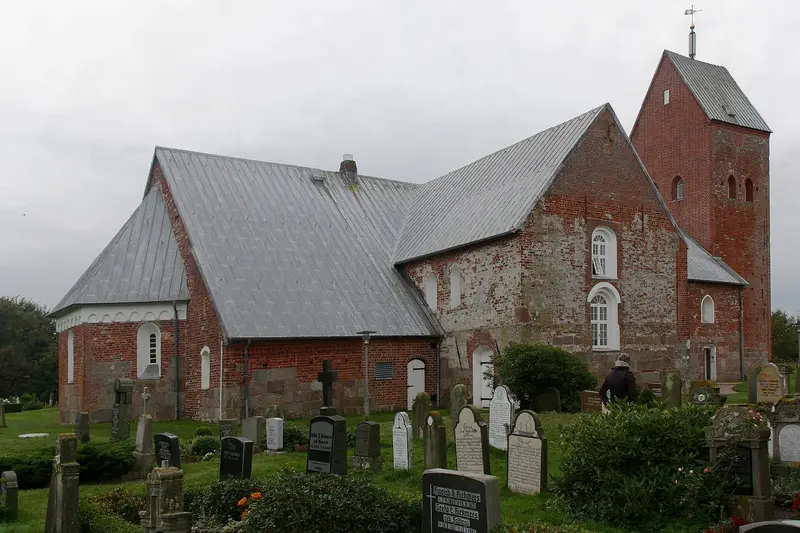
    St. Laurentii in Süderende

    “Sls querhaus” by Dirtsc / Wikimedia Commons / CC BY-SA 3.0, mod.
    Church

    3St. Laurentii in Süderende

    The medieval village church in the west of the island belongs to the three Föhr churches from the 12th and 13th centuries.
    Open in Google Maps
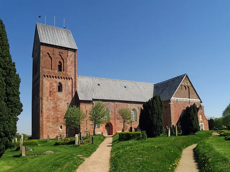
    St. Johannis in Nieblum ("Frisian Cathedral")

    “Föhr Nieblum Kirche St. Johannes 2 2018” by Uwe Barghaan / Wikimedia Commons / CC BY-SA 3.0, mod.

    4St. Johannis in Nieblum ("Frisian Cathedral")

    Built in the first half of the 13th century, the church is known as the 'Friesendom' due to its size and is considered the largest village church in Schleswig-Holstein. In the surrounding churchyard stand approximately 250 Baroque gravestones, many of them 'speaking gravestones' that recount the lives of Föhr seafarers. Nieblum itself is one of the island's most beautiful Frisian villages.
    Open in Google Maps

    Restaurants in Föhr

    1

    Restaurant Alt Wyk

    Gourmet restaurant on Großen Straße in Wyk, awarded one star in the Guide Michelin 2026.
    Show on Google Maps

    Whaling, Costumes, and Frisian Churches

    Maritime HistoryThe Dr.-Carl-Häberlin-Friesenmuseum in Wyk, opened in 1908, tells the story of whaling and seafaring and showcases the Föhr traditional costume with its silver jewelry. The gate is made from the jawbone of a blue whale, and the oldest preserved house on the island, dating from 1617, stands on the premises.Medieval ChurchesThree churches date from the 12th and 13th centuries: St. Johannis in Nieblum, St. Nicolai in Wyk-Boldixum, and St. Laurentii in Süderende.

    Getting there and around on Föhr

    Getting ThereW.D.R. ferries operate multiple times daily from Dagebüll to Wyk, regardless of tides; the crossing takes around 50 minutes. The train takes you directly to Dagebüll Mole. If you plan to bring your car, it's advisable to book well in advance during peak season. From Wyk, there are also ferries to Amrum, with a crossing time of about an hour.On the IslandIsland buses connect Wyk with the villages and the museum in Alkersum. The flat island is great to explore by bike.Mudflat HikingAt low tide, you can walk through the mudflats to Amrum, approx. eight kilometers. Only do this with a guided tour: channels and incoming water are life-threatening without local knowledge.

    Accommodations in Föhr

    Find perfect stay in Föhr

    Booking.com* (Affiliate link)
    Search Hotels
    Agoda* (Affiliate link)
    Search Hotels
    Airbnb
    Vacation Rentals

    * Affiliate link: if you book through it, we earn a small commission. The price stays the same for you.

    Campgrounds in Föhr

    Find perfect campground in Föhr

    Search via Google Maps
    Campgrounds nearby (15km)
    Camping.info
    Find Campgrounds
    Park4Night
    RV Parks & Camping

    Plan your trip to Föhr

    Save places, build a route and plan your city trip, all in one place.

    1. 1
      Sunrise over alpine peaks and a sea of clouds
      1234

      Round trip

      12 days · 4 stops

      Saved

      Pick a route

      Pick a ready-made one or save places and plan your own.

      Open bookmarks
    2. 2

      Trip to Föhr

      Live
      • 1Sandwall in Wyk3 days
      • 2Museum of West Coast Art4 days
      • 3St. Laurentii in Süderende5 days
      Budget

      Plan your trip

      The planner sorts stops, days and budget. Plan together in real time.

      Start trip planning
    3. 3
      9:41 No signal
      Föhr
      Available offline

      Photo by Ralf Heinecke on Pexels

      Use it on the road

      Download the guide to your phone and use it on site, even offline.

    Nearby

    Amrum

    Amrum

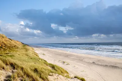
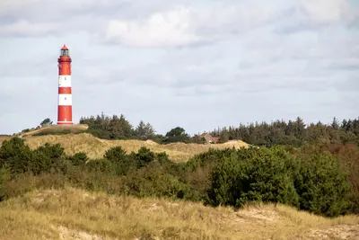
    Amrum is a small North Frisian island of about 20 square kilometers, primarily known for the Kniepsand: an approximately 10-square-kilometer sandbank situated off its western coast, reaching up to 1.5 kilometers in width. Behind it stretches a dune belt, while the interior features heathland and forest.The five villages of Norddorf, Nebel, Süddorf, Steenodde, and Wittdün line the eastern coast. Its landmark is the red-and-white lighthouse, and in Nebel, you'll find St. Clemens Church with the "speaking gravestones" of seafarers and thatched Frisian houses. Amrum is best explored by bicycle.

    Frank Rietsch·Pexels

    Sylt

    Sylt

    Sylt is the largest North Frisian and northernmost German island, 38 kilometers long and 12.6 kilometers wide at its broadest point. You reach it via the 11 km Hindenburgdamm (opened 1927) by train or car shuttle from Niebüll, or by ferry from Rømø to List.An almost 40-kilometer-long sandy beach stretches along the west side. Between Wenningstedt and Kampen, the approx. 30-meter-high Red Cliff glows, with the Uwe-Düne, the island's highest point, rising directly behind it. Westerland is the main town, while Keitum boasts old captain's houses.

    Filipp Romanovski·Pexels

    Tønder & Møgeltønder

    Tønder & Møgeltønder

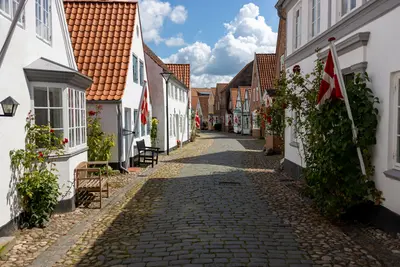
    Tønder ist eine kleine Marschstadt im Süden Jütlands nahe dem Wattenmeer, Møgeltønder liegt rund vier Kilometer westlich. Hierher kommst du für Giebelhäuser, Tønder-Spitzen und die Slotsgade von Møgeltønder vor Schloss Schackenborg.In Tønder führt die Kopfsteingasse Uldgade an den schönsten Giebelhäusern der Stadt vorbei. Die alte Apotheke hat ein barockes Portal von 1671 mit zwei Löwen, die Kristkirken von 1592 wurde mit Geld aus Vieh- und Spitzenhandel ausgestattet. Das Tønder Museum und das Drøhses Hus zeigen Tønder-Spitzen und Kunsthandwerk.In Møgeltønder legte Lensgraf Schack um 1680 die Slotsgade an, ein geschlossenes Ensemble aus Backsteinhäusern des 18. und 19. Jahrhunderts. Dazu gehören der Schlosspark von Schackenborg und die Dorfkirche mit Orgel von 1679 und bemalter Decke. Ende August findet das Tønder Festival statt.

    Joerg Mangelsen·Pexels

    St. Peter-Ording

    St. Peter-Ording

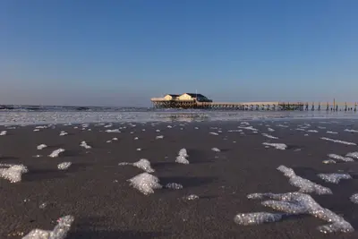
    Sankt Peter-Ording is in southwestern Eiderstedt peninsula, Nordfriesland, a seaside resort since 1877. The town's districts are Böhl, Dorf, Bad, and Ording. It is the terminus of the railway from Husum.In front of the town lies a beach up to 12 kilometers long, becoming 2 kilometers wide at low tide. Landmarks include the 1911-built pile dwellings and the 1095-meter-long pier in the Bad district.

    Joerg Mangelsen·Pexels

    Rømø

    Rømø

    Rømø is the southernmost Danish island in the Wadden Sea, directly north of Sylt. To the west lies Lakolk's kilometre-wide beach, where cars are permitted, and to the east, the mudflats. In between are dune heath, pine forest, and small villages with thatched captain's houses from the whaling era.

    Wolfgang Weiser·Pexels

    Your next steps

    Föhr is in Germany. Ways to carry on from here.

    • More in Germany

      Highlights, areas, routes and the best time to travel for all of Germany.

      Germany travel guide
    • Round trips in Germany

      Ready-made routes through Germany, with stops, nights and a map.

      See the routes

    Sources & method

    • Photos: Wikimedia Commons, Pexels. Each photo carries its credit.
    • Place data such as addresses and ratings comes from Google Maps.
    • The content is based on web research from public, traceable sources. How the content is made · The role of AI