Fernweh: Home
    ExploreTravel GuidesPlan a tripMy tripLast visited
    de|en
    All Places & RegionsAll highlightsAbout FernwehFAQPrivacy PolicyImprint
    ExploreTravel GuidesPlan a tripMy tripLast visited
    Ubirr Rock Outcrop and Panoramic View

    Australia

    Ubirr Rock Outcrop and Panoramic View

    Natural AreaCulture

    Ubirr is located in the northeast of Kakadu National Park, near the East Alligator River, the border to Arnhem Land.

    by Felix Gillen

    1. Home
    2. Destinations
    3. Australia
    4. Kakadu National Park
    5. Ubirr Rock Outcrop and Panoramic View
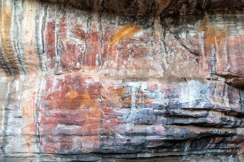
    Ubirr is located in the northeast of Kakadu National Park, near the East Alligator River, the border to Arnhem Land. Under the rock overhangs, X-ray style paintings depict fish, turtles, and wallabies, as well as Mimih spirit figures and a thylacine.A short climb leads to the Nadab Lookout with views over the floodplain. The sunset from here is one of the most visited moments in the park. The road to Ubirr can be flooded during the wet season.

    Sehenswürdigkeiten

    Discover the most important sights and attractions

    1Nadab Lookout

    Rock plateau above the Ubirr galleries with panoramic views over the Nadab floodplain to the Arnhem Land escarpment. The ascent is short but steep and rocky. It gets crowded for sunset, so come early enough.
    Open in Google Maps

    2Red Lily Lookout

    Lookout point on the road to Oenpelli, beyond Cahills Crossing, with views of Arnhem Land's wetlands and rock formations. The route is already in Arnhem Land and is only accessible with a permit or on guided tours.
    Open in Google Maps
    Ubirr Art Site

    3Ubirr Art Site

    A 1 km circular walk along several rock overhangs. In the Main Gallery, X-ray style paintings depict barramundi, turtles, and wallabies with bones and organs. Information boards explain the images; during the dry season, rangers offer free guided tours.
    Open in Google Maps

    4Guluyambi Cultural Cruise

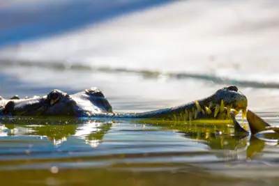
    Boat trip on the East Alligator River with Aboriginal guides who share insights into hunting, bush tucker, and the land's stories. En route, the boat makes a brief stop on the banks of Arnhem Land. Crocodiles are almost always sighted.
    Open in Google Maps
    Cahills Crossing

    5Cahills Crossing

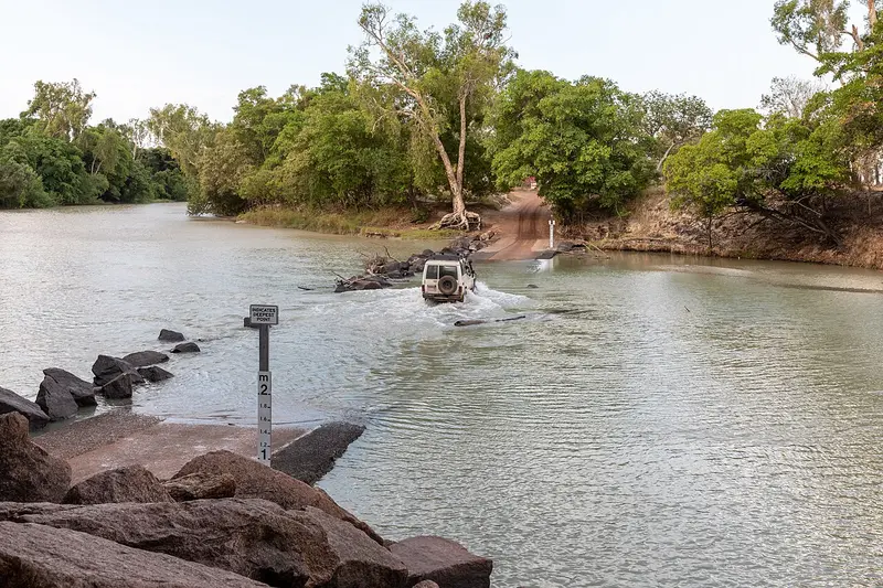
    Ford across the East Alligator River to Arnhem Land, known for its saltwater crocodiles waiting for fish at high tide. Only observe them from the viewing platform. Passage to Arnhem Land requires a permit.
    Open in Google Maps

    Restaurants in Ubirr Rock Outcrop and Panoramic View

    Culture & Character

    Rock-edge GalleriesUbirr is situated in northern Kakadu near the East Alligator River, bordering Arnhem Land. Beneath the rock overhangs, a series of paintings stretches: Barramundi, turtles, and wallabies in X-ray style, showing bones and organs, plus Mimih spirit figures. One figure depicts a Thylacine – the marsupial wolf, extinct on the mainland for millennia.Contact History on the WallOne of the more recent paintings depicts a man with his hands in his pockets – a European, painted by someone who saw him. Such images make Ubirr more than an art collection: The rock documents food sources, laws, and encounters over a period against which European historiography seems brief.

    Orientation & Arrival

    Getting ThereUbirr is located approximately 40 kilometres north of Jabiru, near Cahills Crossing. The access road is sealed and usually passable year-round. Low-lying sections may be submerged after heavy rain – check current conditions at Bowali Visitor Centre.TimingThe area opens in the afternoon and closes after sunset. The galleries are in the shade of the overhangs, while the lookout is in full sun. Allow a good two hours for the loop walk and climb, and be at the top in good time – the last ascent is closed before the gate closes.

    Accommodations in Ubirr Rock Outcrop and Panoramic View

    Find perfect stay in Ubirr Rock Outcrop and Panoramic View

    Booking.com* (Affiliate link)
    Search Hotels
    Agoda* (Affiliate link)
    Search Hotels
    Airbnb
    Vacation Rentals

    * Affiliate link: if you book through it, we earn a small commission. The price stays the same for you.
    Nearby

    Rock art of Nourlangie (Burrunggui)

    Rock art of Nourlangie (Burrunggui)

    Burrunggui, also known as Nourlangie Rock, is a sandstone rock on the edge of the Arnhem Plateau in Kakadu National Park. Beneath its overhangs lie some of Australia's most renowned rock art, including the Anbangbang Gallery featuring Namarrgon, the Lightning Man.An asphalted loop trail of about 1.5 km connects the galleries and a lookout point. The access road from the Kakadu Highway is passable by any car.
    The Wetlands of Yellow Water

    The Wetlands of Yellow Water

    Yellow Water, on Gundjeihmi Ngurrungurrudjba, is a billabong on the South Alligator River near Cooinda in the heart of Kakadu National Park. During the dry season, saltwater crocodiles, water buffalo, and thousands of waterfowl gather here.The best way to experience the area is on one of the guided boat tours, which depart several times daily from Cooinda Lodge.
    Kakadu National Park

    Kakadu National Park

    Kakadu National Park in the north of the Northern Territory is Australia's largest national park, spanning nearly 20,000 km². It stretches from tidal rivers on the coast across vast wetlands to the Arnhem Plateau escarpment with its waterfalls.The park is listed as a natural and cultural heritage site on the UNESCO World Heritage List. The Bininj/Mungguy have lived here for at least 65,000 years, and their rock art at Ubirr and Burrunggui is among the most significant in the world.
    Darwin

    Darwin

    Darwin is the tropical capital of the Northern Territory and the gateway to Kakadu and Litchfield. A relaxed coastal town with night markets, sunsets, and rich war history.
    Kununurra

    Kununurra

    Kununurra, in the east of the Kimberley, was established in the 1960s as the heart of the Ord River Irrigation Scheme. Today, approximately 5,000 people reside here, surrounded by irrigated fields of mangos, melons, and sandalwood, Lake Kununurra, and the red rocks of Mirima National Park.The town is a starting point for Lake Argyle, the Bungle Bungles, and the eastern end of the Gibb River Road.

    Sources & method

    • Photos: Wikimedia Commons, Pexels. Each photo carries its credit.
    • Place data such as addresses and ratings comes from Google Maps.
    • The content is based on web research from public, traceable sources. How the content is made · The role of AI