Fernweh: Home
    ExploreTravel GuidesPlan a tripMy tripLast visited
    de|en
    All Places & RegionsAll highlightsAbout FernwehFAQPrivacy PolicyImprint
    ExploreTravel GuidesPlan a tripMy tripLast visited
    Regional Natural Park of the Auvergne Volcanoes

    France

    Regional Natural Park of the Auvergne Volcanoes

    Point of Interest

    Founded in 1977, the Parc Naturel Régional des Volcans d'Auvergne is, with nearly 390,000 hectares, the largest Regional Nature Park in mainland France.

    by Felix Gillen

    1. Home
    2. Destinations
    3. France
    4. Auvergne-Rhône-Alpes
    5. Regional Natural Park of the Auvergne Volcanoes
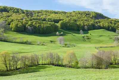
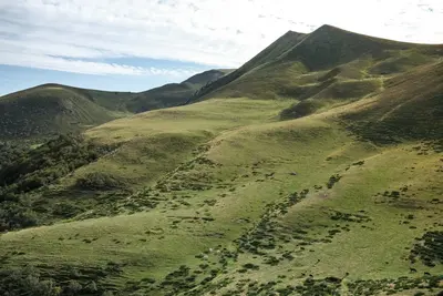
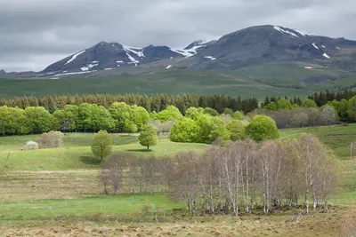
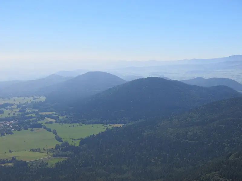
    Founded in 1977, the Parc Naturel Régional des Volcans d'Auvergne is, with nearly 390,000 hectares, the largest Regional Nature Park in mainland France. It encompasses the Chaîne des Puys with around 80 volcanoes, including the Puy de Dôme, the Monts Dore with the Puy de Sancy, the Cantal Massif, and the Cézallier high plateau. The landscape is characterized by volcanic cones, crater lakes, alpine pastures, and forests, and boasts a dense network of hiking trails. In the villages, you can find cheeses like Saint-Nectaire, Cantal, and Salers. The hiking season usually runs from May to October; early mornings are the quietest on the well-known peaks.

    Places of Interest

    Discover the most important sights and attractions

    Massif du Puy de Dôme

    1Massif du Puy de Dôme

    The Puy de Dôme, at 1465 metres, is the highest volcano in the Chaîne des Puys, which has been a UNESCO World Heritage site since 2018. You can reach the summit by taking the Panoramique des Dômes rack railway or on foot. From the top, you'll have panoramic views of the volcanic chain and the Limagne. On the summit lie the foundations of a Roman Temple of Mercury; in 1648, Blaise Pascal had his brother-in-law Florin Périer conduct air pressure measurements here. Our Tip: Early in the morning on a clear day, the long-distance views are best, and it's still quiet.
    Open in Google Maps

    2Point de vue

    The Point de vue at the Parc Naturel Régional des Volcans d'Auvergne provides you with a comprehensive view of France's unique volcanic landscape. This region is shaped by the Chaîne des Puys, a chain of extinct volcanoes that is a UNESCO World Heritage site and a testament to the Earth's geological activity. From this viewpoint, you'll survey gentle hills, wide valleys, and the characteristic cones of the volcanoes that shape the landscape. In clear weather, the view extends far beyond the Auvergne, enabling you to appreciate the geological formations in their full splendor. For the best lighting conditions and to optimally capture the expansive beauty of the landscape, an early morning or late afternoon visit is highly recommended. Tip: Always check the weather forecast, as fog can significantly limit visibility at these higher altitudes. Binoculars can assist you in discerning distant details and studying the volcanic structures more effectively.
    Open in Google Maps

    3Le Traversin

    Le Traversin is a viewpoint on the trails between Puy de Dôme and Puy de Pariou, in the Orcines municipality. From here, you look out on one side over the volcanic cones of the Chaîne des Puys, a UNESCO World Heritage site since 2018, and on the other side down to Clermont-Ferrand.Our tip: This spot can be easily included in a hike to Puy de Pariou or onto Puy de Dôme. Stay on the marked paths to protect the sensitive vegetation.
    Open in Google Maps

    4Puy Fillu

    Puy Fillu lies about two kilometers northwest of the Puy de Dôme in the Chaîne des Puys, designated a UNESCO World Heritage site in 2018. From the trails here, you'll gaze upon the surrounding volcanic cones.Our tip: The light is most beautiful early in the morning or late in the afternoon. Be sure to wear sturdy shoes, as the trails are unpaved.
    Open in Google Maps

    Food and Drink

    La Flèche d'Argent

    Restaurant in 5 Pl. Allard.
    Show on Google Maps

    Auberge des Gros Manaux

    Bar in Col de Ceyssat.
    Show on Google Maps

    Le Petit Graillou

    Bar in 9 Pl. des Parsières.
    Show on Google Maps

    Boulangerie Patisserie Lastique

    Bakery in 74 Rte du Puy de Dôme.
    Show on Google Maps

    Mac Tataouine

    Restaurant in 43 Av. Joseph Claussat.
    Show on Google Maps

    Eating & Drinking

    The park thrives on alpine farming. Cheese, potatoes, and beef define the cuisine; eateries are found in the villages and along the hiking trails.

    Saint-Nectaire

    This semi-hard cheese matures on rye straw and comes from the region between Sancy and Cantal. It is available as a farmhouse and a dairy version.

    Cantal and Salers

    Two large hard cheeses of the same tradition. Salers is made only between spring and autumn from the milk of grazing cows.

    Aligot

    Mashed potatoes with fresh Tomme, stirred until it stretches into threads. At alpine festivals, it is prepared in large kettles.

    Alpine inns

    Along the hiking trails are burons, former cheese-making huts of the alpine pastures. Some are now run and serve simple dishes.

    Culture, Art, and History of the Volcanic Landscape

    The park combines a volcanic landscape with a long settlement history. On the summit of the Puy de Dôme, a large Mercury temple stood in Roman times. The Middle Ages, in particular, left their mark: Romanesque churches like the Basilica Notre-Dame d'Orcival or the Church of Saint-Nectaire are among the main works of Auvergne's Romanesque art. Castles such as the Château de Murol recall the noble dominions of that era.In the villages, dark volcanic rock is the defining building material for many farmhouses and churches. Culturally, the park is strongly influenced by cattle breeding and cheese production. The AOP cheeses Salers, Cantal, and Saint-Nectaire are an expression of regional identity; in the mountain pastures, the *burons*, former cheese-making huts, recall the summer farming tradition. Local festivals, such as the spring cattle drive, keep customs alive.

    Exploring Locally

    The park is sprawling and sparsely populated; your own vehicle offers the most flexibility. Public transport is limited to regional buses and a few train lines connecting larger towns. The Panoramique des Dômes cogwheel train runs to Puy de Dôme from Orcines.Hikers and cyclists will find a dense network of signposted trails, including routes for mountain bikes. An e-bike is practical for the hilly terrain. Taxis are available in larger towns, but should be booked in advance in rural areas.At higher altitudes, the weather can change quickly; check conditions in advance with Météo-France and the tourist offices.

    Accommodations in Regional Natural Park of the Auvergne Volcanoes

    Find perfect stay in Regional Natural Park of the Auvergne Volcanoes

    Booking.com* (Affiliate link)
    Search Hotels
    Agoda* (Affiliate link)
    Search Hotels
    Airbnb
    Vacation Rentals

    * Affiliate link: if you book through it, we earn a small commission. The price stays the same for you.

    Campgrounds in Regional Natural Park of the Auvergne Volcanoes

    Find perfect campground in Regional Natural Park of the Auvergne Volcanoes

    Search via Google Maps
    Campgrounds nearby (15km)
    Camping.info
    Find Campgrounds
    Park4Night
    RV Parks & Camping

    Nearby

    Puy de Dôme

    Puy de Dôme

    At 1465 meters, the Puy de Dôme is the highest volcano of the Chaîne des Puys, a World Heritage site since 2018 as part of “Chaîne des Puys – Faille de Limagne”. You can reach the summit on foot or by the Panoramique des Dômes rack railway. From the top, enjoy panoramic views of the volcanic chain and the Limagne plain, and see the remains of a Roman Mercury temple.
    Clermont-Ferrand

    Clermont-Ferrand

    Clermont-Ferrand is the largest city in Auvergne and the gateway to the Chaîne des Puys, a chain of extinct volcanoes that is a UNESCO World Heritage site. The city is known for its Gothic cathedral built from dark lava stone and as the headquarters of tire manufacturer Michelin.
    Lac Chambon

    Lac Chambon

    The **Lac Chambon** is located at the foot of the Massif du Sancy in Auvergne and is of volcanic origin: A lava flow from the Tartaret volcano once dammed the Couze valley. With its bathing beaches, lakeside path, and the visible Murol castle, it is a popular destination for families, hikers, and water sports enthusiasts.
    Mont-Dore

    Mont-Dore

    Le Mont-Dore is a traditional spa town in the valley of the young Dordogne, at the foot of Puy de Sancy in the Parc Naturel Régional des Volcans d'Auvergne. Thermal springs, Belle Époque buildings, and its location between extinct volcanoes make the town a starting point for hiking and winter sports in the Massif du Sancy.
    Salers

    Salers

    Salers, at an altitude of around 950 metres in the green highlands of Cantal in Auvergne, is one of the 'Plus Beaux Villages de France'. In its cobblestone streets stand well-preserved towers and mansions made of dark lava stone, most dating from the 15th and 16th centuries.

    Sources & method

    • Photos: Wikimedia Commons, Unsplash. Each photo carries its credit.
    • The content is based on web research from public, traceable sources. How the content is made · The role of AI