Fernweh: Home
    ExploreTravel GuidesPlan a tripMy tripLast visited
    de|en
    All Places & RegionsAll highlightsAbout FernwehFAQPrivacy PolicyImprint
    ExploreTravel GuidesPlan a tripMy tripLast visited
    • Neighborhoods & highlights
    • Walking tours
    • Eat & drink
    • Food culture
    • Culture
    • Getting around
    • Accommodation
    • Plan trip
    • Nearby
    Mycenae

    Greece

    Mycenae

    CityCulture

    Mycenae is situated on a hill at the northern edge of the Argolic Plain, approximately 25 kilometers north of Nafplio.

    by Felix Gillen

    1. Home
    2. Destinations
    3. Greece
    4. Peloponnese
    5. Mycenae
    Mycenae is situated on a hill at the northern edge of the Argolic Plain, approximately 25 kilometers north of Nafplio. Between approximately 1350 and 1200 BC, the citadel was the center of a palace culture that gave its name to an entire era. Heinrich Schliemann excavated the shaft graves starting in 1876, and since 1999, the site, along with Tiryns, has been a UNESCO World Heritage site.

    Sights in Mycenae

    Discover the most important sights and attractions

    Acropolis of Mycenae

    1Acropolis of Mycenae

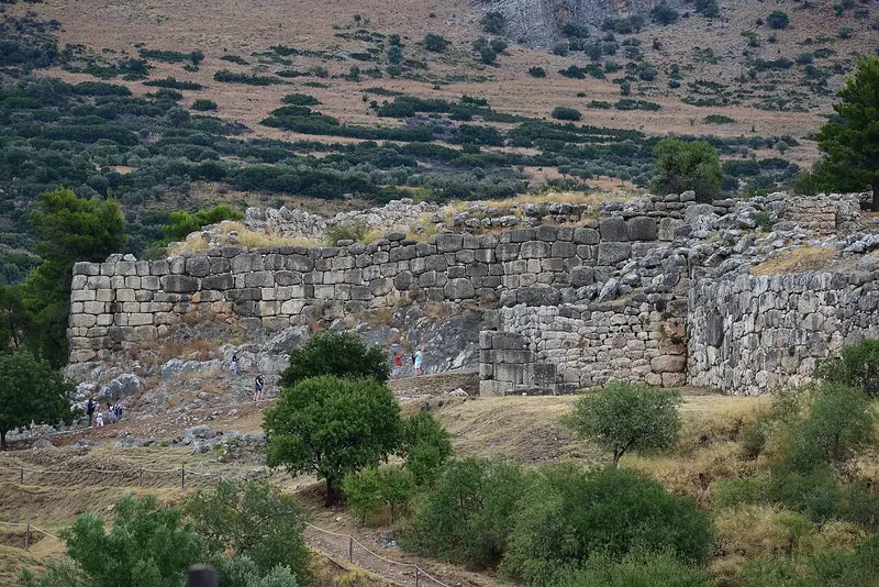
    The fortress on a rocky spur between Profitis Ilias and Zara mountains is encircled by a wall eight meters thick in parts. Blocks weighing several tons led later Greeks to deem them Cyclopean work, hence the 'Cyclopean Wall'. The walls enclose the palace complex with its summit Megaron, storerooms, cult areas, and Grave Circle A. Reaching its greatest extent around 1250 BC, the complex saw its palace burn down some fifty years later, the cause still unknown. From above, you overlook the Argolic Plain to the sea, a view explaining its strategic location. Allow one and a half hours for the tour.
    Open in Google Maps
    Schatzhaus des Atreus

    2Schatzhaus des Atreus

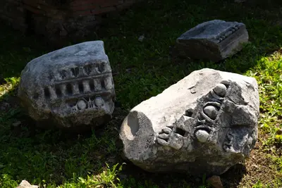
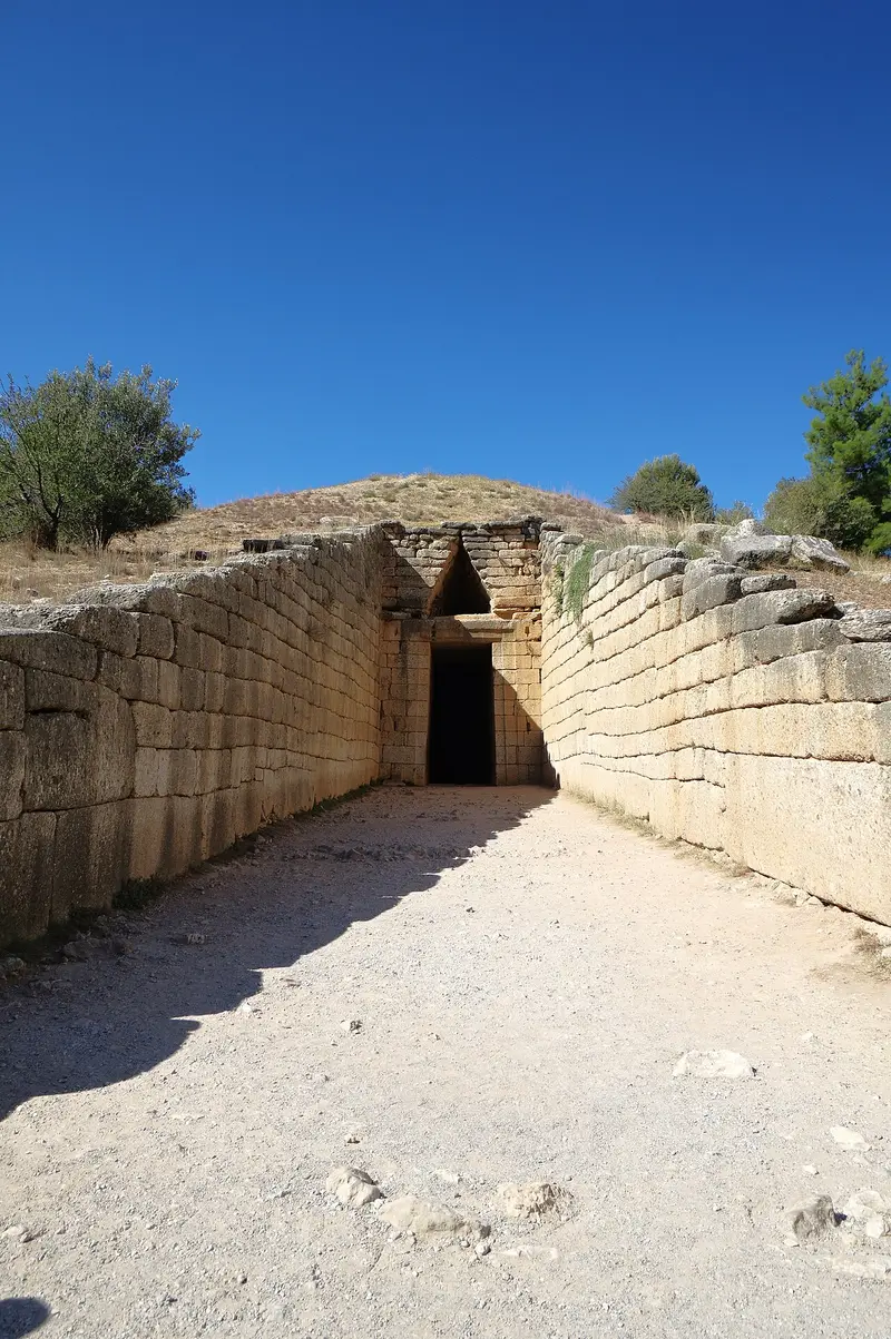
    The so-called Treasury of Atreus is not a treasury, but a tholos tomb from the late Bronze Age, built in the 14th or 13th century BC. A roughly 36-meter-long passage lined with ashlar blocks, the dromos, leads to the entrance, whose inner lintel alone weighs over 100 tons. Above it lies a relieving triangle, which was originally covered with relief slabs; fragments of these are in the British Museum. The chamber behind it has a diameter of approximately 14.5 meters and a height of around 13 meters; its dome, constructed from corbelled stone rings, remained the largest of its kind for over a millennium. The tomb is located a few hundred meters below the citadel on the access road and is included in the site's ticket.
    Open in Google Maps
    Archaeological Museum of Mycenae

    3Archaeological Museum of Mycenae

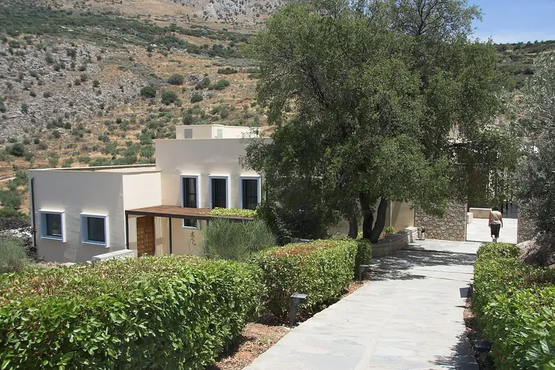
    The museum opened in 2003 on the northern slope below the citadel and is included in the site's ticket.It organizes the finds thematically: Settlement and Economy, Cult, Grave Goods, and Writing.On display are clay tablets in Linear B, the oldest known form of Greek, as well as frescoes, weapons, and the painted Warrior Vase.Schliemann's most famous gold finds, including the Funerary Mask, are housed in the National Archaeological Museum in Athens; here, replicas are exhibited.The building is air-conditioned and a better choice than the citadel hill for the midday hours. Allow one hour.
    Open in Google Maps

    4Tomb Tour A

    The **Grave Circle A** in Mycenae is one of the most significant archaeological discoveries of the Mycenaean civilization. Located directly behind the imposing Lion Gate, this circular enclosure houses six shaft graves dating from around 1600-1500 BC. Here, the early rulers and elites of Mycenae were buried, whose rich grave goods – including golden masks, weapons, and jewelry – can now be admired in the National Archaeological Museum in Athens. The finds impressively attest to the wealth and power of these early Mycenaean dynasties. You can discern the outlines of the former shaft graves within the stone enclosure and grasp the historical significance of this site. Our tip: Visit the Grave Circle in the early morning to enjoy the tranquility of the site and explore the details without large crowds. For a comprehensive perspective on the entire complex and the surrounding Cyclopean walls, the slightly elevated viewpoints within the Acropolis are ideal.
    Open in Google Maps
    Liongate

    5Liongate

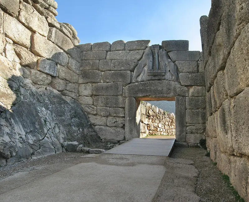
    The Lion Gate is the main entrance of the castle and was built around 1250 BC during the expansion of the wall. Above the lintel, within a relieving triangle, sits a relief depicting two felines flanking a column; the heads are missing, as they were made from a different material and presumably turned towards the viewer. Whether they are lions or griffins is debated among researchers. It is the oldest preserved monumental relief in Europe and, unlike the rest of the city, was never buried: travelers described it long before the excavations. The approach leading up to it was designed so that attackers had to turn their unprotected right side towards the wall.
    Open in Google Maps
    Grave Circle A

    6Grave Circle A

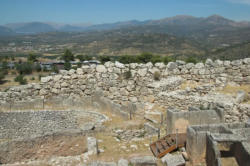
    Immediately to the right behind the Lion Gate lies a circle, enclosed by a stone parapet, containing six shaft graves from the 16th century BC. Heinrich Schliemann excavated it in 1876 and uncovered 19 burials with rich gold offerings, including masks, swords, and drinking vessels. His interpretation that he had found Agamemnon was incorrect: The graves are about 300 years older than the Trojan War, which tradition places. The burials date from a time when the citadel was not yet walled; the circle originally lay outside and was deliberately incorporated during later wall construction. The finds themselves can be seen in Athens.
    Open in Google Maps

    City walks in Mycenae

    Curated walking tours through the city's highlights, handpicked by experienced travel journalists.

    In the Footsteps of the Mythical Kings: A Walk Through Ancient Mycenae

    Immerse yourself in the legendary world of Agamemnon and the Mycenaean kings. This tour takes you through the impressive ruins of the ancient citadel, past mighty walls and royal tombs, to the monumental tholos tombs outside the city walls.

    ~2 Std.
    Open in Google Maps
    Stops (5)

    Dining & Drinks

    1

    Melina's Taverna Restaurant

    Melina's Taverna is on the access road in the village of Mykines, about two kilometers below the archaeological site of Mycenae. The family establishment serves Greek cuisine.
    Show on Google Maps
    2

    Electra Restaurant

    The Electra is on the main road in the village of Mykines, on the way to the archaeological site of Mycenae. The cuisine is Greek.
    Show on Google Maps
    3

    Ταβέρνα Η άμπελος

    The taverna I Ampelos (The Grapevine) is located in the Tenea region, about seven kilometers north of Mycenae. The cuisine is Greek.
    Show on Google Maps
    4

    Selio Cafe

    The Selio is a cafe on the old road from Corinth to Argos in the region of Tenea, about ten kilometers north of Mycenae. It offers coffee and light meals.
    Show on Google Maps
    5

    Καλύτερα εδώ, παρά εκεί...

    The taverna Kalytera edo, para ekei (Better here than there) is located in the Tenea area, just ten kilometers north of Mycenae. Greek cuisine is served.
    Show on Google Maps

    Food and Drink around Mycenae

    Locally, there are only a handful of tavernas relying on day visitors. The area's produce, however, is distinctive: The Argolic Plain is a key fruit-growing region in Greece; to its north lies the Nemea wine region.
    Agiorgitiko from Nemea

    Agiorgitiko from Nemea

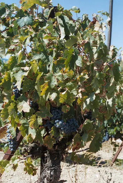
    Greece's largest red wine region begins 20 kilometers north of Mycenae. The Agiorgitiko varietal yields, depending on the location, soft, berry-flavored wines or more robust wines from higher elevations. In the tavernas, it's almost always served by the carafe. Several wineries in the valley accept walk-in visitors.

    Apricots from Argolis

    The Argolic Plain is the country's main apricot-growing region, harvested in June. Along the road between Argos and Mycenae, you'll find farmers' stalls. The fruits are processed into compote, jam, and spoon sweets. Outside the season, you'll only find them dried.
    Zitrusfrüchte aus der Ebene

    Zitrusfrüchte aus der Ebene

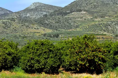
    Between Argos, Nafplio, and Neo Kios, orange and tangerine groves stretch across the entire plain. From December to March, freshly squeezed juice is a must in every café. In spring, the whole area smells of orange blossom. A syrup is also made from the blossoms that goes over yogurt.

    Olive oil from the Argolis

    An den Hängen um Mykene und Chonikas stehen Olivenhaine, gepresst wird zwischen November und Januar. Die vorherrschende Sorte Manaki ergibt ein mildes, grasiges Öl. Kleine Mühlen in den Dörfern verkaufen direkt ab Fass, mitgebrachte Flaschen werden befüllt. In den Tavernen steht das Öl offen auf dem Tisch.

    Mycenae and the Mycenaean Culture

    Namesake of an EraMycenae gave its name to the Mycenaean culture of the Late Bronze Age, shaping the Greek mainland from approximately the 16th to the 12th century BCE. Palaces managed agriculture and crafts with Linear B clay tablets, the oldest known Greek script. Around 1200 BCE, the palace burned down; the causes of its collapse are still debated.BuildingsWalls of massive blocks were attributed by later Greeks to the Cyclops, leading to the term "Cyclopean Wall." At the main entrance, the Lion Gate, a relief of two felines flanks a column. The so-called Treasury of Atreus is a tholos tomb, its corbelled vault of stone rings remaining the largest dome of its kind for over a millennium.Myth and ExcavationIn legend, Mycenae is the seat of King Agamemnon and the House of Atreus, whose story Aeschylus dramatized in the Oresteia. Heinrich Schliemann excavated Grave Circle A from 1876, believing he had found Agamemnon; however, the graves are considerably older. Since 1999, Mycenae, along with Tiryns, is a UNESCO World Heritage site.

    On the Road in Mycenae

    Getting ThereMost visitors arrive by car or tour bus. From Nafplio, it's 25 kilometers and about 30 minutes; from Corinth, 45 kilometers via the A7. KTEL buses connect Argos and Nafplio with Mykines village, though only a few times a day; from the village to the entrance it's another two kilometers uphill. Taxis are available in Argos and Nafplio, but you should pre-order one for your return trip, as none wait at the site in the afternoon.On-siteWithin the citadel, you can only proceed on foot. The path from the Lion Gate past the Palace to the Cistern rises steeply, and the limestone, polished by millions of steps, is consequently slippery. Sturdy shoes are a must; sandals are not sufficient. Several hundred meters separate the parking lot, museum, and Treasury of Atreus, but the Tholos Tomb has its own parking area on the road. Only the area up to the Lion Gate is wheelchair accessible. Water is available at the kiosk near the entrance, but not up on the citadel hill.

    Accommodations in Mycenae

    Find perfect stay in Mycenae

    Booking.com* (Affiliate link)
    Search Hotels
    Agoda* (Affiliate link)
    Search Hotels
    Airbnb
    Vacation Rentals

    * Affiliate link: if you book through it, we earn a small commission. The price stays the same for you.

    Campgrounds in Mycenae

    Find perfect campground in Mycenae

    Search via Google Maps
    Campgrounds nearby (15km)
    Camping.info
    Find Campgrounds
    Park4Night
    RV Parks & Camping

    Plan your trip to Mycenae

    Save places, build a route and plan your city trip, all in one place.

    1. 1
      Sunrise over alpine peaks and a sea of clouds
      1234

      Round trip

      12 days · 4 stops

      Saved

      Pick a route

      Pick a ready-made one or save places and plan your own.

      Open bookmarks
    2. 2

      Trip to Mycenae

      Live
      • 1Acropolis of Mycenae3 days
      • 2Schatzhaus des Atreus4 days
      • 3Archaeological Museum of Mycenae5 days
      Budget

      Plan your trip

      The planner sorts stops, days and budget. Plan together in real time.

      Start trip planning
    3. 3
      9:41 No signal
      Mycenae
      Available offline

      Use it on the road

      Download the guide to your phone and use it on site, even offline.

    Nearby

    Nafplio

    Nafplio

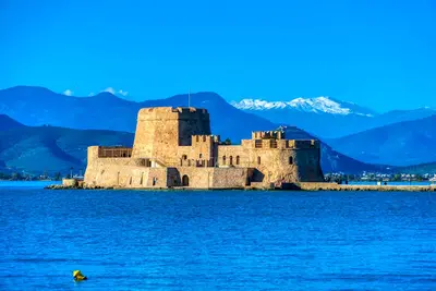
    Nafplio lies on Argolis' east coast, on the Argolian Gulf, some 140 kilometers southwest of Athens. From 1823 to 1834, it served as the first capital of independent Greece, having previously seen Venetians and Ottomans alternately rule its port. The city retains three fortresses, a compact old town of Venetian and neoclassical houses, and a scenic rock path encircling the peninsula.
    Corinth

    Corinth

    Corinth is situated on the Isthmus, the narrowest point between the Peloponnese and the Greek mainland, and thus controlled traffic between two seas for centuries. The ancient city was destroyed by Rome in 146 BC and re-established as a colony a century later; it was here that the Apostle Paul preached. The Temple of Apollo, the Acrocorinth fortress, and the canal opened in 1893 represent three very different eras in one place.
    Ancient Epidauros

    Ancient Epidauros

    Ancient Epidaurus refers to two sites, twelve kilometers apart: the coastal village of Palea Epidavros on the Saronic Gulf and the Asklepieion inland, a UNESCO World Heritage site since 1988. For centuries, this sanctuary was the most important healing center in the Greek world. Predominantly preserved is the theater from the 4th century BC, whose acoustics still work without technical amplification today.
    Peloponnese

    Peloponnese

    The Peloponnese hangs off the southern end of the Greek mainland and, strictly speaking, is an island since the construction of the Corinth Canal. Mycenaean castles, the Sanctuary of Olympia, Byzantine ruined cities, and Venetian sea fortresses lie close together here.Between them, mountain ranges rise to over 2,400 meters, with Taygetos reaching 2,407 meters. The coastal roads remain narrow and winding; those who travel the peninsula are better off planning with few base locations and day trips.
    Hydra

    Hydra

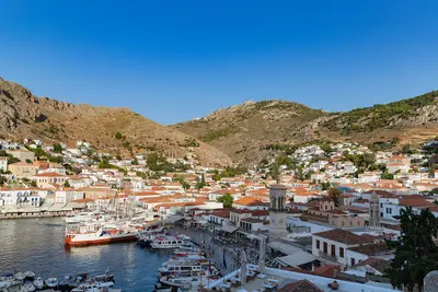
    Hydra is a narrow, rocky island in the Saronic Gulf off the coast of the Peloponnese. Around the semicircular harbour rise the stone houses and mansions of the shipping families who supplied a large part of the Greek fleet during the War of Independence in 1821. There are no cars or other vehicles on the island; loads are carried by mules and donkeys.

    Sources & method

    • Photos: Wikimedia Commons, Unsplash. Each photo carries its credit.
    • The content is based on web research from public, traceable sources. How the content is made · The role of AI