Fernweh: Home
    ExploreTravel GuidesPlan a tripMy tripLast visited
    de|en
    All Places & RegionsAll highlightsAbout FernwehFAQPrivacy PolicyImprint
    ExploreTravel GuidesPlan a tripMy tripLast visited
    • Neighborhoods & highlights
    • Recommendations
    • Walking tours
    • Eat & drink
    • Food culture
    • Culture
    • Getting around
    • Accommodation
    • Plan trip
    • Nearby
    Nafplio

    Greece

    Nafplio

    City

    Nafplio lies on Argolis' east coast, on the Argolian Gulf, some 140 kilometers southwest of Athens.

    by Felix Gillen

    1. Home
    2. Destinations
    3. Greece
    4. Peloponnese
    5. Nafplio
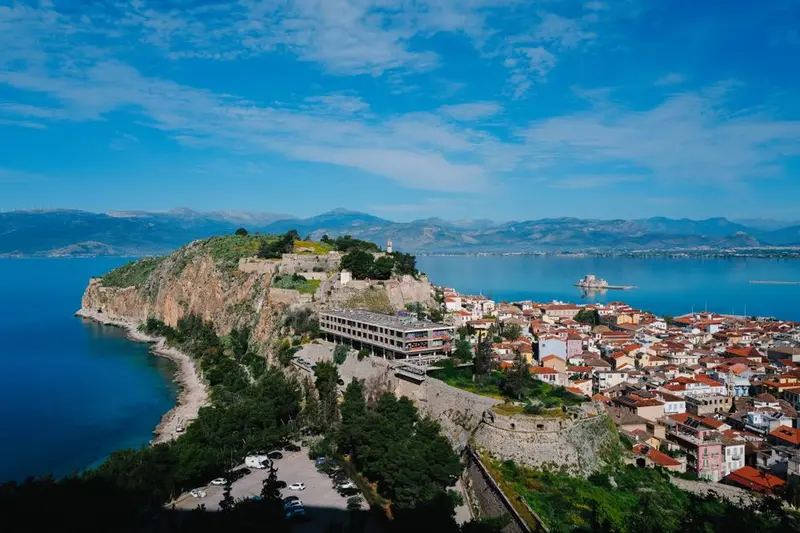
    Nafplio lies on Argolis' east coast, on the Argolian Gulf, some 140 kilometers southwest of Athens. From 1823 to 1834, it served as the first capital of independent Greece, having previously seen Venetians and Ottomans alternately rule its port. The city retains three fortresses, a compact old town of Venetian and neoclassical houses, and a scenic rock path encircling the peninsula.

    Sights in Nafplio

    Discover the most important sights and attractions

    Palamidi-Festung

    1Palamidi-Festung

    The Palamidi Fortress stands on a 216-meter-high rock east of the Old Town and was built by the Venetians between 1711 and 1714. It consists of eight independent bastions that covered each other and could be defended individually. Already in 1715, just one year after its completion, the Ottomans captured the complex after a brief siege. In the Miltiadis bastion, freedom fighter Theodoros Kolokotronis was later imprisoned; his cell is accessible. A staircase with approximately 850 to 900 steps leads to the fortress, popularly known as 999. Start before the midday heat; alternatively, a road leads up from the back.
    Open in Google Maps
    Bourtzi-Festung

    2Bourtzi-Festung

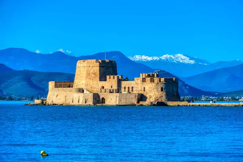
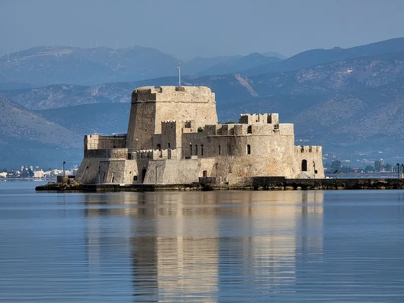
    The Bourtzi stands on a rocky islet about 450 meters from the harbour, constructed as a sea fortress by the Venetians from 1473. A chain between the island and mainland could block the harbour entrance, making Nafplio difficult to attack for centuries. After independence, the building served temporarily as the seat of government, later as the executioner's residence, and from the 1930s, as a hotel. Today, small boats ferry visitors from the harbour; the trip takes a few minutes, and the interior rooms are only partially accessible. Boat services are suspended during strong southwest winds.
    Open in Google Maps
    Altstadt von Nafplio & Syntagma-Platz

    3Altstadt von Nafplio & Syntagma-Platz

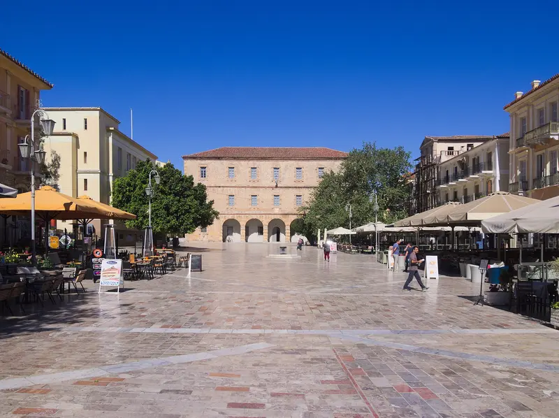
    The old town of Nafplio still follows its Venetian layout: three longitudinal streets between the harbor and the castle hill, with stairs and passages running across them. Syntagma Square forms the center, paved with marble and bounded by the Venetian Arsenal, the former Vouleftiko Mosque, where the first Greek Parliament convened in 1825, and a row of neoclassical houses from its time as capital. Parallel to it, Staikopoulou is the tavern street, and Vasileos Konstantinou is the shopping street. Cars only reach the harbor wall; within the old town, everything is on foot. In the late afternoon, the square gets crowded; in the mornings, you usually have it to yourself.
    Open in Google Maps
    Archaeological Museum of Nafplio

    4Archaeological Museum of Nafplio

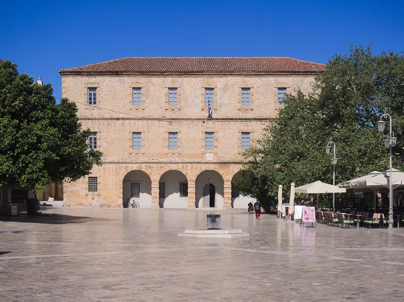
    The Archaeological Museum occupies two floors in the Venetian Arsenal from 1713, on the west side of Syntagma Square. It displays finds from across the Argolis, ranging from Neolithic tools and Mycenaean pottery to Roman sculptures. The most famous piece is a bronze cuirass from Dendra, dating from the 15th century BC, Europe's oldest largely complete armor preserved. Also featured are frescoes from Tiryns and grave goods from Mycenae, which perfectly complement a visit to the excavation sites. About an hour is sufficient for the collection; the building is air-conditioned, making it an option for the midday heat.
    Open in Google Maps
    Akronafplia

    5Akronafplia

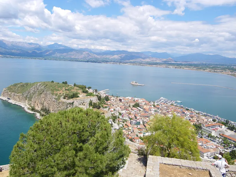
    The **Akronafplia** rock ridge directly above the Old Town is the city's oldest fortified part. Its walls date from Byzantine, Frankish, and Venetian times and partly overlap, which is why three construction phases can be seen on one wall in some sections. Under Ottoman rule, the complex was known as Its Kale, and in the 20th century, it served as a prison for political prisoners. Today, access is free; however, parts of the site are closed off or obstructed by a hotel ruin. A lift shaft in the rock connects the Old Town to the plateau, but it is not always in operation.
    Open in Google Maps
    Arvanitia Promenade

    6Arvanitia Promenade

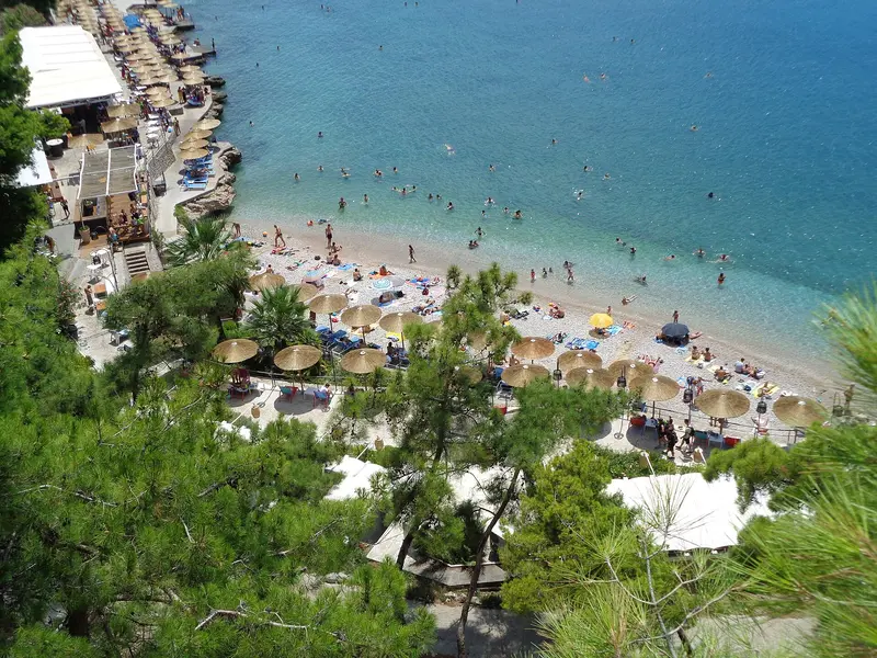
    At the western end of the harbour, a nearly one-kilometre long, rock-hewn path begins, encircling the peninsula below the Akronafplia and ending at the bathing cove Arvanitia. The path is flat and car-free; to the left, the rock drops into the sea, to the right stands the fortress wall. Arvanitia itself is a pebble beach with concrete platforms, organised and well-frequented in summer. Those who wish to continue can follow the marked path around the south side to the sandy beach Karathona, which takes about an hour. In the late afternoon, the promenade is shaded, which is the most pleasant time.
    Open in Google Maps

    City walks in Nafplio

    Curated walking tours through the city's highlights, handpicked by experienced travel journalists.

    Nafplio: A Walk Through Greece's First Capital

    Discover Nafplio, Greece's charming first capital, on a two-hour circular walk. Stroll through picturesque lanes, enjoy breathtaking sea views and immerse yourself in the rich history of this Venetian-influenced town.

    ~2 Std.
    Open in Google Maps
    Stops (6)

    Restaurants & Cafes

    1

    Karamalis Tavern

    The Karamalis Tavern is on Bouboulinas, the waterfront street at Nafplio harbour. It serves Greek cuisine.
    Show on Google Maps
    2

    Aiolos Tavern

    The Aiolos Taverna is located on Vasilissis Olgas in the Old Town of Nafplio, just a few steps from the port. The cuisine is Greek.
    Show on Google Maps
    3

    3Sixty Cafe & Wine Bar

    3Sixty, at the corner of Rigas Feraiou and Dimitriou Ypsilantou in Nafplio's Old Town, is a café, wine bar, and restaurant. By day, enjoy coffee and light dishes; by night, wine and food.
    Show on Google Maps

    Pension Dafni and Brunch

    Cozy rooms and studios, some with a balcony, in a traditional guesthouse with a courtyard and free Wi-Fi.
    Show on Google Maps

    Eating and Drinking in Nafplio

    The Argolis is an agricultural plain; accordingly, much fruit and vegetables find their way into the local cuisine. Fish comes from the Argolian Gulf, wine from Nemea, about 30 kilometers north.

    Citrus fruits from Argolis

    The plain between Nafplio, Argos and Neo Kios is one of Greece's largest growing regions for oranges and mandarins. From December to March, freshly squeezed juices are on offer in every café; in spring, the streets between the groves smell of blossoms. At the weekly market in the new town, producers sell directly. The peels are also used to make candied fruits and spoon sweets.

    Fish from the Argolic Gulf

    Fish taverns line the harbour and Bouboulinas. Commonly served are sea bream, sea bass, sardines, and squid, usually simply grilled and served with lemon and olive oil. Before ordering, ask for the daily catch and price per kilo; this is customary in Greece and avoids surprises. Farmed fish from the gulf is marked on the menu.

    Agiorgitiko from Nemea

    The Nemea wine region is located a good half-hour north and is the country's largest red wine region. The Agiorgitiko grape produces, depending on altitude, soft, berry-like wines or more robust, age-worthy wines. In the tavernas of Nafplio, it is almost always on the menu as house wine. Several wineries in the valley accept visitors without prior booking.

    Mezedes in the Staikopoulou

    Staikopoulou alley, below the Palamidi steps, is the Old Town's most concentrated row of tavernas. Here, dishes are traditionally ordered as small plates: fried feta, aubergine dip, octopus in vinegar, meatballs with mint. The eateries actively approach passers-by, which some find pushy. A little further in the side alleys, it's quieter and usually cheaper.

    Ice cream and spoonable desserts

    Nafplio has an unusual density of artisan ice cream parlors, a consequence of Italian influences from Venetian times and its years as capital. Besides classic flavors, you'll find regional varieties with mastic, honey, or lemon. Additionally, there are Glyka tou koutaliou, fruits preserved in syrup, traditionally served with coffee. They are also sold in jars as souvenirs.

    History of the City

    In the vicinity of Nafplio lie Mycenae and Tiryns, two of the most important cities of the Mycenaean Bronze Age. The city itself was mainly shaped in modern times: Venetians and Ottomans alternated as masters of the port between the 14th and 18th centuries.Venice and OttomansFrom 1473, the Venetians built the water castle Bourtzi in front of the harbor and, from 1711 to 1714, the Palamidi fortress on the hill above the city. The Ottomans recaptured Nafplio in 1715. Mosques on Syntagma Square date from their time; one later served as Greece's first parliament.First CapitalAfter its capture by Greek rebels in 1822, Nafplio became the seat of government, officially capital from 1829. In 1831, Ioannis Kapodistrias, the country's first head of government, was assassinated in front of Agios Spyridon Church; the bullet hole is still visible. King Otto landed here in 1833, and in 1834, the capital moved to Athens. Many neoclassical houses in the old town date from this era.

    Local exploration

    Getting ThereBuses run approximately hourly from the KTEL Argolida terminal in Kifissos, Athens, to Nafplio, a journey of about two hours. By car, via the toll highway through Corinth, it also takes around two hours. The bus station is located on the edge of the Old Town, and offers connections to Mycenae, Epidaurus, Argos, and Tolo.Getting Around TownThe Old Town is small and largely car-free, best explored on foot. Approximately 900 steps lead up to Palamidi Fortress, or you can take a road by taxi or car to the upper entrance. The Arvanitia coastal path circles the rocky peninsula to the city beach. In summer, small boats depart from the harbor to Bourtzi.By CarParking is available at the harbor and on the edge of the Old Town; in the alleys themselves, it's scarce. A rental car is most convenient for excursions to the ancient sites of Argolis, most of which are 20 to 40 minutes away.

    Accommodations in Nafplio

    Find perfect stay in Nafplio

    Booking.com* (Affiliate link)
    Search Hotels
    Agoda* (Affiliate link)
    Search Hotels
    Airbnb
    Vacation Rentals

    * Affiliate link: if you book through it, we earn a small commission. The price stays the same for you.

    Campgrounds in Nafplio

    Find perfect campground in Nafplio

    Search via Google Maps
    Campgrounds nearby (15km)
    Camping.info
    Find Campgrounds
    Park4Night
    RV Parks & Camping

    Plan your trip to Nafplio

    Save places, build a route and plan your city trip, all in one place.

    1. 1
      Sunrise over alpine peaks and a sea of clouds
      1234

      Round trip

      12 days · 4 stops

      Saved

      Pick a route

      Pick a ready-made one or save places and plan your own.

      Open bookmarks
    2. 2

      Trip to Nafplio

      Live
      • 1Palamidi-Festung3 days
      • 2Bourtzi-Festung4 days
      • 3Altstadt von Nafplio & Syntagma-Platz5 days
      Budget

      Plan your trip

      The planner sorts stops, days and budget. Plan together in real time.

      Start trip planning
    3. 3
      9:41 No signal
      Nafplio
      Available offline

      Use it on the road

      Download the guide to your phone and use it on site, even offline.

    Nearby

    Mycenae

    Mycenae

    Mycenae is situated on a hill at the northern edge of the Argolic Plain, approximately 25 kilometers north of Nafplio. Between approximately 1350 and 1200 BC, the citadel was the center of a palace culture that gave its name to an entire era. Heinrich Schliemann excavated the shaft graves starting in 1876, and since 1999, the site, along with Tiryns, has been a UNESCO World Heritage site.
    Ancient Epidauros

    Ancient Epidauros

    Ancient Epidaurus refers to two sites, twelve kilometers apart: the coastal village of Palea Epidavros on the Saronic Gulf and the Asklepieion inland, a UNESCO World Heritage site since 1988. For centuries, this sanctuary was the most important healing center in the Greek world. Predominantly preserved is the theater from the 4th century BC, whose acoustics still work without technical amplification today.
    Peloponnese

    Peloponnese

    The Peloponnese hangs off the southern end of the Greek mainland and, strictly speaking, is an island since the construction of the Corinth Canal. Mycenaean castles, the Sanctuary of Olympia, Byzantine ruined cities, and Venetian sea fortresses lie close together here.Between them, mountain ranges rise to over 2,400 meters, with Taygetos reaching 2,407 meters. The coastal roads remain narrow and winding; those who travel the peninsula are better off planning with few base locations and day trips.
    Corinth

    Corinth

    Corinth is situated on the Isthmus, the narrowest point between the Peloponnese and the Greek mainland, and thus controlled traffic between two seas for centuries. The ancient city was destroyed by Rome in 146 BC and re-established as a colony a century later; it was here that the Apostle Paul preached. The Temple of Apollo, the Acrocorinth fortress, and the canal opened in 1893 represent three very different eras in one place.
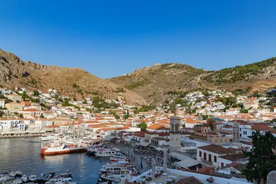
    Hydra

    Hydra

    Hydra is a narrow, rocky island in the Saronic Gulf off the coast of the Peloponnese. Around the semicircular harbour rise the stone houses and mansions of the shipping families who supplied a large part of the Greek fleet during the War of Independence in 1821. There are no cars or other vehicles on the island; loads are carried by mules and donkeys.

    Sources & method

    • Photos: Wikimedia Commons, Unsplash, Pexels. Each photo carries its credit.
    • Place data such as addresses and ratings comes from Google Maps.
    • The content is based on web research from public, traceable sources. How the content is made · The role of AI