Fernweh: Home
ExploreGuideDestinationsMy tripsMy trip
de|en
All Places & RegionsRound tripsNight trains in EuropeAll highlightsAbout FernwehFAQPrivacy PolicyImprint
Download on the App StoreGet it on Google Play
ExploreGuideDestinationsMy tripsMy trip
    • Neighborhoods & highlights
    • Recommendations
    • Walking tours
    • Eat & drink
    • Food culture
    • Culture
    • Nightlife
    • Getting around
    • Accommodation
    • Plan trip
    • Nearby
    Castleton

    Photo by Angel S on Pexels

    Great Britain

    Castleton

    CityCulture

    Castleton is a village at the western end of the Hope Valley, right where the pale limestone of the White Peak meets the dark shale and sandstone hills of the Dark Peak.

    by Felix Gillen

    1. Home
    2. Destinations
    3. Great Britain
    4. Peak District National Park
    5. Castleton
    Castleton is a village at the western end of the Hope Valley, right where the pale limestone of the White Peak meets the dark shale and sandstone hills of the Dark Peak. Above the stone houses, on a rock spur, stands the ruin of Peveril Castle, one of England's earliest Norman castles.Around the village are four show caves, in two of which the rare Blue John is still mined. Also, there's Winnats Pass and Mam Tor with the ridge to Lose Hill, one of the most popular hikes in the National Park. On weekends, the village gets very busy.
    Great Britain travel guideRound trips in Great BritainPlan a trip with Castleton

    Contents

    • Neighborhoods & highlights
    • Recommendations
    • Walking tours
    • Eat & drink
    • Food culture
    • Culture
    • Nightlife
    • Getting around
    • Accommodation
    • Nearby

    Sights in Castleton

    Discover the most important sights and attractions

    1Winnats Pass View Point

    Winnats Pass is a narrow limestone gorge west of Castleton, through which a steep, narrow road ascends to the high plateau towards Chapel-en-le-Frith. The slopes consist of the remnants of a reef that grew about 330 million years ago at the edge of a tropical sea; fossils are often found within it.From the top and from the slopes, you have a view down into the Hope Valley and across to Mam Tor. The road has a gradient of up to 20 percent and is feared by cyclists. It's best to park in the village or at Speedwell Cavern at the foot of the pass and walk up; there are only a few parking spaces at the top.
    Open in Google Maps
    Cave Dale

    “Peveril Castle and Cave Dale” by Mick Knapton at English Wikipedia / Wikimedia Commons / CC BY-SA 3.0, mod.

    2Cave Dale

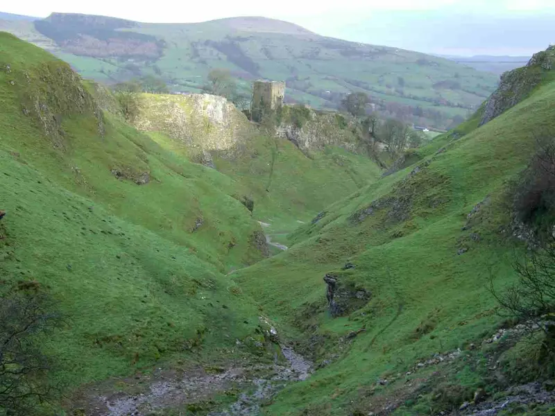
    Cave Dale is a narrow dry valley that begins directly at Castleton's marketplace through a narrow rock passage. Above the entrance, the keep of Peveril Castle stands on a rocky spur; from the valley, you have the most impressive view of the castle.The stony path leads uphill onto the limestone plateau and is part of popular circular hikes, such as the Limestone Way. When wet, the smooth rock steps in the lower section are slippery, sturdy shoes are mandatory here.
    Open in Google Maps
    St Edmund's Church

    “Castleton Church - geograph.org.uk - 1296901” by Wally Haines / Wikimedia Commons / CC BY-SA 2.0, mod.

    3St Edmund's Church

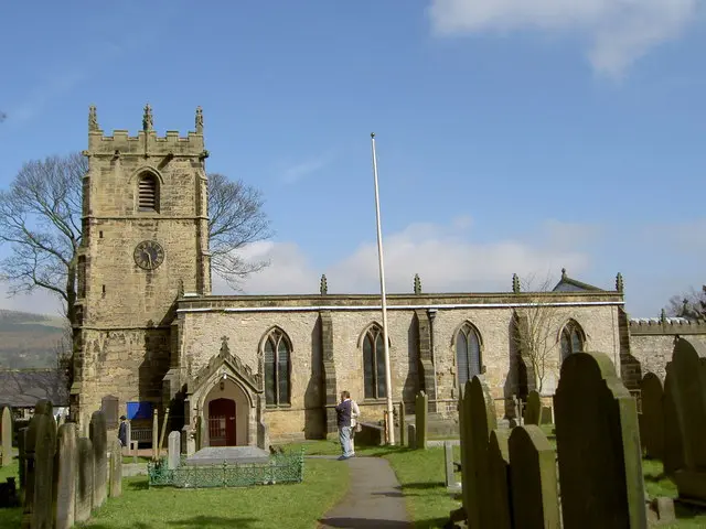
    The Parish Church of Castleton stands in the middle of the village and dates back to the Norman era; a Norman chancel arch is preserved, much else comes from later alterations. It is dedicated to the Anglo-Saxon King Edmund.Inside, the 17th-century pews with carved dates and a small historical library are noteworthy. On Garland Day at the end of May, the village procession ends at the church, where the large floral garland is pulled up to the top of the tower.
    Open in Google Maps

    4Treak Cliff Cavern and Blue John Mines

    Treak Cliff Cavern is located on the slope below Mam Tor, about one and a half kilometers west of the village. The cavern is one of the few sites of Blue John, a banded fluorite in blue, purple, and yellow hues, which has been mined here in small quantities since the 18th century.During the approximately 40-minute guided tour, you will see Blue John veins in the rock and, in the rear section, cave formations, including the so-called Dream Cave. The path is walkable, but with many steps. In the shop at the entrance, the stone is crafted into jewelry and small bowls.
    Open in Google Maps

    City walks in Castleton

    Curated walking tours through the city's highlights, handpicked by experienced travel journalists.

    The Heart of Castleton: A Walk Between History and Nature
    Discover the picturesque lanes and historic treasures of Castleton in the heart of the Peak District. This two-hour walk leads you from the majestic Peveril Castle to the impressive cave entrances and through the lively village centre. Experience the unique mix of medieval history and breathtaking natural scenery.
    ~2 Std.
    Open in Google Maps
    Stops (6)

    Restaurants in Castleton

    1

    Four Monkeys | 1530

    A café with a bar on Cross Street, the main street through the village. During the day, there's coffee, breakfast and light meals; later, drinks too. Well-rated and convenient as a stopover between the caves and Peveril Castle.
    Show on Google Maps
    2

    Tillys of Castleton

    A teashop on Cross Street in the village centre offering breakfast, sandwiches, scones, and cakes. A straightforward spot for a break before or after a hike up Mam Tor.
    Show on Google Maps
    3

    Rose Cottage Cafe & Bistro

    A café and bistro in an old cottage on Cross Street. During the day, they offer breakfast, lunch dishes, and Cream Tea; on sunny days, you can sit in the small garden. On weekends, you often have to wait for a table.
    Show on Google Maps
    4

    Castleton Fish & Chips

    A fish and chips shop on the edge of the village centre, popular with hikers after a day in the hills. Classic battered fish with chips, mostly for takeaway; eat your meal by the stream or on one of the village benches.
    Show on Google Maps
    5

    Three Roofs Cafe

    A long-established tearoom on the small traffic island in the village centre, known for its scones with clotted cream. It also serves breakfast, sandwiches, and hot lunches.
    Show on Google Maps

    Food and Beverages

    Castleton has, for its size, many pubs, tea rooms, and cafés, most of them on Cross Street. Many pubs serve continuously from midday until evening.

    Pub Classics

    After a hike, one traditionally eats in Castleton at the pub: Steak and Ale Pie, Fish and Chips, or a Sunday Roast on the weekend.

    Cream Tea

    Scones with Clotted Cream and jam, along with a pot of tea, you can get in almost every tea room in the village.

    Ale from the Peak District

    Many pubs serve cask ale from small breweries in the Hope Valley and the rest of Derbyshire.

    Culture and History

    Peveril CastleThe castle was built shortly after 1066 by William Peveril, a follower of William the Conqueror, who administered the royal forests and lead mines of the Peak. The keep was built by Henry II in the 12th century. The village developed as a planned settlement below the castle; its rectangular layout with a market square is still discernible today.Lead and Blue JohnFor centuries, Castleton thrived on lead mining. The Speedwell Cavern is an 18th-century adit through which ore was transported by boat. Blue John, a banded fluorite, is found almost exclusively in the hills west of the village and was crafted into vases and bowls in the 18th and 19th centuries, many of which can be found in country houses.Garland DayOn May 29th, the Garland King rides through the village with a bell-shaped floral garland covering him to the waist, accompanied by his Lady, a brass band, and dancing children. At the end, the garland is hoisted onto the church tower. The custom is associated with Oak Apple Day, which commemorates the return of Charles II in 1660.

    Nightlife

    1

    Ye Olde Nags Head

    A 17th-century inn on Cross Street, in the village centre. The bar with an open fireplace serves draught beer and pub food, with guest rooms upstairs. In the evenings, hikers and locals gather here.
    Show on Google Maps
    2

    The George

    An old village pub near the church and the path up to Peveril Castle. Cozy bar with low ceilings, hearty pub food, and a few simple guest rooms. In summer, you can sit outside with views of the castle hill.
    Show on Google Maps

    Getting There & Around

    By TrainThe nearest train station is Hope, on the Sheffield–Manchester line, about three kilometres to the east. From there, it's a 40-minute walk on a footpath to the village, or you can take the bus.By BusLine 272 connects Castleton with Hope, Hathersage, and Sheffield. Additional buses run to Buxton and Bakewell, more frequently on weekends than weekdays.By Car and On FootThe large car park at the visitor centre fills up early on weekends. The road below Mam Tor has been closed since a landslide in 1979; cars use the steep Winnats Pass. Within the village itself and to the caves, everything is accessible on foot.

    Accommodations in Castleton

    Find perfect stay in Castleton

    Booking.com* (Affiliate link)
    Search Hotels
    Agoda* (Affiliate link)
    Search Hotels
    Airbnb
    Vacation Rentals

    * Affiliate link: if you book through it, we earn a small commission. The price stays the same for you.

    Campgrounds in Castleton

    Find perfect campground in Castleton

    Search via Google Maps
    Campgrounds nearby (15km)
    Camping.info
    Find Campgrounds
    Park4Night
    RV Parks & Camping

    Plan your trip to Castleton

    Save places, build a route and plan your city trip, all in one place.

    1. 1
      Sunrise over alpine peaks and a sea of clouds
      1234

      Round trip

      12 days · 4 stops

      Saved

      Pick a route

      Pick a ready-made one or save places and plan your own.

      Open bookmarks
    2. 2

      Trip to Castleton

      Live
      • 1Winnats Pass View Point3 days
      • 2Cave Dale4 days
      • 3St Edmund's Church5 days
      Budget

      Plan your trip

      The planner sorts stops, days and budget. Plan together in real time.

      Start trip planning
    3. 3
      9:41 No signal
      Castleton
      Available offline

      Photo by Angel S on Pexels

      Use it on the road

      Download the guide to your phone and use it on site, even offline.

    Nearby

    Dark Peak

    Dark Peak

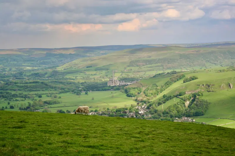
    The Dark Peak is the northern and eastern part of the Peak District, named after the dark Millstone Grit, a coarse sandstone, and the peat bogs that cover it. The landscape is open, sparsely treed, and rugged: high plateaus like Kinder Scout and Bleaklow, rocky edges like Stanage Edge, and deeply cut valleys.Here, in Edale, begins the Pennine Way, and at Kinder Scout in 1932, the Mass Trespass took place, which paved the way for National Parks and free access to the countryside in England. The weather is changeable and often foggy on the plateaus; for tours off the main paths, you will need a map and compass.

    Unsplash

    Peak District National Park

    Peak District National Park

    The Peak District in central England was established in 1951 as Britain's first national park and lies between the major cities of Manchester and Sheffield. It consists of two contrasting halves: the Dark Peak in the north with moorlands and dark gritstone edges, and the White Peak in the south with limestone valleys, dry stone walls, and sheep pastures.In between lie market towns like Bakewell and Buxton, the cave village of Castleton, and country estates like Chatsworth. The area is easily accessible by train and bus and is suitable for day hikes as well as multi-day trips.

    Unsplash

    Buxton

    Buxton

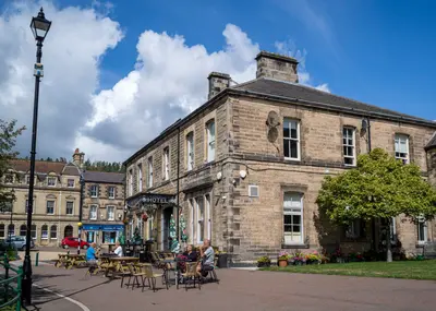
    Buxton is the spa town of the Peak District, located at an altitude of around 300 meters on the western edge of the National Park. Even the Romans used the warm spring, which emerges from the ground here at a constant temperature of about 28 degrees. The town received its current appearance in the 18th and 19th centuries, when the Dukes of Devonshire developed it into a spa resort.In the center are the curved Crescent, today a hotel with a thermal spa, the Opera House by Frank Matcham, and the Pavilion Gardens. At St Ann's Well, you can fill up on the spring water for free. With its train station, the town is a good base for hikes in the Goyt Valley and the White Peak.

    pierre matile·Pexels

    Bakewell

    Bakewell

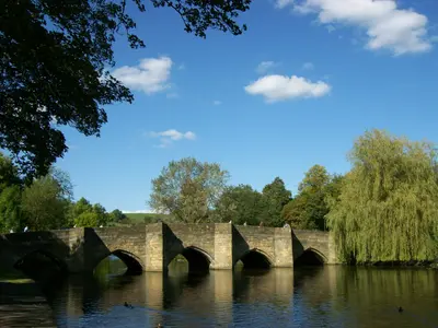
    Bakewell is the only town within the Peak District National Park, a small market town of grey limestone on the River Wye. A medieval five-arched bridge leads into the centre, and above the rooftops stands All Saints Church with its octagonal tower.The town is known for Bakewell Pudding and its Monday market. It serves as a good base for Chatsworth, Haddon Hall, and the Monsal Trail. On summer weekends, the centre is busy; during the week, outside of market days, it is much quieter.

    Tony Grist·public domain

    White Peak

    White Peak

    The White Peak is the limestone plateau in the south and central part of the Peak District. Dry stone walls divide the pastures into narrow fields, and between them, narrow valleys like Lathkill Dale, Monsal Dale, and Dovedale cut into the pale rock. The paths are gentler than in the moorland Dark Peak to the north and are easily accessible all year round.

    Unsplash

    Your next steps

    Castleton is in Great Britain. Ways to carry on from here.

    • More in Great Britain

      Highlights, areas, routes and the best time to travel for all of Great Britain.

      Great Britain travel guide
    • Round trips in Great Britain

      Ready-made routes through Great Britain, with stops, nights and a map.

      See the routes

    Sources & method

    • Photos: Wikimedia Commons, Pexels. Each photo carries its credit.
    • Place data such as addresses and ratings comes from Google Maps.
    • The content is based on web research from public, traceable sources. How the content is made · The role of AI