Fernweh: Home
    ExploreTravel GuidesPlan a tripMy tripLast visited
    de|en
    All Places & RegionsAll highlightsAbout FernwehFAQPrivacy PolicyImprint
    ExploreTravel GuidesPlan a tripMy tripLast visited
    • Overview
    • Places in the region
    • Eat & drink
    • Recommendations
    • Food culture
    • Best travel time
    • Culture
    • Getting around
    • Nearby
    Barrancas del Cobre (Copper Canyon)

    Mexico

    Barrancas del Cobre (Copper Canyon)

    Region

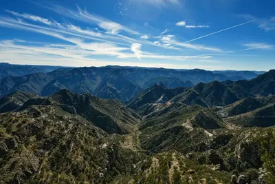
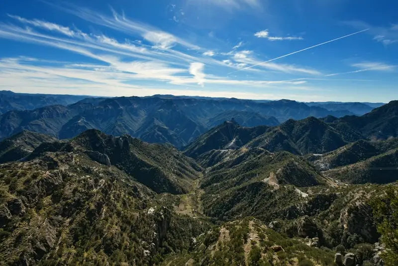
    The Barrancas del Cobre are a system of deep canyons in the Sierra Tarahumara in the southwest of the state of Chihuahua; the deepest, the Barranca de Urique, drops more than 1,800 m.

    by Felix Gillen

    1. Home
    2. Destinations
    3. Mexico
    4. Barrancas del Cobre (Copper Canyon)
    The Barrancas del Cobre are a system of deep canyons in the Sierra Tarahumara in the southwest of the state of Chihuahua; the deepest, the Barranca de Urique, drops more than 1,800 m. You travel there for the Chepe train ride through the Sierra, the views from the rim at Divisadero, and hikes to waterfalls, rock valleys, and down into the warm valley of Batopilas. The region is home to the Rarámuri, and gateway towns are Creel and Divisadero along the Chihuahua al Pacífico railway line.
    The canyons range from pine forests at around 2,400 m to humid, warm valley floors with figs and palm trees. The main starting point is Creel on the railway line, from where roads lead to lakes, rocky valleys, and waterfalls. In Divisadero, you look from the cliff edge into the canyons, and next to it is the Parque de Aventura with a cable car and zip lines. Deep in the valley lies the former silver mining village of Batopilas, accessible via a long, winding serpentine road. The Rarámuri live scattered throughout the Sierra, selling basketry and wood carvings at the viewpoints.
    Batopilas

    Place 1 of 3

    Batopilas

    Batopilas is located at just 580m altitude at the bottom of the gorge of the Río Batopilas, about five bus hours from Creel. From the 18th to the early 20th century, the town was a center of silver mining.

    Discover
    Creel
    Foto Eule / Wikimedia Commons / CC BY-SA 4.0

    Place 2 of 3

    Creel

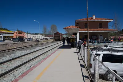
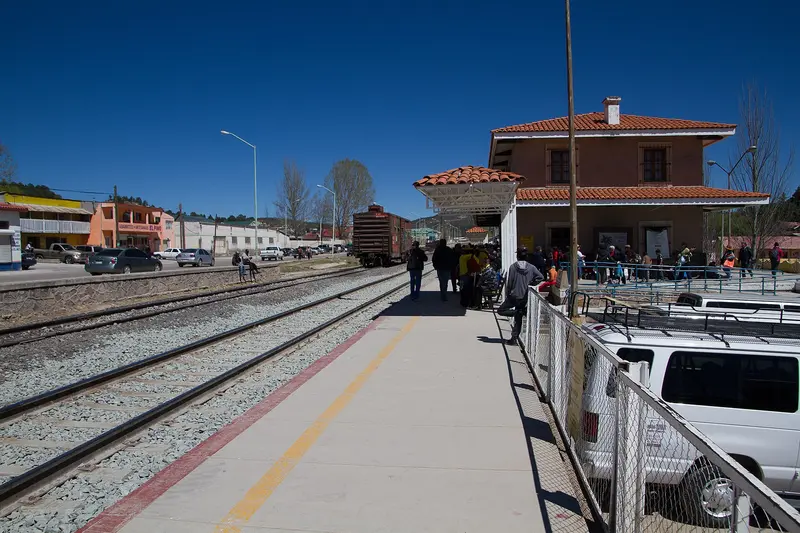
    Creel, at over 2,200 m in the Sierra Tarahumara, is the main gateway to the Barrancas del Cobre. The town began in 1907 as a rail station on the Chihuahua al Pacífico line, and is now the Chepe Express terminus.

    Discover
    Divisadero / Posada Barrancas

    Place 3 of 3

    Divisadero / Posada Barrancas

    Divisadero and the nearby Posada Barrancas are on the edge of the Copper Canyon, 2,400 m high on the Chepe railway line. From the viewpoint at the station, you see into several of the main canyons.

    Discover

    Sights in Barrancas del Cobre (Copper Canyon)

    Discover the most important sights and attractions

    Cascada de Basaseachi National Park
    National Park

    Cascada de Basaseachi National Park

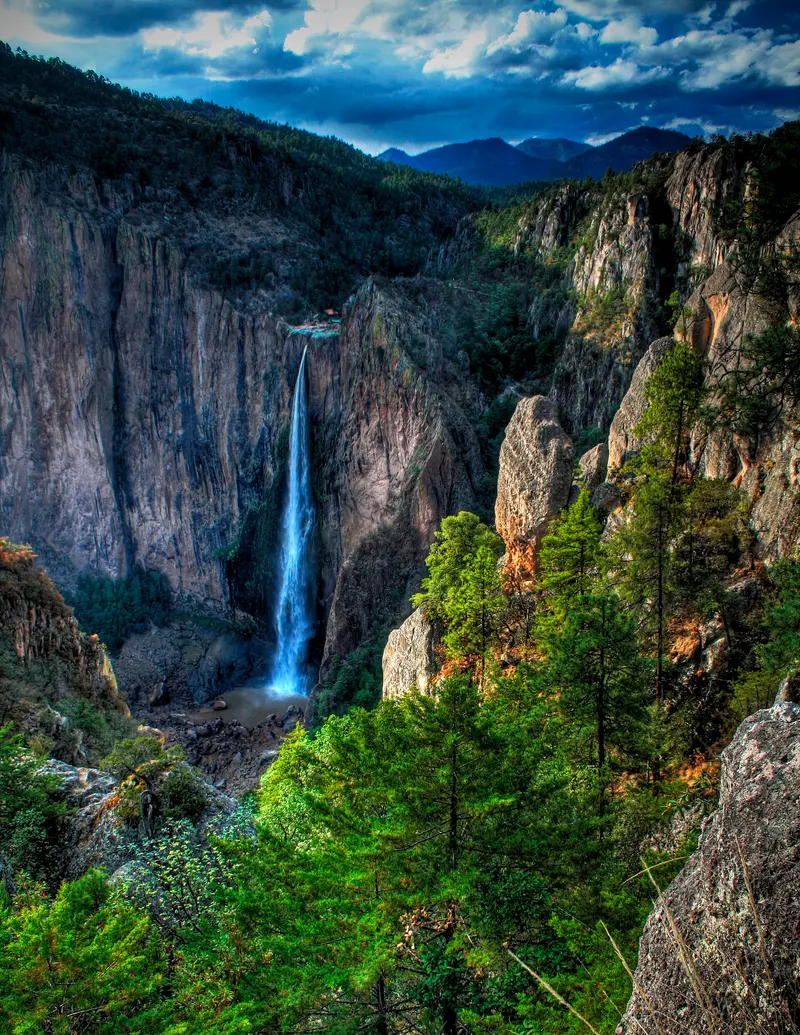
    Founded 1981, the national park protects Mexico's 2nd highest, 246m-high Basaseachi Waterfall, plunging into Barranca de Candameña. Trails lead to viewpoints at the top and base. It carries most water in the rainy season; in dry months, it weakens significantly.
    Open in Google Maps

    Essen & Trinken

    Tacos y Cortes "Barrancas"

    Restaurant in Barrancas del Cobre.
    Show on Google Maps

    Gorditas doña Esther

    Restaurant in Barrancas del Cobre.
    Show on Google Maps

    Food and Drink

    The cuisine of the Sierra is simple and hearty, with corn, beans, meat, and cheese from Chihuahua.

    Gorditas

    Thick, filled corn flatbreads, freshly prepared at many stalls in Creel and Divisadero.

    Mennonite cheese

    Mild slicing cheese from Mennonite communities near Cuauhtémoc, Chihuahua.

    Tesgüino

    A mildly alcoholic corn drink of the Rarámuri, enjoyed during festivals and community work.

    Best Time to Visit

    When is the best time for your trip?

    March
    April
    October
    November
    7–12°C·17–47 mm(little rain)
    In the highlands around Creel and Divisadero, October, November, March, and April are most pleasant: dry and mild. From July to September, most rain falls; the landscape is green, and the waterfalls are full. In winter, nights can be freezing, but in deep canyons like Batopilas, it's warm year-round.
    Climate values for Creel at around 2,350m (normal values 1951-2010). At the canyon bottoms, it's much warmer; April to June, it gets very hot there.

    Seasons

    Jan
    Feb
    Mar
    Apr
    May
    Jun
    Jul
    Aug
    Sep
    Oct
    Nov
    Dec
    Best Time: dry and mild
    Dry, extremely hot in the gorges
    Rainy season, green landscape
    Winter, frost possible in uplands
    Best Time to Visit
    ▶Show detailed monthly data
    MonthTemp (°C)Rain (mm)
    January4.149
    February5.533
    March7.322
    April10.217
    May13.516
    June17.264
    July17.6155
    August17.1138
    September15.689
    October11.847
    November8.027
    December5.249

    Culture and History

    The RarámuriThe Rarámuri, also known as Tarahumara, number around 70,000 people and live scattered throughout the Sierra Tarahumara. They are famous for their long-distance runs, such as the ball game Rarajipari, where a wooden ball is driven by foot for many kilometers. Jesuit missions from the 17th century onwards left churches in the region, including the Satevó Mission near Batopilas.The RailwayThe Chihuahua al Pacífico rail line was completed only in 1961. Over approximately 670 km, it crosses 37 bridges and passes through 86 tunnels, reaching an altitude of around 2,400 m in the Sierra.ExcursionsBasaseachi: National Park with one of Mexico's highest waterfalls, several hours' drive north of Creel.Batopilas: Silver mining village at the bottom of the canyon with the Satevó Mission.El Fuerte: Colonial town in Sinaloa on the railway line, starting or ending point for many Chepe journeys.

    Exploring the Region

    Chepe ExpressThe tourist Chepe Express travels approximately 350 km between Los Mochis in Sinaloa and Creel, with stops in El Fuerte, Bahuichivo, and Divisadero. The journey takes about nine hours. In 2026, it departs from Los Mochis on Mondays, Thursdays, and Saturdays, and from Creel on Tuesdays, Fridays, and Sundays; there is no service on Wednesdays. Check the current schedule on chepe.mx and book early, especially during peak season in July and August.Chepe RegionalThe Chepe Regional serves the entire route between Chihuahua and Los Mochis. Anyone can book the section from Chihuahua to Creel; for sections between Creel and Los Mochis, Ferromex requires a Chepe Express booking. Tickets for the Regional are available by phone or at the counter; schedules and operating days can be found on chepe.mx.By RoadCreel and Divisadero are also accessible by bus and rental car from Chihuahua. A long, winding mountain road leads to Batopilas. Do not drive at night and check the current UK FCDO Travel Advice for Mexico before your trip.

    Nearby

    Divisadero / Posada Barrancas

    Divisadero / Posada Barrancas

    Divisadero and the nearby Posada Barrancas are on the edge of the Copper Canyon, 2,400 m high on the Chepe railway line. From the viewpoint at the station, you see into several of the main canyons. Next to it: the Parque de Aventura with cable car, ZipRider, and zip lines.
    Creel

    Creel

    Creel, at over 2,200 m in the Sierra Tarahumara, is the main gateway to the Barrancas del Cobre. The town began in 1907 as a rail station on the Chihuahua al Pacífico line, and is now the Chepe Express terminus. Nearby are rock valleys, Lago Arareko, and the Cusárare waterfall.
    Batopilas

    Batopilas

    Batopilas is located at just 580m altitude at the bottom of the gorge of the Río Batopilas, about five bus hours from Creel. From the 18th to the early 20th century, the town was a center of silver mining. Since 2012, the village has been a Pueblo Mágico.
    Loreto

    Loreto

    Located on the Gulf Coast of Baja California Sur, Loreto was founded in 1697 as the peninsula's first permanent Spanish settlement. The Mission Church and Mission Museum form the heart of its small downtown. Off the coast is the Bahía de Loreto National Park, home to five larger islands.
    Baja California Sur

    Baja California Sur

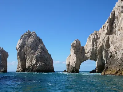
    Baja California Sur encompasses the southern half of the Baja California peninsula, a desert land between the Pacific and the Gulf of California. You go for the resorts of Los Cabos on the southern tip, for boat trips from La Paz to Espíritu Santo Island with the sea lion colony of Los Islotes, and for the artist town Todos Santos near the Pacific coast. Further north lies the mission town Loreto on the Gulf. The islands and protected areas in the Gulf of California have been a UNESCO World Heritage site since 2005.

    Sources & method

    • Photos: Wikimedia Commons, Pexels. Each photo carries its credit.
    • Place data such as addresses and ratings comes from Google Maps.
    • The content is based on web research from public, traceable sources. How the content is made · The role of AI