Fernweh: Home
    ExploreTravel GuidesPlan a tripMy tripLast visited
    de|en
    All Places & RegionsAll highlightsAbout FernwehFAQPrivacy PolicyImprint
    ExploreTravel GuidesPlan a tripMy tripLast visited
    Divisadero / Posada Barrancas

    Mexico

    Divisadero / Posada Barrancas

    Village

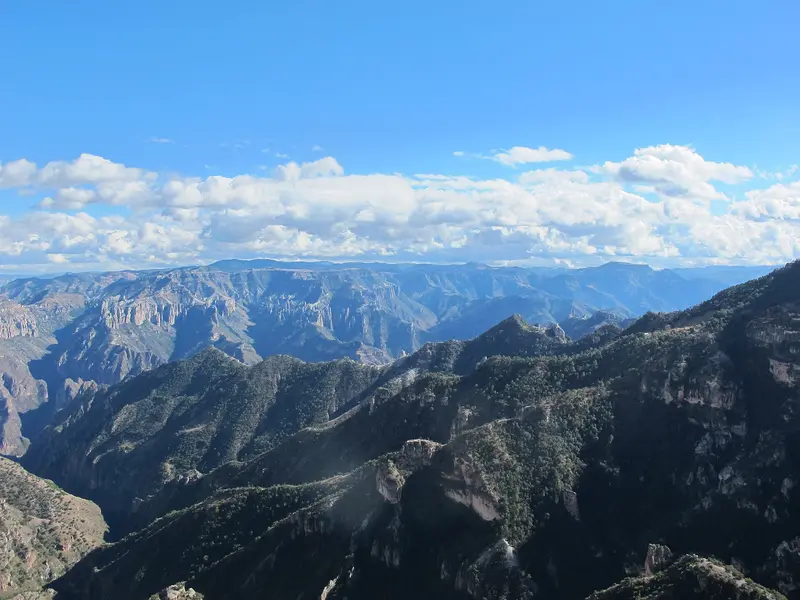
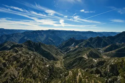
    Divisadero and the nearby Posada Barrancas are on the edge of the Copper Canyon, 2,400 m high on the Chepe railway line. From the viewpoint at the station, you see into several of the main canyons.

    by Felix Gillen

    1. Home
    2. Destinations
    3. Mexico
    4. Barrancas del Cobre (Copper Canyon)
    5. Divisadero / Posada Barrancas
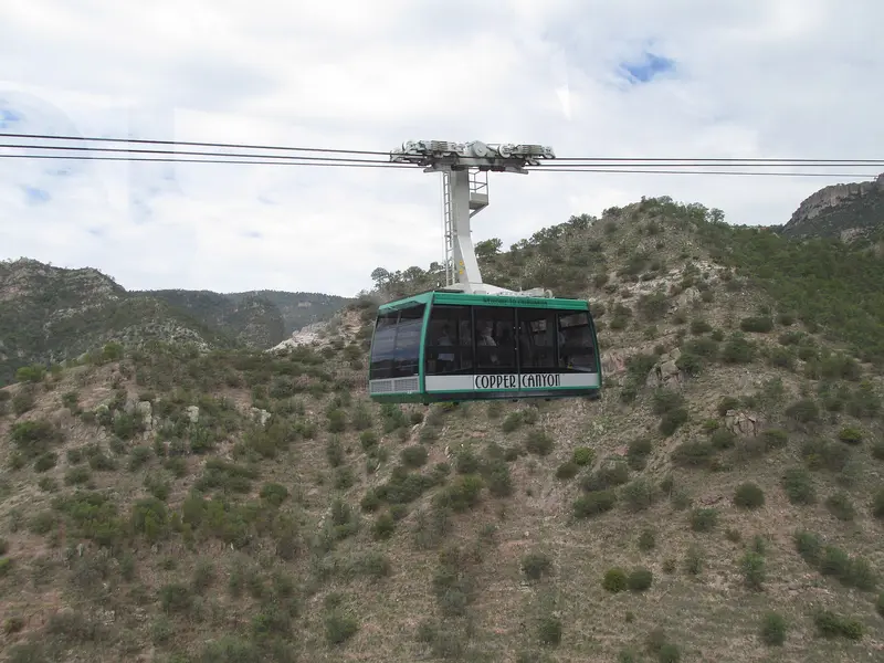
    Divisadero and the nearby Posada Barrancas are on the edge of the Copper Canyon, 2,400 m high on the Chepe railway line. From the viewpoint at the station, you see into several of the main canyons. Next to it: the Parque de Aventura with cable car, ZipRider, and zip lines.

    Sehenswürdigkeiten

    Discover the most important sights and attractions

    Attraction

    1Pilares de Chihuahua Sculpture Garden

    Sculpture garden at the canyon edge near Divisadero, with views over the Barrancas.
    Open in Google Maps
    Attraction

    2ZipRider

    Long zip line in Parque de Aventura, where you sit and ride down into the gorge. The return is usually by cable car.
    Open in Google Maps
    Attraction

    37 Ziplines and 2 Hanging Bridges Tour

    Adventure circuit in the Parque de Aventura with seven zip lines and two suspension bridges along the gorge wall.
    Open in Google Maps
    Attraction

    4Mirador del Cielo

    Viewpoint around 3 km north of Divisadero with a view into the canyon.
    Open in Google Maps
    Parque de Aventura Barrancas del Cobre
    Theme Park

    5Parque de Aventura Barrancas del Cobre

    State Adventure Park on the canyon edge near Posada Barrancas, with cable car, ZipRider, seven zip lines, and via ferrata. The cable car crosses the canyon without intermediate supports; it was fully serviced in 2025 and reopened on August 9.
    Open in Google Maps
    Divisadero
    Attraction

    6Divisadero

    Viewpoint at Divisadero station, perched on the canyon's rim. From here, you gaze into the Urique, Tararecua, and del Cobre valleys. At the edge, Rarámuri sell baskets and carvings. The Chepe makes a brief stop here.
    Open in Google Maps

    Essen & Trinken

    1

    Gorditas "Alondra"

    Gorditas stand in Posada Barrancas at Parque de Aventura, with freshly baked stuffed corn flatbreads.
    Show on Google Maps
    2

    Gorditas Doña Irma

    Simple Gorditas stand in Posada Barrancas near the Parque de Aventura.
    Show on Google Maps
    3

    Gorditas "Mary"

    Gorditas stand in Posada Barrancas, good for a quick snack before or after the park.
    Show on Google Maps
    4

    Restaurante El Barranco

    Restaurant in the Barrancas del Cobre Adventure Park at the canyon rim near Posada Barrancas.
    Show on Google Maps

    Tacos y Cortes "Barrancas"

    Restaurant in Barrancas del Cobre.
    Show on Google Maps

    Gorditas doña Esther

    Restaurant in Barrancas del Cobre.
    Show on Google Maps

    Food and Drink

    Around the station and park, stalls serve simple Sierra dishes; larger meals are available in the hotels.

    Gorditas

    Stuffed corn flatbreads, freshly baked at the stalls in Divisadero and Posada Barrancas.

    Burritos

    Wheat tortillas with stews, typical for Chihuahua.

    Culture and History

    High Above the RailwayThe Chihuahua al Pacífico railway line runs past Divisadero at about 2,400 m altitude, near its highest section, completed in 1961. The high plateau is the settlement area of the Rarámuri; many families live scattered in the canyons and sell their handicrafts at the viewpoints.ExcursionsCreel: Starting point with rock valleys, Lago Arareko and Cusárare waterfall, accessible by Chepe or car.Batopilas: Former silver village at the bottom of the canyon.

    Exploring locally

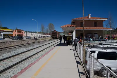
    The train station, viewpoint, and hotels are close by and within walking distance. To Parque de Aventura in Posada Barrancas, you can take a taxi or hotel shuttle, or walk along the rim.The Chepe Express stops in Divisadero, and there's also a road connection to Creel. Find schedules and booking at chepe.mx. Before your trip, check the current UK FCDO Travel Advice for Mexico.

    Accommodations in Divisadero / Posada Barrancas

    Find perfect stay in Divisadero / Posada Barrancas

    Booking.com* (Affiliate link)
    Search Hotels
    Agoda* (Affiliate link)
    Search Hotels
    Airbnb
    Vacation Rentals

    * Affiliate link: if you book through it, we earn a small commission. The price stays the same for you.
    Nearby

    Barrancas del Cobre (Copper Canyon)

    Barrancas del Cobre (Copper Canyon)

    The Barrancas del Cobre are a system of deep canyons in the Sierra Tarahumara in the southwest of the state of Chihuahua; the deepest, the Barranca de Urique, drops more than 1,800 m. You travel there for the Chepe train ride through the Sierra, the views from the rim at Divisadero, and hikes to waterfalls, rock valleys, and down into the warm valley of Batopilas. The region is home to the Rarámuri, and gateway towns are Creel and Divisadero along the Chihuahua al Pacífico railway line.
    Creel

    Creel

    Creel, at over 2,200 m in the Sierra Tarahumara, is the main gateway to the Barrancas del Cobre. The town began in 1907 as a rail station on the Chihuahua al Pacífico line, and is now the Chepe Express terminus. Nearby are rock valleys, Lago Arareko, and the Cusárare waterfall.
    Batopilas

    Batopilas

    Batopilas is located at just 580m altitude at the bottom of the gorge of the Río Batopilas, about five bus hours from Creel. From the 18th to the early 20th century, the town was a center of silver mining. Since 2012, the village has been a Pueblo Mágico.
    Loreto

    Loreto

    Located on the Gulf Coast of Baja California Sur, Loreto was founded in 1697 as the peninsula's first permanent Spanish settlement. The Mission Church and Mission Museum form the heart of its small downtown. Off the coast is the Bahía de Loreto National Park, home to five larger islands.
    Baja California Sur

    Baja California Sur

    Baja California Sur encompasses the southern half of the Baja California peninsula, a desert land between the Pacific and the Gulf of California. You go for the resorts of Los Cabos on the southern tip, for boat trips from La Paz to Espíritu Santo Island with the sea lion colony of Los Islotes, and for the artist town Todos Santos near the Pacific coast. Further north lies the mission town Loreto on the Gulf. The islands and protected areas in the Gulf of California have been a UNESCO World Heritage site since 2005.

    Sources & method

    • Photos: Wikimedia Commons, Pexels, Google Maps. Each photo carries its credit.
    • Place data such as addresses and ratings comes from Google Maps.
    • The content is based on web research from public, traceable sources. How the content is made · The role of AI