Fernweh: Home
    ExploreTravel GuidesPlan a tripMy tripLast visited
    de|en
    All Places & RegionsAll highlightsAbout FernwehFAQPrivacy PolicyImprint
    ExploreTravel GuidesPlan a tripMy tripLast visited
    • Overview
    • Places in the region
    • Eat & drink
    • Culture
    • Getting around
    • Round trips
    • Nearby
    Canterbury

    New Zealand

    Canterbury

    Region

    Canterbury is New Zealand's largest region by area, stretching from the Pacific coast across the vast Canterbury Plains to the main ridge of the Southern Alps.

    by Felix Gillen

    1. Home
    2. Destinations
    3. New Zealand
    4. Canterbury
    Canterbury is New Zealand's largest region by area, stretching from the Pacific coast across the vast Canterbury Plains to the main ridge of the Southern Alps. Christchurch is the gateway to the South Island, with an international airport and a rail connection to the West Coast.Inland lie the turquoise lakes Tekapo and Pukaki and Aoraki/Mount Cook National Park with the country's highest mountain. On the coast await Kaikōura with whales and seals, and Banks Peninsula with Akaroa.
    Most travelers land in Christchurch and continue their journey from there. To the southwest, State Highway 8 leads through the Mackenzie Basin to Lakes Tekapo and Pukaki and on to Queenstown or Wanaka. Northwards, the route follows the coast to Kaikōura and Marlborough. The region around Tekapo belongs to the Aoraki Mackenzie International Dark Sky Reserve; the night sky here is exceptionally clear.
    Aoraki/Mount Cook National Park

    Place 1 of 4

    Aoraki/Mount Cook National Park

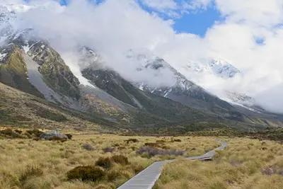
    The Aoraki/Mount Cook National Park encompasses the highest peaks of the Southern Alps, notably Aoraki/Mount Cook at 3,724 meters. Approximately 40 percent of its area is covered by glaciers, including the Tasman Glacier, the country's longest.

    Discover
    Lake Tekapo

    Place 2 of 4

    Lake Tekapo

    Lake Tekapo, in Māori Takapō, is a small town on the southern shore of the eponymous lake in the Mackenzie Basin. Fine rock flour from the glaciers colors the water milky turquoise, with the Southern Alps standing in the background.

    Discover
    Kaikōura

    Place 3 of 4

    Kaikōura

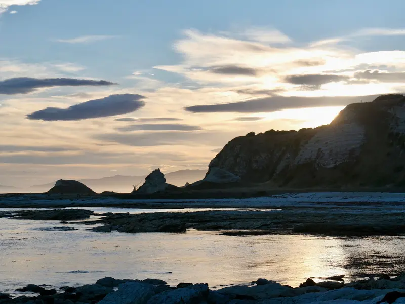
    Kaikōura lies on the east coast of the South Island, nestled between the Pacific and the Kaikōura Ranges, often snow-capped in winter. Just offshore, the seabed drops into a deep trench.

    Discover
    Akaroa

    Place 4 of 4

    Akaroa

    Akaroa is situated within an ancient volcanic crater on the Banks Peninsula, approximately 80 kilometres southeast of Christchurch.

    Discover

    More places in Canterbury

    Christchurch

    Christchurch

    Christchurch, known in Māori as Ōtautahi, is the South Island's largest city. Following the 2010 and 2011 earthquakes, much of the city centre was rebuilt. Today, neo-Gothic stone buildings stand alongside modern architecture, street art, and new public spaces by the Avon River.Distances are short: Hagley Park, the Botanic Gardens, the Museum, and the Arts Centre are all located next to each other on the western edge of the city centre. The city is an excellent starting point for excursions to the Banks Peninsula or the Port Hills.
    Port Hills

    Port Hills

    The Port Hills are the remains of an extinct volcano and separate Christchurch from Lyttelton Harbour. The Summit Road runs along the ridge, with hiking trails and mountain bike tracks branching off in all directions. From the top, you can see across the city and the Canterbury Plains to the Southern Alps.The easiest way up is by gondola. On the other side lies Lyttelton, a small harbour town with cafés, bars, and a weekly market.

    Essen & Trinken

    The George

    Schicke Zimmer in einem gehobenen Hotel mit elegantem Restaurant und Bistro, beide mit Parkblick.
    Show on Google Maps

    Culture and History

    Canterbury is the tribal territory of Ngāi Tahu, the largest iwi of the South Island. From 1850, the Canterbury Association specifically settled the region with English emigrants; you can see traces of this in Christchurch's neo-Gothic architecture.Land of SheepThe Canterbury Plains are still largely agricultural. Large farms, known as high country stations, stretch into the mountains; some offer overnight stays and farm visits.

    Traveling in Canterbury

    Christchurch Airport is the main airport of the South Island. From here, you can best explore the region by rental car or campervan. The TranzAlpine travels to Greymouth, the Coastal Pacific runs in summer via Kaikōura to Picton. Intercity buses connect Christchurch with Tekapo, Mount Cook, and Queenstown.
    Round trips through this region

    New Zealand Classics North & South

    New Zealand Classics North & South

    The route leads from Auckland via Rotorua to Wellington, by ferry across the Cook Strait to Picton, and then across the South Island to Lake Tekapo. The ferry takes a good three hours, and the drive from Picton via Kaikōura and Christchurch to Tekapo takes around seven hours.

    12 Days
    5 stops
    New Zealand South Island Road Trip In-depth

    New Zealand South Island Road Trip In-depth

    The route leads from Lake Tekapo to Aoraki/Mount Cook, on to Queenstown and Te Anau, then via Wanaka and Haast Pass to the West Coast glaciers. From Te Anau, it’s just over two hours’ drive to Milford Sound; Wanaka to Franz Josef is about four hours.

    15 Days
    6 stops
    New Zealand Family-Friendly Roadtrip

    New Zealand Family-Friendly Roadtrip

    On the North Island, you'll travel from Auckland to Rotorua and Taupō, then switch to the South Island for Lake Tekapo and Wanaka. Travel between these stations usually takes one to three hours; for the switch to the South Island via domestic flight or the Wellington–Picton ferry, plan at least a full day.

    17 Days
    5 stops

    Nearby

    Christchurch

    Christchurch

    Christchurch, known in Māori as Ōtautahi, is the South Island's largest city. Following the 2010 and 2011 earthquakes, much of the city centre was rebuilt. Today, neo-Gothic stone buildings stand alongside modern architecture, street art, and new public spaces by the Avon River.Distances are short: Hagley Park, the Botanic Gardens, the Museum, and the Arts Centre are all located next to each other on the western edge of the city centre. The city is an excellent starting point for excursions to the Banks Peninsula or the Port Hills.
    Port Hills

    Port Hills

    The Port Hills are the remains of an extinct volcano and separate Christchurch from Lyttelton Harbour. The Summit Road runs along the ridge, with hiking trails and mountain bike tracks branching off in all directions. From the top, you can see across the city and the Canterbury Plains to the Southern Alps.The easiest way up is by gondola. On the other side lies Lyttelton, a small harbour town with cafés, bars, and a weekly market.
    Akaroa

    Akaroa

    Akaroa is situated within an ancient volcanic crater on the Banks Peninsula, approximately 80 kilometres southeast of Christchurch. This small town stretches along the shore of Akaroa Harbour, with street names like Rue Lavaud and Rue Jolie recalling the French settlers who arrived here in 1840.Most visitors come for the harbour: boat tours lead to Hector's dolphins, seals, and the cliffs at the harbour entrance. In addition, there are hiking trails into the hills and small restaurants along the waterfront promenade.
    West Coast

    West Coast

    The West Coast stretches as a narrow strip for about 600 kilometers along the South Island, between the Tasman Sea and the Southern Alps. Rainforest, wild beaches, and rivers characterize the landscape; the towns are small and spread far apart.In the north await the limestone landscapes of Paparoa and Kahurangi, in the center the old gold mining towns of Greymouth and Hokitika, and in the south the Franz Josef and Fox Glaciers. Most travelers drive the entire coast.
    Kaikōura

    Kaikōura

    Kaikōura lies on the east coast of the South Island, nestled between the Pacific and the Kaikōura Ranges, often snow-capped in winter. Just offshore, the seabed drops into a deep trench. This nutrient-rich water attracts sperm whales, dolphins, fur seals, and albatrosses.This small town thrives on the sea: whale watching by boat or plane, dolphin swimming tours, and crayfish from food trucks. On land, the Peninsula Walkway leads along the peninsula's cliffs.

    Sources & method

    • Photos: Unsplash. Each photo carries its credit.
    • Place data such as addresses and ratings comes from Google Maps.
    • The content is based on web research from public, traceable sources. How the content is made · The role of AI