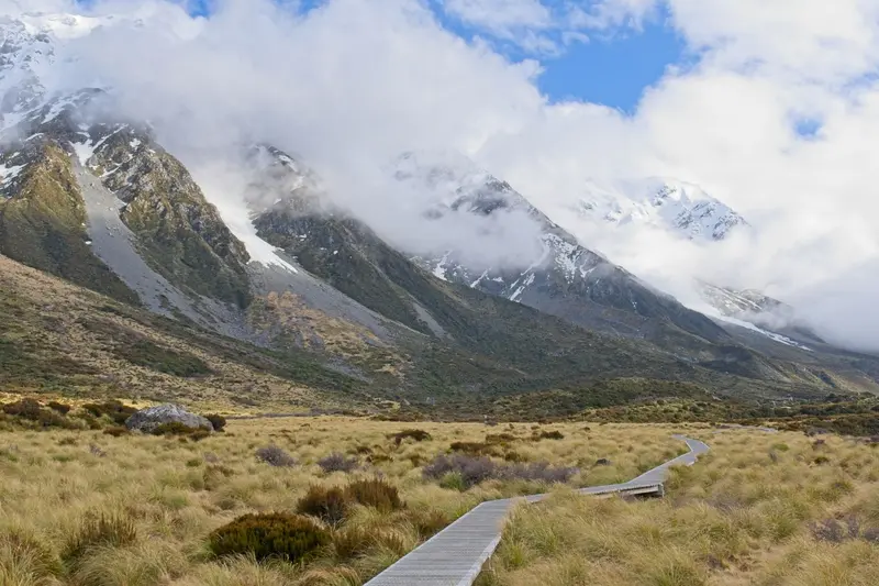
The route leads from Lake Tekapo to Aoraki/Mount Cook, on to Queenstown and Te Anau, then via Wanaka and Haast Pass to the West Coast glaciers. From Te Anau, it’s just over two hours’ drive to Milford Sound; Wanaka to Franz Josef is about four hours.
15 Days / 14 Nights
November–March
6 stops
Why This Route?
For campervan hikers seeking South Island's high mountains, fjords & glaciers on one trip.
Hidden Gems
Tasman Glacier View Track in Aoraki/Mount Cook National Park
Blue Pools at Haast Pass between Wanaka and the West Coast
Lake Matheson near Fox Glacier early morning, when the mountains reflect in the water
Itinerary
Stop 1 • 2 Nights
Lake Tekapo
Village
Lake Tekapo, in Māori Takapō, is a small town on the southern shore of the eponymous lake in the Mackenzie Basin. Fine rock flour from the glaciers colors the water milky turquoise, with the Southern Alps standing in the background.By day, the view from Mount John and the stone church on the shore beckon; by night, the starry sky: The region belongs to the Aoraki Mackenzie International Dark Sky Reserve. In early summer, lupins bloom along the shores, an introduced plant that attracts many photographers.
4 Sights
4 Restaurants
Culture and History
The Mackenzie Country was developed for sheep farming from the mid-19th century. The 1935 Church of the Good Shepherd commemorates the first settlers, while a bronze statue nearby honors the sheepdogs, vital for work on the vast stations.Water and StarsSince the mid-20th century, the lake generates power, its water channeled into the Waitaki System's power plants. In 2012, the region became an International Dark Sky Reserve; strict outdoor lighting rules keep its skies dark.
The Aoraki/Mount Cook National Park encompasses the highest peaks of the Southern Alps, notably Aoraki/Mount Cook at 3,724 meters. Approximately 40 percent of its area is covered by glaciers, including the Tasman Glacier, the country's longest. The park has existed since 1953 and is part of the UNESCO World Heritage Site Te Wāhipounamu.The starting point is the small Mount Cook Village at the end of State Highway 80. From here, short hikes like the Hooker Valley Track, mountaineering tours, and scenic flights depart. At night, the park is part of the Aoraki Mackenzie International Dark Sky Reserve.
5 Sights
2 Restaurants
Kultur & Geschichte
Die Dualität von Aoraki und Mount Cook
Die Region um den höchsten Berg Neuseelands, bekannt als Mount Cook, trägt eine tiefe kulturelle und historische Bedeutung, die eng mit der indigenen Bevölkerung der Māori sowie der europäischen Erkundungsgeschichte verbunden ist. Der Berg ist offiziell als Aoraki/Mount Cook benannt, eine duale Bezeichnung, die sowohl seinen Māori-Namen als auch den europäischen Namen ehrt und die vielschichtige Geschichte des Gebietes widerspiegelt.
Māori-Kultur und Legenden
Für die Ngāi Tahu, den örtlichen Māori-Stamm, ist Aoraki ein heiliger Berg und ein Ahnherr. Sein Name, der übersetzt "Wolkenstecher" bedeutet, ist tief in den mündlichen Überlieferungen und Legenden verankert.
Die bekannteste Legende besagt, dass Aoraki und seine Brüder die Söhne von Rakinui, dem Himmelsvater, waren. Als ihre Waka (Kanu) kenterte, verwandelten sie sich in die Gipfel der Südalpen, wobei Aoraki der höchste ist.
Die Region diente traditionell als wichtiges Jagd- und Sammelgebiet, insbesondere für Tī Kōuka (Kohlbaum) und Pounamu (Grünstein), der in den Flussbetten der Westküste gefunden wurde und über Pässe wie den Copland Pass transportiert wurde.
Du wirst feststellen, dass viele geografische Merkmale in der Umgebung sowohl Māori- als auch europäische Namen tragen, was die lange Präsenz beider Kulturen in diesem Landstrich unterstreicht.
Europäische Erkundung und Benennung
Die europäische Entdeckung der Südalpen erfolgte durch Kapitän James Cook im Jahr 1770, der die majestätische Bergkette von der Küste aus sichtete, jedoch den höchsten Gipfel nicht explizit identifizierte.
Der Berg wurde 1851 von Kapitän J.L. Stokes von der HMS Acheron offiziell als Mount Cook benannt, zu Ehren von James Cook.
Die ersten dokumentierten europäischen Erkundungen und Besteigungsversuche begannen in den späten 1800er Jahren, angezogen von der Herausforderung und Schönheit der alpinen Landschaft.
Pioniergeist des Alpinismus
Mount Cook ist untrennbar mit der Geschichte des Alpinismus in Neuseeland verbunden. Er zieht seit Jahrzehnten Bergsteiger aus aller Welt an und hat einige der größten Persönlichkeiten des Sports hervorgebracht.
Die Erstbesteigung durch Europäer gelang 1894 den Neuseeländern Tom Fyfe, Jack Clarke und George Graham.
Der weltberühmte Bergsteiger Sir Edmund Hillary, der zusammen mit Tenzing Norgay den Mount Everest als Erster bestieg, trainierte intensiv in dieser Region. Das Sir Edmund Hillary Alpine Centre im Mount Cook Village bietet eine umfassende Ausstellung über sein Leben und seine Errungenschaften sowie die alpine Geschichte der Region.
Heute ist das Gebiet ein Zentrum für Bergsteigen, Wandern und andere alpine Aktivitäten, wobei der Respekt vor der Natur und den alpinen Herausforderungen im Vordergrund steht.
For adventure seekers. Perfect for unwinding and relaxation and Stunning nature and outdoors.
Queenstown lies on the northern shore of Lake Wakatipu, framed by the Remarkables and Ben Lomond. The small town is New Zealand's center for Bungy, jet boating, and skiing, but also serves as a base for Milford Sound, the Central Otago wine regions, and hikes on the Routeburn Track.
8 Sights
5 Restaurants
From Gold Rush Town to Adventure Hub
From Gold Mining Town to Adventure HubQueenstown originated in 1862 when gold was discovered on the Shotover River. After the gold rush, a small farming town remained, growing into a ski resort from the 1950s. In 1988, A. J. Hackett opened the world's first commercial bungee jump at Kawarau Bridge, and Queenstown has been an adventure sports hub ever since.The TSS Earnslaw steamboat has been sailing across Lake Wakatipu since 1912, connecting the town with Walter Peak High Country Farm. For the Kāi Tahu, the lake has its own lore: According to their legend, its outline forms the body of the giant Matau.
For adventure seekers. Culinary highlights and Perfect for unwinding and relaxation.
Situated on the eastern shore of Lake Te Anau, the South Island's largest lake, Te Anau is the main base for Fiordland National Park. From here, tours depart for Milford and Doubtful Sound, and the Kepler Track starts at the town's edge.
7 Sights
10 Restaurants
Gate to Fiordland
Gateway to FiordlandLake Te Anau is up to 417 metres deep and, with its three western fjord arms, is itself a glacial lake. The town emerged only in the 20th century, primarily through the construction of the Milford Road and tourism. The glowworm caves on the western shore are linked to an ancient Māori tradition and were rediscovered in 1948.In the Te Anau Bird Sanctuary on the southern shore live Takahē, a flightless bird that was long considered extinct and was rediscovered in 1948 in the nearby Murchison Mountains.
Wanaka is located on the southern shore of Lake Wānaka, about an hour's drive north of Queenstown. It is quieter than its neighbour and a gateway to Mount Aspiring National Park, the Roys Peak track, and the ski fields of Cardrona and Treble Cone.
4 Sights
3 Restaurants
History and Character
History and CharacterFor the Kāi Tahu, the lake and the valleys of Makarora and Matukituki were part of the routes to the West Coast Pounamu. European settlers arrived in the 1850s and 1860s as sheep farmers; the gold rush brushed the area, especially along the Cardrona River. For a long time, Wanaka remained a small holiday resort for families from Otago.Today, the town is a centre for mountain sports and boasts an active arts and café scene. Every second Easter, the Warbirds over Wanaka airshow takes place, and Lake Wānaka is a popular destination for sailors and paddlers.
For adventure seekers. Perfect for unwinding and relaxation.
In Westland Tai Poutini National Park, two glaciers extend from the Southern Alps deep into the rainforest: Franz Josef and Fox Glacier. The two namesake villages are located about 25 kilometers apart on State Highway 6 and serve as the base for glacier hikes, helicopter flights, and valley walks.Both glaciers have retreated significantly in recent decades. Today, you can only access the ice with guided Heli-Hikes; the valley paths end at viewpoints at a distance from the glacier terminus.
6 Sights
4 Restaurants
Glaciers and World Heritage
The National Park is part of the UNESCO World Heritage site Te Wāhipounamu in the southwest of the South Island. The Māori names of the glaciers are Kā Roimata o Hine Hukatere for Franz Josef and Te Moeka o Tuawe for Fox Glacier.WeatherThe west side of the Southern Alps is one of New Zealand's rainiest regions. Helicopter flights are often cancelled due to low clouds, so plan a buffer day if a flight is important to you.