Fernweh: Home
    ExploreTravel GuidesPlan a tripMy tripLast visited
    de|en
    All Places & RegionsAll highlightsAbout FernwehFAQPrivacy PolicyImprint
    ExploreTravel GuidesPlan a tripMy tripLast visited
    Aoraki/Mount Cook National Park

    New Zealand

    Aoraki/Mount Cook National Park

    National Park

    The Aoraki/Mount Cook National Park encompasses the highest peaks of the Southern Alps, notably Aoraki/Mount Cook at 3,724 meters.

    by Felix Gillen

    1. Home
    2. Destinations
    3. New Zealand
    4. Canterbury
    5. Aoraki/Mount Cook National Park
    The Aoraki/Mount Cook National Park encompasses the highest peaks of the Southern Alps, notably Aoraki/Mount Cook at 3,724 meters. Approximately 40 percent of its area is covered by glaciers, including the Tasman Glacier, the country's longest. The park has existed since 1953 and is part of the UNESCO World Heritage Site Te Wāhipounamu.The starting point is the small Mount Cook Village at the end of State Highway 80. From here, short hikes like the Hooker Valley Track, mountaineering tours, and scenic flights depart. At night, the park is part of the Aoraki Mackenzie International Dark Sky Reserve.

    Sights

    Discover the most important sights and attractions

    Tasman Glacier and Lake

    1Tasman Glacier and Lake

    The Tasman Glacier is New Zealand's longest glacier; at its end lies Tasman Lake with floating icebergs. From the car park in Tasman Valley, a short, steep path leads to the viewpoint; in summer, boats operate on the lake.
    Open in Google Maps
    Sir Edmund Hillary Alpine Centre

    2Sir Edmund Hillary Alpine Centre

    Exhibition at the Hermitage Hotel on Sir Edmund Hillary and the history of mountaineering at Aoraki/Mount Cook, with cinema and planetarium. A rainy day option.
    Open in Google Maps
    Kea Point Track

    3Kea Point Track

    Short walk from the village to a platform above Mueller Glacier Lake, overlooking Mount Sefton and Aoraki/Mount Cook. Return trip about two hours.
    Open in Google Maps
    Hooker Valley Track
    Attraction

    4Hooker Valley Track

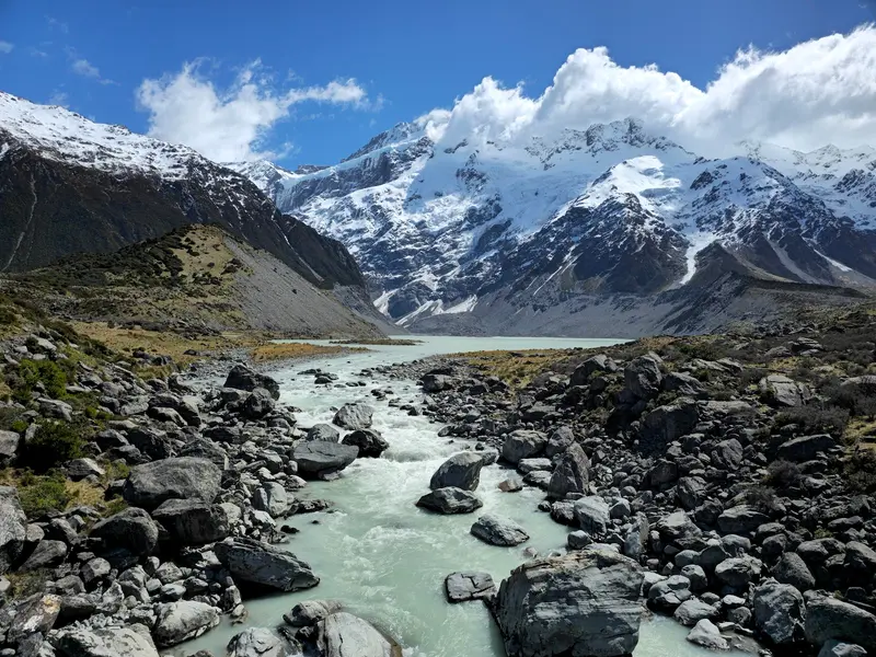
    The most famous hiking trail in the park leads over three suspension bridges through the Hooker Valley to Hooker Lake at the foot of Aoraki/Mount Cook. Allow about three hours for the return trip; the trail is mostly flat.
    Open in Google Maps
    Sealy Tarns
    Attraction

    5Sealy Tarns

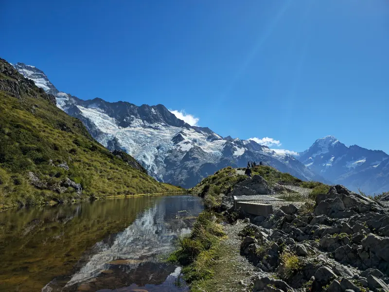
    Small mountain lakes on the slope above Hooker Valley, reached by a steep path with over 2,000 steps. From the top, you'll see the Mueller Glacier and Aoraki/Mount Cook.
    Open in Google Maps

    Restaurants & Cafés

    1

    The Panorama Room

    À la carte restaurant in the Hermitage Hotel with views of Aoraki/Mount Cook. Reservations are recommended in the evening.
    Show on Google Maps
    2

    Alpine Restaurant

    Buffet restaurant in the Hermitage Hotel with large windows facing the mountains.
    Show on Google Maps

    Food & Drink

    Despite its remote location, Mount Cook's dining scene offers solid options, often paired with impressive views. At The Panorama Room, you can enjoy upscale cuisine overlooking the Alps, while Chamois Bar & Grill provides a more relaxed atmosphere for regional specialties.

    Hermitage Hotel

    Most restaurants are in the Hermitage Hotel, including a buffet restaurant and an à la carte restaurant with mountain views. Village offerings are limited, and prices are higher than in cities.

    Self-catering

    The village has very few shops. If you're cooking for yourself or need provisions for hikes, buy them in Twizel or Tekapo.

    Kultur & Geschichte

    Die Dualität von Aoraki und Mount Cook Die Region um den höchsten Berg Neuseelands, bekannt als Mount Cook, trägt eine tiefe kulturelle und historische Bedeutung, die eng mit der indigenen Bevölkerung der Māori sowie der europäischen Erkundungsgeschichte verbunden ist. Der Berg ist offiziell als Aoraki/Mount Cook benannt, eine duale Bezeichnung, die sowohl seinen Māori-Namen als auch den europäischen Namen ehrt und die vielschichtige Geschichte des Gebietes widerspiegelt. Māori-Kultur und Legenden Für die Ngāi Tahu, den örtlichen Māori-Stamm, ist Aoraki ein heiliger Berg und ein Ahnherr. Sein Name, der übersetzt "Wolkenstecher" bedeutet, ist tief in den mündlichen Überlieferungen und Legenden verankert. Die bekannteste Legende besagt, dass Aoraki und seine Brüder die Söhne von Rakinui, dem Himmelsvater, waren. Als ihre Waka (Kanu) kenterte, verwandelten sie sich in die Gipfel der Südalpen, wobei Aoraki der höchste ist. Die Region diente traditionell als wichtiges Jagd- und Sammelgebiet, insbesondere für Tī Kōuka (Kohlbaum) und Pounamu (Grünstein), der in den Flussbetten der Westküste gefunden wurde und über Pässe wie den Copland Pass transportiert wurde. Du wirst feststellen, dass viele geografische Merkmale in der Umgebung sowohl Māori- als auch europäische Namen tragen, was die lange Präsenz beider Kulturen in diesem Landstrich unterstreicht. Europäische Erkundung und Benennung Die europäische Entdeckung der Südalpen erfolgte durch Kapitän James Cook im Jahr 1770, der die majestätische Bergkette von der Küste aus sichtete, jedoch den höchsten Gipfel nicht explizit identifizierte. Der Berg wurde 1851 von Kapitän J.L. Stokes von der HMS Acheron offiziell als Mount Cook benannt, zu Ehren von James Cook. Die ersten dokumentierten europäischen Erkundungen und Besteigungsversuche begannen in den späten 1800er Jahren, angezogen von der Herausforderung und Schönheit der alpinen Landschaft. Pioniergeist des Alpinismus Mount Cook ist untrennbar mit der Geschichte des Alpinismus in Neuseeland verbunden. Er zieht seit Jahrzehnten Bergsteiger aus aller Welt an und hat einige der größten Persönlichkeiten des Sports hervorgebracht. Die Erstbesteigung durch Europäer gelang 1894 den Neuseeländern Tom Fyfe, Jack Clarke und George Graham. Der weltberühmte Bergsteiger Sir Edmund Hillary, der zusammen mit Tenzing Norgay den Mount Everest als Erster bestieg, trainierte intensiv in dieser Region. Das Sir Edmund Hillary Alpine Centre im Mount Cook Village bietet eine umfassende Ausstellung über sein Leben und seine Errungenschaften sowie die alpine Geschichte der Region. Heute ist das Gebiet ein Zentrum für Bergsteigen, Wandern und andere alpine Aktivitäten, wobei der Respekt vor der Natur und den alpinen Herausforderungen im Vordergrund steht.
    Arrival and On-site

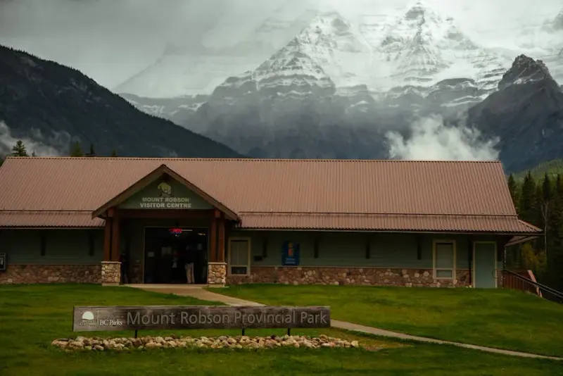
    Access is via State Highway 80 along the western shore of Lake Pukaki, it's about 65 kilometers from Twizel. From Christchurch and Queenstown, you'll each drive a good three to four hours. In the village, hotels, the visitor center, and hiking trails are close together; for the Tasman Valley, you need a car. There's no petrol station in the village, refuel beforehand in Twizel.

    Accommodations in Aoraki/Mount Cook National Park

    Find perfect stay in Aoraki/Mount Cook National Park

    Booking.com* (Affiliate link)
    Search Hotels
    Agoda* (Affiliate link)
    Search Hotels
    Airbnb
    Vacation Rentals

    * Affiliate link: if you book through it, we earn a small commission. The price stays the same for you.

    Nearby

    Gletscherregion (Franz Josef & Fox Glacier)

    Gletscherregion (Franz Josef & Fox Glacier)

    In Westland Tai Poutini National Park, two glaciers extend from the Southern Alps deep into the rainforest: Franz Josef and Fox Glacier. The two namesake villages are located about 25 kilometers apart on State Highway 6 and serve as the base for glacier hikes, helicopter flights, and valley walks.Both glaciers have retreated significantly in recent decades. Today, you can only access the ice with guided Heli-Hikes; the valley paths end at viewpoints at a distance from the glacier terminus.

    Lake Tekapo

    Lake Tekapo, in Māori Takapō, is a small town on the southern shore of the eponymous lake in the Mackenzie Basin. Fine rock flour from the glaciers colors the water milky turquoise, with the Southern Alps standing in the background.By day, the view from Mount John and the stone church on the shore beckon; by night, the starry sky: The region belongs to the Aoraki Mackenzie International Dark Sky Reserve. In early summer, lupins bloom along the shores, an introduced plant that attracts many photographers.

    Wanaka

    Wanaka is located on the southern shore of Lake Wānaka, about an hour's drive north of Queenstown. It is quieter than its neighbour and a gateway to Mount Aspiring National Park, the Roys Peak track, and the ski fields of Cardrona and Treble Cone.
    Hokitika

    Hokitika

    Hokitika is a small town on the South Island's West Coast, founded during the 1860s gold rush. Today, it's known for Pounamu workshops, its driftwood beach, and as a gateway to the turquoise Hokitika Gorge.
    West Coast

    West Coast

    The West Coast stretches as a narrow strip for about 600 kilometers along the South Island, between the Tasman Sea and the Southern Alps. Rainforest, wild beaches, and rivers characterize the landscape; the towns are small and spread far apart.In the north await the limestone landscapes of Paparoa and Kahurangi, in the center the old gold mining towns of Greymouth and Hokitika, and in the south the Franz Josef and Fox Glaciers. Most travelers drive the entire coast.

    Sources & method

    • Photos: Unsplash, Google Maps. Each photo carries its credit.
    • Place data such as addresses and ratings comes from Google Maps.
    • The content is based on web research from public, traceable sources. How the content is made · The role of AI